Safety Score: 4,0 of 5.0 based on data from 9 authorites. Meaning please reconsider your need to travel to U.S. Virgin Islands.
Travel warnings are updated daily. Source: Travel Warning U.S. Virgin Islands. Last Update: 2024-08-13 08:21:03
Discover Johns Folly Bay
Johns Folly Bay in Coral Bay (Saint John Island) is a city in U.S. Virgin Islands about 15 mi (or 24 km) east of Charlotte Amalie, the country's capital city.
Local time in Johns Folly Bay is now 11:08 PM (Thursday). The local timezone is named America / St Thomas with an UTC offset of -4 hours. We know of 7 airports in the vicinity of Johns Folly Bay, of which two are larger airports. The closest is airport we know is Terrance B. Lettsome International Airport in British virgin islands in a distance of 14 mi (or 22 km). The closest airport in U.S. Virgin Islands is Charlotte Amalie Harbor Seaplane Base in a distance of 16 mi (or 22 km), North-East. Besides the airports, there are other travel options available (check left side).
There is one Unesco world heritage site nearby. The closest heritage site is La Fortaleza and San Juan National Historic Site in Puerto Rico in United states at a distance of 77 mi (or 125 km). Also, if you like golfing, there is an option about 16 mi (or 26 km). away. We discovered 4 points of interest in the vicinity of this place. Looking for a place to stay? we compiled a list of available hotels close to the map centre further down the page.
When in this area, you might want to pay a visit to some of the following locations: Cruz Bay, Road Town, Charlotte Amalie, St Croix and Culebra. To further explore this place, just scroll down and browse the available info.
Local weather forecast
Todays Local Weather Conditions & Forecast: 27°C / 80 °F
| Morning Temperature | 26°C / 79 °F |
| Evening Temperature | 27°C / 81 °F |
| Night Temperature | 27°C / 81 °F |
| Chance of rainfall | 5% |
| Air Humidity | 71% |
| Air Pressure | 1010 hPa |
| Wind Speed | Gentle Breeze with 8 km/h (5 mph) from North |
| Cloud Conditions | Clear sky, covering 3% of sky |
| General Conditions | Moderate rain |
Friday, 15th of November 2024
27°C (81 °F)
27°C (81 °F)
Moderate rain, moderate breeze, overcast clouds.
Saturday, 16th of November 2024
27°C (80 °F)
26°C (78 °F)
Moderate rain, gentle breeze, overcast clouds.
Sunday, 17th of November 2024
26°C (79 °F)
26°C (79 °F)
Light rain, gentle breeze, clear sky.
Hotels and Places to Stay
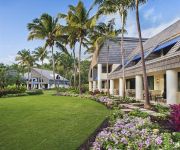
The Westin St. John Resort
The Westin St. John Resort Villas
FORT RECOVERY VILLA AND SUITES HOTEL TOR
SUGAR MILL HOTEL
Nanny Cay Hotel
CONCORDIA ECO-RESOR
Caneel Bay Resort
Videos from this area
These are videos related to the place based on their proximity to this place.
Mooncottage: St. John's Most Romantic Luxury Caribbean Villa Slideshow
http://www.mooncottage.com Secluded and secret rendezvous for couples.Beautiful slideshow of St. John's most romantic, luxury Caribbean villa rental. Perfect for honeymoons, anniversaries...
MoonSwept Villa St. John, Virgin Islands
Beautiful Villa in Calabash Boom, St John. visit us @ www.moonsweptstjohn.com.
St. John, USVI, Windwardside
Driving up the mountain in st. john (coral bay) to windward side guest cottage.
Eco -Tent @ Eco Concordia (Saint John USVI)
One of several eco-tents on the southeastern island of Saint John. Tents are situated adjacent to the USVI National Park overlooking Drunk Bay and Salt Pond Bay. Recorded on January 14, 2011...
St. John U.S. Virgin Islands Maho Bay Concordia Eco-Tent
Battery Charger; a downside of the Eco-Test is there is no USB 5v power source.
Videos provided by Youtube are under the copyright of their owners.
Attractions and noteworthy things
Distances are based on the centre of the city/town and sightseeing location. This list contains brief abstracts about monuments, holiday activities, national parcs, museums, organisations and more from the area as well as interesting facts about the region itself. Where available, you'll find the corresponding homepage. Otherwise the related wikipedia article.
Saint John, U.S. Virgin Islands
St. John is an island in the Caribbean Sea and a constituent district of the United States Virgin Islands (USVI), an unincorporated territory of the United States. St. John is located about four miles east of Saint Thomas, the location of the territory's capital, Charlotte Amalie, and four miles southwest of Tortola, part of the British Virgin Islands. It is 50.8 km² (19.61 sq mi) in area with a population of 4,170 (2010 census). Because there are no airports on St.
Coral Bay, United States Virgin Islands
Coral Bay is a town on the island of St. John in the United States Virgin Islands. It is located on the southeastern side of the island. Though it was once the main commercial and population center on the island due to its sheltered harbor, it has fallen from prominence with the introduction of a ferry service to Cruz Bay, which is now the largest town on St. John.
Calabash, United States Virgin Islands
Calabash is a settlement on the island of St. John in the United States Virgin Islands. It is located in the east of the island on the coast of Coral Bay, to the south of the town of Coral Bay.
Palestina, United States Virgin Islands
Palestina is a settlement on the island of St. John in the United States Virgin Islands located at {{#invoke:Coordinates|coord}}{{#coordinates:18|20|56|N|64|42|24|W|type:city | |name= }}. It is located in the east of the island on the coast of Coral Bay, to the east of the town of Coral Bay. Just west of the community is the Emmaus Moravian Church and Manse, listed on the National Register of Historic Places.
Bordeaux, United States Virgin Islands
Bordeaux is a settlement on the island of Saint John in the United States Virgin Islands.
Emmaus, United States Virgin Islands
Emmaus is a settlement on the island of Saint John in the United States Virgin Islands.
Johns Folly, United States Virgin Islands
Johns Folly is a settlement on the island of Saint John in the United States Virgin Islands.
Lameshur, United States Virgin Islands
Lameshur is a settlement on the island of Saint John in the United States Virgin Islands.


