Safety Score: 2,7 of 5.0 based on data from 9 authorites. Meaning we advice caution when travelling to United States.
Travel warnings are updated daily. Source: Travel Warning United States. Last Update: 2024-08-13 08:21:03
Discover Holly Hills Estates
Holly Hills Estates in Nicholas County (West Virginia) is a town in United States about 209 mi (or 336 km) west of Washington DC, the country's capital city.
Current time in Holly Hills Estates is now 05:03 AM (Saturday). The local timezone is named America / New York with an UTC offset of -5 hours. We know of 10 airports near Holly Hills Estates, of which 5 are larger airports. The closest airport in United States is Raleigh County Memorial Airport in a distance of 39 mi (or 62 km), South-West. Besides the airports, there are other travel options available (check left side).
Also, if you like playing golf, there are a few options in driving distance. Looking for a place to stay? we compiled a list of available hotels close to the map centre further down the page.
When in this area, you might want to pay a visit to some of the following locations: Summersville, Clay, Fayetteville, Sutton and Webster Springs. To further explore this place, just scroll down and browse the available info.
Local weather forecast
Todays Local Weather Conditions & Forecast: 4°C / 39 °F
| Morning Temperature | 3°C / 38 °F |
| Evening Temperature | 4°C / 39 °F |
| Night Temperature | 4°C / 39 °F |
| Chance of rainfall | 4% |
| Air Humidity | 98% |
| Air Pressure | 1016 hPa |
| Wind Speed | Moderate breeze with 10 km/h (6 mph) from East |
| Cloud Conditions | Overcast clouds, covering 100% of sky |
| General Conditions | Light rain |
Saturday, 23rd of November 2024
8°C (46 °F)
4°C (39 °F)
Scattered clouds, gentle breeze.
Sunday, 24th of November 2024
13°C (56 °F)
11°C (52 °F)
Broken clouds, gentle breeze.
Monday, 25th of November 2024
7°C (45 °F)
2°C (36 °F)
Moderate rain, moderate breeze, overcast clouds.
Hotels and Places to Stay
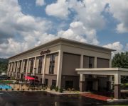
Hampton Inn Summersville
La Quinta Inn and Suites Summersville
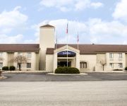
Sleep Inn
Quality Inn Summersville
Summers Inn
Econo Lodge Summersville
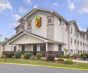
SUPER 8 SUMMERSVILLE
Videos from this area
These are videos related to the place based on their proximity to this place.
Summersville Road Trip
This is my road trip to Summersville on old U.S. Route 60 East on the historic Midland Trail to get to Hardman's Hardware and on my way back across Pre-Revolutionary and Civil War landmarks...
Quarter Scale World Models clipped wing Cub at Wally's Squadron, Summersville WV.
This is me flying my quarter Scale World Models clipped wing Cub at Wally's Squadron field in Summersville WV. The power plant is a mere .91 Magnum four stroke that flies her very scale like.
Summersville Lake Plane Ride with AJ & Justin
Summersville Lake WV, Plane Ride with AJ & Justin - nice view of the Lighthouse, only one in WV Visit our site at http://www.Harvway.com!
Spring2012_WV_RoadTrip.mp4
Spring Road Trip to ride the twisted two lanes around Summersville West Virginia with my Bud Rick Kennedy. We spent three days on the road, 850 miles, with about 600 miles on backroads. Awesome ...
Mt State Baptist - Under The Blood - 6/29/14
Mt State Baptist Church, Summersville WV - Jacob Lyons, Kati Collins and Mattea Groves - June 29, 2014.
Mt State Baptist - Beulah Land - 10/26/14
Mt State Baptist Church, Summersville WV - BB Secrist - Oct 26, 2014.
Mt State Baptist - He Came Down To Us - 9/7/14
Mt State Baptist Church, Summersville WV - Garth Holcomb - Sept 7, 2014.
Mt State Baptist - It's Still The Blood - 5/18/14
Mt State Baptist Church, Summersville WV - Mt State Harmony or The Sunday School Quartet - May 18, 2014.
Mt State Baptist - BB Secrist and Trista Rush - 01/12/14 (2)
Mt State Baptist Church, Summersville WV - BB Secrist and Trista Rush- 01/12/14.
Videos provided by Youtube are under the copyright of their owners.
Attractions and noteworthy things
Distances are based on the centre of the city/town and sightseeing location. This list contains brief abstracts about monuments, holiday activities, national parcs, museums, organisations and more from the area as well as interesting facts about the region itself. Where available, you'll find the corresponding homepage. Otherwise the related wikipedia article.
Nicholas County, West Virginia
Nicholas County, West Virginia Map of West Virginia highlighting Nicholas County Map of the U.S. highlighting West Virginia Founded 1818 Seat Summersville Area - Total - Land - Water 654 sq mi (1,694 km²)649 sq mi (1,681 km²)6 sq mi (16 km²), 0.88% Population - - Density 23,233 41/sq mi (16/km²) Website www. nicholascountywv. org/ Nicholas County is a county located in the U.S. state of West Virginia. As of the 2010 census, the population was 23,233. Its county seat is Summersville.
Summersville, West Virginia
Summersville is a town in Nicholas County, West Virginia, United States. The population was 3,572 at the 2010 census. It is the county seat of Nicholas County.
Nicholas County High School
Nicholas County High School is the name of a building listed on the National Register of Historic Places that was formerly a high school, and it is the name of the current high school in a new building. The current high school is a high school in Nicholas County, West Virginia, United States. Nicholas County High School has recently seen an incline in student population as the sister high school, Richwood High School has seen a steady decline.


