Safety Score: 2,7 of 5.0 based on data from 9 authorites. Meaning we advice caution when travelling to United States.
Travel warnings are updated daily. Source: Travel Warning United States. Last Update: 2024-08-13 08:21:03
Delve into Seymour
Seymour in Mineral County (West Virginia) is a city located in United States about 107 mi (or 172 km) north-west of Washington DC, the country's capital town.
Current time in Seymour is now 05:01 AM (Sunday). The local timezone is named America / New York with an UTC offset of -5 hours. We know of 13 airports closer to Seymour, of which 5 are larger airports. The closest airport in United States is John Murtha Johnstown Cambria County Airport in a distance of 50 mi (or 80 km), North. Besides the airports, there are other travel options available (check left side).
There is one Unesco world heritage site nearby. It's Monticello and the University of Virginia in Charlottesville in a distance of 129 mi (or 208 km), South-East. Also, if you like playing golf, there are some options within driving distance. In need of a room? We compiled a list of available hotels close to the map centre further down the page.
Since you are here already, you might want to pay a visit to some of the following locations: Cumberland, Keyser, Romney, Somerset and Bedford. To further explore this place, just scroll down and browse the available info.
Local weather forecast
Todays Local Weather Conditions & Forecast: 8°C / 47 °F
| Morning Temperature | 6°C / 43 °F |
| Evening Temperature | 5°C / 42 °F |
| Night Temperature | 5°C / 41 °F |
| Chance of rainfall | 0% |
| Air Humidity | 72% |
| Air Pressure | 1018 hPa |
| Wind Speed | Gentle Breeze with 7 km/h (4 mph) from East |
| Cloud Conditions | Broken clouds, covering 83% of sky |
| General Conditions | Broken clouds |
Sunday, 24th of November 2024
15°C (59 °F)
12°C (53 °F)
Light rain, light breeze, broken clouds.
Monday, 25th of November 2024
6°C (43 °F)
1°C (34 °F)
Light rain, moderate breeze, broken clouds.
Tuesday, 26th of November 2024
7°C (45 °F)
1°C (34 °F)
Overcast clouds, light breeze.
Hotels and Places to Stay
BW BRADDOCK MOTOR INN
Fairfield Inn & Suites Cumberland
RAMADA WORLDWIDE-CUMBERLAND
Rodeway Inn Lavale
Comfort Inn & Suites LaVale - Cumberland
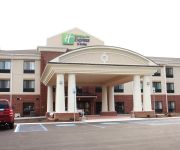
Holiday Inn Express & Suites CUMBERLAND - LA VALE
SUPER 8 LA VALE-CUMBERLAND ARE
Videos from this area
These are videos related to the place based on their proximity to this place.
Western Maryland 734, Cumberland in October
Cumberland Maryland , Western Maryland RR videos from 08 & 09.
Mountain Maryland's Best Kept Secrets: Coney Island Sauce
Shhh... Host Kimberli Rowley has a delicious Mountain Maryland secret, as she explains how the sauce used on the Coney Island wieners at Curtis' in downtown Cumberland, Maryland, attracts fans...
Western Maryland 734 leaves Ridgeley
WMSR 734 leaving Ridgeley Yard heading to the station in Cumberland, Maryland. Video taken from the cab,
2007 Chrysler Town & Country Used Cars Cumberland MD
http://www.barthshomeautosales.com This 2007 Chrysler Town & Country is available from Barth's Home Auto Sales & Service. For details, call us at 301-729-1122.
Cresaptown Eagles Cheerleading Squad- 2014
Second Game of the Year at the Ridgeley Hawks Field in WV and the First time of the Year that our Girls performed their entire Routine. The Cresaptown Eagles A, B and C Team Hello Cheer and...
cessna 172 cockpit view night landing
Landing on runway 23 after a trip to Somerset PA. Moderate winds from 310. Not the best landing but hey we all walked away and the plane is in one piece.
Videos provided by Youtube are under the copyright of their owners.
Attractions and noteworthy things
Distances are based on the centre of the city/town and sightseeing location. This list contains brief abstracts about monuments, holiday activities, national parcs, museums, organisations and more from the area as well as interesting facts about the region itself. Where available, you'll find the corresponding homepage. Otherwise the related wikipedia article.
Cresaptown-Bel Air, Maryland
Cresaptown-Bel Air was a census-designated place in Allegany County, Maryland, United States. The population was 5,884 at the 2000 census. For the 2010 census, the area was separated into two CDPs, Cresaptown and Bel Air. Cresaptown-Bel Air is part of the Cumberland, MD-WV Metropolitan Statistical Area.
North Branch Correctional Institution
North Branch Correctional Institution (NBCI) is a high-tech, maximum security prison operated by the Maryland Department of Public Safety and Correctional Services in Cresaptown, unincorporated Allegany County, Maryland, near Cumberland. The prison houses the most serious offenders within the State of Maryland. NBCI opened in January 2003 and the final housing unit began operation in the summer of 2008.
Bowling Green, Maryland
The communities of Roberts Place, Bowling Green & Potomac Park are located along McMullen Highway between Cumberland to the north, Cresaptown to the south, the Potomac River to the east and Haystack Mountain to the west. For many years, the community was mostly farmland but was later divided into building lots by the Buchanan, Roberts and Long families.
Cumberland Race Track
The Cumberland Race Track (1924-1961), also known as the Fairgo Race Track, was located just outside the west side of Cumberland, Maryland along McMullen Highway at the location of the present day Allegany County Fairgrounds. The Track facility boasted 300 horse stalls and was the first half-mile track in the state of Maryland for racing horses. The Track was founded in 1924 when the Fairgo company was formed by the stock holders of the Cumberland Fair Associations.
Allegany County Fairgrounds
The Allegany County Fairgrounds is located just west of Cumberland, Maryland along McMullen Highway. Throughout the year the fairground holds musical concerts, car races, and private events. Once a year the Allegany County fair is held on the grounds, called the Allegany County Fair and AgExpo. As of 2006, the annual fair is an 8-day event customarily in the middle of July.
Allegany County Sheriff's Office (Maryland)
The Allegany County Sheriff's Office (ACSO) is the primary law enforcement agency for Allegany County, Maryland. The ACSO is a nationally accredited law enforcement agency servicing 430 square miles and a population of 75,300.
Country Club Mall
Country Club Mall is a shopping mall located in La Vale, Maryland, a suburb of Cumberland, Maryland in Allegany County, Maryland. The mall has 60 retail units, as well as 7 vendor stands on the main concourse. The largest retailers in the mall are Wal-Mart, the Bon-Ton, Sears, and JCPenney. Also located in the Country Club Mall is the Country Club Mall 8 Cinemas 6, the largest movie theatre in Allegany County. The mall is managed by Gumberg Asset Management Corp.
Calvary Christian Academy
Calvary Christian Academy (CCA) is a non-profit private school located in Cresaptown, Maryland in Allegany County. It was established as an outreach of Calvary Baptist Church of Cresaptown in 1973.


