Safety Score: 2,7 of 5.0 based on data from 9 authorites. Meaning we advice caution when travelling to United States.
Travel warnings are updated daily. Source: Travel Warning United States. Last Update: 2024-08-13 08:21:03
Discover Norwood
The district Norwood of Meadowdale in Marion County (West Virginia) is a district in United States about 170 mi west of Washington DC, the country's capital city.
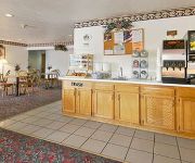
Looking for a place to stay? we compiled a list of available hotels close to the map centre further down the page.
When in this area, you might want to pay a visit to some of the following locations: Fairmont, Grafton, Morgantown, Clarksburg and Philippi. To further explore this place, just scroll down and browse the available info.
Local weather forecast
Todays Local Weather Conditions & Forecast: 13°C / 55 °F
| Morning Temperature | 4°C / 39 °F |
| Evening Temperature | 11°C / 52 °F |
| Night Temperature | 14°C / 57 °F |
| Chance of rainfall | 0% |
| Air Humidity | 53% |
| Air Pressure | 1016 hPa |
| Wind Speed | Gentle Breeze with 7 km/h (4 mph) from North-East |
| Cloud Conditions | Broken clouds, covering 53% of sky |
| General Conditions | Light rain |
Tuesday, 26th of November 2024
9°C (48 °F)
2°C (36 °F)
Moderate rain, moderate breeze, broken clouds.
Wednesday, 27th of November 2024
7°C (44 °F)
4°C (40 °F)
Overcast clouds, light breeze.
Thursday, 28th of November 2024
8°C (47 °F)
2°C (35 °F)
Light rain, light breeze, overcast clouds.
Hotels and Places to Stay
Hampton Inn Fairmont WV
Holiday Inn Express & Suites FAIRMONT
Fairfield Inn & Suites Fairmont
MICROTEL INN & SUITES BY WYNDH
Clarion Inn Fairmont
THE INN AT PETTYJOHN
Quality Inn Fairmont
SUPER 8 FAIRMONT
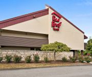
Red Roof Inn Fairmont
DAYS INN FAIRMONT
Videos from this area
These are videos related to the place based on their proximity to this place.
That Secret Place In Christ - Christian Love Ministries Fairmont WV - Sunday Sermon
Christian Love Ministries Fairmont WV Pastor Leo Riley Co-Pastor Regina Riley.
U.S. Rt. 19 Approaching Fairmont , WV
A typical afternoon sight just outside Fairmont, WV on my last visit to my old hometown. My father used to take me to work with him on Friday night. I would help him inventory these cars filled...
Fairmont Skyline
Best of Fairmont Skyline Fairmont, West Virginia, United States of America Population (2012 Estimate): 18737 Number of Buildings: 15.
Christmas Lights 2014 Fairmont, WV
This is a short film of the Christmas light display in Morris Park Fairmont, West Virginia. I hope you enjoy this as much as I do!
Plumber Fairmont WV | 304-935-5154 | Plumbing Services West Virginia
Plumber Fairmont WV | 304-935-5154 | Plumbing Services West Virginia Looking for the Best Plumber in West Virginia? We offer a complete plumbing service for new installations, repairs, and...
Marion County WV - A Portrait
Discover Fairmont, the Famous Friendly City, and discover a piece of paradise. Escape to tranquility with spectacular mountain views, historic sites and sample a flavor of West Virginia hospitality...
BARRACKVILLE COVERED BRIDGE, Barrackville West Virginia
Barrackville Covered Bridge in Barrackville West Virginia on 10/3/14.
Videos provided by Youtube are under the copyright of their owners.
Attractions and noteworthy things
Distances are based on the centre of the city/town and sightseeing location. This list contains brief abstracts about monuments, holiday activities, national parcs, museums, organisations and more from the area as well as interesting facts about the region itself. Where available, you'll find the corresponding homepage. Otherwise the related wikipedia article.
Marion County, West Virginia
Marion County is a county located in the U.S. state of West Virginia. As of the 2010 census, the population was 56,418. Its county seat is Fairmont. Marion County was named in honor of General Francis Marion, known in history as "The Swamp Fox".
Barrackville, West Virginia
Barrackville is a town in Marion County, West Virginia, United States. The population was 1,302 at the 2010 census. Barrackville was founded in 1767 by William "Indian Billy" Ice and named in honor of an early settler, John Barrack. It was incorporated January 25, 1968.
Fairmont, West Virginia
Fairmont is a city in Marion County, West Virginia, United States. Nicknamed "The Friendly City". The population was 18,704 at the 2010 census. It is the county seat of Marion County.
Grant Town, West Virginia
Grant Town is a town in Marion County, West Virginia, in the eastern United States. The population was 613 at the 2010 census. The town was formed in 1901 with the opening of the Federal Coal and Coke Company bituminous coal mine, and was named for Robert Grant, vice president of the coal company. The "Federal No. 1" mine http://www. coalingstation. com/images/18. jpg remained open for the next 84 years until its closure in 1985.
Monongah, West Virginia
Monongah is a town in Marion County, West Virginia along the West Fork River. The population was 1,044 at the 2010 census. Monongah was incorporated in 1891 by Circuit Court. Its name is abbreviated from Monongahela, the river formed by the confluence of the West Fork and Tygart Valley Rivers a few miles north of the town.
Pleasant Valley, West Virginia
Pleasant Valley is a city in Marion County, West Virginia, United States. The population was 3,149 at the 2010 census.
White Hall, West Virginia
White Hall is a town in Marion County, West Virginia, United States. The population was 648 at the 2010 census. White Hall became incorporated in 1989.
Rivesville, West Virginia
Rivesville is a town and former coal town in Marion County, West Virginia, United States. The population was 934 at the 2010 census.
Poplar Island (West Virginia)
Poplar Island is a bar island in Marion County, West Virginia on the Tygart Valley River.
Robertson Island (West Virginia)
Robertson Island is a bar island in Marion County, West Virginia on the Tygart Valley River.
Scout Island
Scout Island is a forested bar island in Marion County, West Virginia on the Tygart Valley River. Scout Island was used by a Troop as their personal camp in the 1940s and 50s. Since then it is visited by scouts with permission of the current owner. A pavilion and campsites can still be seen.
Independent Verification and Validation Facility
Located in the heart of West Virginia's emerging technology sector, NASA's IV&V Program was established in 1993 as part of an Agency-wide strategy to provide the highest achievable levels of safety and cost-effectiveness for mission critical software.
WKKW
WKKW is a Country formatted broadcast radio station licensed to Fairmont, West Virginia, serving North-Central West Virginia. WKKW is owned and operated by West Virginia Radio Corporation.
WGYE
WGYE is a Country formatted broadcast radio station licensed to Mannington, West Virginia, serving North-Central West Virginia. WGYE is owned and operated by Burbach Broadcasting Company.
WFGM-FM
WFGM-FM is an Oldies and Classic rock formatted broadcast radio station licensed to Barrackville, West Virginia, serving North-Central West Virginia area. WFGM is owned and operated by West Virginia Radio Corporation.
WRLF
WRLF is an Classic rock formatted broadcast radio station licensed to Fairmont, West Virginia, serving the North-Central West Virginia area. WRLF is owned and operated by Fantasia Broadcasting, Inc. WRLF carries The Bob & Tom Show, the West Virginia Mountaineers, the Pittsburgh Steelers, and other sporting events.
WMMN
WMMN is a News/Talk/Sports formatted broadcast radio station licensed to Fairmont, West Virginia, serving North-Central West Virginia. WMMN is owned and operated by Fantasia Broadcasting, Inc.
WTCS
WTCS is a News/Talk/Sports formatted broadcast radio station licensed to Fairmont, West Virginia, serving the Fairmont/Grafton area. WTCS is owned and operated by Fantasia Broadcasting, Inc.
Hildebrand Lock and Dam
Hildebrand Lock and Dam is a navigational lock and gated dam on the Monongahela River at Hilderbrand, West Virginia. (Hildebrand is a misspelling of Hilderbrand. ) It is part of a series of dams that canalizes the Monongahela to a depth of at least 9 feet for its entire length from Fairmont, West Virginia to Pittsburgh, Pennsylvania. It is maintained by the U.S. Army Corps of Engineers, Pittsburgh District. Hildebrand has a single lock chamber located on the left-descending river bank.
Opekiska Lock and Dam
Opekiska Lock and Dam is a navigational lock and gated dam on the Monongahela River at Lowsville, West Virginia. It is part of a series of dams that canalizes the Monongahela to a depth of at least 9 feet for its entire length from Fairmont, West Virginia to Pittsburgh, Pennsylvania. It is maintained by the U.S. Army Corps of Engineers' Pittsburgh District. Opekiska has a single lock chamber located on the right-descending river bank.
Robert H. Mollohan-Jefferson Street Bridge
The Robert H. Mollohan-Jefferson Street Bridge, also known as the Million Dollar Bridge, or the High Level Bridge is located in Fairmont, Marion County, West Virginia. It was dedicated on May 30, 1921. This bridge connects east and west Fairmont, and crosses the Monongahela River. After falling into poor repair over the years, it was preserved and repaired and reopened in October 2000. The bridge is now a significant historic landmark in the city.
David Morgan Bridge
The David Morgan Bridge, commonly known as the Third Street Bridge, is a span that crosses the Monongahela River, in Fairmont, West Virginia. The bridge has a characteristic curve in it, and was built in the 1979 in order to relieve some of the traffic from the Robert H. Mollohan-Jefferson Street Bridge after the Low Level Bridge had closed.
Low Level Bridge (Fairmont, West Virginia)
In 1908, after rapid growth in population due to industry, a steel bridge was erected in Fairmont, West Virginia to replace the suspension bridge. It also, spanned the Monongahela River. The bridge was called the "Nickel Bridge" because one had to pay a nickel toll in order to cross it. Its other nickname the "Low Level Bridge" was due to it being downstream from the Robert H. Mollohan-Jefferson Street Bridge which was on a "higher span" than the nickel bridge was.
Country Club Bakery
Country Club Bakery, located in Fairmont, West Virginia, USA, is a small family owned bakery that is significant because it is the home of the pepperoni roll. The pepperoni roll is a snack popular in West Virginia and some nearby regions of the Appalachian Mountains. Ubiquitous in West Virginia, but typically little known elsewhere, it is arguably the food most closely associated with the state (a competitor for this distinction is the ramp).
Opekiska, West Virginia
Opekiska was an unincorporated community located in Monongalia County, West Virginia. The Opekiska Post Office is no longer open.


