Safety Score: 2,7 of 5.0 based on data from 9 authorites. Meaning we advice caution when travelling to United States.
Travel warnings are updated daily. Source: Travel Warning United States. Last Update: 2024-08-13 08:21:03
Touring Arborland Acres
Arborland Acres in Kanawha County (West Virginia) is a town located in United States about 263 mi (or 423 km) west of Washington DC, the country's capital place.
Time in Arborland Acres is now 12:23 PM (Saturday). The local timezone is named America / New York with an UTC offset of -4 hours. We know of 9 airports nearby Arborland Acres, of which 5 are larger airports. The closest airport in United States is Yeager Airport in a distance of 15 mi (or 24 km), East. Besides the airports, there are other travel options available (check left side).
Also, if you like the game of golf, there are several options within driving distance. Need some hints on where to stay? We compiled a list of available hotels close to the map centre further down the page.
Being here already, you might want to pay a visit to some of the following locations: Winfield, Charleston, Hamlin, Madison and Ripley. To further explore this place, just scroll down and browse the available info.
Local weather forecast
Todays Local Weather Conditions & Forecast: 17°C / 62 °F
| Morning Temperature | 4°C / 39 °F |
| Evening Temperature | 12°C / 53 °F |
| Night Temperature | 9°C / 47 °F |
| Chance of rainfall | 0% |
| Air Humidity | 35% |
| Air Pressure | 1028 hPa |
| Wind Speed | Light breeze with 4 km/h (2 mph) from South-West |
| Cloud Conditions | Broken clouds, covering 64% of sky |
| General Conditions | Broken clouds |
Saturday, 2nd of November 2024
22°C (71 °F)
15°C (59 °F)
Scattered clouds, light breeze, broken clouds.
Sunday, 3rd of November 2024
22°C (72 °F)
15°C (58 °F)
Overcast clouds, gentle breeze.
Monday, 4th of November 2024
27°C (80 °F)
20°C (67 °F)
Few clouds, gentle breeze.
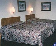
Hotels and Places to Stay
Holiday Inn Express WINFIELD - TEAYS VALLEY
Holiday Inn Express & Suites CHARLESTON NW - CROSS LANES
Comfort Inn Cross Lanes
Sleep Inn & Suites
MOTEL 6 CHARLESTON WEST - CROSS LANES WV
Days Inn Teays Valley
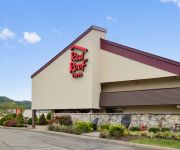
RED ROOF CHARLESTON WEST HURRICANE
Videos from this area
These are videos related to the place based on their proximity to this place.
VLOG | My moving trip
DONT FORGET TO GIVE THE VIDEO A THUMBS UP! ***Audio file(s) (if any) provided by http://www.audiomicro.com*** Want a low-cost high-quality Minecraft server of your own?
Stratosphere Survival w/Nappy & Country Ep. 21 FINALE
DONT FORGET TO GIVE THE VIDEO A THUMBS UP!!! Stratosphere Playlist: http://www.youtube.com/playlist?list=PLMkJCMIHl4-BFSt6d0ZTQn_P_Jc7IdIXo&feature=view_all Want a low-cost ...
Stratosphere Survival w/Nappy & Country Ep. 17 & Ep. 18
DONT FORGET TO GIVE THE VIDEO A THUMBS UP!!! Stratosphere Playlist: http://www.youtube.com/playlist?list=PLMkJCMIHl4-BFSt6d0ZTQn_P_Jc7IdIXo&feature=view_all Want a low-cost ...
Stratosphere Survival w/Nappy & Country Nether Time! Ep. 15
DONT FORGET TO GIVE THE VIDEO A THUMBS UP!!! Stratosphere Playlist: http://www.youtube.com/playlist?list=PLMkJCMIHl4-BFSt6d0ZTQn_P_Jc7IdIXo&feature=view_all Want a low-cost ...
Stratosphere Survival w/Nappy & Country Ep. 16
DONT FORGET TO GIVE THE VIDEO A THUMBS UP!!! Stratosphere Playlist: http://www.youtube.com/playlist?list=PLMkJCMIHl4-BFSt6d0ZTQn_P_Jc7IdIXo&feature=view_all Want a low-cost ...
Stratosphere Survival w/Nappy & Country Ep. 12
DONT FORGET TO GIVE THE VIDEO A THUMBS UP!!! Stratosphere Playlist: http://www.youtube.com/playlist?list=PLMkJCMIHl4-BFSt6d0ZTQn_P_Jc7IdIXo&feature=view_all Want a low-cost ...
Stratosphere Survival w/Nappy & Country Ep. 20
DONT FORGET TO GIVE THE VIDEO A THUMBS UP!!! Stratosphere Playlist: http://www.youtube.com/playlist?list=PLMkJCMIHl4-BFSt6d0ZTQn_P_Jc7IdIXo&feature=view_all Want a low-cost ...
Stratosphere Survival w/Nappy & Country Ep. 19
DONT FORGET TO GIVE THE VIDEO A THUMBS UP!!! Stratosphere Playlist: http://www.youtube.com/playlist?list=PLMkJCMIHl4-BFSt6d0ZTQn_P_Jc7IdIXo&feature=view_all Want a low-cost ...
Stratosphere Survival w/Nappy & Country Ep. 14
DONT FORGET TO GIVE THE VIDEO A THUMBS UP!!! Stratosphere Playlist: http://www.youtube.com/playlist?list=PLMkJCMIHl4-BFSt6d0ZTQn_P_Jc7IdIXo&feature=view_all Want a low-cost ...
Videos provided by Youtube are under the copyright of their owners.
Attractions and noteworthy things
Distances are based on the centre of the city/town and sightseeing location. This list contains brief abstracts about monuments, holiday activities, national parcs, museums, organisations and more from the area as well as interesting facts about the region itself. Where available, you'll find the corresponding homepage. Otherwise the related wikipedia article.
Nitro, West Virginia
Nitro is a city in Kanawha and Putnam counties in the U.S. state of West Virginia, along the Kanawha River. The population was 7,178 at the 2010 census. Nitro is a part of the Huntington-Ashland, WV-KY-OH, Metropolitan Statistical Area (MSA). As of the 2010 census, the MSA had a population of 287,702. New definitions from February 28, 2013 placed the population at 363,000. Nitro was incorporated in 1932 by Circuit Court.
WCHS-TV
WCHS-TV is the ABC-affiliated television station for Charleston and Huntington, West Virginia. This area is the second-largest market in terms of area east of the Mississippi River and consists of 61 counties in Central West Virginia, Eastern Kentucky, and Southern Ohio. It broadcasts a high definition digital signal on UHF channel 41 from a transmitter south of Scott Depot along the Putnam and Kanawha County line.
WVAH-TV
WVAH-TV is the Fox-affiliated television station for Charleston and Huntington, West Virginia which is the second-largest market in terms of area east of the Mississippi River. It broadcasts a high definition digital signal on UHF channel 19 from a transmitter south of Scott Depot along the Putnam and Kanawha County line. Owned by Cunningham Broadcasting, WVAH is operated through a local marketing agreement (LMA) by the Sinclair Broadcast Group.
WJYP
WJYP is a Southern Gospel-formatted broadcast radio station licensed to St. Albans, West Virginia, serving Western Kanawha County, West Virginia and Central Putnam County, West Virginia. WJYP is owned and operated by L.M. Communications, Inc.


