Safety Score: 2,7 of 5.0 based on data from 9 authorites. Meaning we advice caution when travelling to United States.
Travel warnings are updated daily. Source: Travel Warning United States. Last Update: 2024-08-13 08:21:03
Discover Brooke Haven
The district Brooke Haven of Charles Town in Jefferson County (West Virginia) is a subburb in United States about 51 mi north-west of Washington DC, the country's capital city.
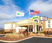
If you need a hotel, we compiled a list of available hotels close to the map centre further down the page.
While being here, you might want to pay a visit to some of the following locations: Berryville, Martinsburg, Winchester, Leesburg and Hagerstown. To further explore this place, just scroll down and browse the available info.
Local weather forecast
Todays Local Weather Conditions & Forecast: 11°C / 52 °F
| Morning Temperature | 4°C / 39 °F |
| Evening Temperature | 11°C / 51 °F |
| Night Temperature | 7°C / 45 °F |
| Chance of rainfall | 0% |
| Air Humidity | 56% |
| Air Pressure | 1020 hPa |
| Wind Speed | Light breeze with 3 km/h (2 mph) from North |
| Cloud Conditions | Overcast clouds, covering 100% of sky |
| General Conditions | Overcast clouds |
Monday, 18th of November 2024
17°C (62 °F)
10°C (50 °F)
Scattered clouds, gentle breeze, broken clouds.
Tuesday, 19th of November 2024
15°C (59 °F)
13°C (55 °F)
Light rain, gentle breeze, overcast clouds.
Wednesday, 20th of November 2024
17°C (63 °F)
11°C (52 °F)
Light rain, fresh breeze, clear sky.
Hotels and Places to Stay
Home2 Suites by Hilton Charles Town
Hampton Inn - Suites Charles Town WV
Holiday Inn Express CHARLES TOWN
WV Motel 6 Charles Town
KNIGHTS INN CHARLES TOWN
Rodeway Inn & Suites Charles Town
THE INN AT CHARLES TOWN
AMERICAS BEST VALUE INN
Clarion Inn Harpers Ferry-Charles Town
Videos from this area
These are videos related to the place based on their proximity to this place.
Zion Episcopal Church & Graveyard, Charles Town, WV
Jim Surkamp standing and discussing Washington lineage at the grave of Lt. Col. John Augustine Washington aid-de-camp to Gen. Robert E. Lee and last Washington to own "Mount Vernon." There...
Charles Town West Virginia
Little tour driving West on Route 51. Town ends at the tracks. Really - just ends.
Tree Planting Ceremony - 225th Anniversary Charles Town, West Virginia
16SEP11: Charles Town Mayor Peggy A. Smith and Washington family decendent Mr. Walter Washington, Esq. plant an elm tree at Jefferson Memorial Park in Charles Town, West Virginia at the ...
Charles Town Barn Fire 02 of 12
Taking full control, Amber clears this smaller barn before it is overrun by the flames.
181 SPRUCE HILL WAY, CHARLES TOWN, WV Presented by Kevin Coomler.
Click to see more: http://listings.listhub.net/pages/MRIS/JF8516274/?channel=listingstoleads 181 SPRUCE HILL WAY CHARLES TOWN, WV 25414 Contact Kevin Coomler for more information.
Charles Town Barn Fire 09 of 12
Steve walks to the opposite side of the scene, and encounters a Casino security guard with objections to videography.
Wreath Laying Ceremony at Charles Washington's Grave - Charles Town, WV
16SEP11: The opening ceremony of the 225th Anniversary of Charles Town started with a wreath laying ceremony at the grave of Colonel Charles and Mildred Washington in Charles Town, WV.
Charles Town Barn Fire 04 of 12
After moving the car, Steve walks back up the hill. Initial thought is that no horses were lost, but we're sadly mistaken. Good footage of firefighters in action. Ladies try to determine...
Charles Town Barn Fire 03 of 12
The final horses have been removed from the last barn, just as the flames take over the roof. Steve then encourages his beloved and the others to get the HELL out of the barn. By this time...
202 FENWAY DRIVE, CHARLES TOWN, WV Presented by The Linda Kilroy Team.
Click to see more: http://www.searchallproperties.com/listings/2056138/202-FENWAY-DRIVE-CHARLES-TOWN-WV/auto?reqpage=video 202 FENWAY DRIVE CHARLES TOWN, WV 25414 Contact ...
Videos provided by Youtube are under the copyright of their owners.
Attractions and noteworthy things
Distances are based on the centre of the city/town and sightseeing location. This list contains brief abstracts about monuments, holiday activities, national parcs, museums, organisations and more from the area as well as interesting facts about the region itself. Where available, you'll find the corresponding homepage. Otherwise the related wikipedia article.
Harpers Ferry, West Virginia
Harpers Ferry is a historic town in Jefferson County, West Virginia, United States. It was formerly Harper's Ferry with an apostrophe and that form continues to appear in some references. It is situated at the confluence of the Potomac and Shenandoah rivers where the U.S. states of Maryland, Virginia and West Virginia meet. It is the easternmost town in West Virginia. The town is located on a low-lying flood plain created by the two rivers and surrounded by higher ground.
Jefferson County, West Virginia
Jefferson County, founded in 1801, is the easternmost county of the U.S. state of West Virginia. As of the 2010 census, the population was 53,498. Its county seat is Charles Town. Jefferson County is part of the Washington Metropolitan Area.
Bolivar, West Virginia
Bolivar is a town in Jefferson County in the U.S. state of West Virginia's Eastern Panhandle. The population was 1,045 at the 2000 census and was exactly the same number in the 2010 census. Originally known as Mudfort, Bolivar was granted a charter as a town by the Virginia General Assembly in December 1825.
Ranson, West Virginia
Ranson (formerly Corporation of Ranson) is a city in Jefferson County, West Virginia, United States. The population was 4,440 at the 2010 census. Although the Census Bureau listed it as a town in 2000, it is classified (along with all other municipalities with populations between two and ten thousand) as a city by state law.
Charles Town, West Virginia
Not to be confused with the state capital, Charleston, West Virginia. For other cities of this name, see Charlestown (disambiguation).
Shepherdstown, West Virginia
Shepherdstown is a town in Jefferson County, West Virginia, United States, located along the Potomac River. It is the arguably the oldest town in the state, having been chartered in 1762 by Colonial Virginia's General Assembly. Its status as the oldest town in West Virginia is only contested by Romney, which was chartered in the same year. The town's population was 1,734 at the 2010 United States Census. The town is home to Shepherd University.
Battle of Harpers Ferry
The Battle of Harpers Ferry was fought September 12–15, 1862, as part of the Maryland Campaign of the American Civil War. As Gen. Robert E. Lee's Confederate army invaded Maryland, a portion of his army under Maj. Gen. Thomas J. "Stonewall" Jackson surrounded, bombarded, and captured the Union garrison at Harpers Ferry, Virginia, a major victory at relatively minor cost.
Storer College
Storer College was a historically black college located in Harpers Ferry in Jefferson County, West Virginia. It operated from 1865 until 1955. Its former campus is now part of the Harpers Ferry National Historical Park.
Battle of Cool Spring
The Battle of Cool Spring, also known as Castleman's Ferry, Island Ford, Parker's Ford, and Snicker's Ferry, was a battle in the American Civil War fought July 17–18, 1864, in Clarke County, Virginia, as part of the Valley Campaigns of 1864. The battle was a Confederate victory.
WSHC
WSHC is an Adult Album Alternative formatted broadcast radio station licensed to Shepherdstown, West Virginia, serving the Shepherdstown/Sharpsburg area. WSHC is owned and operated by Shepherd College Board of Governors.
John Brown's Fort
John Brown's Fort was the building built in 1848 that was originally constructed for use as a guard and fire engine house for the federal Harpers Ferry Armory in Harpers Ferry, West Virginia, then a part of Virginia. An 1848 military report described the building as "An engine and guard-house 35? x 24 feet, one story brick, covered with slate, and having copper gutters and down spouts…" The building achieved notoriety during John Brown's Raid on the Harpers Ferry Armory in 1859.
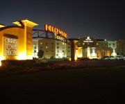
Hollywood Casino at Charles Town Races
Hollywood Casino at Charles Town Races is a race track and casino just outside the eastern city limits of Charles Town, West Virginia, owned and operated by Penn National Gaming. It features a six furlong thoroughbred horse racing facility that is home of the West Virginia Breeders' Classic. It is one of the busiest thoroughbred tracks in the country with over 240 racing dates scheduled for 2012.
Virginius Island, West Virginia
Virginius Island is an island on the Shenandoah River in Harpers Ferry, West Virginia. The island is formed by the Shenandoah Canal, constructed by the Patowmack Company between 1806 and 1807, which separates it from the town of Harpers Ferry. Virginius Island is part of the Harpers Ferry National Historical Park. Virginius Island was once its own thriving industrial town on the Shenandoah River in the nineteenth century.
Summit Point Motorsports Park
Summit Point Motorsports Park is a road racing and driver training facility located in Jefferson County, West Virginia about two hours west of Washington, D.C. in the state's Eastern Panhandle.
Jefferson Rock
Jefferson Rock is a rock formation on the Appalachian Trail above lower Harpers Ferry in Harpers Ferry National Historical Park. It consists of several large masses of shale rock, piled one upon the other, that overlook the Shenandoah River just prior to its confluence with the Potomac River. The name of this landmark derives from Thomas Jefferson, who stood there on October 25, 1783.
Battle of Summit Point
The Battle of Summit Point, also known as Flowing Springs or Cameron's Depot, was an inconclusive battle of the American Civil War fought on August 21, 1864, near Summit Point, West Virginia. The battle was part of Union Maj. Gen. Philip Sheridan's Shenandoah Valley Campaign, which took place between August and December 1864. While Sheridan concentrated his army near Charles Town, Confederate Lt. Gen. Jubal A. Early and Maj. Gen. Richard H.
Battle of Smithfield Crossing
The Battle of Smithfield Crossing was a small battle during the American Civil War fought August 25 through August 29, 1864, in Jefferson and Berkeley counties in West Virginia. On August 29, two Confederate infantry divisions under Lieutenant General Jubal Early crossed Opequon Creek at Smithfield Crossing and forced back Wesley Merritt's Union cavalry division. However, a counterattack from Ricketts' infantry division stopped the Confederate advance. The results were inconclusive.
WMRE
WMRE is a Sports formatted broadcast radio station licensed to Charles Town, West Virginia, serving Charles Town and Jefferson County, West Virginia. WMRE is owned and operated by Clear Channel Communications. WMRE, while licensed to Charles Town, West Virginia, where the station's tower is also located, the station is run from the Clear Channel studios in Winchester, Virginia.
Duffields (MARC station)
Duffields is a passenger rail station on the MARC Brunswick Line between Washington, D.C. and Martinsburg, WV, in the community of Duffields. Because it is located in West Virginia, the station is maintained by the West Virginia State Rail Authority, rather than by MARC itself.
John Brown's raid on Harpers Ferry
John Brown's raid on Harpers Ferry (also known as John Brown's raid or The raid on Harpers Ferry; in many books the town is called "Harper's Ferry" with an apostrophe-s. ) was an attempt by the white abolitionist John Brown to start an armed slave revolt in 1859 by seizing a United States arsenal at Harpers Ferry, Virginia. Brown's raid, accomplished by 20 men in his party, was defeated by a detachment of U.S. Marines led by Col. Robert E. Lee.
Dargan, Maryland
Dargan is an unincorporated community in Washington County, Maryland, United States.
Sandy Hook, Maryland
Sandy Hook is an unincorporated community in Washington County, Maryland, United States.
German River
The German River is the principal tributary of the North Fork of the Shenandoah River, flowing for 14.7 miles in the U.S. state of Virginia. The river originates in northern Rockingham County, just east of the West Virginia border, in the George Washington National Forest, near the crest of Shenandoah Mountain in the Allegheny Mountains.
Shenandoah Downs
Shenandoah Downs was a five-furlong horse-racing track located just outside the eastern limits of Charles Town, West Virginia, USA, that operated from 1959 through 1975. The grandstand remained until 2006 when it was demolished. The site is now a training facility operated by the adjacent Charles Town racetrack.
Charles Town Cave
Charles Town Cave — also formerly known as Crystal Lake Cave and Lakeland Cave — is located in the center of Charles Town, West Virginia, USA. The entrance is in the cellar of a bakery and leads down to a passage about 175 feet long to a large pool of clear water about 25 feet in diameter. The cave was discovered accidentally in 1906 and was for a time developed as a commercial show cave.


