Safety Score: 2,7 of 5.0 based on data from 9 authorites. Meaning we advice caution when travelling to United States.
Travel warnings are updated daily. Source: Travel Warning United States. Last Update: 2024-08-13 08:21:03
Delve into Marcum Terrace
The district Marcum Terrace of Beverly Hills in Cabell County (West Virginia) is a subburb in United States about 291 mi west of Washington DC, the country's capital town.
If you need a hotel, we compiled a list of available hotels close to the map centre further down the page.
While being here, you might want to pay a visit to some of the following locations: Huntington, Wayne, Catlettsburg, Ironton and Hamlin. To further explore this place, just scroll down and browse the available info.
Local weather forecast
Todays Local Weather Conditions & Forecast: 17°C / 62 °F
| Morning Temperature | 4°C / 40 °F |
| Evening Temperature | 12°C / 53 °F |
| Night Temperature | 8°C / 47 °F |
| Chance of rainfall | 0% |
| Air Humidity | 35% |
| Air Pressure | 1028 hPa |
| Wind Speed | Light breeze with 4 km/h (2 mph) from South-West |
| Cloud Conditions | Broken clouds, covering 50% of sky |
| General Conditions | Scattered clouds |
Sunday, 3rd of November 2024
21°C (70 °F)
16°C (61 °F)
Scattered clouds, gentle breeze.
Monday, 4th of November 2024
22°C (71 °F)
15°C (60 °F)
Overcast clouds, gentle breeze.
Tuesday, 5th of November 2024
27°C (80 °F)
20°C (69 °F)
Light rain, gentle breeze, few clouds.
Hotels and Places to Stay
TownePlace Suites Huntington
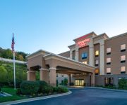
Hampton Inn University Area Huntington WV
Fairfield Inn & Suites Huntington
PULLMAN PLAZA HOTEL
Holiday Inn & Suites HUNTINGTON-CIVIC ARENA
Travelers Motel
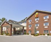
SUPER 8 HUNTINGTON WV
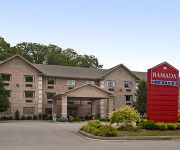
RAMADA LIMITED HUNTINGTON
Econo Lodge Huntington
HUNTINGTON INN
Videos from this area
These are videos related to the place based on their proximity to this place.
Huntington WV Fire Department response
Huntington WV Fire Department Engine company 2 responding from University Station.
KM White/Southeastern Hydraulic Elevator-Memorial Student Ctr-Marshall University-Huntington, WV
Installed in 1970-1971.
Lovely Dover Oildraulic Elevator in Jenkins Hall at Marshall University in Huntington, WV
Installed c. 1970.
Schooners Waterfront Bar & Grill
Location: Buffington Street and the River Huntington, WV Phone: 304-529-FOOD (3663) Mon - Thurs: 11:00 am - 10:00 pm Fri - Sat: 11:00 am - 11:00 pm Sun: 12:00 pm - 9:00 pm.
Marshall University: Get to Know Mourag from Tunisia
http://intohigher.com/Marshall BS Finance student, Mourag, talks about how he's made friends from around the world and how he is now used to life at Marshall and the US. Join our community...
Ready Built Chicken Coop
6x8 Chicken Coop by Leonard's of Huntington. Fits in just about any yard whether you live in the city or the country. Store bought eggs don't compare to fresh eggs any way you look at it.Call...
Videos provided by Youtube are under the copyright of their owners.
Attractions and noteworthy things
Distances are based on the centre of the city/town and sightseeing location. This list contains brief abstracts about monuments, holiday activities, national parcs, museums, organisations and more from the area as well as interesting facts about the region itself. Where available, you'll find the corresponding homepage. Otherwise the related wikipedia article.
Chesapeake, Ohio
Chesapeake is a village in Lawrence County, Ohio, United States. The population was 745 at the 2010 census. It lies across the Ohio River from Huntington, West Virginia, at the mouth of Symmes Creek. A bridge across the Ohio River connects Chesapeake to Huntington's downtown area. At one time, this was the only bridge connection across the Ohio River linking Ohio to Huntington. In recent years, bridges across the Ohio River connecting Ohio to Huntington's East and West sides have been built.
Proctorville, Ohio
Proctorville is a village in Lawrence County, Ohio, United States, along the Ohio River. The population was 574 at the 2010 census. The East End Bridge connects Proctorville to Huntington, West Virginia across the Ohio River. Proctorville is a part of the Huntington-Ashland, WV-KY-OH, Metropolitan Statistical Area (MSA). As of the 2000 census, the MSA had a population of 288,649.
Marshall University
Marshall University is a coeducational public research university in Huntington, West Virginia, United States founded in 1837, and named after John Marshall, the fourth Chief Justice of the United States.
Guyandotte River
The Guyandotte River is a tributary of the Ohio River, approximately 166 mi (267 km) long, in southwestern West Virginia in the United States. It was named after the French term for the Wendat Native Americans. It drains an area of the unglaciated Allegheny Plateau south of the Ohio between the watersheds of the Kanawha River to the northeast and Twelvepole Creek and the Big Sandy River to the southwest. Via the Ohio River, it is part of the Mississippi River watershed.
Cam Henderson Center
The Cam Henderson Center is the primary indoor athletics complex at Marshall University in Huntington, West Virginia, USA. The first basketball game played in the facility was a varsity match between Marshall and Army on November 27, 1981. The venue is named for Cam Henderson, who coached football and basketball at the school from 1935 to 1955.
Big Sandy Superstore Arena
The Big Sandy Superstore Arena, originally known as the Huntington Civic Center and later as the Huntington Civic Arena, is a municipal complex located in the downtown area of Huntington, West Virginia one block west of Pullman Square. The Big Sandy Superstore Arena consists of a 9,000-seat multi-purpose arena and an attached conference center. It is currently home to numerous concerts, events and will be the home of the Huntington Hammer of the Ultimate Indoor Football League for 2011.
Veterans Memorial Fieldhouse
The Veterans Memorial Fieldhouse was a 8,500-seat (6,500 for basketball) multi-purpose arena in Huntington, West Virginia. It was built in 1950. Prior to the completion of the Huntington Civic Center (now known as Big Sandy Superstore Arena) in 1976, it was the only large arena in the city. It closed on February 10, 2012, and was demolished later that year. The Fieldhouse was the home of the Marshall University basketball teams until the completion of the Cam Henderson Center in 1981.
WTSF
WTSF is a charismatic Christian television station in the Huntington-Charleston, West Virginia market, which covers parts of that state, eastern Kentucky and southeastern Ohio. It operates on digital channel 44. While the station is licensed to Ashland, Kentucky and its offices and studio are located in Ashland, its transmitter is located on a very short tower in Huntington's city park.
Robert C. Byrd Bridge
The Robert C. Byrd Bridge is a 720-foot continuous truss automobile bridge that crosses the Ohio River between Huntington, West Virginia and Chesapeake, Ohio. The crossing was constructed to replace an old, narrow two lane structure that was demolished after 69 years of service in a spectacular implosion on July 17, 1995.
East Huntington Bridge
The East Huntington Bridge (officially the Frank Gatski Memorial Bridge, also called the East End Bridge or the 31st Street Bridge) is a 900-foot cable-stayed bridge crossing the Ohio River at Huntington, West Virginia. It carries WV 106 on the West Virginia approach and OH 775 on the Ohio approach.
WMUL
WMUL is a Variety formatted broadcast radio station licensed to Huntington, West Virginia, serving Metro Huntington. WMUL is owned and operated by Marshall University.
Camden Park (amusement park)
Camden Park is a 26 acre amusement park located near Huntington, West Virginia. The park first opened in 1903 as a picnic spot along the Camden Interstate Railway street car line between Huntington and Ashland, Kentucky. It is a traditional park home to over 30 rides and attractions. The park features two of the three remaining roller coasters built by National Amusement Devices.
Huntington Museum of Art
For The Huntington Museum, Art Collections, Library and Botanical Gardens in San Marino, California see The Huntington Library.
Fairfield Stadium
Fairfield Stadium was a stadium in Huntington, West Virginia. It was primarily used for football, and was the home field of the Marshall University football team between 1927 and 1990, prior to the opening of Joan C. Edwards Stadium.
Sam Hood Field
Sam Hood Field was a soccer-specific stadium located in Huntington, West Virginia on the campus of Marshall University. The 1,500-seat stadium was built in 1995 and was home to the men's and women's soccer programs from Marshall. Prior to 1995 the teams played at Joan C. Edwards Stadium/James F. Edwards Field. The University is, for the 2012-13 season, removing the stadium to build an indoor practice facility for football.
Joan C. Edwards Stadium
The Joan C. Edwards Stadium is a football stadium located on the campus of Marshall University in Huntington, West Virginia. It can hold 38,019 spectators and includes twenty deluxe, indoor suites, 300 wheelchair-accessible seating, a state-of-the-art press-box, fourteen concession areas, and sixteen separate restrooms. It also features 90,000 sq ft . of artificial turf and 1,837 tons of structural steel. It also houses the Shewey Athletic Center, a fieldhouse and a training facility.
Fairland High School (Proctorville, Ohio)
Fairland High School is a public high school in Proctorville, Ohio, United States. It is the only high school in the Fairland Local School District. Their nickname is the Dragons. The Principal is Chad Belville and the Vice Principal is Jonathan Bradley.
Huntington (Amtrak station)
The Huntington Amtrak station is an Amtrak station in Huntington, West Virginia. Located at 1050 8th Avenue, the station consists of a platform on the south side of the east-west tracks, a small parking lot, and a small building in between. The station contains a waiting room and ticket office. Huntington is served by the Cardinal route.
St. Joseph Central Catholic High School
St. Joseph Central Catholic High School is a private, Roman Catholic high school in Huntington, West Virginia. It is part of the Roman Catholic Diocese of Wheeling-Charleston.
Huntington-Ashland-Ironton metropolitan area
The Huntington-Ashland-Ironton metropolitan area is the largest MSA in the State of West Virginia. The United States metropolitan area includes seven counties in West Virginia, Kentucky and Ohio. As of the 2010 census, the MSA had a population of 278,000. New definitions from February 28, 2013 placed the population at 363,000. The MSA is nestled along the banks of the Ohio River within the Appalachian Plateau region. The area is most often referred to locally as the Tri-State region.
WTCR-FM
WTCR-FM is a radio station broadcasting a Country format. Licensed to Huntington, West Virginia, USA, it serves the Huntington WV area. The station is currently owned by Clear Channel Communications.
WHKU
WHKU is a radio station broadcasting an Adult Standards/MOR format. Licensed to Proctorville, Ohio, USA, it serves the Huntington WV area. The station is currently owned by Educational Media Foundation.
Guyandotte, Huntington, West Virginia
Guyandotte is an historic neighborhood of Huntington, West Virginia and was formerly a small town in Virginia (and after 1863, West Virginia) located at the confluence of the Guyandotte River (which drains much of the more rugged portion of southern West Virginia) and the Ohio River. In 1873, when the Chesapeake and Ohio Railway (C&O) reached its western terminus there and built new facilities, the newly enlarged city was named Huntington, in honor of C&O Railway leader Collis P. Huntington.
Mountwest Community and Technical College
Mountwest Community and Technical College is the name of an independent community college serving the metropolitan Huntington, West Virginia area in the United States. It is one of ten regional community colleges in the West Virginia Community and Technical College System. The institution evolved from community college programs of Marshall University.
Tri-State Transit Authority
The Tri-State Transit Authority (TTA), which markets itself as "THE Transit Authority, is the city bus system in Huntington, West Virginia, and Ironton, Ohio, as well as its suburbs. Its buses range, on the West Virginia side from 19th Street West in Huntington to Milton, West Virginia, about 20 miles to the east. On the Ohio side the buses range from downtown Ironton to the Huntington suburb of Proctorville, Ohio, which is also a range of about 20 miles.


