Safety Score: 2,7 of 5.0 based on data from 9 authorites. Meaning we advice caution when travelling to United States.
Travel warnings are updated daily. Source: Travel Warning United States. Last Update: 2024-08-13 08:21:03
Delve into West Valley
West Valley in Yakima County (Washington) with it's 12,655 habitants is located in United States about 2,243 mi (or 3,610 km) west of Washington DC, the country's capital town.
Current time in West Valley is now 03:52 AM (Thursday). The local timezone is named America / Los Angeles with an UTC offset of -8 hours. We know of 8 airports close to West Valley, of which 3 are larger airports. The closest airport in United States is Yakima Air Terminal McAllister Field in a distance of 3 mi (or 5 km), South-East. Besides the airports, there are other travel options available (check left side).
Also, if you like playing golf, there are some options within driving distance. If you need a hotel, we compiled a list of available hotels close to the map centre further down the page.
While being here, you might want to pay a visit to some of the following locations: Yakima, Ellensburg, Goldendale, Wenatchee and Prosser. To further explore this place, just scroll down and browse the available info.
Local weather forecast
Todays Local Weather Conditions & Forecast: 2°C / 36 °F
| Morning Temperature | 2°C / 36 °F |
| Evening Temperature | 2°C / 36 °F |
| Night Temperature | 3°C / 37 °F |
| Chance of rainfall | 5% |
| Air Humidity | 98% |
| Air Pressure | 1018 hPa |
| Wind Speed | Light breeze with 4 km/h (2 mph) from South |
| Cloud Conditions | Overcast clouds, covering 100% of sky |
| General Conditions | Moderate rain |
Thursday, 21st of November 2024
3°C (38 °F)
3°C (37 °F)
Rain and snow, light breeze, overcast clouds.
Friday, 22nd of November 2024
2°C (36 °F)
2°C (36 °F)
Broken clouds, light breeze.
Saturday, 23rd of November 2024
4°C (39 °F)
2°C (36 °F)
Overcast clouds, light breeze.
Hotels and Places to Stay
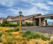
Comfort Suites Yakima
Quality Inn
Videos from this area
These are videos related to the place based on their proximity to this place.
Super Breezy Adventure STOL -- Yakima Aerosport
http://www.yakimaaerosport.com/aircraft/super-breezy/ Short take off and landing (STOL) performance of the Yakima Aerosport Super Breezy.
Yakima Taijutsu Martial Arts Randori and Instruction
Sensei Jeremiah teaching from the different elements.
Selah Cub Scout Pack 276 - Pumpkin Bowling
See photo report: http://www.selahadventures.com/2014/selah-cub-scout-pack-276-pack-meeting-dollars-and-sense.
GoPro HD2 Longboarding Crusher Canyon Selah, Wa. 6-11-12 Kel Clark & Anson Morgan!
Nice evening cruisin down Crusher.......
2012 Selah Community Day Street Dance
Selah Community Day Street Dance on East Naches Avenue in front of the Pastime & Double Barrel. The report and 250 photos for the Selah Community Days are at ...
Sherry Dawson of King's Row takes the ALS ice bucket challenge!
Dawson of King's Row in Selah, Washington takes the ALS ice bucket challenge. See who she calls out!
Simon Cowell The Gaited Mule
Super well gaited mule. Simon is the coolest. Never misses a beat of his perfect four beat gait. He loves going out on the trails, loves to lope, moves out so willingly. He is truly an...
Videos provided by Youtube are under the copyright of their owners.
Attractions and noteworthy things
Distances are based on the centre of the city/town and sightseeing location. This list contains brief abstracts about monuments, holiday activities, national parcs, museums, organisations and more from the area as well as interesting facts about the region itself. Where available, you'll find the corresponding homepage. Otherwise the related wikipedia article.
Ahtanum, Washington
Ahtanum is a census-designated place (CDP) in Yakima County, Washington, United States. The population was 3,601 at the 2010 census.
Summitview, Washington
Summitview is a census-designated place (CDP) in Yakima County, Washington, United States. The population was 967 at the 2010 census. Based on per capita income, Summitview ranks 18th of 522 areas in the state of Washington to be ranked. It is also the highest rank achieved in Yakima County.
West Valley, Washington
West Valley is a former census-designated place (CDP) in Yakima County, Washington, United States. The area has been annexed by the city of Yakima. The population was 10,433 at the 2000 census. Based on per capita income, West Valley ranks 76th of 522 areas in the state of Washington to be ranked.
Ahtanum View Corrections Center
Ahtanum View Corrections Center was Washington's Convalescent Hospital for Convicts until the Dept. of Corrections closed the facility in 2010 due to budget cuts. It was where inmates with long-term care issues were incarcerated. These can be issues relating to age or long-term health-care needs.
Eisenhower High School (Yakima, Washington)
Dwight David Eisenhower High School in Yakima, Washington is a school named after U.S. President Dwight Eisenhower. It is one of four high schools in the Yakima School District with the others being Davis High School, Stanton Academy and O.I.C. Alternative. Students of Eisenhower and other schools refer to Eisenhower High School as Ike.
West Valley High School (Yakima)
West Valley High School is a public secondary school in Yakima, Washington in the West Valley School District. It consists of two adjacent campuses: The main campus for sophomores, juniors, and seniors, and a freshmen campus next to Gotfred E. Clasen field. The school has approximately 1600 students.
Naches Heights AVA
The Naches Heights AVA is an American Viticultural Area contained within the Columbia Valley AVA. The AVA was recognized officially on 13 January 2012. Additionally, it is the first AVA in Washington State to be fully sustainable, with all 7 vineyards practicing in either biodynamic or LIVE certification. It is the smallest AVA in Washington with 37.2 acres planted.


