Safety Score: 2,7 of 5.0 based on data from 9 authorites. Meaning we advice caution when travelling to United States.
Travel warnings are updated daily. Source: Travel Warning United States. Last Update: 2024-08-13 08:21:03
Discover Hillsdale
Hillsdale in Whatcom County (Washington) is a town in United States about 2,339 mi (or 3,764 km) west of Washington DC, the country's capital city.
Current time in Hillsdale is now 04:41 AM (Tuesday). The local timezone is named America / Los Angeles with an UTC offset of -8 hours. We know of 10 airports near Hillsdale, of which 4 are larger airports. The closest airport in United States is Bellingham International Airport in a distance of 15 mi (or 24 km), South-East. Besides the airports, there are other travel options available (check left side).
There is one Unesco world heritage site nearby. It's Olympic National Park in a distance of 84 mi (or 135 km), South. Also, if you like playing golf, there are a few options in driving distance. We discovered 10 points of interest in the vicinity of this place. Looking for a place to stay? we compiled a list of available hotels close to the map centre further down the page.
When in this area, you might want to pay a visit to some of the following locations: Bellingham, Friday Harbor, Mount Vernon, Coupeville and Chilliwack. To further explore this place, just scroll down and browse the available info.
Local weather forecast
Todays Local Weather Conditions & Forecast: 8°C / 46 °F
| Morning Temperature | 4°C / 40 °F |
| Evening Temperature | 7°C / 45 °F |
| Night Temperature | 4°C / 40 °F |
| Chance of rainfall | 0% |
| Air Humidity | 73% |
| Air Pressure | 1024 hPa |
| Wind Speed | Moderate breeze with 12 km/h (7 mph) from South-East |
| Cloud Conditions | Overcast clouds, covering 100% of sky |
| General Conditions | Overcast clouds |
Tuesday, 5th of November 2024
7°C (44 °F)
4°C (38 °F)
Sky is clear, light breeze, clear sky.
Wednesday, 6th of November 2024
6°C (44 °F)
5°C (42 °F)
Broken clouds, light breeze.
Thursday, 7th of November 2024
8°C (47 °F)
9°C (48 °F)
Overcast clouds, light breeze.
Hotels and Places to Stay
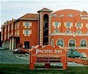
PACIFIC INN SOUTH SURREY
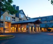
Semiahmoo Resort Golf & Spa
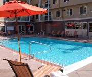
Raintree's Sandcastle
Bayside Motor Inn
Anchor Inn Motel
Northwoods Motel
Driftwood Lodge
Pacific Inn Resort & Conference Centre
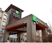
Holiday Inn Express & Suites LANGLEY
Breakaway Motel
Videos from this area
These are videos related to the place based on their proximity to this place.
Beautiful Blaine Washington USA 98230
A video tour of Blaine Washington including Ken Imus's new building.
Blaine Washington the Peace Arch City
Blaine Washington is quietly undergoing an amazing transformation as Entrepreneurs, City leaders and it's citizens embrace thoughtful progress while cherishing it's rich Maritime and Historic past.
Seascape Luxury Waterfront Condos, Blaine, Washington
Seascape Luxury Waterfront Condos, Blaine, Washington.
Re-Discover Blaine Washington
Quick Tour of beautiful Blaine Washington positioned on the U.S. Canada border North of Seattle.
Blaine, Washington canopy lift.wmv
Performance canopies out of Renton, Washington lifts a 40' x 50' service station canopy off it's columns and sets it on the ground with A 500 ton hydraulic crane.
Blaine, WA - Beautiful - Home 237 8th Street Blaine, WA
Gorgeous Home In Blaine WA - Close To USA-Canadian Border - Well Kept - Lots Of Flowers And Color - Huge Shop - RV Pad.
2194 Cedarwood Lane, Blaine, WA Presented by Raymond Pelletti.
Click to see more: http://www.searchallproperties.com/listings/2003937/2194-Cedarwood-Lane-Blaine-WA/auto?reqpage=video 2194 Cedarwood Lane Blaine, WA 98230 ...
MLS 362695 - 8753 Blaine Rd, Blaine, WA
One of a kind rare opportunity. Seller has lived on prop. for 32 years. Sgl level 2BR/1.5BA (1536 sq ft) home w/2 bay shop/garage on 2.8 acres. http://www.coldwellbanker.com/property?action=detail&...
Ryan Wallen 4 Iron 200 yards
HS Senior Blaine, Washington 6' 180# Loomis Trail Golf Club Blaine, Washington.
Videos provided by Youtube are under the copyright of their owners.
Attractions and noteworthy things
Distances are based on the centre of the city/town and sightseeing location. This list contains brief abstracts about monuments, holiday activities, national parcs, museums, organisations and more from the area as well as interesting facts about the region itself. Where available, you'll find the corresponding homepage. Otherwise the related wikipedia article.
Birch Bay, Washington
Birch Bay is a census-designated place (CDP) in Whatcom County, Washington, United States. Birch Bay is a protected bay located between Semiahmoo Bay and Lummi Bay. It is also commonly referred to as the community near and around this body of water, but is actually not its own town. Birch Bay is approximately 100 miles north of Seattle and 35 miles south of Vancouver, BC, Canada. The population was 8,413 at the 2010 census, a 69.6% increase over the 2000 census.
Blaine High School (Washington)
Blaine High School is a high school located in Blaine, Washington. Their school mascot is a Borderite, and their colors are orange and black. Present administrators are Principal Ellis and Vice Principal Vezzetti. As of 2009, Blaine High School is 103 years old. ALUMNI::: Scott Gomez plays in the NHL he attended school there in 2003. Luke Ridnour, Shooting Guard for the Minnesota Timberwolves, attended Blaine High school.
Blaine Middle School
Blaine middle is a part of the blaine school district together with blaine high school, primary school, pt. roberts primary, and blaine elementary. blaine middle provides a wide range of elective classes taken during the school day which last from 8:20 till 2:50. many who do not ride the bus tend to wake up later in the day racing to school and striving not to be late.
Semiahmoo First Nation
Semiahmoo First Nation is the band government of the Semiahmoo people, a Coast Salish subgroup. The band's main community and offices are located on 312 acres of Indian Reserve just south of White Rock, British Columbia and near the Canada-United States boundary and Peace Arch Provincial Park.
Douglas, British Columbia
This article is for the border-crossing and locality in Surrey, BC. For the town at the head of Harrison Lake, see Port Douglas, British Columbia Douglas is a locality in Surrey, British Columbia, Canada, just southeast and outside of the boundary of White Rock, that is the Canadian side of the Peace Arch Border Crossing between British Columbia and Whatcom County, Washington in the United States.
KARI (AM)
KARI (branded as Word Radio) is a radio station serving the Metro Vancouver and Northwest Washington areas with a Christian talk radio format. It broadcasts on AM frequency 550 kHz and is under ownership of Multicultural Broadcasting.
KVRI
KVRI (branded as Radio India) is a radio station licensed to Blaine, Washington, United States, serving Vancouver, British Columbia, Canada with a combined India News/Talk/Music format. It broadcasts on AM frequency 1600 kHz and is under ownership of Multicultural Broadcasting with studios in Surrey, British Columbia.
Blaine Municipal Airport
Blaine Municipal Airport was a city-owned public-use airport located one nautical mile (1.8 km) east of the central business district of Blaine, a city in Whatcom County, Washington, United States. Blaine Municipal Airport (AKA Dierks Field) was closed on December 31, 2008.


