Safety Score: 2,7 of 5.0 based on data from 9 authorites. Meaning we advice caution when travelling to United States.
Travel warnings are updated daily. Source: Travel Warning United States. Last Update: 2024-08-13 08:21:03
Explore South Union
South Union in Thurston County (Washington) is a city in United States about 2,351 mi (or 3,784 km) west of Washington DC, the country's capital.
Local time in South Union is now 09:17 AM (Tuesday). The local timezone is named America / Los Angeles with an UTC offset of -8 hours. We know of 10 airports in the vicinity of South Union, of which 5 are larger airports. The closest airport in United States is Olympia Regional Airport in a distance of 2 mi (or 3 km), North. Besides the airports, there are other travel options available (check left side).
There is one Unesco world heritage site nearby. It's Olympic National Park in a distance of 58 mi (or 93 km), North. Also, if you like golfing, there are multiple options in driving distance. We found 3 points of interest in the vicinity of this place. If you need a place to sleep, we compiled a list of available hotels close to the map centre further down the page.
Depending on your travel schedule, you might want to pay a visit to some of the following locations: Olympia, Chehalis, Shelton, Tacoma and Port Orchard. To further explore this place, just scroll down and browse the available info.
Local weather forecast
Todays Local Weather Conditions & Forecast: 7°C / 45 °F
| Morning Temperature | 1°C / 33 °F |
| Evening Temperature | 2°C / 36 °F |
| Night Temperature | 1°C / 33 °F |
| Chance of rainfall | 0% |
| Air Humidity | 56% |
| Air Pressure | 1025 hPa |
| Wind Speed | Light breeze with 3 km/h (2 mph) from South-West |
| Cloud Conditions | Scattered clouds, covering 28% of sky |
| General Conditions | Scattered clouds |
Tuesday, 3rd of December 2024
8°C (47 °F)
3°C (37 °F)
Sky is clear, calm, clear sky.
Wednesday, 4th of December 2024
7°C (44 °F)
5°C (42 °F)
Light rain, light breeze, overcast clouds.
Thursday, 5th of December 2024
8°C (46 °F)
10°C (50 °F)
Light rain, gentle breeze, overcast clouds.
Hotels and Places to Stay
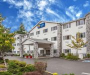
Comfort Inn Conference Center Tumwater - Olympia
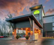
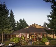
La Quinta Inn and Suites Tumwater - Olympia
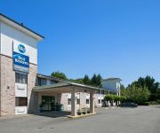
BW TUMWATER OLYMPIA INN
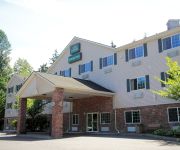
GUESTHOUSE INN TUMWATER
MOTEL 6 TUMWATER OLYMPIA
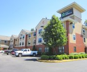
EXTENDED STAY AMERICA TUMWATER
HOTEL RL BY RED LION OLYMPIA
Videos from this area
These are videos related to the place based on their proximity to this place.
Deschutes River Tumwater Falls Flood 2008
In January, 2008, record snowmelt and heavy rains created a large amount of water that had to go SOMEWHERE. This is the view of the Deschutes River in Tumwater on the bridge behind the Old...
Logan Coach Toy Hauler 17' Garage 10'X10' Living Quarters
Check out this awesome 2014 Logan Coach living quarters with slideout. Use it for a race car or any of your other toys. Much better quality than most toy haulers on the market at a great price!...
More Night Train Activity
1) Coal train northbound on main two passes Waldrick Bridge, then at S. Rich Rd.: 2) container stack train southbound on main one, and 3) grain train northbound on main two.
U12 T-Birds Basketball Game 10 - Blazers - Rilee's Layup
Rilee takes a pass, makes a nice move and scores a neat little lay up to decrease the T-Bird advantage. (Why on earth am I showing a Blazers highlight you ask? Rilee's Jenna's bud (from soccer)...
I'm Sick of United Airlines Stupid Decisions
I was smiling at 5:00 AM when I was going through TSA security check. It's a small airport and I fly a lot so as always there was friendly chit chat with the gate and TSA agents. But then I...
U12 T-Birds Basketball Game 3 - Centralia - Sawyer Feeds Jenna for Two
Out of the half time break the T-Birds run the "replace" motion again. The twist is that both post players (Jenna and Courtney) are on the wings. Sawyer goes to Jenna's side so Jenna runs...
U12 T-Birds Basketball Game 1 - Blazers - Inbound Stack Play, Part II
This time it's Katie in-bounding the basketball. Once again the Blazers fail to pick up Jenna and Katie rifles the ball into her. Jenna scores her 3rd bucket of the game.
U12 T-Birds Basketball Game 3 - Centralia - Relentless Defensive Pressure
Centralia breaks the press but the T-Birds pressure the ball relentlessly. Katie and Sawyer cause a turnover that Jenna grabs for another steal. Jenna spies Katie alone up court and tosses...
U13 T-Birds Basketball - Game 7 - Barracudas - Steal and Drive to the Hoop
Jenna grabs a steal, turns and drives the floor for a lay in.
Videos provided by Youtube are under the copyright of their owners.
Attractions and noteworthy things
Distances are based on the centre of the city/town and sightseeing location. This list contains brief abstracts about monuments, holiday activities, national parcs, museums, organisations and more from the area as well as interesting facts about the region itself. Where available, you'll find the corresponding homepage. Otherwise the related wikipedia article.
Millersylvania State Park
Millersylvania is an 842 acre (3.4 km²) park 10 miles (16 km) south of Olympia, Washington. The park has 6 miles of trails (including the 1-mile fitness trail), old-growth cedar and fir trees, and also features camping and 3,300 feet (1 km) of freshwater shoreline on Deep Lake. Deep Lake is located in Section 3, Township 16N, Range 2W, Willamette. According to the survey done by the State Department of Game in 1947, Deep Lake is 17 feet deep at its deepest part.
Olympic Flight Museum
The Olympic Flight Museum is an aviation museum at the Olympia Airport in Olympia, Washington, USA. The museum has more than 20 vintage planes and helicopters on display, most of which are in airworthy condition. Children can climb in such as the mobile Huey and T-28 Trojan. There is a scale model airplane display. See up close an airworthy and pristine P-51 Mustang, a replica A6M Zero, T-6 Texan World War II trainer, and several helicopters including a HH-43 Huskie and an OH-6 Cayuse (Loach).
Olympia Regional Airport
Olympia Regional Airport is a public use airport located four nautical miles (7 km) south of the central business district of Olympia, a city in Thurston County and the capital of the U.S. state of Washington. Formerly known as Olympia Airport, it is owned by the Port of Olympia. It is about one mile (1.6 km) east of Interstate 5, actually within the boundaries of the city of Tumwater which is south of and adjacent to Olympia.
Tumwater High School
Tumwater High School is a secondary school in Tumwater, Washington serving grades 9-12 in Thurston County. It is one of two comprehensive high schools in the Tumwater School District. Tumwater High School generally draws students from the portions of the Tumwater School District east of Interstate 5 and the Littlerock area west of I-5.
Black Hills High School
A.G. West Black Hills High School is a secondary school in Tumwater, Washington serving grades 9-12 in Thurston County. BHHS serves approximately 1000 students each year. The Black Hills High School staff is composed of 3 Administrators, 52 teachers, 3 counselors, 8 Educational Assistants, and 25 Support Staff.
Scott Lake (Washington)
Scott Lake is a lake in Thurston County, Washington, United States. It is located 3.2 miles south of the Tumwater city limits, 8.4 miles south of the Olympia city limits, and 14.1 miles north of the Centralia city limits. The location for Scott Lake is in Sections 33 and 34, Township 17N, Range 2W, Willamette Meridian. The lake receives its water from a creek that comes out of Deep Lake. The creek is officially unnamed, but is referred to as Spruce Creek by the Millersylvania State Park.


