Safety Score: 2,7 of 5.0 based on data from 9 authorites. Meaning we advice caution when travelling to United States.
Travel warnings are updated daily. Source: Travel Warning United States. Last Update: 2024-08-13 08:21:03
Explore Pasadena Park
The district Pasadena Park of Spokane Valley in Spokane County (Washington) is located in United States about 2,087 mi west of Washington DC, the country's capital.
If you need a place to sleep, we compiled a list of available hotels close to the map centre further down the page.
Depending on your travel schedule, you might want to pay a visit to some of the following locations: Spokane, Newport, Saint Maries, Colfax and Davenport. To further explore this place, just scroll down and browse the available info.
Local weather forecast
Todays Local Weather Conditions & Forecast: 2°C / 36 °F
| Morning Temperature | -1°C / 30 °F |
| Evening Temperature | 0°C / 33 °F |
| Night Temperature | -0°C / 31 °F |
| Chance of rainfall | 0% |
| Air Humidity | 61% |
| Air Pressure | 1031 hPa |
| Wind Speed | Calm with 2 km/h (1 mph) from South |
| Cloud Conditions | Overcast clouds, covering 100% of sky |
| General Conditions | Overcast clouds |
Wednesday, 4th of December 2024
3°C (37 °F)
0°C (32 °F)
Sky is clear, calm, clear sky.
Thursday, 5th of December 2024
3°C (38 °F)
0°C (32 °F)
Sky is clear, calm, clear sky.
Friday, 6th of December 2024
3°C (37 °F)
3°C (38 °F)
Overcast clouds, calm.
Hotels and Places to Stay
Quality Inn Valley Suites
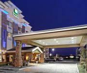
Holiday Inn Express SPOKANE-VALLEY
Comfort Inn & Suites Spokane Valley
Baymont Inn & Suites Spokane Valley
SUPER 8 SPOKANE VALLEY
MOTEL 6 SPOKANE EAST
Rodeway Inn & Suites
CROSSLAND STUDIOS SPOKANE VLLY
OXFORD SUITES SPOKANE VALLEY
Videos from this area
These are videos related to the place based on their proximity to this place.
Roadhouse New Year's Eve Bull Ride 1 .m4v
Roadhouse New Year's Eve Bull Ride 1, Roadhouse, Spokane Valley WA.
BNSF Autorack/Doublestack
Newly added scenery makes a good photo-op for this combo priority train. Filmed at the Inland Northwest Society of HO Modular Engineers (INSHOME) club layout 8-29-2014.
Big Grain - Twice the Fun
A grain train from two points of view. Filmed at the INSHOME model railroad club in Spokane, WA.
Custom Injection Molding Service | Injection Molding Manufactures | MERI China #4
This is the fourth in a series of videos about Custom Injection Molding Services by MERI China. Visit http://merichina.com for a Free Quote on your next Custom Injection Molding project. Do...
HO Rail-fanning
See 4 of my favorite clips all shot over the last few years. Dubbed up right for your viewing enjoyment! #1: BN Grainer #2: BN Mixed Freight #3: Rio Grande Coal (special appearance...
Trains Across America - Part 19
This interactive video series features model railroaders sharing their trains around the USA. The transformer from part 15 comes to the Pacific coast.
Custom Injection Molding Service | Injection Molding Manufactures | MERI China #5
This is the fifth in a series of videos about Custom Injection Molding Services by MERI China. Visit http://merichina.com for a Free Quote on your next Custom Injection Molding project. Do...
South 40 Local Spokane WA
The South 40 Local in Spokane switches the many industries that line the south side of Yardley yard in Parkwater WA. (Between Spokane WA and Spokane Valley WA). On this day power for the...
Videos provided by Youtube are under the copyright of their owners.
Attractions and noteworthy things
Distances are based on the centre of the city/town and sightseeing location. This list contains brief abstracts about monuments, holiday activities, national parcs, museums, organisations and more from the area as well as interesting facts about the region itself. Where available, you'll find the corresponding homepage. Otherwise the related wikipedia article.
Dishman, Washington
Dishman is a former census-designated place (CDP) in Spokane County, Washington, United States. Founded by A.T. Dishman, who operated a nearby rock quarry, its population was 10,031 at the 2000 census. Dishman has been part of Spokane Valley since 2003.
Millwood, Washington
Millwood is a city in Spokane County, Washington, United States. The population was 1,786 at the 2010 census. Millwood is a suburb of Spokane, Washington, and is surrounded on three sides by the city of Spokane Valley, Washington.
Opportunity, Washington
Opportunity is a former census-designated place in Spokane County, Washington, United States. The population was 25,065 at the 2000 census. The area has been a city neighborhood of Spokane Valley since the city incorporated in 2003.
Trentwood, Washington
Trentwood is a former census-designated place (CDP) in Spokane County, Washington, United States. The population was 4,388 at the 2000 census. Trentwood has been part of the city of Spokane Valley since it incorporated in 2003.
Veradale, Washington
Veradale is a former census-designated place (CDP) in Spokane County, Washington, United States. The population was 9,387 at the 2000 census. Since 2003, the area has been incorporated as part of the city of Spokane Valley.
Hillyard, Spokane, Washington
Hillyard, Washington is a neighborhood in Spokane, Washington which existed as a separate town between 1892 and 1924. The town came about due to the Great Northern Railway and was named for James J. Hill, then-head of the railroad. Between 1904 and 1912, many of the town's houses were built, to house railroad workers working in the local yard. Hillyard was the home of the Great Northern's famed shops where locomotives were manufactured, repaired, and refurbished.
KSPO
KSPO is a religious broadcasting talk outlet serving the Spokane, Washington area. The flagship station for the American Christian Network, it is owned by Thomas W. Read/Classical Broadcasting and its city of license is Dishman, Washington, broadcasting at 106.5 MHz with an ERP of 2.25 kW.
KQNT
KQNT is a news-talk radio station in Spokane, Washington, United States, that offers a mix of news and syndicated talk fare. The station is currently owned by Clear Channel Communications and features programing from Fox News Radio and Premiere Radio Networks.
Avista Stadium
Avista Stadium is an outdoor athletic venue in Spokane Valley, Washington. It is the home ballpark of the Spokane Indians minor league baseball team of the Northwest League, a Class A short-season affiliate of the Texas Rangers.
Felts Field
Felts Field is a public use airport located four nautical miles northeast of the central business district of Spokane, in Spokane County, Washington, United States. It is owned by Spokane City-County. The airport has two hard surface runways and one runway on the Spokane River. Felts Field is primarily used for general aviation now, however was Spokane's primary passenger airport before the opening of Spokane International Airport.
Saint Michael's Academy
Saint Michael's Academy is an American day and boarding school for boys and girls from kindergarten through twelfth grade located in Spokane, Washington, United States, and administered by a sedevacantist group, the Congregation of Mary Immaculate Queen, Traditionalist Catholic group.
Mead, Washington
Mead is an unincorporated suburb and census-designated place north of Spokane in Spokane County, Washington, United States. Named for Civil War general George Meade, this rural area is tracked by the United States Census Bureau. As of 2010, population of Mead was 7,275. In 1900 Mead was the second stop on the Spokane Falls & Northern Railway.
Dishman Hills
Dishman Hills Natural Resources Conservation Area is a 530 acre (2.14 km²) area protected by a combination of public (Spokane County Parks and Recreation Department and Washington Department of Natural Resources) and non-profit groups, located in Spokane County, Washington. The granite outcroppings that form the bulk of the area were originally formed 70 million years ago, by volcanic magma pushing up through the Earth's crust, and then cooling.
University High School (Spokane Valley, Washington)
University High School (nicknamed 'U-Hi' or 'U-High') is a 3A, grade 9-12 high school in Spokane Valley, Washington. It is part of the Central Valley School District in Spokane Valley. In 2003, the school campus moved approximately 2 miles to a new location. The new building has a higher capacity than the old, capable of housing around 1900 students.
Spokane College of English Language
Spokane College of English Language (known as SCEL) is an English language college in Spokane, Washington, USA. The college is located in downtown Spokane, WA.
Spokane Community College
Established in 1963, Spokane Community College is part of Community Colleges of Spokane. It is a comprehensive educational institution, offering liberal arts-transfer degrees and a wide array of career-technical degree and certificate options in the fields of manufacturing, transportation, environmental sciences, hospitality, public safety, business, information technology, hospitality and culinary arts.
Spokane Valley Mall
Spokane Valley Mall is a shopping mall located at 14700 East Indiana Avenue in Spokane Valley, Washington, United States. It is about 9.5 miles away from NorthTown Mall in Spokane which is the largest mall in Eastern Washington. The mall is owned by General Growth Properties and the current anchors are Sears, JCPenney, and Macy's, and it includes a Regal Cinemas with 12 screens.
Morning Star Boys' Ranch
Morning Star Boys' Ranch is a residential facility for youth in Spokane, Washington established in 1956. There have been allegations of sexual and physical abuse by staff at the facility and others against the boys who lived there. In Feb. 2010 a jury returned a verdict clearing the Boys' Ranch of any wrongdoing in the only case brought to trial.
West Valley High School (Spokane)
West Valley High School is a public secondary school in Spokane, Washington. It enrolls over 900 students in grades 9 through 12. The school colors are orange and black and the mascot is the eagles. As a Gates "Washington Achievers" grant high school, West Valley has started a mentor groups program. Staff members meet with small groups of students daily to discuss issues in students' lives and connect with the students in the hopes that it will improve student experience and performance.
Valley Christian School (Spokane Valley, Washington)
Valley Christian School is a private Christian school located in Spokane Valley, Washington, United States. The school was founded in 1975 located in the previous University High School in Spokane Valley. It is a non-denominational, non-profit 501C3 school, and is accredited by ACSI and NASC. It is approved by the State of Washington, and enrolls students in grades K-12.
East Valley Middle School (Spokane)
East Valley Middle School (also known as EVMS) is a public middle school located in Spokane Valley, Washington. It serves 6th, 7th, and 8th graders in East Valley School District. It's one of the 2 primary middle schools in EVSD, the other being Mountain View Middle School.
West Valley School District (Spokane)
West Valley School District (WVSD) is located in the city of Spokane Valley, Washington. The District has four elementary schools, two middle schools, and four high schools, which include two non-traditional high schools. The grade configurations are K-5 in the elementary, 6-8 in the middle schools, and 9-12 in the high schools.
Spokane Valley High School
Spokane Valley High School (also known as SVHS) is a enterprising school of choice, founded on relationships and driven to actively challenge students. It's a non-traditional, all-day project-based school which has won Washington Achievement Award and Washington Designated Innovative Schools Award. In addition to all-day programs the school also offers Transition and G.E.D. programs that help students with difficult circumstances to continue their education.
River City Leadership Academy
RiverCity Leadership Academy (also known as RLA) is a fully accredited high school in which students share common wilderness experiences, use applied technology, study under a group of teachers and create their own projects according to individual interests. RiverCity Leadership Academy is the first Project-based high school in Washington state to utilize this successful and revolutionary hands-on approach to learning developed by the EdVisions coop.
West Valley City School
West Valley City School (also known as City School); provides educational opportunities for families whose children are in the fifth through eighth grades. School offers high academic standards in an experiential learning format. School does that by arranging everything in a real-world environment. Each student has their own job and when something school-related needs to be handled everyone does their job as they would in real life. The inside of the school is designed to feel like real world.


