Safety Score: 2,7 of 5.0 based on data from 9 authorites. Meaning we advice caution when travelling to United States.
Travel warnings are updated daily. Source: Travel Warning United States. Last Update: 2024-08-13 08:21:03
Delve into Fort Rains
Fort Rains in Skamania County (Washington) is located in United States about 2,310 mi (or 3,718 km) west of Washington DC, the country's capital town.
Current time in Fort Rains is now 02:47 AM (Tuesday). The local timezone is named America / Los Angeles with an UTC offset of -8 hours. We know of 8 airports close to Fort Rains, of which 3 are larger airports. The closest airport in United States is Portland International Airport in a distance of 33 mi (or 53 km), West. Besides the airports, there are other travel options available (check left side).
Also, if you like playing golf, there are some options within driving distance. If you need a hotel, we compiled a list of available hotels close to the map centre further down the page.
While being here, you might want to pay a visit to some of the following locations: Stevenson, Hood River, The Dalles, Vancouver and Oregon City. To further explore this place, just scroll down and browse the available info.
Local weather forecast
Todays Local Weather Conditions & Forecast: 6°C / 44 °F
| Morning Temperature | 6°C / 43 °F |
| Evening Temperature | 6°C / 42 °F |
| Night Temperature | 5°C / 42 °F |
| Chance of rainfall | 0% |
| Air Humidity | 97% |
| Air Pressure | 1025 hPa |
| Wind Speed | Moderate breeze with 11 km/h (7 mph) from East |
| Cloud Conditions | Overcast clouds, covering 100% of sky |
| General Conditions | Light rain |
Tuesday, 5th of November 2024
8°C (47 °F)
3°C (37 °F)
Few clouds, light breeze.
Wednesday, 6th of November 2024
8°C (46 °F)
3°C (37 °F)
Sky is clear, light breeze, clear sky.
Thursday, 7th of November 2024
7°C (45 °F)
5°C (42 °F)
Broken clouds, light breeze.
Hotels and Places to Stay
BEST WESTERN PLUS COLUMBIA RVR
Bonneville Hot Springs Resort & Spa
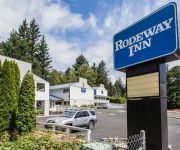
Rodeway Inn Stevenson
Columbia Gorge Inn
Skamania Lodge
Videos from this area
These are videos related to the place based on their proximity to this place.
View of Cascade Locks, OR and Stevenson, WA, from the Columbia River
Views of the cities of Cascade Locks, Oregon and Stevenson, Washington. View includes the Bridge of the Gods nearby. Taken from the sternwheeler paddleboat cruise ship Wednesday June 6, 2012.
Skamania Lodge
Travel Writer Nancy D. Brown, http://www.nancydbrown.com, visits Skamania Lodge & Waterleaf Spa in Stevenson, Washington. The 175 acre resort is pet-friendly & offers golf, hiking, biking,...
A Sunday Ride down the old Gorge Hwy
Part of a Sundays ride from Tigard Oregon down the old Gorge Hwy through the Womans Forum and Bridal Veil. This trip is down the old Oregon Gorge Hwy to Casc...
Raptor Adventures at Skamania Lodge
From demonstration of falconry at Skamania Lodge - Stevenson, WA. Video is copyright 2010 - Tuttle Images, All Rights Reserved. Video may be linked to, but not downloaded and resold. Additional...
No public access
Hello fellow Wonderers, this is our teaser video for our mini roadtrip to Portland, OR last weakened. While we were driving some old back country roads we fo...
Sweeney Falls
Sweeney Falls is located in the western Columbia River Gorge on the Washington side of the river, approximately five miles east of Bridge of the Gods or 2 miles east of the town of Stevenson....
Cycling the Bridge of the Gods
RAW 2007, cycling over the Bridge of the Gods - Columbia River between Washington state and Oregon. Near Stevenson, WA.
Roasters at Roasters Guild Retreat 2014
The 14th Annual Roasters Guild Retreat had a record number of coffee roasters in the roasting tent. A dozen small production roasters and a half dozen sample roasters were available to use....
2008-09-15 UP 8531 Westbound at Cascade Locks and Dodson OR
Awsome horn on this one. First at West Cascade Locks siding and Dodson Siding.
Videos provided by Youtube are under the copyright of their owners.
Attractions and noteworthy things
Distances are based on the centre of the city/town and sightseeing location. This list contains brief abstracts about monuments, holiday activities, national parcs, museums, organisations and more from the area as well as interesting facts about the region itself. Where available, you'll find the corresponding homepage. Otherwise the related wikipedia article.
Bridge of the Gods (land bridge)
The Bridge of the Gods was a natural dam created by the Bonneville Slide, a major landslide that dammed the Columbia River near present-day Cascade Locks, Oregon in the Pacific Northwest of the United States. The river eventually breached the bridge and washed much of it away, but the event is remembered in local legends of the Native Americans as the Bridge of the Gods.
Cascades Rapids
The Cascades Rapids (sometimes called Cascade Falls or Cascades of the Columbia) were an area of rapids along North America's Columbia River, between the U.S. states of Washington and Oregon. Through a stretch approximately 150 yards wide, the river dropped about 40 feet in 2 miles .
Bridge of the Gods (modern structure)
The Bridge of the Gods is a steel truss cantilever bridge that spans the Columbia River between Cascade Locks, Oregon and Washington state near North Bonneville. It is approximately 40 miles (64 kilometers) east of Portland, Oregon and 4 miles (6.4 km) upriver from the Bonneville Dam. It currently serves as a toll bridge operated by the Port of Cascade Locks. The bridge was built by the Wauna Toll Bridge Company of Walla Walla, Washington and opened in 1926 at a length of 1,127 feet (343 m).
Eagle Creek (Multnomah County, Oregon)
Eagle Creek is a creek in Hood River County, Oregon, United States. The creek drains into the Columbia River in Multnomah County, with its outlet on the Columbia River Gorge. It is in the Mount Hood National Forest. The Eagle Creek Trail – the most popular trail in the Gorge – follows the creek. Tunnel Falls and Punch Bowl Falls, located on Eagle Creek, are remote and scenic waterfalls along the creek. The Historic Columbia River Highway crosses the creek's outlet to the Columbia River.
Fort Raines
Fort Raines (spelled "Rains" on interpretive signs) was a United States Army blockhouse built in October 1855 to protect the portage road around the Cascades Rapids. It is located on the Washington side of the Columbia River, west of the Bridge of the Gods, at the "middle cascades. " It was abandoned by 1857. The interpretive sign at the former site states that the post was "damp and lonely. " Fort Raines was named for Brigadier General Gabriel J.
Sheridan State Scenic Corridor
Sheridan State Scenic Corridor is a state park in the Columbia River Gorge, west of Cascade Locks, Oregon. The 11-acre property, containing an old-growth forest, is located on the south side of Interstate 84 at approximately milepoint 42.5, and was not accessible by motor vehicle since I-84 was built in 1960. However, with the opening of the Eagle Creek-Cascade Locks segment of the Historic Columbia River Highway State Trail in 1998, it has become easily accessible by foot or bicycle.
List of rapids of the Columbia River
This is a list of rapids of the Columbia River, listed in upriver order. The river flows through Canada and the USA. Almost all of these rapids are now submerged in the reservoirs of dams. The list is not exhaustive; there were numerous minor rapids and riffles, many of which were never named.
Oregon Portage Railroad
The Oregon Portage Railroad was the first railroad in the U.S. state of Oregon. It originally ran for 4.5 miles with 7 miles of telegraph line, and was later extended to a length of 15 miles . The railroad was located on the south bank of the Cascades canal, of the Columbia River, from Tanner Creek (near the modern-day location of Bonneville Dam) to the Cascade Locks (which were under construction in the later years of the railroad's operation).


