Safety Score: 2,7 of 5.0 based on data from 9 authorites. Meaning we advice caution when travelling to United States.
Travel warnings are updated daily. Source: Travel Warning United States. Last Update: 2024-08-13 08:21:03
Discover Shaw Island
Shaw Island in San Juan County (Washington) is a city in United States about 2,348 mi (or 3,778 km) west of Washington DC, the country's capital city.
Local time in Shaw Island is now 03:02 AM (Thursday). The local timezone is named America / Los Angeles with an UTC offset of -8 hours. We know of 10 airports in the vicinity of Shaw Island, of which 4 are larger airports. The closest airport in United States is Deer Harbor SPB in a distance of 4 mi (or 7 km), North-West. Besides the airports, there are other travel options available (check left side).
There is one Unesco world heritage site nearby. It's Olympic National Park in a distance of 60 mi (or 97 km), South. Also, if you like golfing, there are a few options in driving distance. We discovered 10 points of interest in the vicinity of this place. Looking for a place to stay? we compiled a list of available hotels close to the map centre further down the page.
When in this area, you might want to pay a visit to some of the following locations: Friday Harbor, Coupeville, Victoria, Bellingham and Port Townsend. To further explore this place, just scroll down and browse the available info.
Local weather forecast
Todays Local Weather Conditions & Forecast: 7°C / 44 °F
| Morning Temperature | 7°C / 44 °F |
| Evening Temperature | 7°C / 45 °F |
| Night Temperature | 7°C / 45 °F |
| Chance of rainfall | 0% |
| Air Humidity | 65% |
| Air Pressure | 1013 hPa |
| Wind Speed | Moderate breeze with 11 km/h (7 mph) from North-West |
| Cloud Conditions | Scattered clouds, covering 47% of sky |
| General Conditions | Light rain |
Thursday, 21st of November 2024
8°C (46 °F)
8°C (47 °F)
Moderate rain, fresh breeze, overcast clouds.
Friday, 22nd of November 2024
7°C (45 °F)
7°C (45 °F)
Light rain, fresh breeze, overcast clouds.
Saturday, 23rd of November 2024
7°C (45 °F)
4°C (39 °F)
Light rain, fresh breeze, overcast clouds.
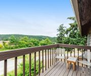
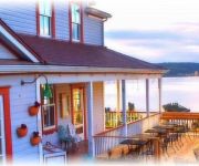
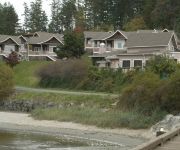
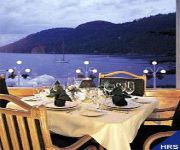
Hotels and Places to Stay
Tucker House Inn
Deer Harbor Inn
The Edenwild Boutique Inn
TUCKER HOUSE AND HA
ORCAS HOTEL
Deer Harbor Resort
Rosario Resort
Videos from this area
These are videos related to the place based on their proximity to this place.
Ferry landing on Orcas Island
A morning ferry arrives at Orcas Island on a day in late December. Shaw Island is in the background.
Ferry Traffic at the Orcas Landing
shot from the 3rd floor of the Orcas Hotel on Orcas Island, Washington, Christmas morning 2008.
Ferry departing Orcas Village - February 24th, 2014
Some comments from Dana & Rose at the end of our Orcas Island trip - Feb. 21 to Feb 24, 2014. We're on the ferry leaving Orcas Village, Orcas Island, WA. Filmed Feb. 24, 2014.
Trip USA n Canada 3 - San Juan n Orcas Islands 28 4 2
Orcas Island is the largest of the San Juan Islands, which are located off the northern coast of Washington State. 1:20 hour from the mainland city of Anacor...
iris and the cheshire ferry
We are having coffee at the Orcas Hotel and watch the ferry disappear in the fog.
Splitting the big logs.
Today we split wood at our Orcas Island home using a log-splitter. The rounds are so big we need a ramp to roll them up onto the splitter. I felled the tree, I cut it into rounds, loaded the...
MV Kaleetan approaching Shaw Island
The MV Kaleetan is a Super Class ferry in the Washington State Ferry fleet. It serves the San Juan Islands including this August 2014 morning run from Shaw Island to Anacortes.
Videos provided by Youtube are under the copyright of their owners.
Attractions and noteworthy things
Distances are based on the centre of the city/town and sightseeing location. This list contains brief abstracts about monuments, holiday activities, national parcs, museums, organisations and more from the area as well as interesting facts about the region itself. Where available, you'll find the corresponding homepage. Otherwise the related wikipedia article.
San Juan County, Washington
San Juan County is a county located in the Salish Sea in the far northwestern corner of the U.S. state of Washington. It comprises most of the San Juan Islands. The county is named after San Juan Island, which was reportedly named after St. John the Baptist (San Juan Bautista) by the Spanish explorer Francisco de Eliza in 1791. The area that now constitutes San Juan County was part of Whatcom County until October 31, 1873.
Shaw Island
Shaw Island is the smallest of the four San Juan Islands served by the Washington State Ferries. The island has a land area of 19.952 km² (7.7037 sq mi) and a small year-round population of 240. Summer time weekends swell with other residents and the occasional tourist. The Wilkes Expedition, in 1841, named the island after John Shaw, a United States Naval Officer.
Canoe Island
Canoe Island lies in the center of the San Juan Islands in Upright Channel between Shaw Island and Lopez Island. The two water approaches to Indian Cove County Park on Shaw Island pass to either side of Canoe Island, which protects Indian Cove from high waves and surf. At low tide, mudflats in the shallow cove may be exposed. The island has a maximum elevation of 60 feet and has a 49.58-acre span.
Blind Island State Park
Blind Island State Park in San Juan County, Washington is one of the Washington State Parks and part of the Cascadia Marine Trail. It consists of 3 acres of marine park on a small island near the entrance to Blind Bay and includes 1,280 feet of saltwater shoreline. Available activities include crabbing, boating and camping. Campsites are only open to visitors arriving by human- or wind-powered boats).
Blind Bay (Washington)
Blind Bay is a small bay on Shaw Island in San Juan County, Washington. On an island near its mouth is Blind Island State Park.
Upright Channel State Park
Upright Channel State Park in San Juan County, Washington is one of the Washington State Parks. It consists of 20 acres of island, beach, and tidelands on Lopez Island. Available activities include hiking, boating, clamming, beachcombing, birdwatching, and wildlife viewing.
Canoe Island French Camp
Canoe Island French Camp (CIFC) offers children ages nine to sixteen the opportunity to learn the French culture while participating in traditional camp activities. The camp is located on Canoe Island in the San Juan Islands in Washington state. CIFC capitalizes on its secluded island location by keeping session sizes to about 45 campers. Canoe Island is accredited by the American Camp Association and is a member of the Western Association of Independent Camps. CIFC is a non-profit organization.
Westsound/WSX Seaplane Base
Westsound/WSX Seaplane Base is a seaplane base located adjacent to Westsound on Orcas Island in San Juan County, Washington, United States. It is owned by the Westsound Marina.


