Safety Score: 2,7 of 5.0 based on data from 9 authorites. Meaning we advice caution when travelling to United States.
Travel warnings are updated daily. Source: Travel Warning United States. Last Update: 2024-08-13 08:21:03
Discover Madrona Point
The district Madrona Point of Marine Drive in Kitsap County (Washington) is a district in United States about 2,338 mi west of Washington DC, the country's capital city.
Looking for a place to stay? we compiled a list of available hotels close to the map centre further down the page.
When in this area, you might want to pay a visit to some of the following locations: Port Orchard, Seattle, Tacoma, Port Townsend and Shelton. To further explore this place, just scroll down and browse the available info.
Local weather forecast
Todays Local Weather Conditions & Forecast: 6°C / 43 °F
| Morning Temperature | 5°C / 41 °F |
| Evening Temperature | 6°C / 43 °F |
| Night Temperature | 5°C / 40 °F |
| Chance of rainfall | 4% |
| Air Humidity | 95% |
| Air Pressure | 1006 hPa |
| Wind Speed | Light breeze with 4 km/h (3 mph) from North-East |
| Cloud Conditions | Overcast clouds, covering 100% of sky |
| General Conditions | Moderate rain |
Sunday, 24th of November 2024
7°C (45 °F)
5°C (40 °F)
Moderate rain, light breeze, overcast clouds.
Monday, 25th of November 2024
5°C (41 °F)
4°C (40 °F)
Moderate rain, light breeze, overcast clouds.
Tuesday, 26th of November 2024
5°C (42 °F)
5°C (41 °F)
Overcast clouds, calm.
Hotels and Places to Stay
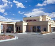
Hampton Inn Colby KS
BAYMONT INN & SUITES BREMERTON
BEST WESTERN PLUS SILVERDALE
Hampton Inn - Suites Bremerton
Fairfield Inn & Suites Seattle Bremerton
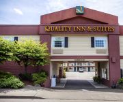
Quality Inn & Suites Bremerton
OYSTER BAY INN AND RESTAURANT
Bremerton Inn
MOTEL 6 BREMERTON WA
MIDWAY INN
Videos from this area
These are videos related to the place based on their proximity to this place.
Apartments In Bremerton | Property Management Bremerton | West And Wheeler Bremerton
Please Visit: http://www.bremertonapartment.com/ or call (360) 479-3024 for more Info. At West And Wheeler We Provide The Best And The Most Affordable One Bedroom Apartments In Bremerton ...
USS Ranger Departs Bremerton for Dismantling
USS Ranger Departs Bremerton. HD Video by Petty Officer 2nd Class Cory Asato | Navy Public Affairs Support Element, Det. Northwest | Date: 03.05.2015. Tugs tow the ex-USS Ranger (CV 61) through ...
2004-07-09+10 PSAP Speeder Trip Part 2
PRO speeder trip on the Puget Sound & Pacific Railroad. These videos cover the two day round-trips originating in Elma, WA, with runs to the Bremerton Naval base on Saturday, then to Gate...
Brownsville Marina, Bremerton WA
The Brownsville Marina is several miles east of Silverdale and at the intersection of the Brownsville Highway, Illahee Road and South Keyport Road, There's much more real estate info on www.homesi.
Armed Forces Parade, Bremerton 2012
Don't miss this year's Armed Forces Day Parade... the largest of its kind in the nation. This is an important opportunity to celebrate our armed forces, honor the men and women who serve our...
Seattle's Link Light Rail - First Trip
Our first trip on Link - Seattle's new light rail system. This trip was on July 21, 2009, the second day of operation. This first line goes from Westlake Station in downtown Seattle to Tukwila/Inte...
Discovery Depot Montessori School, Tracyton WA
The Discovery Depot Montessori School is located on Tracyton Boulevard less than two miles from Silverdale. There's more school info on www.homesinkitsap.com.
Barker Ridge, Tracyton WA
This neighborhood is located off Tracyton Boulevard about a mile and a half from Silverdale. Joels Court and Coralie Court are the two streets in Barker Ridge.
Reid Avenue---move in ready....
For more details click here: http://www.visualtour.com/showvt.asp?t=2635194 2659 Reid Ave. Bremerton, WA 98310 $119900, 3 bed, 1.5 bath, 1313 SF, MLS# 2900...
Videos provided by Youtube are under the copyright of their owners.
Attractions and noteworthy things
Distances are based on the centre of the city/town and sightseeing location. This list contains brief abstracts about monuments, holiday activities, national parcs, museums, organisations and more from the area as well as interesting facts about the region itself. Where available, you'll find the corresponding homepage. Otherwise the related wikipedia article.
USS Kitty Hawk (CV-63)
The supercarrier USS Kitty Hawk (CV-63), formerly CVA-63, was the second naval ship named after Kitty Hawk, North Carolina, the site of the Wright brothers' first powered airplane flight. Kitty Hawk was both the first and last active ship of her class, and the last oil fired aircraft carrier in service with the US Navy. Kitty Hawk was laid down by the New York Shipbuilding Corporation, Camden, New Jersey, 27 December 1956; and launched 21 May 1960, sponsored by Mrs. Camilla F.
Kitsap County, Washington
Kitsap County is a county located in the U.S. state of Washington, named after Chief Kitsap of the Suquamish tribe. As of the 2010 census, its population was 251,133. Its county seat is at Port Orchard, and its largest city is Bremerton. Kitsap County was formed out of King County, Washington, and Jefferson County, Washington on January 16, 1857. Originally named Slaughter County, it was soon renamed.
Erlands Point-Kitsap Lake, Washington
Erland's Point-Kitsap Lake is a census-designated place (CDP) in Kitsap County, Washington, United States. The population was 2,723 at the 2000 census. Based on per capita income, one of the more reliable measures of affluence, Erlands Point-Kitsap Lake ranks 84th of 522 areas in the state of Washington to be ranked.
Navy Yard City, Washington
Navy Yard City is a census-designated place (CDP) in Kitsap County, Washington, United States. The population was 2,477 at the 2010 census.
Port Orchard, Washington
Port Orchard is a city in and the county seat of Kitsap County, Washington, United States. It is located 13 miles due west of West Seattle and connected to Seattle and Vashon Island via the Washington State Ferries run to Southworth. It is named after Port Orchard, the strait that separates Bainbridge Island from the Kitsap Peninsula. The population was 11,144 at the 2010 census. The Washington State Office of Financial Management's 2012 estimate placed the population at 11,780.
Tracyton, Washington
Tracyton is a census-designated place (CDP) in Kitsap County, Washington, United States. Its population was 5,233 at the 2010 census. Tracyton was named for 19th century Secretary of the Navy Benjamin F. Tracy
USS Constellation (CV-64)
USS Constellation (CV-64), a Kitty Hawk–class supercarrier, was the third ship of the United States Navy to be named in honor of the "new constellation of stars" on the flag of the United States and the only naval vessel ever authorized to display red, white, and blue designation numbers. One of the fastest ships in the Navy, as proven by her victory during a battlegroup race held in 1985, she was nicknamed "Connie" by her crew and officially as "America's Flagship".
USS Long Beach (CGN-9)
USS Long Beach (CLGN-160/CGN-160/CGN-9) was a nuclear-powered guided missile cruiser in the United States Navy. She was the only ship of her class. Long Beach was the first "all-new" cruiser designed and constructed after World War II (all others were completions or conversions of cruisers begun or completed during the war). She was the third Navy ship named after the city of Long Beach, California, and the last ship built on a traditional "cruiser hull" in the U.S.
USS Ranger (CV-61)
The seventh USS Ranger (CV/CVA-61) is one of four Forrestal-class supercarriers built for the US Navy in the 1950s. Although all four ships of the class were completed with angled decks,Ranger had the distinction of being the first US carrier built from the very beginning as an angled deck ship. Commissioned in 1957, she served extensively in the Pacific, especially the Vietnam War, for which she earned 13 battle stars.
USS Independence (CV-62)
The fifth USS Independence (CV/CVA-62) is a Forrestal-class aircraft carrier of the United States Navy. It was the fourth and final member of the Forrestal-class of conventional-powered Supercarriers. It entered service in 1959, with much of its early years spent in the Mediterranean Fleet.
USS Triton (SSRN-586)
USS Triton (SSRN/SSN-586), a United States Navy nuclear-powered radar picket submarine, was the first vessel to execute a submerged circumnavigation of the Earth, doing so in early 1960. Triton accomplished this objective during her shakedown cruise while under the command of Captain Edward L. "Ned" Beach, Jr. The only member of her class, she also had the distinction of being the only Western submarine powered by two nuclear reactors.
USS Turner Joy (DD-951)
USS Turner Joy (DD-951) was one of 18 Forrest Sherman-class destroyers of the United States Navy. She was named for Admiral Charles Turner Joy USN (1895–1956). Commissioned in 1959, she spent her entire career in the Pacific. She participated extensively in the Vietnam War, and was one of the principal ships involved in the Gulf of Tonkin Incident. Decommissioned in 1982, she is now a museum ship in Bremerton, Washington.
Dyes Inlet
Dyes Inlet is an inlet on the Kitsap Peninsula in western Washington State, USA. Silverdale, WA is located on the north shore of the inlet and has a marina, waterfront park, boat ramp, and boardwalk. The west shoreline is part of Chico, WA and the east shoreline is Tracyton, WA. Dyes Inlet is connected to Port Orchard via the Port Washington Narrows, Port Washington being an earlier name for the inlet. It was named for John W. W. Dyes, a taxidermist with the Wilkes Expedition of 1841.
Olympic College
Olympic College is an urban-based, but rural- and urban-serving, 2-year public institution in Bremerton, in the U.S. state of Washington. Olympic College opened its doors as Olympic Junior College on September 5, 1946. The main building was located in Bremerton, Washington. They had 575 students (423 men and 152 women) and the tuition was $35 per quarter or students had the option to pay for three quarters in advanced for $75. Olympic College serves Kitsap and Mason counties in Washington.
Port Washington Narrows
The Port Washington Narrows is a tidal strait located in Bremerton, Washington. The northwest entrance is marked on the west side by Rocky Point, and the southeast entrance is located at Point Turner on the west side and Point Herron on the east side. It located between downtown Bremerton from the Manette Peninsula. It is through this 3 mile channel which Dyes Inlet drains into Sinclair Inlet and into Puget Sound. Tidal currents attain velocities in excess of 4 knots at times.
KBRO
KBRO in Bremerton and KNTB in Lakewood, both Washington, are a pair of simulcasting Spanish-language radio stations serving the Puget Sound region. KBRO broadcasts at 1490 kHz with 1,000 watts fulltime while KNTB broadcasts at 1480 kHz with 1,000 watts day and 111 watts night. Both stations are owned by Seattle Streaming Radio, LLC. They both broadcast the ESPN Deportes Radio network.
Bremerton High School
Bremerton High School is a high school located in the port city of Bremerton, Washington, west across Puget Sound from Seattle, in the Bremerton School District. As of the 2011-2012 school year, Bremerton High facilitates grades 9-12. Several changes in the district's grade configuration have meant freshmen have been in and out of the building. From 1993 to 2007, the school only contained grades 10-12 while the Ninth grade remained at Bremerton Junior High School.
Olympic High School (Silverdale, Washington)
Olympic High School is a secondary school located in Bremerton, Washington. It is one of six secondary schools in the Central Kitsap School District. OHS currently educates grades 10-12.
Manette Bridge
The Manette Bridge is a steel truss bridge that spans the Port Washington Narrows in Bremerton, Washington, USA. It connects the community of Manette, Washington to downtown Bremerton. Although it is not part of a numbered state highway, it is one of four bridges specifically designated by state law to be maintained by the Washington Department of Transportation. The bridge is 82 feet above the water, and has a horizontal clearance of 321 feet between the piers.
Manette, Washington
Manette, Washington is a community in Kitsap County, Washington, United States. It was established as a town on April 20, 1891, but was later made part of Bremerton, Washington. Manette is located on Point Herron, commonly known as the Manette Peninsula, in the body of water known as Port Orchard, part of Puget Sound.
KITZ
KITZ is a radio station featuring a News/Talk format. Licensed to Silverdale, Washington, USA, it serves the Puget Sound Region. The main KITZ studio and production facilities are located in Port Orchard, Washington. The station was originally launched in 1948 as KTNT-AM in Tacoma, Washington & was owned by the Tacoma News Tribune which also owned KTNT-TV & KTNT-FM. In 1983, KTNT-AM became KPMA which lasted until the end of 1984.
Port Orchard Marina
Popular Port Orchard Marina is located 1 mile away from Bremerton, across Sinclair Inlet. Approaching from the northwest, boaters will find the marked entry channel leading to the marina. The marina is a public marina with an accessible pumpout. The facility is open year round. Hours of operation are Monday through Sunday, from 8am to 5pm. A slip is available for pumpout usage. Access to this pumpout is limited to vessels with a length of no more than 100 feet. There is a stationary pumpout.
Bremerton Marina
Bremerton Marina is a public marina located in downtown Bremerton, Washington on Puget Sound, in Sinclair Inlet. The facility of the marina is within Kitsap County.
National Register of Historic Places listings in Kitsap County, Washington
National Register of Historic Places listings in Kitsap County, Washington
Sheridan, Washington
Sheridan was a small town in southeast King County (Washington). Some amount of silver mining went on in Sheridan in the 1890s. There was a post office in Sheridan from 1892 to 1895. In addition, there was a hotel, store and a mill.


