Safety Score: 2,7 of 5.0 based on data from 9 authorites. Meaning we advice caution when travelling to United States.
Travel warnings are updated daily. Source: Travel Warning United States. Last Update: 2024-08-13 08:21:03
Explore East Bremerton
East Bremerton in Kitsap County (Washington) is located in United States about 2,336 mi (or 3,759 km) west of Washington DC, the country's capital.
Local time in East Bremerton is now 09:01 AM (Tuesday). The local timezone is named America / Los Angeles with an UTC offset of -8 hours. We know of 9 airports in the wider vicinity of East Bremerton, of which 3 are larger airports. The closest airport in United States is Bremerton National Airport in a distance of 10 mi (or 16 km), South-West. Besides the airports, there are other travel options available (check left side).
There is one Unesco world heritage site nearby. It's Olympic National Park in a distance of 11 mi (or 18 km), North. Also, if you like golfing, there are multiple options in driving distance. We found 10 points of interest in the vicinity of this place. If you need a place to sleep, we compiled a list of available hotels close to the map centre further down the page.
Depending on your travel schedule, you might want to pay a visit to some of the following locations: Port Orchard, Seattle, Tacoma, Port Townsend and Everett. To further explore this place, just scroll down and browse the available info.
Local weather forecast
Todays Local Weather Conditions & Forecast: 8°C / 46 °F
| Morning Temperature | 2°C / 35 °F |
| Evening Temperature | 3°C / 38 °F |
| Night Temperature | 2°C / 36 °F |
| Chance of rainfall | 0% |
| Air Humidity | 73% |
| Air Pressure | 1026 hPa |
| Wind Speed | Light breeze with 3 km/h (2 mph) from South |
| Cloud Conditions | Clear sky, covering 2% of sky |
| General Conditions | Sky is clear |
Tuesday, 3rd of December 2024
8°C (47 °F)
3°C (37 °F)
Sky is clear, light breeze, clear sky.
Wednesday, 4th of December 2024
6°C (42 °F)
7°C (44 °F)
Light rain, light breeze, overcast clouds.
Thursday, 5th of December 2024
8°C (46 °F)
9°C (47 °F)
Light rain, gentle breeze, overcast clouds.
Hotels and Places to Stay
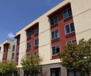
The Inn at Pleasant Beach
Fairfield Inn & Suites Seattle Bremerton
BEST WESTERN PLUS SILVERDALE
Hampton Inn Colby KS
BAYMONT INN & SUITES BREMERTON
OYSTER BAY INN AND RESTAURANT
Hampton Inn - Suites Bremerton
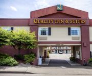
Quality Inn & Suites Bremerton
Bremerton Inn
FLAGSHIP INN
Videos from this area
These are videos related to the place based on their proximity to this place.
Mc Clouds Grill House Bremerton | Bremerton Restaurants | Restaurants In Bremerton
Video Marketing | Video Production http://www.hypereffects.com/ . Every Tuesday Enjoy An Awesome Jazz Night At Mc Clouds Grill House In Bremerton ! Mc Clouds Is AN Amazing Steak In Bremerton...
Bremerton WA :: Evergreen Park
Bremerton WA :: Evergreen Park www.WestSoundLive.com This last Thursday and today Saturday, June 14th, were great for getting out and about in the Bremerton area. We finally received some...
Town and Country Truck #5825: 2004 Mitsubishi Fuso 16 Ft. Flatbed Dump Truck
THIS TRUCK HAS BEEN SOLD. Thank-you. Please contact us at 866.377.0804 and we will help you locate a similar truck. Town and Country Truck Sales, Kent, WA also offers flatbed trucks, dump...
Seattle's Link Light Rail - First Trip
Our first trip on Link - Seattle's new light rail system. This trip was on July 21, 2009, the second day of operation. This first line goes from Westlake Station in downtown Seattle to Tukwila/Inte...
Town and Country Truck #5816: 2007 Chevrolet 3500 14 Ft. Cube Box Truck
THIS TRUCK HAS BEEN SOLD. Thank-you. Please contact us at 866.377.0804 or go to http://www.townandcountrytruck.com/search-for-trucks to locate a similar truck.
Town and Country Truck # 5843: 1997 FORD F800 11 Ft. Chip Truck
THIS TRUCK HAS BEEN SOLD. Thank-you. Please contact us at 866.377.0804 or go to http://www.townandcountrytruck.com/search-for-trucks to locate a similar truck.
Town and Country Truck #5750A: 1999 FORD F550 12 Ft. Tall Sided Flatbed Dump Truck
THIS TRUCK HAS BEEN SOLD. Thank-you. Please contact us at 866.377.0804 or go to http://www.townandcountrytruck.com/search-for-trucks to locate a similar truck.
Discovery Depot Montessori School, Tracyton WA
The Discovery Depot Montessori School is located on Tracyton Boulevard less than two miles from Silverdale. There's more school info on www.homesinkitsap.com.
Barker Ridge, Tracyton WA
This neighborhood is located off Tracyton Boulevard about a mile and a half from Silverdale. Joels Court and Coralie Court are the two streets in Barker Ridge.
Drew Ruana - 2010 PNW Regional Sport Climbing Competition
Drew Ruana (10 yrs old) competes in the Pacific NW Regional Sport Climbing competition which was held at Vertical World in Bremerton, WA on May 15, 2010. He was one of 12 competitors in the...
Videos provided by Youtube are under the copyright of their owners.
Attractions and noteworthy things
Distances are based on the centre of the city/town and sightseeing location. This list contains brief abstracts about monuments, holiday activities, national parcs, museums, organisations and more from the area as well as interesting facts about the region itself. Where available, you'll find the corresponding homepage. Otherwise the related wikipedia article.
Tracyton, Washington
Tracyton is a census-designated place (CDP) in Kitsap County, Washington, United States. Its population was 5,233 at the 2010 census. Tracyton was named for 19th century Secretary of the Navy Benjamin F. Tracy
Olympic College
Olympic College is an urban-based, but rural- and urban-serving, 2-year public institution in Bremerton, in the U.S. state of Washington. Olympic College opened its doors as Olympic Junior College on September 5, 1946. The main building was located in Bremerton, Washington. They had 575 students (423 men and 152 women) and the tuition was $35 per quarter or students had the option to pay for three quarters in advanced for $75. Olympic College serves Kitsap and Mason counties in Washington.
Port Washington Narrows
The Port Washington Narrows is a tidal strait located in Bremerton, Washington. The northwest entrance is marked on the west side by Rocky Point, and the southeast entrance is located at Point Turner on the west side and Point Herron on the east side. It located between downtown Bremerton from the Manette Peninsula. It is through this 3 mile channel which Dyes Inlet drains into Sinclair Inlet and into Puget Sound. Tidal currents attain velocities in excess of 4 knots at times.
Illahee State Park
Illahee State Park, part of the Washington State Park System, is located in the hamlet of Illahee, Washington, USA, just north of East Bremerton, on Port Orchard Bay part of the Puget Sound. The park offers camping, hiking, and a boat launch and dock. Located within the park is one of the country's oldest Pacific Yews, which has been standing for approximately 400 years. The word "Illahee" means earth or country in Indian tradition.
Bremerton High School
Bremerton High School is a high school located in the port city of Bremerton, Washington, west across Puget Sound from Seattle, in the Bremerton School District. As of the 2011-2012 school year, Bremerton High facilitates grades 9-12. Several changes in the district's grade configuration have meant freshmen have been in and out of the building. From 1993 to 2007, the school only contained grades 10-12 while the Ninth grade remained at Bremerton Junior High School.
Manette Bridge
The Manette Bridge is a steel truss bridge that spans the Port Washington Narrows in Bremerton, Washington, USA. It connects the community of Manette, Washington to downtown Bremerton. Although it is not part of a numbered state highway, it is one of four bridges specifically designated by state law to be maintained by the Washington Department of Transportation. The bridge is 82 feet above the water, and has a horizontal clearance of 321 feet between the piers.
Manette, Washington
Manette, Washington is a community in Kitsap County, Washington, United States. It was established as a town on April 20, 1891, but was later made part of Bremerton, Washington. Manette is located on Point Herron, commonly known as the Manette Peninsula, in the body of water known as Port Orchard, part of Puget Sound.
Sheridan, Washington
Sheridan was a small town in southeast King County (Washington). Some amount of silver mining went on in Sheridan in the 1890s. There was a post office in Sheridan from 1892 to 1895. In addition, there was a hotel, store and a mill.


