Safety Score: 2,7 of 5.0 based on data from 9 authorites. Meaning we advice caution when travelling to United States.
Travel warnings are updated daily. Source: Travel Warning United States. Last Update: 2024-08-13 08:21:03
Delve into Agate Point
Agate Point in Kitsap County (Washington) is located in United States about 2,332 mi (or 3,753 km) west of Washington DC, the country's capital town.
Current time in Agate Point is now 04:22 AM (Thursday). The local timezone is named America / Los Angeles with an UTC offset of -8 hours. We know of 9 airports close to Agate Point, of which 3 are larger airports. The closest airport in United States is Boeing Field King County International Airport in a distance of 17 mi (or 28 km), South-East. Besides the airports, there are other travel options available (check left side).
There is one Unesco world heritage site nearby. It's Olympic National Park in a distance of 2 mi (or 4 km), North. Also, if you like playing golf, there are some options within driving distance. We encountered 10 points of interest near this location. If you need a hotel, we compiled a list of available hotels close to the map centre further down the page.
While being here, you might want to pay a visit to some of the following locations: Port Orchard, Seattle, Everett, Port Townsend and Tacoma. To further explore this place, just scroll down and browse the available info.
Local weather forecast
Todays Local Weather Conditions & Forecast: 6°C / 43 °F
| Morning Temperature | 4°C / 39 °F |
| Evening Temperature | 5°C / 42 °F |
| Night Temperature | 5°C / 40 °F |
| Chance of rainfall | 2% |
| Air Humidity | 78% |
| Air Pressure | 1014 hPa |
| Wind Speed | Light breeze with 4 km/h (3 mph) from South |
| Cloud Conditions | Overcast clouds, covering 100% of sky |
| General Conditions | Moderate rain |
Thursday, 21st of November 2024
9°C (49 °F)
5°C (42 °F)
Moderate rain, gentle breeze, few clouds.
Friday, 22nd of November 2024
5°C (41 °F)
5°C (42 °F)
Light rain, gentle breeze, overcast clouds.
Saturday, 23rd of November 2024
5°C (42 °F)
4°C (39 °F)
Moderate rain, gentle breeze, overcast clouds.
Hotels and Places to Stay
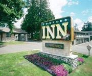
THE POULSBO INN
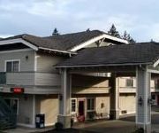
ISLAND INN
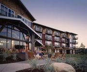
CLEARWATER CASINO
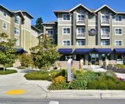
BEST WESTERN PLUS BAINBRIDGE
AVANTE SUITES
Videos from this area
These are videos related to the place based on their proximity to this place.
Kingston Rotary Holiday party 2013
Kingston NK Rotary Club Holiday Party 2013 at Indianola Club House via YouTube Capture.
My Wifey pulling up Crab Pots in Indianola while I cheer
Annelise pulling up crab pots Indianola,Wa.
Catching Dungeness Crab in the Puget Sound
Video of our Dungeness Crab catch off of Indianola in the Puget Sound.
PERSEPHONE FARM The Season - Week 1 Moe
Moe tells us why she wants to apprentice at Persephone Farm in Indianola, WA.
Five Principles for Creating Spaciousness, Ease, and Prosperity in 2013
What if your business could be more spacious, more easeful, and more profitable in 2013? In this video I share five principles I gleaned from reflecting on my own success and that of my most...
Alyssum and Michael's Wedding Day
Alyssum and Michael's Wedding Ceremony, April 20, 2012. DON'T FORGET TO RATE THE VIDEO TOO and leave a message to the newly weds!
2006Revived EP1 - Priest in Peril! :D
Hey everyone! I know it's been a long time since there's been any videos on my channel, but here I am again! Sorry for the lag, but my computer is quite low-end. Enjoy! :) IGN: Chrisc65.
RammTLC Folding neck on Pathfinder and Pilot prior to 2010
A short tutorial on the basic operation of the Turning Leg Caddy folding neck.
Videos provided by Youtube are under the copyright of their owners.
Attractions and noteworthy things
Distances are based on the centre of the city/town and sightseeing location. This list contains brief abstracts about monuments, holiday activities, national parcs, museums, organisations and more from the area as well as interesting facts about the region itself. Where available, you'll find the corresponding homepage. Otherwise the related wikipedia article.
Suquamish, Washington
Suquamish is a census-designated place (CDP) in Kitsap County, Washington, United States. The population was 4,140 at the 2010 census. Located within the Port Madison Indian Reservation, it is the burial site of Chief Seattle.
Bloedel Reserve
The Bloedel Reserve is a 150-acre forest garden on Bainbridge Island, Washington, USA, made by the vice-chairman of a lumber company, under the influence of the conservation movement and Asian philosophy. Prentice and Virginia Bloedel wished to 'capture the essence of the Japanese garden - the qualities of naturalness, subtlety, reverence, tranquility - and construct a Western expression of it'.
Port Madison Indian Reservation
The Port Madison Indian Reservation is an Indian reservation in northern Kitsap County, Washington. It occupies 30.273 km² (11.689 sq mi) on the western and northern shores of Port Madison, and is divided into two separate parcels by Miller Bay. The unincorporated towns of Suquamish and Indianola both lie within the bounds of the reservation. A resident population of 6,536 persons was counted in the 2000 census.
Agate Point, Bainbridge Island, Washington
Agate Point is a community of Bainbridge Island, Washington. It is located north of State Highway 305 and is identifiable by many street names containing "Agate" (Agatewood Road, Agate Pass Road, Agate Point Road, and Agate Street). Agate Point is the northernmost point on Bainbridge Island.
Seabold, Bainbridge Island, Washington
Seabold is a community of Bainbridge Island, Washington. It is located on the northwest corner of the island, on Agate Point. Seabold generally encompasses the south of Agate Point, along NE Seabold Road and NE West Port Madison Road, near State Route 305.
Agate Pass
Agate Pass or Agate Passage is a high-current tidal strait in Puget Sound connecting Port Madison and Port Orchard. It lies between Bainbridge Island and the mainland of the Kitsap Peninsula near Suquamish. It is the northern entrance to Port Orchard, extending about one mile (1.6 km) in a straight, southwesterly direction. The depth is about 20 feet . The shores are wooded and fairly steep. The shoreline is mostly rocky and fringed with kelp to Point Bolin.
Old Man House
Old Man House was the largest "bighouse" (a type of longhouse) in what is now the U.S. state of Washington, and once stood on the shore of Puget Sound. Lying at the center of the Suquamish winter village on Agate Pass, just south of the present-day town of Suquamish, it was home to Chief Sealth (Chief Seattle) and Chief Kitsap.
Agate Pass Bridge
The Agate Pass Bridge is a structural steel truss cantilever bridge spanning Agate Pass, connecting Bainbridge Island to the Kitsap Peninsula. It was built in 1950, and it replaced a car ferry service which dated from the 1920s. The bridge provides a direct route along Washington State Route 305 between Seattle, via the Seattle-Bainbridge Island ferry, and the Kitsap Peninsula.


