Safety Score: 2,7 of 5.0 based on data from 9 authorites. Meaning we advice caution when travelling to United States.
Travel warnings are updated daily. Source: Travel Warning United States. Last Update: 2024-08-13 08:21:03
Touring The Firs Mobile Home Park
The Firs Mobile Home Park in King County (Washington) is a town located in United States about 2,321 mi (or 3,735 km) west of Washington DC, the country's capital place.
Time in The Firs Mobile Home Park is now 04:08 AM (Thursday). The local timezone is named America / Los Angeles with an UTC offset of -8 hours. We know of 9 airports nearby The Firs Mobile Home Park, of which 3 are larger airports. The closest airport in United States is Seattle Tacoma International Airport in a distance of 2 mi (or 4 km), North. Besides the airports, there are other travel options available (check left side).
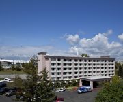
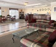
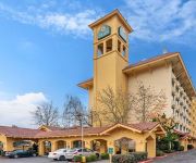
There is one Unesco world heritage site nearby. It's Olympic National Park in a distance of 26 mi (or 41 km), North-West. Also, if you like the game of golf, there are several options within driving distance. We collected 10 points of interest near this location. Need some hints on where to stay? We compiled a list of available hotels close to the map centre further down the page.
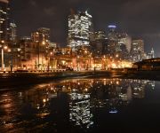
Being here already, you might want to pay a visit to some of the following locations: Seattle, Tacoma, Port Orchard, Everett and Olympia. To further explore this place, just scroll down and browse the available info.
Local weather forecast
Todays Local Weather Conditions & Forecast: 5°C / 42 °F
| Morning Temperature | 4°C / 39 °F |
| Evening Temperature | 6°C / 42 °F |
| Night Temperature | 5°C / 40 °F |
| Chance of rainfall | 0% |
| Air Humidity | 73% |
| Air Pressure | 1014 hPa |
| Wind Speed | Light breeze with 3 km/h (2 mph) from South-West |
| Cloud Conditions | Overcast clouds, covering 100% of sky |
| General Conditions | Overcast clouds |
Thursday, 21st of November 2024
9°C (48 °F)
7°C (44 °F)
Moderate rain, gentle breeze, clear sky.
Friday, 22nd of November 2024
5°C (41 °F)
6°C (42 °F)
Light rain, light breeze, overcast clouds.
Saturday, 23rd of November 2024
6°C (43 °F)
5°C (41 °F)
Moderate rain, light breeze, overcast clouds.
Hotels and Places to Stay
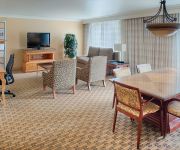
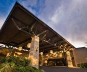
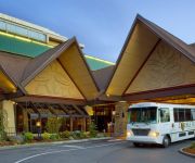
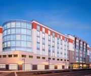
Hilton Seattle Airport - Conference Center
Seattle Airport Marriott
DoubleTree by Hilton Seattle Airport
Four Points by Sheraton Seattle Airport South
COAST GATEWAY HOTEL
DAYS INN SEATAC AIRPORT
LA QUINTA INN SEATTLE SEA-TAC AIRPORT
Hampton Inn - Suites Seattle-Airport-28th Ave WA
Quality Inn Sea-Tac Airport
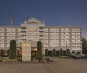
Radisson Hotel Seattle Airport
Videos from this area
These are videos related to the place based on their proximity to this place.
Boeing 757-200 Landing KSEA 051514
Landing of Delta Air Lines Flight 1557 with service to KSEA (Seattle/Tacoma, WA) from KSLC (Salt Lake City, UT). Equipment: Boeing 757-200 Registration: N6703D Seat: 7A.
Delta 757-200 Takeoff from Seattle
Flight 2150 from Seattle to Salt Lake City Aircraft N640DL Taken from Seat 33A.
Airpet Hotel (206) 745-9419
Airpet Hotel Address: 19111 Des Moines Memorial Dr Ste B, Seatac, WA 98148 Phone number: (206) 745-9419 AirPet Hotel is a new concept in caring for your pets while you are away. Offering...
Golden Tee Great Shot on Rocky Hollow!
Fiddy Gees!!! hit an amazing shot at BULL PEN, DES MOINES, WA!
Golden Tee Great Shot on Rocky Hollow!
Fiddy Gees!!! hit an amazing shot at BULL PEN, DES MOINES, WA!
TSA agent Raymond Evans detains, assaults, and threatens me for exercising my first amendment rights
2012.12.24, around 11:30AM. SEA security checkpoint #2. Sorry for the terrible quality, this was taken with my phone and I don't think the settings were right. This is the shirt I was wearing:...
Riding STS Trains at SeaTac Airport
I couldn't get on that first car, so you get a slightly different view.
SeaTac Airport Moving Walkway
Seattle-Tacoma International airport has two sets of moving walkways; this is the set closer to the central terminal.
Videos provided by Youtube are under the copyright of their owners.
Attractions and noteworthy things
Distances are based on the centre of the city/town and sightseeing location. This list contains brief abstracts about monuments, holiday activities, national parcs, museums, organisations and more from the area as well as interesting facts about the region itself. Where available, you'll find the corresponding homepage. Otherwise the related wikipedia article.
SeaTac, Washington
SeaTac is an American city in southern King County, Washington, and an outlying suburb of Seattle, Washington. "SeaTac" is a portmanteau of Seattle and Tacoma. The City of SeaTac is 10 square miles in area and has a population of 26,909 according to the 2010 census. The City boundaries surround the Seattle–Tacoma International Airport (approximately 3 square miles in area), which is owned and operated by the Port of Seattle.
Angle Lake
Angle Lake is an L-shaped lake in SeaTac, Washington, United States, occupying 90 acres between Interstate 5 and State Route 99. On the western shore is a 10-acre park, Angle Lake Park, administered by the City of SeaTac Parks and Recreation department. The remainder of the shoreline is ringed with private homes. The lake is stocked with rainbow trout by the Washington Department of Fish and Wildlife. It is also home to kokanee, largemouth bass, crappie, catfish, and yellow perch.
Mount Rainier High School
Mount Rainier High School is a secondary school in Des Moines, Washington, United States; named for Mount Rainier which can be seen quite well from the school on a clear day, Mount Rainier serves approximately 1572 students and has been active since 1957. It was created to handle the overflow from nearby Highline High School, the district's first High School located in Burien, Washington.
Tyee Educational Complex
Tyee Educational Complex is a public high school campus located in SeaTac, Washington, USA. It was founded originally as Tyee High School, a single public high school, in 1962. It is operated by the Highline School District. Starting in the 2005-06 academic year, it was split from a single school into three smaller high schools as a part of the small schools movement. It is also a member of the Coalition of Essential Schools.
Academy of Citizenship and Empowerment
The Academy of Citizenship and Empowerment (ACE) is a public high school in SeaTac, Washington. It is one of three small schools at the Tyee Educational Complex, along with Global Connections High School and Odyssey — The Essential School. It was founded in 2005 when Tyee High School converted into these three schools, and accredited individually in 2006. It is operated by the Highline School District.
1965 Olympia earthquake
The 1965 Olympia earthquake occurred at 08:29 PDT on April 29 within the Puget Sound region of Washington State. It had a magnitude of 6.7 on the moment magnitude scale and a maximum perceived intensity of VIII (Destructive) on the Mercalli intensity scale. It caused the deaths of seven people and about $12.5 million in damage. There were no recorded aftershocks.
S. 200th (Link station)
S. 200th Station will be an elevated Sound Transit Link Light Rail Station in SeaTac, Washington. It is being built as part of the Airport Link Extension project, extending Central Link and will connect to South Link to Redondo/Star Lake and beyond. During the 2008 Sound Transit 2 campaign, Sound Transit indicated that the station would open in 2020 along with North Link.
Federal Detention Center, SeaTac
The Federal Detention Center, SeaTac (FDC SeaTac) is a prison operated by the Federal Bureau of Prisons. It is located in SeaTac, Washington, near the Seattle–Tacoma International Airport, 12 miles south of downtown Seattle and 16 miles north of Tacoma, 1 mile west of the 200th Street exit at the Interstate 5. The administrative facility employed 200 staff as of 2002 and housed 821 male and female inmates as of July 29, 2010.


