Safety Score: 2,7 of 5.0 based on data from 9 authorites. Meaning we advice caution when travelling to United States.
Travel warnings are updated daily. Source: Travel Warning United States. Last Update: 2024-08-13 08:21:03
Delve into View Ridge
The district View Ridge of Seattle in King County (Washington) is a subburb in United States about 2,319 mi west of Washington DC, the country's capital town.
If you need a hotel, we compiled a list of available hotels close to the map centre further down the page.
While being here, you might want to pay a visit to some of the following locations: Everett, Port Orchard, Tacoma, Port Townsend and Coupeville. To further explore this place, just scroll down and browse the available info.
Local weather forecast
Todays Local Weather Conditions & Forecast: 5°C / 41 °F
| Morning Temperature | 2°C / 36 °F |
| Evening Temperature | 5°C / 42 °F |
| Night Temperature | 4°C / 38 °F |
| Chance of rainfall | 0% |
| Air Humidity | 75% |
| Air Pressure | 1014 hPa |
| Wind Speed | Light breeze with 3 km/h (2 mph) from South-West |
| Cloud Conditions | Overcast clouds, covering 100% of sky |
| General Conditions | Light rain |
Friday, 22nd of November 2024
8°C (47 °F)
6°C (43 °F)
Moderate rain, gentle breeze, few clouds.
Saturday, 23rd of November 2024
6°C (42 °F)
5°C (42 °F)
Light rain, light breeze, overcast clouds.
Sunday, 24th of November 2024
6°C (42 °F)
4°C (39 °F)
Moderate rain, light breeze, overcast clouds.
Hotels and Places to Stay
Woodmark Hotel and Spa
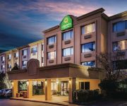
La Quinta Inn and Suites Seattle Bellevue / Kirkland
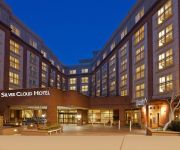
Silver Cloud Hotel - Broadway
Graduate Seattle at Univ of WA
Residence Inn Seattle University District
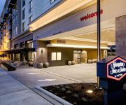
Hampton Inn - Suites by Hilton Seattle-Northgate
Residence Inn Seattle Downtown/Lake Union
Bed And Breakfast On Broadway
Columbus Motor Inn
THE RIVET
Videos from this area
These are videos related to the place based on their proximity to this place.
Designing Streets to Enhance Community, Dongho Chang, City of Seattle
From the Washington Recreation & Park Association and the Washington Society of Landscape Architects (WASLA/WRPA) 2014 joint conference. Dongho Chang, Chief City Traffic Engineer, City of ...
Retrofitting Our Streets to Increase Access to Parks, Schools and Destination Spots
From the Washington Recreation & Park Association and the Washington Society of Landscape Architects (WASLA/WRPA) 2014 joint conference. Brice Maryman, SvR Design Company Sally Bagshaw, ...
50 yards butterfly swim at Pneumonia Open
First annual "Pneumonia Open", Sand Point Country Club, Seattle WA, 2013-03-02. I mistakenly omitted my estimated time when entered the meet and was placed in the first heat. My time was 29.8 ...
Rusty Williams on Parks and Trees for Seattle
Candidate for City Council Position 8, Rusty Williams speaks on the importance of trees and parks, and specifically Magnuson Park, for Seattle.
Classic Hawthorne Hills - 4947 Purdue Ave, Seattle, WA
http://www.coldwellbanker.com/property?action=detail&brandType=CB&propertyId=270082534 Meticulously maintained, mid-century renovated, stunning views, light filled kitchen, newly remodeled...
SketchUp animation
a study using shade sails on a day care center located on the top of University Village Seattle AbstraktDesign.com.
Home Inspector Seattle WA Tips on your Rental Property | (425) 207-3688 | CALL US!
https://www.youtube.com/watch?v=qopmrcphpwg http://www.propertyinspectorllc.com | Seattle Home Inspector | Property Inspector, LLC Property Inspector, LLC 50...
Home Inspection Seattle | (425) 207-3688 | CALL US!
https://www.youtube.com/watch?v=qt3ahgtr3p4 http://www.propertyinspectorllc.com | Seattle Home Inspector | Property Inspector, LLC Property Inspector, LLC 50...
Meet the Twins
I'm such a goober sometimes... I was walking up to take a photo of these two and didn't realize I had clicked record video... Though, sometimes, an accident ...
Videos provided by Youtube are under the copyright of their owners.
Attractions and noteworthy things
Distances are based on the centre of the city/town and sightseeing location. This list contains brief abstracts about monuments, holiday activities, national parcs, museums, organisations and more from the area as well as interesting facts about the region itself. Where available, you'll find the corresponding homepage. Otherwise the related wikipedia article.
Windermere, Seattle
Windermere is a well-to-do residential neighborhood in Seattle, Washington, named after Windermere in England's Lake District. It is bounded on the north by Magnuson Park, part of Sand Point; on the northwest by Sand Point Way N.E. , beyond which is Hawthorne Hills; on the southwest by Ivanhoe Place N.E. , beyond which is Laurelhurst; and on the southeast by Lake Washington. The area has been a part of Seattle since 1910.
Burke-Gilman Trail
The Burke-Gilman Sammamish Trail is a rail trail in King County, Washington. The 27-mile multi-use recreational trail is part of the King County Regional Trail System and occupies an abandoned Seattle, Lake Shore and Eastern Railway corridor. The Burke-Gilman segment is managed by the City of Seattle south of NE 145th Street. The trail begins at 11th Avenue NW in Ballard and follows along the Lake Washington Ship Canal and north along Lake Washington.
University Prep
University Prep, formerly known as University Preparatory Academy and now popularly known as U Prep, is an independent, coeducational middle and high school located in the Wedgwood neighborhood of Seattle, Washington. The campus sits just across the street from Dahl Playfield and is adjacent to the Picardo Farm, the original P-Patch (community garden area). Approximately 510 students attend University Prep.
Magnuson Park
Magnuson Park is a 350 acre (1.4 km²) park on Sand Point at Pontiac Bay, Lake Washington, in the Sand Point neighborhood of Seattle, Washington. The park is the second largest in Seattle, after 534 acre (2.2 km²) Discovery Park in Magnolia. It is located on the spot of the former Naval Station Puget Sound. Sand Point is the peninsula with Pontiac and Wolf bays that juts into Lake Washington in northeast Seattle.
Calvary Cemetery (Seattle)
Calvary Cemetery is a Roman Catholic cemetery in Seattle, Washington, USA, located in the Ravenna/Bryant neighborhood. Dedicated on December 1, 1889, it is on the southwest slope of a hill overlooking University Village. The cemetery is owned and operated by the Archdiocese of Seattle. The 40-acre, square-shaped cemetery is bounded on the north by N.E. 55th Street, on the east by 35th Avenue N.E. , on the south by N.E. 50th Street, and on the west by 30th Avenue N.E.
Bryant Playground (Seattle)
Bryant Playground is a 3.1 acre (13,000 m²) playground and park located in Seattle, USA, at N.E. 65th Street and 40th Avenue N.E. This places it at the very northern end of the Hawthorne Hills/Bryant neighborhood or the very southern end of the View Ridge neighborhood. It was acquired by the city in 1976 from Brook Haven Baptist Church for $155,000. The park and playground were developed two years later at a cost of $415,000.
Seattle Children's
Seattle Children's, formerly Children's Hospital and Regional Medical Center, is a 250-bed children's hospital in the Laurelhurst neighborhood of Seattle, Washington. Currently ranked as one of the top 10 children's hospitals in America by U.S. News & World Report, Children's serves as a major pediatric referral center for Washington, Alaska, Montana and Idaho.
Wedgwood, Seattle
Wedgwood is a middle class residential neighborhood of northeast Seattle, Washington, with a modest commercial strip. Wedgwood is located about two miles (3 km) north, and slightly east, of the University of Washington; it is about six miles (10 km) northeast of Downtown. The neighborhood is further typical of Seattle neighborhoods in having more than one name and having different, overlapping, but well-documented definitions of the neighborhood.
Wedgwood Rock
Wedgwood Rock is a glacial erratic (and known to geologists as the "Wedgwood Erratic") near the neighborhood of Wedgwood in Seattle, Washington. (Technically, the rock is outside the boundary of Wedgwood, in the Bryant/Ravenna neighborhoods. ) Its mineral composition matches that of Mount Erie, on Fidalgo Island in Skagit County, Washington. Prior to the establishment of the Wedgwood neighborhood, the erratic was known first as Lone Rock and later simply as Big Rock.
Laurelhurst, Seattle
Laurelhurst is a residential neighborhood in Seattle, Washington, USA. It is bounded on the northeast by Ivanhoe Place N.E. , beyond which is Windermere; on the northwest by Sand Point Way N.E. and N.E. 45th Street, beyond which are Hawthorne Hills, Ravenna, and University Village; on the west by Mary Gates Memorial Drive N.E. , beyond which is the East Campus of the University of Washington; on the southwest by Union Bay; and on the east by Lake Washington.
Sand Point (peninsula)
Sand Point is a peninsula that juts into Lake Washington from north Seattle, Washington, USA. It is mostly occupied by Magnuson Park and gives its name to the Sand Point neighborhood to the west. Formerly a U.S. naval air station, it is mostly public park area, but with a portion occupied by NOAA. Sand Point was used as a game location in The X-Files: The Game.
Sand Point, Seattle
Sand Point is a neighborhood in Seattle, Washington, United States, named after and consisting mostly of the Sand Point peninsula that juts into Lake Washington, which is itself largely given over to Magnuson Park. Its southern boundary can be said to be N.E. 65th Street, beyond which are Windermere and Hawthorne Hills; its northern boundary, N.E. 95th Street, beyond which is Lake City.
Bryant, Seattle
Bryant is a residential neighborhood in northeast Seattle, Washington. It is bounded by 25th Avenue NE on the west, beyond which is Ravenna; NE Blakeley Street, Union Bay Place NE and NE 45th Street on the south, beyond which is University Village; Sand Point Way NE on the east, beyond which are Laurelhurst and Windermere; and NE 75th Street on the north, beyond which are View Ridge and Wedgwood. The neighborhood is sometimes known as Ravenna-Bryant, due to its proximity to Ravenna Park.
Matthews Beach, Seattle
Matthews Beach is a neighborhood in Seattle, Washington; it and Meadowbrook are the southern neighborhoods of the annexed township of Lake City (1954). Matthews Beach lies about 2 miles (3 km) northeast of the University of Washington, about 8 miles (13 km) northeast of Downtown.
View Ridge, Seattle
View Ridge is a neighborhood in north Seattle, Washington. As with all Seattle neighborhoods, its boundaries are not fixed, but can be thought of as NE 65th Street in the south, 40th and 45th Avenues NE in the west, the Sand Point Country Club in the north, and Sand Point Way NE in the east. Many homes offer views of Lake Washington, Mount Rainier, and the Cascade Range.
Hawthorne Hills, Seattle
Hawthorne Hills is an upscale neighborhood in Seattle, Washington bounded on the north by NE 65th Street, on the south and east by the Burke-Gilman Trail, and on the west by 45th Avenue NE. The majority of homes were built in the 1940s to 1950s with some of the original homes dating to the 1920s.
McCurdy Park (Seattle)
McCurdy Park is a 1.5-acre park in the Montlake neighborhood of the U.S. city of Seattle, Washington. Currently home to the Museum of History and Industry, it is effectively bounded on the west by the museum and East Montlake Park, on the south by State Route 520, on the east by the Washington Park Arboretum, and on the north by Union Bay marshland. However, there is no obvious demarcation between McCurdy Park, East Montlake Park, and the Arboretum.
Cascade Bicycle Club
The Cascade Bicycle Club is a nonprofit 501(c)(4) community organization based in Seattle, Washington in the United States. It is the largest bicycling club in the United States with more than 14,000 members. It is run by unpaid directors, professional staff and volunteers. The organization focuses on recreation, education, and political action. The Cascade office is located at 7400 Sand Point Way NE, Seattle, WA. 98115.
Picardo Farm
Picardo Farm is a 98,000 sq ft . parcel of property in Wedgwood, Seattle, Washington, consisting largely of 281 plots used for gardening allotments. It is the original P-Patch (the local term for such community gardens): the "P" originally stood for "Picardo", after the family who owned it.
Nathan Eckstein Middle School
Nathan Eckstein Middle School (originally Nathan Eckstein Junior High School) is located in Seattle, Washington and is part of the Seattle Public Schools.
A Sound Garden
A Sound Garden is one of five public art works on the National Oceanic and Atmospheric Administration (NOAA) campus that lies adjacent to the Warren G. Magnuson Park on the northwestern shore of Lake Washington in Seattle, Washington. Designed and built by sculptor Douglas Hollis from 1982–83, A Sound Garden features 12 steel tower structures, inside of which hang organ pipes of varying lengths that produce low tones when the wind blows around and through them.
Villa Academy
Villa Academy is a Catholic independent grade school located in the Laurelhurst neighborhood of Seattle, Washington on a tract of land near Lake Washington. The school has a preschool, Lower School and Middle School and was founded by America's first Catholic saint, Mother Cabrini who was canonized as St. Frances Xavier Cabrini in 1946. The campus includes orchards, gardens, three age appropriate playgrounds, an athletic field and a tennis court.
Seattle Monolith
On New Year's Day 2001, a replica of the Monolith from 2001: A Space Odyssey appeared on Kite Hill in Seattle's Magnuson Park. The Seattle Monolith was a guerrilla art installation by a group of Seattle artists calling themselves “Some People”.
Naval Station Puget Sound
Naval Station Puget Sound is a former United States Naval station located on Sand Point in Seattle, Washington. Today, the land is occupied by Magnuson Park.
University Unitarian Church
University Unitarian Church was designed by Seattle architect Paul Hayden Kirk in 1959. The church is located in the Wedgwood, Seattle neighborhood at the corner of 35th Avenue NE and 68th Street. The building is approximately a mile and half Northeast of the University of Washington Campus and sits across from the Northwest Branch of the Seattle Public Library. It was designed during the time when architect Kirk was working as a sole practitioner.


