Safety Score: 2,7 of 5.0 based on data from 9 authorites. Meaning we advice caution when travelling to United States.
Travel warnings are updated daily. Source: Travel Warning United States. Last Update: 2024-08-13 08:21:03
Delve into Rainier Valley
The district Rainier Valley of Seattle in King County (Washington) is a district located in United States about 2,320 mi west of Washington DC, the country's capital town.
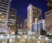
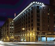
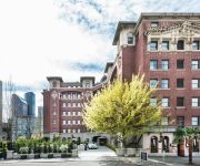
In need of a room? We compiled a list of available hotels close to the map centre further down the page.
Since you are here already, you might want to pay a visit to some of the following locations: Tacoma, Port Orchard, Everett, Port Townsend and Coupeville. To further explore this place, just scroll down and browse the available info.
Local weather forecast
Todays Local Weather Conditions & Forecast: 6°C / 42 °F
| Morning Temperature | 4°C / 40 °F |
| Evening Temperature | 6°C / 43 °F |
| Night Temperature | 5°C / 41 °F |
| Chance of rainfall | 0% |
| Air Humidity | 73% |
| Air Pressure | 1014 hPa |
| Wind Speed | Light breeze with 3 km/h (2 mph) from South-West |
| Cloud Conditions | Overcast clouds, covering 100% of sky |
| General Conditions | Light rain |
Friday, 22nd of November 2024
10°C (50 °F)
7°C (45 °F)
Moderate rain, gentle breeze, clear sky.
Saturday, 23rd of November 2024
6°C (43 °F)
6°C (43 °F)
Light rain, gentle breeze, overcast clouds.
Sunday, 24th of November 2024
6°C (44 °F)
5°C (42 °F)
Moderate rain, light breeze, overcast clouds.
Hotels and Places to Stay
W Seattle
Fairmont Olympic Seattle
Renaissance Seattle Hotel
Kimpton Hotel Vintage Seattle
INN AT THE WAC
Hilton Seattle
Embassy Suites by Hilton Seattle Downtown Pioneer Square
Alexis Seattle
The Arctic Club Seattle - a DoubleTree by Hilton
SORRENTO HOTEL
Videos from this area
These are videos related to the place based on their proximity to this place.
Blue Angels 2
4 FA-18's fly in diamond formation over Hillman City and past St. Edwards Church during the Sunday air show. St. Edwards is the high point of the Rainier Val...
Community Video: Columbia City in Seattle, WA
Take a video tour of the Columbia City section of Seattle, WA. http://www.coldwellbanker.com/real_estate/neighborhood_info.
Jeff Perkins and Golden Child
First up is me, Jeff Perkins and then Kevin "Golden Child" Kemp from TFB going at it in the Jamal Crawford Pro Am Slam Dunk contest Follow me on Twitter: @2_Bouncee.
Honda WX 10 4 Stroke Water Pump with Adapter for Hose Discussion
It pumps 37 gallons a minute at max. It has a 17 foot suction hose, and uses a garden hose for discharge. It is 4 stroke so it doesn't burn oil. Its a Honda so it runs longer than you thought....
Hilfarth to Sankt Hubert - A Personal Journey
www.storyguide.net In February 2014 producer Drew Keller retraced his father's journey through Germany during World War Two. This video essay takes you through Staff Sargent I. Robert Keller's...
Columbia City Theater - Prohibition Out!
I had a great time seeing this show and I talk a little about it.
Ridin' LINK From Columbia City Station To Beacon Hill Station
Ridin' LINK From Columbia City Station To Beacon Hill Station.
LINK LIGHT RAIL AT COLUMBIA CITY STATION & SITTING IDLE NEAR RAINIER BEACH STATION
"LINK" LIGHT RAIL AT COLUMBIA CITY STATION & SITTING IDLE NEAR RAINIER BEACH STATION.
Salsa at City Escape 2011
Salsa performance to "La Salsa Vive" (Tito Nieves) by Victoria Parasochka and Nicolás Pinel. Choreography by Bell Town Dance Studio.
Jitters Alleycat 2011
Alleycat fundraiser for Bike Works in the Columbia City area of Seattle.We rode from Colmbia City to Ballard and Freemont to the University of Washington back to Columbia City and finished...
Videos provided by Youtube are under the copyright of their owners.
Attractions and noteworthy things
Distances are based on the centre of the city/town and sightseeing location. This list contains brief abstracts about monuments, holiday activities, national parcs, museums, organisations and more from the area as well as interesting facts about the region itself. Where available, you'll find the corresponding homepage. Otherwise the related wikipedia article.
Sick's Stadium
Sick's Stadium, also known as Sick's Seattle Stadium and later as Sicks' Stadium, was a baseball stadium located in Seattle, Washington's Rainier Valley at the corner of S. McClellan Street and Rainier Avenue S. The site was previously the location of Dugdale Park, a 1913 ballpark that was the home of the minor league Seattle Indians.
Columbia City, Seattle
Columbia City is a neighborhood in the Rainier Valley area of southeast Seattle, Washington, known either for being one of the "hottest" neighborhoods in Seattle, or for its rapid gentrification, depending on one's perspective.
Seward Park, Seattle
Seward Park is a neighborhood in southeast Seattle, Washington just west of the park of the same name. The park itself occupies all of Bailey Peninsula, a prominent, forested peninsula that juts into Lake Washington.
Rainier Valley, Seattle
The Rainier Valley (Valley) neighborhood in Seattle, is located east of Beacon Hill; west of Mount Baker, Seward Park, and Leschi; south of the Central District and First Hill; and north of the city line. It is said to be the most culturally and economically diverse neighborhood in the Pacific Northwest http://www. aolnews. com/opinion/article/opinion-americas-most-diverse-zip-code-shows-the-way/19414386.
Franklin High School (Seattle)
This article is about Franklin High School in Seattle, Washington. For others of a similar name, see Franklin High School (disambiguation) 40x40pxThis article appears to be written like an advertisement. Please help improve it by rewriting promotional content from a neutral point of view and removing any inappropriate external links. Franklin High School File:FranklinHSSeattleLogo. png Truth, Unity, Honor Address 3013 South Mt.
Jefferson Park (Seattle)
Jefferson Park is a 52.4 acre (212,055 m²) public park and golf course on top of Beacon Hill in Seattle, Washington, bounded on the east by 24th Avenue S. and 24th Place S. , on the west by 15th Avenue S. , on the north by S. Spokane Street, and on the south by Cheasty Boulevard S.
Lake People Park
Lake People Park is a 0.5-acre park located at 3070 S. Bradford Street in the Columbia City neighborhood of Seattle, Washington, just south of the intersection of Martin Luther King Jr. Way S. and Rainier Avenue S. In 2003, the land was donated to the Seattle Parks Foundation by Monte Powell, a developer who was responsible for much of the newer construction in the neighborhood. He was moved to make the donation after attending a presentation on community-established parks.
Cleveland High School (Seattle, Washington)
Cleveland High School is a public secondary school located in Seattle, Washington. It is part of the Seattle Public Schools. The building, designated a historic landmark by the City of Seattle in 1981, stands atop Beacon Hill. The original 1927 building underwent a $68 million renovation in 2007, when a new gym and classroom building were added.
Brighton, Seattle
Brighton is a neighborhood in south Seattle, Washington, part of the greater Rainier Valley district.
Books4cars
Books4cars is a web-based company located in Seattle, Washington that carries used and rare books related to cars, trucks and motorcycles, such as service manuals, owners manuals and historical books. The business was started in 1997 in Detroit, Michigan from a home collection of books by automotive engineer and mechanic Alex Voss. Books4cars relocated to Seattle's Columbia City neighborhood in 2000.
South End, Seattle
The South End is a group of neighborhoods in the southeast of Seattle, Washington, U.S.A.. The definition is a bit fluid, but has traditionally included the area south of the Central District, and east of Interstate 5: Rainier Valley, Rainier Beach, Seward Park, Mount Baker, and Beacon Hill. Sometimes its definition is extended to Skyway and Bryn Mawr in unincorporated King County, though these are not technically in the city.
Genesee Park (Seattle)
Genessee Park is a 57.7-acre park in the Rainier Valley neighborhood of Seattle, Washington. A waterway, Wetmore Slough, before the lowering of Lake Washington by nine feet in 1917 as part of the construction of the Lake Washington Ship Canal, it was purchased by the city in 1947 and used as a dump until 1963. Development of the park began in 1968. It also hosts Seafair hydroplane races and air shows every year.
Chief Sealth Trail
The Chief Sealth Trail is a multi-use recreational trail in Seattle, Washington. The 3.6-mile (6 km) trail, which opened on May 12, 2007, follows the Seattle City Light transmission right-of-way from S. Dawson Street and Beacon Avenue S. in Beacon Hill, near Jefferson Park, to S. Gazelle Street and 51st Avenue S. in Rainier Valley, near Kubota Gardens. Extensions are planned northward to Downtown and southward to the city limits.
Hillman City
Hillman City is a neighborhood in Seattle, King County, Washington, United States. Hillman City was settled in the 1890s and is named after the colorful Clarence Dayton Hillman, a real estate developer and con man, who made his fortune selling real and imagined plots of land to out of state speculators. Hillman City was never as populous as Columbia City to the north, but it did have a stop on the Rainier Avenue streetcar line.
Othello (Link station)
The Othello Station is a Sound Transit Central Link station in the Rainier Valley area of Seattle. It opened on July 18, 2009, and 1,400 daily boardings are expected by the year 2020.
Columbia City (Link station)
The Columbia City Station is a Sound Transit Central Link light rail station in the Rainier Valley area of Seattle. It is an at-grade, or surface, station. It features side platforms. It opened on July 18, 2009, and 2,900 daily boardings are projected for 2020.
Mount Baker (Link station)
The Mount Baker Station is a Sound Transit Central Link light rail station in the Mount Baker neighborhood of Seattle. It opened on July 18, 2009 and is projected to have 3500 daily boardings in 2020 – although this number will increase with the completion of the University Link extension. The station is elevated with side platforms, and is located west of Rainier Ave South at Martin Luther King Jr. Way South, south of South Forest Street.
Graham Hill Elementary School
Graham Hill Elementary School is an elementary school located in the Seward Park neighborhood of Seattle, Washington, USA. The school serves students from Pre-K (3+ yrs) through 5th grade as part of the Seattle Public Schools district.
Cheasty Boulevard South
Cheasty Boulevard South is a 1.3-mile route along the eastern edge of Seattle, Washington's Beacon Hill neighborhood. It was declared a City of Seattle landmark on January 15, 2003. Designed in 1903 as part of Seattle's Olmstead parks system, the property was acquired in 1910. Originally named Jefferson Boulevard, it was renamed in 1914 after E.C. Cheasty of the Parks Board, a former commissioner of the Seattle Police Department and the Alaska-Yukon-Pacific Exposition.
Fifth Church of Christ, Scientist (Seattle, Washington)
The former Fifth Church of Christ, Scientist, located at 3515 South Alaska Street (corner of 36th Avenue, South) in the Columbia City neighborhood in the Rainier Valley area of Seattle, Washington, is an historic Christian Science church edifice, whose original entrance was on 36th Avenue. South. Built in 1921. was designed by Earl A. Roberts in the Greek Revival and Neo-Palladian styles.
NewHolly, Seattle
NewHolly (formerly Holly Park) is a neighborhood in southeast Seattle, Washington, USA. Holly Park was built in the 1940s to house defense workers and veterans, but in the 1950s, it was converted into public housing under the aegis of the Seattle Housing Authority (SHA). As the mid-century style of low-income housing projects fell out of fashion, and with its housing stock not faring well over the decades, SHA decided in 1995 to rebuild Holly Park as a mixed-income neighborhood.
Aki Kurose Middle School Academy
Aki Kurose Middle School is a public secondary school in Seattle, Washington, part of the Seattle Public Schools. Located in the Rainier Valley in southeast Seattle, it serves students in grades 6-8. Aki Kurose has 97% minority enrollment, very high racial diversity and a high proportion of recent immigrants. 42% of the students are non-English speakers.
Comet Lodge Cemetery
The Comet Lodge Cemetery on Beacon Hill in Seattle, Washington is situated just east of Interstate 5 on the hill's western slope, on S. Graham Street between 21st and 23rd Avenues S. The cemetery was established in the 1890s.
Sephardic Bikur Holim Congregation
Sephardic Bikur Holim Congregation (SBH) is a Sephardic congregation with a synagogue in the Seward Park neighborhood of Seattle, Washington. The name Bikur Holim (which can be transliterated various ways into English) means visiting or comforting the sick, an important mitzvah.
Hillman City, Seattle
Hillman City is a primarily residential neighborhood of southeast Seattle, Washington, located in the Rainier Valley and centered about a mile south of the Columbia City neighborhood. It was annexed to Seattle in 1907 along with the rest of the city of Southeast Seattle. The approximate borders of the neighborhood are South Dawson Street to the north, South Graham Street to the south, Martin Luther King Jr. Way South to the west, and 48th Avenue South to the east. First homesteaded by M.D.


