Safety Score: 2,7 of 5.0 based on data from 9 authorites. Meaning we advice caution when travelling to United States.
Travel warnings are updated daily. Source: Travel Warning United States. Last Update: 2024-08-13 08:21:03
Delve into Riverton Heights
Riverton Heights in King County (Washington) is located in United States about 2,321 mi (or 3,735 km) west of Washington DC, the country's capital town.
Current time in Riverton Heights is now 03:06 AM (Thursday). The local timezone is named America / Los Angeles with an UTC offset of -8 hours. We know of 9 airports close to Riverton Heights, of which 3 are larger airports. The closest airport in United States is Seattle Tacoma International Airport in a distance of 1 mi (or 2 km), South. Besides the airports, there are other travel options available (check left side).
There is one Unesco world heritage site nearby. It's Olympic National Park in a distance of 23 mi (or 36 km), North-West. Also, if you like playing golf, there are some options within driving distance. We encountered 10 points of interest near this location. If you need a hotel, we compiled a list of available hotels close to the map centre further down the page.
While being here, you might want to pay a visit to some of the following locations: Seattle, Tacoma, Port Orchard, Everett and Olympia. To further explore this place, just scroll down and browse the available info.
Local weather forecast
Todays Local Weather Conditions & Forecast: 6°C / 42 °F
| Morning Temperature | 4°C / 39 °F |
| Evening Temperature | 6°C / 42 °F |
| Night Temperature | 5°C / 40 °F |
| Chance of rainfall | 0% |
| Air Humidity | 72% |
| Air Pressure | 1014 hPa |
| Wind Speed | Light breeze with 3 km/h (2 mph) from South-West |
| Cloud Conditions | Overcast clouds, covering 100% of sky |
| General Conditions | Overcast clouds |
Thursday, 21st of November 2024
9°C (48 °F)
7°C (44 °F)
Moderate rain, gentle breeze, clear sky.
Friday, 22nd of November 2024
5°C (42 °F)
6°C (42 °F)
Light rain, light breeze, overcast clouds.
Saturday, 23rd of November 2024
6°C (43 °F)
5°C (41 °F)
Moderate rain, light breeze, overcast clouds.
Hotels and Places to Stay
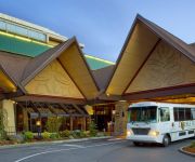
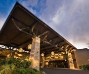
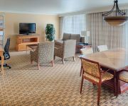
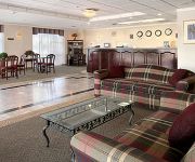
DoubleTree by Hilton Seattle Airport
Seattle Airport Marriott
Hilton Seattle Airport - Conference Center
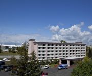
Quality Inn Sea-Tac Airport
DAYS INN SEATAC AIRPORT
Hampton Inn - Suites Seattle-Airport-28th Ave WA
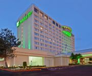
Crowne Plaza SEATTLE AIRPORT
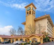
LA QUINTA INN SEATTLE SEA-TAC AIRPORT
COAST GATEWAY HOTEL
Radisson Hotel Seattle Airport
Videos from this area
These are videos related to the place based on their proximity to this place.
Live Rollercoaster Ride on Timberhawk
This is from the front row of the Timberhawk at Wildwaves/Enchanted Village in Federal Way, WA.
Bishop Lawrence Williams--I KNOW, Pt. 1 of 3 @ Living Again WWM, Mill Creek, WA
Bishop Williams preaching from Romans 8 @ Living Again Worldwide Ministries, Mill Creek, WA during their Pastoral Appreciation.
Take Off Seattle to Salt Lake City - Jackson Hole Ski Trip - 6th February 2015 3
Delta Airlines 737-900 Sea-Tack to Salt Lake City International.
Beautiful View over Lake Washington - Landing at SeaTac (KSEA) [2013]
Landing at SeaTac (Seattle/Tacoma International, KSEA) on runway 16R on January 15th.
Alaska Air coming in sideways at SeaTac
Standing directly underneath the flight path of a landing Alsaka Airliner on a windy day at SeaTac.... (***DISCLAIMER : I was hoping this would look a lot better than it does. I took it on...
United 737-800 departing Seattle-Tacoma (SeaTac)
United flight 1603 very fun takeoff from Seattle at night going to Anchorage (Note: I will not upload the landing as there was nothing to see there, only the winglet. I will only put it up...
Travel Light, Seattle's New Light Rail Train
A sampling of the ride offered by Seattle's new light rail train. The clips start out in Tukwilla Station, move up along I-5, travel along Martin Luther King Jr. Way, and finish off in the...
Alaska 737 takeoff from SeaTac climbing through clouds
Departing from 34R on the morning of 11/10/14, you can see the light filtering in underneath the broken cloud layer to the rolling hills east of SeaTac. We then climbed through the thin layer...
United 757-200 arriving at Seattle-Tacoma (SeaTac)
United flight 472 landing in SeaTac after flying from Houston. This was the pilot's last flight after 38 years of flying.
SeaTac Airport North Satellite N9 Parking
http://www.portseattle.org/Sea-Tac/Maps-and-Directions/Pages/North-Satellite.aspx Hanging out at N8, waiting for my flight to arrive at N9. 400% normal speed.
Videos provided by Youtube are under the copyright of their owners.
Attractions and noteworthy things
Distances are based on the centre of the city/town and sightseeing location. This list contains brief abstracts about monuments, holiday activities, national parcs, museums, organisations and more from the area as well as interesting facts about the region itself. Where available, you'll find the corresponding homepage. Otherwise the related wikipedia article.
SeaTac, Washington
SeaTac is an American city in southern King County, Washington, and an outlying suburb of Seattle, Washington. "SeaTac" is a portmanteau of Seattle and Tacoma. The City of SeaTac is 10 square miles in area and has a population of 26,909 according to the 2010 census. The City boundaries surround the Seattle–Tacoma International Airport (approximately 3 square miles in area), which is owned and operated by the Port of Seattle.
Tukwila, Washington
Tukwila is a Seattle suburb in King County, Washington, United States. The northern edge of Tukwila borders the city of Seattle. The population was 19,107 at the 2010 census. The population was 19,080 at 2012 Estimate from Office of Financial Management.
Highline Botanical Garden
Highline Botanical Garden is a 10.5-acre community botanical garden located at 13735 24th Avenue South, SeaTac, Washington. It is open daily without charge. The garden started as the private plantings by Elda and Ray Behm on a 1-acre site. Their property was slated for demolition in the mid-1990s for the Seattle-Tacoma International Airport's proposed third runway.
Highline High School
Highline High School is a high school in Burien, Washington, United States, located about 3.5 highway miles from Seattle-Tacoma International Airport. Highline High School, the flagship high school of the Highline School District, opened its doors in 1924 and served the cities of Burien, Des Moines, and an area south of Seattle now known as White Center. Today those cities all have their own area high schools, but at the time Highline was the only high school in the area.
SeaTac/Airport (Link station)
Seatac/Airport Station is a Sound Transit Link Light Rail station serving Sea-Tac Airport and the city of SeaTac, Washington. It is the current terminus of the Central Link light rail line that connects the airport with Downtown Seattle. The station features public art from four artists, among them Werner Klotz and Fernanda D'Agostino.
Tukwila International Boulevard (Link station)
The Tukwila International Boulevard Station is an elevated, side-platform station on Sound Transit's Central Link light rail line in Seattle, USA. It opened on July 18, 2009, and served as the terminus until December 19, 2009, when the SeaTac/Airport Station opened. It is connected to a 600-stall park and ride.
Riverton, Washington
Riverton is a census-designated place (CDP) in King County, Washington, United States. The population was 6,407 at the 2010 census. Riverton was formerly part of the Riverton-Boulevard Park CDP, which was split up for the 2010 census into Riverton and Boulevard Park. Riverton also refers to a neighboring former community in part of what is now Tukwila in the Duwamish River Valley.
Foster High School (Tukwila, Washington)
Foster High School is located in Tukwila, Washington. It serves students from 9th grade to 12th grade. It is part of the Tukwila School District. This is not a very large district and space is often in high demand, however it is the most diverse high school in the nation. This school is part of the Bill and Melinda Gates small school program. The school was previously separated into three small schools; the experience academy, the discovery academy, and the arts academy.





!['Beautiful View over Lake Washington - Landing at SeaTac (KSEA) [2013]' preview picture of video 'Beautiful View over Lake Washington - Landing at SeaTac (KSEA) [2013]'](https://img.youtube.com/vi/ZfEczjX4R00/mqdefault.jpg)


