Safety Score: 2,7 of 5.0 based on data from 9 authorites. Meaning we advice caution when travelling to United States.
Travel warnings are updated daily. Source: Travel Warning United States. Last Update: 2024-08-13 08:21:03
Explore Carlton Park
The district Carlton Park of Briarcliff in King County (Washington) is located in United States about 2,325 mi west of Washington DC, the country's capital.
If you need a place to sleep, we compiled a list of available hotels close to the map centre further down the page.
Depending on your travel schedule, you might want to pay a visit to some of the following locations: Seattle, Port Orchard, Tacoma, Everett and Port Townsend. To further explore this place, just scroll down and browse the available info.
Local weather forecast
Todays Local Weather Conditions & Forecast: 7°C / 45 °F
| Morning Temperature | 2°C / 36 °F |
| Evening Temperature | 6°C / 42 °F |
| Night Temperature | 4°C / 39 °F |
| Chance of rainfall | 0% |
| Air Humidity | 46% |
| Air Pressure | 1024 hPa |
| Wind Speed | Calm with 2 km/h (1 mph) from North |
| Cloud Conditions | Clear sky, covering 0% of sky |
| General Conditions | Sky is clear |
Thursday, 5th of December 2024
6°C (43 °F)
7°C (44 °F)
Light rain, light breeze, overcast clouds.
Friday, 6th of December 2024
8°C (46 °F)
9°C (47 °F)
Light rain, light breeze, overcast clouds.
Saturday, 7th of December 2024
11°C (52 °F)
8°C (46 °F)
Moderate rain, gentle breeze, overcast clouds.
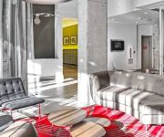
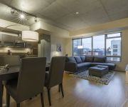
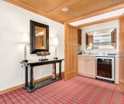
Hotels and Places to Stay
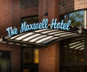
The Maxwell Hotel
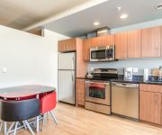
Space Needle Condos by Barsala
South Lake Union Condos by Domicile
The Edgewater
Seattle Center Luxury Suites by NSpire
Ginosi Bell Apartel
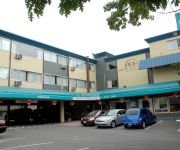
SEATTLE PACIFIC HOTEL
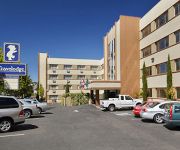
TRAVELODGE SEATTLE BY THE SPAC
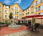
Four Points by Sheraton Downtown Seattle Center
BW EXECUTIVE INN
Videos from this area
These are videos related to the place based on their proximity to this place.
Discovery Park, hiking to West Point Lighthouse
March 2, 2014. Seattle, Washington. One of the wildest places in Seattle, in other words this is a great place to get away from the nearby urban hustle and bustle, and out into Nature. On...
Gracie Raccoon - Part 4
Gracie, our petite raccoon visitor enjoying a little lounging time. NOTE to commenters: Gracie resides in a region where there hasn't been a case of raccoon rabies for over 25 years which...
Fred the Friendly Raccoon - Part 2
Fred, Part 2. NOTE to commenters: Fred lives in a region where there hasn't been a case of raccoon rabies for over 25 years which is tracked and verified by the State's Public Health Dept....
How A Raccoon Steals Your Heart - Cinnamon
Cinnamon is demonstrating simply how a raccoon just steals your heart. Did it work? NOTE to commenters: Cinnamon resides in a region where there hasn't been a case of raccoon rabies for over...
Funny Raccoon Cinnamon - Closeup
Silly Cinnamon girl is caught sticking out her tongue (at the 8 second mark) and... claps to beg for food. NOTE to commenters: Cinnamon lives in a region where there hasn't been a case of...
Harry and Peanut Raccoons - Part 4
One of the ways we can safely take a closer look at the raccoons paws, face and teeth is to have them participate in an enrichment game. In order from left to right is: Harry, Peanut & Willard....
Fred the Friendly Raccoon - Part 24
Fred has been visiting us less lately, but feels and looks healthy. Fred is a young friendly wild raccoon who's an unbelievably gentle soul. NOTE to commenters: Fred lives in a region...
Fred the Friendly Raccoon - Part 22
Fred stopped by for an afternoon nap and then a meet-n-greet before returning to his nap and later leaving. Fred is a young friendly wild raccoon who's an unbelievably gentle soul. NOTE...
Fred the Friendly Raccoon - Part 5
Yet another video in our series of Fred, our tamest wild raccoon visitor. It's been two weeks since his last visit so we're absolutely delighted to see him again. He's truly irresistible! ...
Fred the Friendly Raccoon - Part 20
Fred's eye injury has healed nicely that there's no signs of it ever being there. NOTE to commenters: Fred lives in a region where there hasn't been a case of raccoon rabies for over 25...
Videos provided by Youtube are under the copyright of their owners.
Attractions and noteworthy things
Distances are based on the centre of the city/town and sightseeing location. This list contains brief abstracts about monuments, holiday activities, national parcs, museums, organisations and more from the area as well as interesting facts about the region itself. Where available, you'll find the corresponding homepage. Otherwise the related wikipedia article.
Salmon Bay
Salmon Bay is that part of the Lake Washington Ship Canal—which passes through the city of Seattle, linking Lake Washington to Puget Sound—that lies west of the Fremont Cut. It is the westernmost section of the canal, and empties into Shilshole Bay, which is part of Puget Sound. Because of the Hiram M. Chittenden Locks, the smaller, western half of the bay is salt water, and the eastern half is fresh water (though not without saline contamination—see Lake Union).
Daybreak Star Cultural Center
The Daybreak Star Cultural Center is a Native American cultural center in Seattle, Washington, described by its parent organization United Indians of All Tribes as "an urban base for Native Americans in the Seattle area.
Hiram M. Chittenden Locks
The Hiram M. Chittenden Locks is a complex of locks that sits at the west end of Salmon Bay, part of Seattle's Lake Washington Ship Canal. They are known locally as the Ballard Locks after the neighborhood to the north. (Magnolia lies to the south. ) The locks and associated facilities serve three purposes: To maintain the water level of the fresh water Lake Washington and Lake Union at 20–22 feet ( ) above sea level.
West Point (Seattle)
West Point is the westernmost point in Seattle, Washington, USA, jutting into Puget Sound from the Magnolia neighborhood. It also marks the northern extent of Elliott Bay; a line drawn southeastward to Alki Point marks the western extent of the bay. At the point itself is the 1881 West Point Lighthouse, the first manned light station on Puget Sound. Just to the east is King County's sewage treatment plant, and beyond that, Discovery Park, formerly the U.S. Army's Fort Lawton.
Interbay, Seattle
Interbay is a neighborhood in Seattle, Washington in the United States consisting of the valley between Queen Anne Hill on the east and Magnolia on the west, plus filled-in areas of Smith Cove and Salmon Bay. The neighborhood is bounded on the north by Salmon Bay, part of the Lake Washington Ship Canal, across which is Ballard; on the south by what remains of Smith Cove, an inlet of Elliott Bay; on the east by 15th Avenue W. and Elliott Avenue W.
Salmon Bay Bridge
The Salmon Bay Bridge, also known as Bridge No. 4, is a single-leaf bascule bridge across Seattle, Washington's Salmon Bay from Magnolia/Interbay to Ballard, just west of Commodore Park. It carries the main line of the BNSF Railway on its way north to Everett and south to King Street Station and Seattle's Industrial District. Built in 1914 by the Great Northern Railway, it has an opening span of 61 meters (200 feet) and has two tracks.
Ballard Terminal Railroad
The Ballard Terminal Railroad, a short line terminal railroad in Seattle, Washington, USA's Ballard neighborhood, was formed in 1997 to operate trains on three miles of track on the north side of Salmon Bay. The spur had been abandoned earlier that year by the Burlington Northern and Santa Fe Railway. BNSF had only three customers when it decided to abandon service in early 1997: the Salmon Bay Sand & Gravel Co. , the Olsen Furniture Co.
Discovery Park (Seattle)
Discovery Park is a 534 acres park in the Magnolia neighborhood of Seattle, Washington. It is the city's largest public park and contains 11.81 miles of walking trails. United Indians of All Tribes' Daybreak Star Cultural Center is within the park's boundaries. On the south side of the North Beach strip is a sewage treatment plant, but it is almost entirely concealed from the marsh, beach, and trail.
Magnolia, Seattle
Magnolia is the second largest neighborhood of Seattle, Washington by area. It occupies a hilly peninsula northwest of downtown. Magnolia is isolated from the rest of Seattle, connected by road to the rest of the city by only three bridges over the tracks of the BNSF Railway: W. Emerson Place in the north, W. Dravus Street in the center, and W. Garfield Street in the south. (The Salmon Bay Bridge to Ballard is rail-only, no motorized traffic is permitted to cross the Hiram M.
USS Memphis (1862)
The second USS Memphis was a 7‑gun screw steamer, built by William Denny and Brothers, Dumbarton, Scotland in 1861, which briefly served as a Confederate blockade runner before being captured and taken into the Union Navy during the American Civil War.
Kiwanis Ravine
Kiwanis Ravine is an 8.7-acre public park a block east of Discovery Park in the Magnolia neighborhood of Seattle, Washington. Purchased by the Kiwanis Club in the 1950s and donated to Seattle Parks Department, it is home to the largest nesting colony of great blue herons in the city.
Fort Lawton
Fort Lawton was a United States Army post located in the Magnolia neighborhood of Seattle, Washington. A large majority, 534 acres of Fort Lawton, was given to the city of Seattle and dedicated as Discovery Park in 1973. The fort was included in the 2005 Base Realignment and Closure list. Fort Lawton officially closed on September 14, 2011.
Carl S. English, Jr., Botanical Gardens
The Carl S. English, Jr. , Botanical Garden (7 acres) are botanical gardens located on the grounds of the Hiram M. Chittenden Locks at 3015 NW 54th Street, Seattle, Washington. They are open daily 7 a.m. to 9 p.m. without charge. After the locks were built in 1911, landscape architect Carl English of the United States Army Corps of Engineers transformed the construction site into garden in an English landscape style. All told, he spent 43 years planting and tending the gardens.
Fishermen's Terminal
Fishermen's Terminal is located on Salmon Bay in the Interbay neighborhood in Seattle, Washington, east of the Hiram M. Chittenden Locks and immediately west of the Ballard Bridge. Operated by the Port of Seattle, it is home to some of the vessels that are on the Discovery Channel show the Deadliest Catch. It was also the topic of a documentary film Fishermen's Terminal. The documentary centers on the conflict between the moorage needs of the fishing fleet and pleasure boaters.
Interbay P-Patch
Interbay P-Patch, "The Garden Between The Bays", is one of Seattle, Washington's largest and most involved community gardens, and is recognized as an example of resourcefulness and sustainability.
Interbay Stadium
Interbay Stadium (often simply called Interbay) is a 1000-seat soccer-specific stadium in Interbay, a neighborhood of Seattle, Washington. Built in 1997, it is home to the Seattle Pacific University soccer program. It also serves as home to local league teams, and was occasionally used by the USL Seattle Sounders for pre-season matches.
Smith Cove (Washington)
Smith Cove (formerly known as "Smith's Cove") is a body of water, the northern part of Seattle, Washington's Elliott Bay, immediately south of the area that has been known since 1894 as Interbay. More precisely, it is the part of the bay that lies north of a line running southeasterly from the west end of Elliott Bay Marina in the northwest to the far northwest tip of Myrtle Edwards Park in the southeast. It is home to the Port of Seattle's Piers 90 and 91, in addition to the marina.
Magnolia Bridge
The Magnolia Bridge, built in 1930, connects the Seattle neighborhoods of Magnolia and Interbay over the filled-in tidelands of Smith Cove. It is one of only three road connections from Magnolia to the rest of Seattle. It carries W. Garfield Street from Magnolia Way W. in the west to the intersection of Elliott and 15th Avenues W. in the east. Having been damaged in the 2001 Nisqually earthquake, it is currently scheduled for replacement.
Ballard Avenue Historic District
The Ballard Avenue Historic District is a section of downtown Ballard in Seattle, Washington, that was listed on the National Register of Historic Places in 1976 (ID #76001885). The district consists of Ballard Avenue N.W. between N.W. Market Street and N.W. Dock Place, and is located near to and along Salmon Bay.
Commodore Park (Seattle)
Commodore Park is an 3.9-acre public park at the south end of the Hiram M. Chittenden Locks in the Magnolia neighborhood of Seattle, Washington. Conceived in 1966, it was dedicated in 1978. It was named after West Commodore Way, which forms its southern boundary.
Balmer Yard
Balmer Yard is a rail yard located in the Interbay neighborhood of Seattle, Washington. The yard is owned by BNSF Railway, and was built by predecessor Great Northern Railway as Interbay Yard. As part of a modernization in the late 1960s, which included a 16-track hump, it was renamed after former GN vice president Thomas Balmer. The nearby engine servicing area is still known as Interbay. The yard is over 80 acres in size and has 41 parallel tracks for switching cars.
Cruise West
Cruise West was an independent, destination focused small-ship cruise operator based in Seattle, Washington. The line was the largest operator of U.S. flagged cruise vessels (by number of vessels) with nine currently operating. They were best known for their Alaska cruises but their reach includes destinations all around the Pacific Ocean. Cruise West announced on September 18, 2010 that it is ceasing operations.
Elliott Bay Marina
Elliott Bay Marina is a public marina located in Seattle, Washington. Since it opened in 1991, after 17 years in the planning and permit process. There are 900 slips available for pumpout usage. There is a stationary pumpout located on the fuel dock. The facility also has a Porta-Potty dump station. The slips range in size from 32 to 63 feet with 52% of the boats between 36 and 50 feet LOA.
Fort Lawton Air Force Station
Fort Lawton Air Force Station is a closed United States Air Force General Surveillance Radar station. It is located on Fort Lawton in the Magnolia neighborhood of northwest Seattle, Washington. The Air Force inactivated its unit in 1963; while the site remained under Army control until 1974. Today the Federal Aviation Administration (FAA) operates the site as part of the Joint Surveillance System (JSS).
Center for Sex Positive Culture
The Center for Sex Positive Culture or CSPC (formerly known as The Wet Spot) is a non-profit, membership-based organization located in Seattle, Washington. It organizes events and provides space for several different sex-positive subcultures, notably BDSM, swinging, and polyamory groups. It caters to both heterosexual and LGBT people. The Center is a 501(c)(7) recreational club; its sister organization, the Foundation for Sex Positive Culture is a 501(c)(3) charitable/educational organization.


