Safety Score: 2,7 of 5.0 based on data from 9 authorites. Meaning we advice caution when travelling to United States.
Travel warnings are updated daily. Source: Travel Warning United States. Last Update: 2024-08-13 08:21:03
Discover Broadview
The district Broadview of Bitter Lake in King County (Washington) is a district in United States about 2,323 mi west of Washington DC, the country's capital city.
Looking for a place to stay? we compiled a list of available hotels close to the map centre further down the page.
When in this area, you might want to pay a visit to some of the following locations: Seattle, Everett, Port Orchard, Tacoma and Port Townsend. To further explore this place, just scroll down and browse the available info.
Local weather forecast
Todays Local Weather Conditions & Forecast: 5°C / 41 °F
| Morning Temperature | 3°C / 38 °F |
| Evening Temperature | 5°C / 42 °F |
| Night Temperature | 4°C / 40 °F |
| Chance of rainfall | 0% |
| Air Humidity | 74% |
| Air Pressure | 1014 hPa |
| Wind Speed | Light breeze with 4 km/h (2 mph) from South |
| Cloud Conditions | Overcast clouds, covering 100% of sky |
| General Conditions | Light rain |
Friday, 22nd of November 2024
9°C (48 °F)
6°C (43 °F)
Moderate rain, gentle breeze, clear sky.
Saturday, 23rd of November 2024
6°C (42 °F)
6°C (42 °F)
Light rain, gentle breeze, overcast clouds.
Sunday, 24th of November 2024
6°C (42 °F)
4°C (39 °F)
Moderate rain, light breeze, overcast clouds.
Hotels and Places to Stay
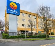
Comfort Inn & Suites
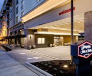
Hampton Inn - Suites by Hilton Seattle-Northgate
Graduate Seattle at Univ of WA
Residence Inn Seattle University District
Holiday Inn Express & Suites NORTH SEATTLE - SHORELINE
Hotel Ballard
Marco Polo Motel
DAYS INN SEATTLE AURORA
Ballard Inn
Crown Inn
Videos from this area
These are videos related to the place based on their proximity to this place.
Ingrahm High School trees cut down
Ingrahm High School trees come crashing down after neighbors unsuccessfully try to block cutting. More here: http://www.seattlepi.com/local/434342_ingrahamtrees.html.
We Shall Meet as the Sun Sets - BNSF Scenic Sub at Carkeek Park, July 30th, 2013
Train #1, 7:58 PM, Main 2: westbound (southbound) manifest with C44-9W's #4503 and #764. Trains #2 and #3, 8:07 PM, Meet: Train #2, Main 1: eastbound (northbound) manifest with AC4400CW ...
Private Broadview Retreat - 11301 2nd Ave, Seattle, WA
http://www.coldwellbanker.com/property?action=detail&brandType=CB&propertyId=271521990 First time on mkt, built 1962, spacious, 3 FP, privacy, western views, inviting front porch, formal entry,...
2011 Neighbor Appreciation Day Bitter Lake
A slideshow of the 2011 Neighbor Appreciation Day Celebration at Bitter Lake. Sponsored by Seattle Parks and Department of Neighborhoods along with Broadview Community Council. Guests ...
Mexican Table Sauce: Fresh Takes
You'll find this recipe on our Town & Country Markets website: http://bit.ly/1nKFjWA Authentic Mexican Table Sauce is great on tacos, burritos, enchiladas or tamales - or as a dip when mixed...
epoxy floor paint on concrete, how to paint epoxy, seattle painting, shearer painting
http://shearerpainting.com/ In May 2009 we painted the new Highlands maintenance building adjacent to the Seattle Golf & Country Club. The owners had asked for a durable coating for a storage...
Jenna Schlosser Lvl 9 ~ Vault #2 @ Regionals.AVI
USAG Region 2 Gymnastics Championships April 11-14 2012 ~ Shoreline, WA Jenna Schlosser ~ Class of 2015 Lvl 9 ~ Age Division: SrB Score: 8.975 ~ 6th Place (t) 9th Place All-Around ~ 34.60.
Jenna Schlosser Lvl 9 ~ Beam @ Regionals.AVI
USAG Region 2 Gymnastics Championships April 11-14 2012 ~ Shoreline, WA Jenna Schlosser ~ Class of 2015 Lvl 9 ~ Age Division: SrB Score: 7.90 ~ 12th Place 9th Place All-Around ~ 34.60.
Jenna Schlosser Lvl 9 ~ Bars @ Regionals.AVI
USAG Region 2 Gymnastics Championships April 11-14 2012 ~ Shoreline, WA Jenna Schlosser ~ Class of 2015 Lvl 9 ~ Age Division: SrB Score: 9.075 ~ 2nd Place 9th Place All-Around ~ 34.60.
Videos provided by Youtube are under the copyright of their owners.
Attractions and noteworthy things
Distances are based on the centre of the city/town and sightseeing location. This list contains brief abstracts about monuments, holiday activities, national parcs, museums, organisations and more from the area as well as interesting facts about the region itself. Where available, you'll find the corresponding homepage. Otherwise the related wikipedia article.
Haller Lake, Seattle
Haller Lake is a small lake and neighborhood in north central Seattle, Washington, US, named for Theodore N. Haller, who platted the neighborhood in 1905. His father, Granville O. Haller, was one of Seattle's early settlers, an army officer who amassed a large estate in the region. The Duwamish tribe called the lake "Calmed Down a Little", probably referring to the lake site as a place of refuge during slave raids.
Bitter Lake (Seattle)
For the neighborhood, see Bitter Lake, Seattle. Bitter Lake 240px Location Northwest Seattle, Washington Coordinates coord}}{{#coordinates:47|43|36|N|122|21|08|W|region:US-WA_type:waterbody primary name=Bitter Lake }} Basin countries United States Surface area 19 acres Average depth 16 ft Max. depth 31 ft Bitter Lake is a small lake in northwest Seattle, Washington, USA. The lake covers 19 acres (77,000 m²), with a mean depth of 16 feet (5 m) and a maximum depth of 31 feet (9 m).
Pipers Creek
Pipers Creek is a 1.4-mile urban stream in the Broadview and Blue Ridge neighborhoods of Seattle, Washington, whose entire length is within the boundaries of Carkeek Park. Its tributaries are Venema Creek and Mohlendorph Creek. It empties into Puget Sound. The creek was renamed "Piper's" by early White settler A. W. Piper, but the name has largely become "Pipers". The Duwamish called the creek "Dropped Down". Daylighted Mohlendorph Creek is mostly within the boundaries of Carkeek Park.
Shoreline Community College
Shoreline Community College is a community college in Shoreline, Washington, United States, north of Seattle. It is located in a residential area east of Shoreview Park. The college contains 83 acres (340,000 m²) and continuously serves 12,000 full and part-time students. Shoreline Community College (SCC) has been operating for over 40 years, offering a wide variety of degree and certificate programs.
Bitter Lake, Seattle
Bitter Lake is a neighborhood in Seattle, Washington, USA, named after its most notable feature, Bitter Lake. It was a mostly natural forest of Douglas-fir and Western Redcedar, inhabited by Native Americans, until the late 19th century. Development especially picked up when the Seattle-to-Everett Interurban streetcar reached the lake in 1906. A sawmill operated in the area until 1913, when most of the trees had been cut down. To its east, across Aurora Avenue N.
Greenwood, Seattle
Greenwood is a neighborhood in north central Seattle, Washington, USA. The intersection of Greenwood Avenue North and North 85th Street is the commercial center. Greenwood is known for its numerous bars, restaurants, coffee houses and specialty stores. Since 1993 the neighborhood has hosted the "Greenwood Classic Car Show" on the last Saturday in June. Another event is the "Greenwood Seafair Parade", held on the last Wednesday in July.
Broadview, Seattle
Broadview is a neighborhood in northwestern Seattle, Washington, USA. Broadview is bounded on the west by Puget Sound; on the north by N.W. 145th Street, beyond which is the city of Shoreline; on the east by Greenwood Avenue N.
Carkeek Park
Carkeek Park is a 216-acre (87.1 ha) park located in the Broadview neighborhood of Seattle, Washington. The park contains Piper Orchard, Pipers Creek (and its tributaries Venema Creek and Mohlendorph Creek), play and picnic areas, picnic shelters, and hiking trails. A pedestrian bridge across the main lines of the BNSF Railway connects to the Carkeek Park sand beach on Puget Sound. Park program activities are largely out of the Carkeek Park Environmental Education Center.
Ingraham High School
Ingraham International High School is a public high school serving grades 9–12 located in the Haller Lake neighborhood of Seattle, Washington, USA. Opened in 1959, it is named after Edward Sturgis Ingraham, the first superintendent of the Seattle Public Schools. Since 2002, Ingraham has been an International Baccalaureate school, and also offers programs such as the Academy of Information Technology.
Licton Springs, Seattle
Licton Springs or North College Park is a neighborhood in the informal Northgate district of North Seattle. It is bounded by Interstate 5 to the east, beyond which is Maple Leaf neighborhood and the Northgate Mall; Aurora Avenue N to the west, beyond which is Greenwood; N 85th Street to the south, beyond which is Green Lake, and N 105th Street and N Northgate Way to the north, beyond which is Haller Lake.
Crown Hill, Seattle
Crown Hill is a neighborhood in the city of Seattle, in the US state of Washington. The neighborhood is bounded on the south by N.W. 85th Street, beyond which is Loyal Heights & Whittier Heights, followed by Ballard; on the east by 8th Avenue N.W. , beyond which is Greenwood; on the north by Holman Road NW, beyond which are (from east to west) Broadview, Carkeek Park, and Blue Ridge,and on the west by 15th Avenue N.W.
Blue Ridge, Seattle
Blue Ridge is a neighborhood in the city of Seattle, in the US state of Washington. The neighborhood is bounded on the south by Northwest 100th Street, beyond which lies Crown Hill; on the east by 12th Ave NW, beyond which lies Greenwood; on the north by Carkeek Park; and on the west by Puget Sound.
St. Dunstan's Church of the Highlands Parish, Shoreline, Washington
Saint Dunstan's Church of the Highlands Parish is an Episcopal congregation of over 250 people in the Diocese of Olympia. The main church location is located on the city limits between Seattle and Shoreline, Washington. Parishioners primarily come from the northern Seattle, Shoreline, Edmonds, and Mountlake Terrace. Some come from as far away as Bellevue, Mill Creek, and Everett. On the parish grounds is a carving of Chief Spokan Garry by Dudley C.
Cascades Drum and Bugle Corps
The Cascades Drum and Bugle Corps is a World Class (formerly Division I) competitive junior drum and bugle corps. Based in Seattle, Washington, the Cascades is a member corps of Drum Corps International.
The Evergreen School
The Evergreen School (formerly known as The Evergreen School for Gifted Children) is an elementary through middle school located in Shoreline, Washington that educates highly capable students from preschool to eighth grade. The school was founded in 1963 by Edith Christensen, with an initial enrollment of six children. Enrollment as of September 2005 was 392 students, with an average of 16 students per classroom.
826 Seattle
826 Seattle is a nonprofit organization located in Seattle, Washington dedicated to supporting students ages 6 to 18 with their creative and expository writing skills, and to helping teachers inspire their students to write. It is a regional chapter of the 826 National organization, founded by authors Dave Eggers and Vendela Vida.
Christ the King School (Seattle, Washington)
Christ the King School is a Roman Catholic parochial school in Seattle, Washington, USA, teaching children from preschool through eighth grade.
Piper Orchard
Piper Orchard is a fruit orchard containing primarily heirloom apple trees, located within Seattle Washington's Carkeek Park.
Boeing Creek
Boeing Creek is a stream in the U.S. state of Washington, located in the city of Shoreline, just north of Seattle. It is about 1.6 miles long and empties into Puget Sound. The creek is heavily modified along its course, and in many places has been diverted into culverts. The watershed of Boeing Creek is about 11.2 square miles in size, with two main tributaries aside from the mainstem. The creek takes its name from William Boeing, who built a mansion along the creek in 1913.
Taproot Theatre Company
Taproot Theatre Company (TTC) is a professional, non-profit theatre company in Seattle, Washington, with a multi-faceted production program. Founded in 1976, Taproot Theatre has mainstage productions, at its location in the Greenwood neighborhood, touring productions through the Pacific Northwest, and theatrical training through its acting studio. Taproot Theatre Company is a member of Theatre Communications Group (TCG), Theatre Puget Sound (TPS), and the Greenwood-Phinney Chamber of Commerce.
Evergreen Washelli Memorial Park
Evergreen Washelli Memorial Park originated in 1885. It is located on both sides of Aurora Avenue in Seattle, Washington, and occupies roughly 144 acres . It is the largest cemetery in Seattle.
Northwest Hospital & Medical Center
Northwest Hospital & Medical Center is a 281-bed hospital in Seattle, Washington. On September 17, 2009, it announced that as of January 1, 2010 it would become part of UW Medicine, associated with the University of Washington. UW Medicine also includes University of Washington Medical Center, Harborview Medical Center, the UW School of Medicine and several smaller entities. Prior to the merger, a 1997 agreement had already made Northwest the home for a UW Medicine cardiac surgery program.
Seattle Community Access Network
Seattle Community Access Network (SCAN) is one of the Public, educational, and government access (PEG) cable tv channels in Seattle, Washington. The station provides camera equipment, TV studios and training that allow residents of King County to create and cablecast their own television shows for a small fee. The station is carried on Comcast and Broadstripe cable systems in King County and the greater Puget Sound region except for 6 cities covered by Puget Sound Access.
The Highlands (Seattle)
The Highlands is a gated community in Shoreline, Washington, United States, 12 miles north of Downtown Seattle. The community borders the northern edge of the Seattle city limits. The neighborhood has been the home of prominent Northwest families including the Boeing, Nordstrom, and Stimson families. The Highlands is known for its noteworthy residents and high security.
William E. Boeing House
The William E. Boeing House is a house located in the gated community of The Highlands in Shoreline, Washington. It is listed on the National Register of Historic Places. Boeing was the founder of The Boeing Company.


