Safety Score: 2,7 of 5.0 based on data from 9 authorites. Meaning we advice caution when travelling to United States.
Travel warnings are updated daily. Source: Travel Warning United States. Last Update: 2024-08-13 08:21:03
Delve into Beacon Hill
Beacon Hill in King County (Washington) is a town located in United States about 2,321 mi (or 3,735 km) west of Washington DC, the country's capital town.
Time in Beacon Hill is now 12:40 AM (Thursday). The local timezone is named America / Los Angeles with an UTC offset of -8 hours. We know of 9 airports closer to Beacon Hill, of which 3 are larger airports. The closest airport in United States is Boeing Field King County International Airport in a distance of 3 mi (or 5 km), South. Besides the airports, there are other travel options available (check left side).
There is one Unesco world heritage site nearby. It's Olympic National Park in a distance of 16 mi (or 26 km), North-West. Also, if you like the game of golf, there are some options within driving distance. We saw 10 points of interest near this location. In need of a room? We compiled a list of available hotels close to the map centre further down the page.
Since you are here already, you might want to pay a visit to some of the following locations: Seattle, Port Orchard, Tacoma, Everett and Port Townsend. To further explore this place, just scroll down and browse the available info.
Local weather forecast
Todays Local Weather Conditions & Forecast: 6°C / 42 °F
| Morning Temperature | 4°C / 40 °F |
| Evening Temperature | 6°C / 43 °F |
| Night Temperature | 5°C / 41 °F |
| Chance of rainfall | 0% |
| Air Humidity | 73% |
| Air Pressure | 1014 hPa |
| Wind Speed | Light breeze with 3 km/h (2 mph) from South-West |
| Cloud Conditions | Overcast clouds, covering 100% of sky |
| General Conditions | Light rain |
Thursday, 21st of November 2024
10°C (50 °F)
7°C (45 °F)
Moderate rain, gentle breeze, clear sky.
Friday, 22nd of November 2024
6°C (43 °F)
6°C (43 °F)
Light rain, gentle breeze, overcast clouds.
Saturday, 23rd of November 2024
6°C (44 °F)
5°C (42 °F)
Moderate rain, light breeze, overcast clouds.
Hotels and Places to Stay
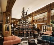
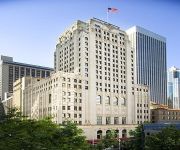
Fairmont Olympic Seattle
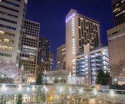
W Seattle
Hilton Seattle
INN AT THE WAC
Alexis Seattle
Kimpton Hotel Monaco Seattle
Loews Hotel 1000
Crowne Plaza SEATTLE-DOWNTOWN
Kimpton Hotel Vintage Seattle
Renaissance Seattle Hotel
Videos from this area
These are videos related to the place based on their proximity to this place.
5 trains within 15 minutes (Seattle Link Light Rail)
At Beacon Hill station, Southbound platform towards Tukwila International Boulevard station, lots of trains to handle the post-Mariner game traffic. Each and every train was full of people....
Left Coast Tour presented by Tony Hawk & Birdhouse
evo went out to Tony Hawk & Birdhouse's Left Coast Tour at Jefferson Park Skatepark on Beacon Hill to watch Tony and some other pros going big in the bowl jam. Check out more pictures and...
Seattle Sounders Short Film: A Night of Champions
This is my first short film and it was inspired by "A Night at the Emirates", one of my favorite tribute films. I shot it during the night of the 2011 MLS US Open Cup Final between Seattle...
Seattle skyline from I-5
This is a short clip of driving into seattle at night going north on I-5 from the south end of seattle.
2010-09/18 - NAAM - Northwest African American Museum - Seattle
NAAM - Northwest African American Museum http://en.wikipedia.org/wiki/File:Seattle_-_NAAM_04.jpg http://en.wikipedia.org/wiki/Northwest_African_American_Museum.
Link Inaugural Ride
Seattle's Central Link Light Rail opened today, July 18 2009, and I was lucky enough to be among the first to ride it. This is an abridged video of the official Inaugural Ride. The stations...
Odometer rolls - 777777.7 miles
2002 Mack CH600 semi truck odometer rolls - 777777.7 miles (seven sevens) drivng in Seattle, WA on Airport Way South - 6.6.2012.
Mark Linvill's Favorite Seattle Things - Soundtransit LightRail
Mark Linvill, a realtor in Seattle with Coldwell Banker Bain shares his favorite things in Seattle. Today, Mark talks about the Light Rail system and how eas...
Videos provided by Youtube are under the copyright of their owners.
Attractions and noteworthy things
Distances are based on the centre of the city/town and sightseeing location. This list contains brief abstracts about monuments, holiday activities, national parcs, museums, organisations and more from the area as well as interesting facts about the region itself. Where available, you'll find the corresponding homepage. Otherwise the related wikipedia article.
Sick's Stadium
Sick's Stadium, also known as Sick's Seattle Stadium and later as Sicks' Stadium, was a baseball stadium located in Seattle, Washington's Rainier Valley at the corner of S. McClellan Street and Rainier Avenue S. The site was previously the location of Dugdale Park, a 1913 ballpark that was the home of the minor league Seattle Indians.
Beacon Hill, Seattle
Beacon Hill is a hill and neighborhood in southeast Seattle, Washington. The municipal government subdivides it into North Beacon Hill, Mid-Beacon Hill, Holly Park, and South Beacon Hill, though most people who live there simply call it "Beacon Hill. " Former home to the world headquarters of Amazon.
Jefferson Park (Seattle)
Jefferson Park is a 52.4 acre (212,055 m²) public park and golf course on top of Beacon Hill in Seattle, Washington, bounded on the east by 24th Avenue S. and 24th Place S. , on the west by 15th Avenue S. , on the north by S. Spokane Street, and on the south by Cheasty Boulevard S.
Center Park
Center Park, located at 2121 26th Avenue South, is a subsidized high-rise building complex located in the Mt. Baker neighborhood of Seattle, Washington, designed to provide living accommodation to physically or mentally challenged individuals and their caretakers. The apartments were built in the 1960s by Ida May Daly, a progressive woman with severe muscular dystrophy. She purchased an area of inexpensive land in the Rainier Valley neighborhood in south Seattle.
Dai Bai Zan Cho Bo Zen Ji
Dai Bai Zan Cho Bo Zen Ji is a Rinzai-style Zen temple, located on North Beacon Hill in Seattle, Washington. Its name translates from Japanese as "Listening to the Dharma Zen Temple on Great Plum Mountain."
Northwest African American Museum
The Northwest African American Museum (NAAM) in Seattle, Washington, USA opened March 8, 2008. Intended to "document and exhibit the unique historical and cultural experiences of African Americans in Seattle and the Pacific Northwest", the museum is part of the new Urban League Village at the former Colman School (built 1909, and with official status as a City of Seattle landmark).
Mount Baker (Link station)
The Mount Baker Station is a Sound Transit Central Link light rail station in the Mount Baker neighborhood of Seattle. It opened on July 18, 2009 and is projected to have 3500 daily boardings in 2020 – although this number will increase with the completion of the University Link extension. The station is elevated with side platforms, and is located west of Rainier Ave South at Martin Luther King Jr. Way South, south of South Forest Street.
Beacon Hill (Link station)
The Beacon Hill Station is a Sound Transit Central Link light rail stop in the Beacon Hill neighborhood of Seattle. It is a tunnel station, about 160 feet under South Lander Street, with an entrance located at the southeast corner of Beacon Avenue South and South Lander Street. The station opened with the rest of the Central Link line on July 18, 2009. Sound transit predicts 3,000 daily boardings at the Beacon Hill Station for the year 2020.
Cheasty Boulevard South
Cheasty Boulevard South is a 1.3-mile route along the eastern edge of Seattle, Washington's Beacon Hill neighborhood. It was declared a City of Seattle landmark on January 15, 2003. Designed in 1903 as part of Seattle's Olmstead parks system, the property was acquired in 1910. Originally named Jefferson Boulevard, it was renamed in 1914 after E.C. Cheasty of the Parks Board, a former commissioner of the Seattle Police Department and the Alaska-Yukon-Pacific Exposition.
Lester Apartments
The Lester Apartments was a building in the west side of Beacon Hill, Seattle, Washington, USA. It was constructed in 1910–1911, originally intended to be the world's largest brothel. After scandal forced Seattle mayor Hiram Gill from office, the building was converted to be an ordinary apartment house. It met a disastrous end when a B-50 Superfortress crashed into it in 1951, causing a fire that engulfed the building.
The Jungle (Seattle)
The Jungle is a greenbelt on the western slope of Beacon Hill in Seattle that is known for its homeless encampments and crime.
Beacon Food Forest
Beacon Food Forest is a 7-acre food forest in development adjacent to Jefferson Park on Beacon Hill in Seattle, Washington in the vicinity of 15th Ave South and South Dakota. By the design of the project, and as the area is on public land, food in the edible forest section of the project will be available freely to those visiting the park. The project also has more traditional private allotments, similar to those in other local P-Patch gardens.


