Safety Score: 2,7 of 5.0 based on data from 9 authorites. Meaning we advice caution when travelling to United States.
Travel warnings are updated daily. Source: Travel Warning United States. Last Update: 2024-08-13 08:21:03
Delve into Nordland
Nordland in Jefferson County (Washington) is located in United States about 2,338 mi (or 3,762 km) west of Washington DC, the country's capital town.
Current time in Nordland is now 09:38 AM (Tuesday). The local timezone is named America / Los Angeles with an UTC offset of -8 hours. We know of 10 airports close to Nordland, of which 4 are larger airports. The closest airport in United States is Snohomish County (Paine Field) Airport in a distance of 21 mi (or 34 km), South-East. Besides the airports, there are other travel options available (check left side).
There is one Unesco world heritage site nearby. It's Olympic National Park in a distance of 22 mi (or 35 km), South. Also, if you like playing golf, there are some options within driving distance. We encountered 10 points of interest near this location. If you need a hotel, we compiled a list of available hotels close to the map centre further down the page.
While being here, you might want to pay a visit to some of the following locations: Port Townsend, Coupeville, Everett, Port Orchard and Mount Vernon. To further explore this place, just scroll down and browse the available info.
Local weather forecast
Todays Local Weather Conditions & Forecast: 7°C / 45 °F
| Morning Temperature | 4°C / 39 °F |
| Evening Temperature | 5°C / 41 °F |
| Night Temperature | 5°C / 41 °F |
| Chance of rainfall | 0% |
| Air Humidity | 75% |
| Air Pressure | 1026 hPa |
| Wind Speed | Light breeze with 3 km/h (2 mph) from South |
| Cloud Conditions | Broken clouds, covering 50% of sky |
| General Conditions | Scattered clouds |
Tuesday, 3rd of December 2024
8°C (46 °F)
5°C (41 °F)
Sky is clear, light breeze, clear sky.
Wednesday, 4th of December 2024
8°C (46 °F)
6°C (43 °F)
Overcast clouds, gentle breeze.
Thursday, 5th of December 2024
9°C (47 °F)
10°C (49 °F)
Light rain, fresh breeze, overcast clouds.
Hotels and Places to Stay
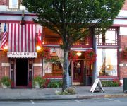
PALACE HOTEL PORT TOWNSEND
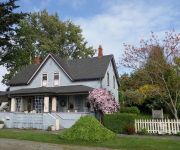
Blue Gull Inn Bed and Breakfast
Fort Worden
Port Townsend Inn
Inn At Port Hadlock / Port Townsend
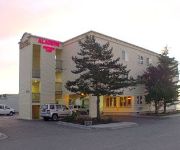
ALADDIN MOTOR INNS
Videos from this area
These are videos related to the place based on their proximity to this place.
Downtown Port Townsend, WA
Quick morning flight over downtown (east end) Port Townsend, WA. Video captured with GoPro Hero4 on Zenmuse H3-3D gimbal attached to my DJI Phantom 2.
Port Townsend Kinetic Sculpture Race 2013 Aerial Video
Port Townsend Kinetic Sculpture Race 2013. For more event aerial videos visit www.iwanttoflylikeaneagle.com.
Port Townsend Wooden Boat Festival 2013 Aerial Video
The Eagle flew the Port Townsend Boat festival this year on a glorious sunny day. See more Eagle videos at www.iwanttoflylikeaneagle.com.
Sea Otter Family in Port Townsend
A family of five giant sea otters lives in the Port Townsend waterfront, and they are quite curious, swimming up to kayaks, leaping off docks, and foraging for goodies on the bottom.
Seeattle.com - The Traveling Twins - Point Hudson RV park, Port Townsend (Washington)
Seeattle.com - The Traveling Twins - Point Hudson RV park, Port Townsend (Washington)
port townsend WA balcony discussion at sirens pub
scott breaks into German to startle the locals at sirens pub.
July 2014 Port Ludlow Cruise
An overnight cruise from Port Townsend to Port Ludlow, Washington, on Sage 17 AIR BORN.
Videos provided by Youtube are under the copyright of their owners.
Attractions and noteworthy things
Distances are based on the centre of the city/town and sightseeing location. This list contains brief abstracts about monuments, holiday activities, national parcs, museums, organisations and more from the area as well as interesting facts about the region itself. Where available, you'll find the corresponding homepage. Otherwise the related wikipedia article.
Marrowstone, Washington
Marrowstone is a census-designated place (CDP) in Jefferson County, Washington, USA. The population was 837 at the 2000 census. All Marrowstone addresses are in Nordland, Washington, and the ZIP code for Marrowstone Island is 98358. Marrowstone takes its name from Marrowstone Point, the northernmost point on Marrowstone Island. It was given the name "Marrow-Stone Point" in 1792 by the British explorer George Vancouver, descriptive of the hard, claylike soil.
Mystery Bay State Park
Mystery Bay State Park is a 10-acre Washington state park on Mystery Bay, a small inlet off of Scow Bay/Kilisut Harbor on the western side of Marrowstone Island. It has 685 feet of moorage space and is primarily intended for the use of boaters. It is located approximately one half mile north of the Nordland General Store (which also faces Mystery Bay) on Flagler Road. Mystery Bay is a favorite anchorage for boaters with many older wooden sailboats swinging at permanent moorage there.
Indian Island, Washington
Indian Island is an unincorporated community in Jefferson County, Washington, United States. It is located between Port Townsend Bay and Kilisut Harbor. Parts also border on Oak Bay and Scow Bay. Until the construction of the Port Townsend Ship Canal (also known as Portage Canal) Indian Island was connected to the mainland by a broad sand flat and backshore marsh. Indian Island is the location of the Indian Island Naval Reserve, which covers the entire island.
Port Townsend Ship Canal
The Port Townsend Ship Canal links Port Townsend Bay with Oak Bay in Jefferson County, Washington. Prior to construction this area was occupied by a broad sand flat and backshore marsh.
Kinney Point State Park
Kinney Point State Park in Jefferson County, Washington is a marine camping park in the Washington State Park System. It consists of 76 acres with 683 feet of saltwater shoreline at the south end of Marrowstone Island. Campsites are restricted to visitors arriving by human- or wind-powered watercraft. Available activities include boating, fishing, clamming, and crabbing. The park is part of the Cascadia Marine Trail.


