Safety Score: 2,7 of 5.0 based on data from 9 authorites. Meaning we advice caution when travelling to United States.
Travel warnings are updated daily. Source: Travel Warning United States. Last Update: 2024-08-13 08:21:03
Delve into Mount Olive
Mount Olive in Northumberland County (Virginia) is a town located in United States about 84 mi (or 136 km) south-east of Washington DC, the country's capital town.
Time in Mount Olive is now 02:25 PM (Thursday). The local timezone is named America / New York with an UTC offset of -5 hours. We know of 8 airports closer to Mount Olive, of which 6 are larger airports. The closest airport in United States is Newport News Williamsburg International Airport in a distance of 46 mi (or 74 km), South. Besides the airports, there are other travel options available (check left side).
There is one Unesco world heritage site nearby. It's Monticello and the University of Virginia in Charlottesville in a distance of 64 mi (or 103 km), West. Also, if you like the game of golf, there are some options within driving distance. We saw 7 points of interest near this location. In need of a room? We compiled a list of available hotels close to the map centre further down the page.
Since you are here already, you might want to pay a visit to some of the following locations: Lancaster, Heathsville, Saluda, Mathews and Warsaw. To further explore this place, just scroll down and browse the available info.
Local weather forecast
Todays Local Weather Conditions & Forecast: 11°C / 52 °F
| Morning Temperature | 8°C / 46 °F |
| Evening Temperature | 9°C / 48 °F |
| Night Temperature | 5°C / 41 °F |
| Chance of rainfall | 0% |
| Air Humidity | 47% |
| Air Pressure | 1005 hPa |
| Wind Speed | Moderate breeze with 13 km/h (8 mph) from South-East |
| Cloud Conditions | Clear sky, covering 0% of sky |
| General Conditions | Light rain |
Thursday, 21st of November 2024
6°C (43 °F)
6°C (42 °F)
Light rain, moderate breeze, clear sky.
Friday, 22nd of November 2024
11°C (52 °F)
7°C (45 °F)
Light rain, moderate breeze, clear sky.
Saturday, 23rd of November 2024
12°C (53 °F)
8°C (46 °F)
Few clouds, gentle breeze.
Hotels and Places to Stay
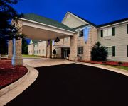
BEST WESTERN KILMARNOCK HOTEL
Videos from this area
These are videos related to the place based on their proximity to this place.
Menokin - History
A brief history of Menokin, home of Francis Lightfoot Lee, a signer of the Declaration of Independence.
Sandra Hargett Coldwell Banker Chesapeake Bay Properties
Sandra Hargett Northern Neck Real Estate http://www.coldwellbanker.com/servlet/AgentListing?action=detail&ComColdwellbankerDataAgent_id=576034.
Devils Backbone state park in western Maryland
One of the most picturesque and totally relaxing state parks I've run across in some time. Located on Antietam Creek just east of Hagerstown, with a spectacular small dam, and downstream, a...
Watching Dolphins at the mouth of the Wicomico River.mp4
A group of Dolphins at the mouth of the Wicomico River off of the Chesapeake Bay.
Purcellville, VA N 21st St panorama
Here's my 1st effort to capture a sense of what this delightful small town at the end of the W&OD Bike Trail has to offer.... This technology is now a regular part of my marketing resources...
Osage Orange tree dropping leaves
A frost overnight caused this tree to gently drop its leaves in the morning sun...
Northern Neck Real Estate
Real Estate in Virginia's Northern Neck presented by Ken Smith, an award winning Realtor, retired commercial waterman, bay advocate, and Northern Neck native. Ken knows the land, water, and...
The Athena Winery
Beautiful award winning winery with 10000 vines on 14 cultivated acres with the entire property on 40 acres in Heathsville Virginia. Beautiful wine tasting room with vat room and cooler facilities...
Videos provided by Youtube are under the copyright of their owners.
Attractions and noteworthy things
Distances are based on the centre of the city/town and sightseeing location. This list contains brief abstracts about monuments, holiday activities, national parcs, museums, organisations and more from the area as well as interesting facts about the region itself. Where available, you'll find the corresponding homepage. Otherwise the related wikipedia article.
Hardins Corner, Virginia
Hardins Corner is an unincorporated community in Northumberland County, in the U.S. state of Virginia.
Mount Olive, Virginia
Mount Olive is an unincorporated community in Northumberland County, in the U.S. state of Virginia.
Remo, Virginia
Remo is an unincorporated community in Northumberland County, in the U.S. state of Virginia.
Waddeys, Virginia
Waddeys is an unincorporated community in Northumberland County, in the U.S. state of Virginia.
Wicomico Church, Virginia
Wicomico Church is an unincorporated community in Northumberland County, in the U.S. state of Virginia.


