Safety Score: 2,7 of 5.0 based on data from 9 authorites. Meaning we advice caution when travelling to United States.
Travel warnings are updated daily. Source: Travel Warning United States. Last Update: 2024-08-13 08:21:03
Explore Basic City
The district Basic City of Waynesboro in City of Waynesboro (Virginia) is located in United States about 115 mi south-west of Washington DC, the country's capital.
If you need a place to sleep, we compiled a list of available hotels close to the map centre further down the page.
Depending on your travel schedule, you might want to pay a visit to some of the following locations: Staunton, Lovingston, Harrisonburg, Charlottesville and Stanardsville. To further explore this place, just scroll down and browse the available info.
Local weather forecast
Todays Local Weather Conditions & Forecast: 13°C / 55 °F
| Morning Temperature | 5°C / 40 °F |
| Evening Temperature | 9°C / 47 °F |
| Night Temperature | 7°C / 44 °F |
| Chance of rainfall | 0% |
| Air Humidity | 44% |
| Air Pressure | 1018 hPa |
| Wind Speed | Gentle Breeze with 8 km/h (5 mph) from East |
| Cloud Conditions | Broken clouds, covering 72% of sky |
| General Conditions | Broken clouds |
Monday, 25th of November 2024
17°C (63 °F)
13°C (55 °F)
Scattered clouds, light breeze.
Tuesday, 26th of November 2024
10°C (50 °F)
1°C (35 °F)
Light rain, fresh breeze, broken clouds.
Wednesday, 27th of November 2024
10°C (49 °F)
4°C (38 °F)
Overcast clouds, light breeze.
Hotels and Places to Stay
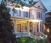
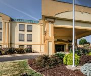
Belle Hearth Bed and Breakfast
Residence Inn Waynesboro
Holiday Inn Express & Suites WAYNESBORO-ROUTE 340
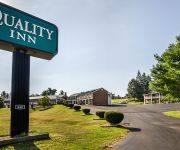
Quality Inn Waynesboro
Colony House Motel
Affordable Corporate Suites of Waynesboro
Deluxe Budget Motel Waynesboro
Comfort Inn Waynesboro
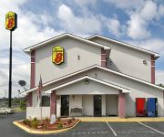
SUPER 8 WAYNESBORO
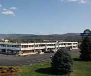
DAYS INN WAYNESBORO
Videos from this area
These are videos related to the place based on their proximity to this place.
How Much Do Adjustable Beds Cost? | Waynesboro VA
http://www.SleepOnItWaynesboro.com Call TOLL FREE 877-317-5337 for AFFORDABLE Adjustable Beds in Waynesboro, Staunton, Charlottesville VA.Sleep On It SPECIALIZES in only mattresses.
Trip to the Crozet Tunnel
An afternoon hike to the Claudius Crozet Blue Ridge Tunnel near Waynesboro, VA. My friend and I explored the now-abandoned railroad tunnel from its western entrance to the midway point beneath...
Limousine Service Waynesboro VA - Camryn Limo - Luxury Rides
(434) 990-9070 - http://camryn-limo.com/Camryn/Waynesboro VA/limo-service/ Exactly what Makes a Limousine Service a good way to Travel? Traveling has always been an integral part of people's...
Waynesboro VA Limousine Services - Camryn Limo - Call Now
(434) 990-9070 - http://camryn-limo.com/Camryn/waynesboro/limo-service What Makes a Waynesboro Virginia Limousine Service Ideal for Travel? Employing a Waynesboro Virginia limousine service.
Waynesboro VA Black Car Service - Camryn Limo - Call Now
(434) 990-9070 - http://camryn-limo.com/Camryn/Waynesboro Virginia/limo-service/ Go through the Most Luxurious and Well-Appointed Travel by means of a Waynesboro Virginia Limousine Service...
Waynesboro VA Private Car Service - Camryn Limo - Visit Website
(434) 990-9070 - http://camryn-limo.com/Camryn/waynesboro/limo-service Why You Must Take a Waynesboro VA limousine Service for Your Trip? Everyone wants to reach their destination in the...
Camryn Limo - Waynesboro VA Sedan Service - Call Today
(434) 990-9070 - http://camryn-limo.com/Camryn/waynesboro/limo-service The Most Elegant Way to Travel with Limousine Service Everyone wants to reach their destination in the most convenient...
The Disciples Kitchen Soup Kitchen in Waynesboro, Virginia
The Disciples Kitchen in Waynesboro, VA is a non-profit soup kitchen run by volunteers. Anyone in need of a hot meal is welcome to join us for lunch at Second Presbyterian Church on Mondays,...
Videos provided by Youtube are under the copyright of their owners.
Attractions and noteworthy things
Distances are based on the centre of the city/town and sightseeing location. This list contains brief abstracts about monuments, holiday activities, national parcs, museums, organisations and more from the area as well as interesting facts about the region itself. Where available, you'll find the corresponding homepage. Otherwise the related wikipedia article.
Waynesboro, Virginia
Waynesboro (formerly Flack), deriving its name from General Anthony Wayne, is an independent city surrounded by Augusta County in the U.S. state of Virginia. The population was 21,006 in 2010. It is located in the Shenandoah Valley, near many important historical markers of the Civil War and Shenandoah National Park. A portion of Interstate 64 falls within the city limits of Waynesboro, and the Blue Ridge Parkway, Skyline Drive, and the Appalachian Trail are less than five miles away.
Dooms, Virginia
Dooms is a census-designated place (CDP) in Augusta County, Virginia, United States. The population was 1,282 at the 2000 census. It is part of the Staunton–Waynesboro Micropolitan Statistical Area.
Crimora, Virginia
Crimora is a census-designated place (CDP) in Augusta County, Virginia, United States. The population was 1,796 at the 2000 census. It is part of the Staunton–Waynesboro Micropolitan Statistical Area.
Fishersville, Virginia
Fishersville is a census-designated place (CDP) in Augusta County, Virginia, United States. The population was 4,998 at the 2000 census. It is part of the Staunton–Waynesboro Micropolitan Statistical Area. Fishersville is also home to Barren Ridge Vineyards (on the Shenandoah Valley Wine Trail), winner of the 2009 Best in Show wine at the Virginia State Fair.
Sherando, Virginia
Sherando is a census-designated place (CDP) in Augusta County, Virginia, United States. The population was 665 at the 2000 census. It is part of the Staunton–Waynesboro Micropolitan Statistical Area.
Lyndhurst, Virginia
Lyndhurst is a census-designated place (CDP) in Augusta County, Virginia, United States. The population was 1,527 at the 2000 census. It is part of the Staunton–Waynesboro Micropolitan Statistical Area.
Blue Ridge Tunnel
The Blue Ridge Tunnel, also known as the Crozet Tunnel, was the longest of four tunnels built on the Blue Ridge Railroad to cross the Blue Ridge Mountains at Rockfish Gap near Afton Mountain in central Virginia. It has been named a Historic Civil Engineering Landmark.
Ladd, Virginia
Ladd is a small village in Virginia, United States. Ladd is located just outside the independent city of Waynesboro, Virginia and inside Augusta County. Founded in 1854, the only notable buildings of Ladd left as of 2005 are the Bethlehem Lutheran Church (built 1854), the General Store, and two homes dating to the early 1900s.
Battle of Waynesboro, Virginia
The Battle of Waynesboro was fought on March 2, 1865, at Waynesboro in Augusta County, Virginia, during the American Civil War. It was the final battle for Confederate Lt. Gen. Jubal Early, whose force was destroyed.
Rockfish Gap
Rockfish Gap is a wind gap located in the Blue Ridge Mountains between Charlottesville and Waynesboro, Virginia, United States, through Afton Mountain, which is frequently used to refer to the gap. Joining the Shenandoah Valley to the Piedmont region of the state, it is the site of the mountain crossing of Interstate 64, U.S. Highway 250, and the former Blue Ridge Railroad which later became part of the Chesapeake and Ohio Railway and is currently part of the CSX line.
Basic City, Virginia
Basic City was an incorporated town located in Augusta County, Virginia, in the United States. Formed in 1890, it was named after a process for steel manufacture. This process was to be implemented in Basic City, and gave rise to land speculation. There was an explosion of manufacturing and commercial development in Basic City between 1890 and 1893 as two railroads crossed here, the Norfolk and Western and the Chesapeake and Ohio.
Waynesboro Outlet Village
The Waynesboro Outlet Village, later rebranded Waynesboro Village, was an outdoor outlet mall in Waynesboro, Virginia, as one of Waynesboro's first attempts to make the town a shopping destination. In its heyday, the facility housed factory outlet stores, and in later years housed a combination of outlet stores and offices for nonprofit organizations.
Shenandoah Valley Governor's School
The Shenandoah Valley Governor's School is one of Virginia's 18 state-initiated magnet Governor's Schools. It is a part-time school where 11th and 12th grade students take advanced classes in the morning (receiving their remaining classes from their home high school).
Wilson Memorial High School
Wilson Memorial High School is a public school located in Fishersville, Virginia. The school is named after the 28th President of the United States, Thomas Woodrow Wilson who was born in nearby Staunton, Virginia. WMHS home of the Green Hornets, is located in the Woodrow Wilson Complex which consists of the Woodrow Wilson Rehabilitation Center, Augusta County Public Schools Board offices, Valley Vocational Technical Center, Wilson Elementary School, and Wilson Middle School.
WCYK-FM
WCYK-FM is a Country formatted broadcast radio station licensed to Staunton, Virginia, though has studios located in Charlottesville. WCYK serves the Harrisonburg/Staunton and Charlottesville, Virginia areas. WCYK is owned and operated by Monticello Media.
WKCI (AM)
WKCI is a News/Talk/Sports formatted broadcast radio station licensed to Waynesboro, Virginia, serving the Waynesboro and Staunton area. WKCI is owned and operated by Clear Channel Communications and currently operates as a simulcast of sister station WKCY.
Augusta Health
Augusta Health, formerly Augusta Medical Center, is a hospital in Fishersville, Virginia. It serves Augusta County, Virginia, as well as the cities of Staunton and Waynesboro. It is located near I-64. Augusta Medical Center was formed in 1994 as a consolidation of Kings Daughters Hospital in Staunton, and Waynesboro Community Hospital in Waynesboro. Augusta Medical Center changed its name to Augusta Health in June 2009. The campus went tobacco-free in 2009.
Eagle's Nest Airport (Virginia)
Eagle's Nest Airport is a public-use airport located three miles (5 km) west of the central business district of Waynesboro, in Augusta County, Virginia, United States. It is privately owned by Michael L. Fogle.
Avon, Virginia
Avon is an unincorporated community in Nelson County, Virginia, United States.
Durrett Town, Virginia
Durrett Town is an unincorporated community in Nelson County, Virginia, United States.
Onan, Virginia
Onan is an unincorporated community in Nelson County, Virginia, United States.
Humpback Rock
Humpback Rock is a massive greenstone outcrop near the peak of Humpback Mountain with a summit elevation of 3,080 feet . The rock is so named for the visual effect of a "hump" it creates on the western face of the mountain. Humpback Rocks, along with a well maintained trail and visitors' center, are located in the Blue Ridge Mountains near Waynesboro, Virginia in Augusta County and Nelson County.
Waynesboro High School
Waynesboro High School is a public high school in Waynesboro, Virginia, United States.
Greenwood Tunnel
The Greenwood Tunnel is a historic railroad tunnel constructed in 1853 by Claudius Crozet during the construction of the Blue Ridge Railroad. The tunnel was the easternmost tunnel in a series of four tunnels used to cross the Blue Ridge Mountains of Virginia. Located near Greenwood in Albemarle County, Virginia, the tunnel was used by the Chesapeake and Ohio Railway (C&O) until its abandonment in 1944.
Brookville Tunnel
The Brookville Tunnel (also Brooksville Tunnel) was a historic railroad tunnel engineered by Claudius Crozet during the construction of the Blue Ridge Railroad in the 1850s. The tunnel was part of a series of four tunnels used to cross the Blue Ridge Mountains of Virginia for the Virginia Central Railroad of the United States.


