Safety Score: 2,7 of 5.0 based on data from 9 authorites. Meaning we advice caution when travelling to United States.
Travel warnings are updated daily. Source: Travel Warning United States. Last Update: 2024-08-13 08:21:03
Delve into Wonderland Forest
Wonderland Forest in City of Suffolk (Virginia) is located in United States about 148 mi (or 238 km) south of Washington DC, the country's capital town.
Current time in Wonderland Forest is now 09:23 PM (Thursday). The local timezone is named America / New York with an UTC offset of -5 hours. We know of 8 airports close to Wonderland Forest, of which 4 are larger airports. The closest airport in United States is Norfolk International Airport in a distance of 18 mi (or 28 km), East. Besides the airports, there are other travel options available (check left side).
There is one Unesco world heritage site nearby. It's Monticello and the University of Virginia in Charlottesville in a distance of 101 mi (or 163 km), North-West. Also, if you like playing golf, there are some options within driving distance. We encountered 6 points of interest near this location. If you need a hotel, we compiled a list of available hotels close to the map centre further down the page.
While being here, you might want to pay a visit to some of the following locations: Suffolk, Portsmouth, Norfolk, Chesapeake and Isle of Wight. To further explore this place, just scroll down and browse the available info.
Local weather forecast
Todays Local Weather Conditions & Forecast: 6°C / 43 °F
| Morning Temperature | 2°C / 35 °F |
| Evening Temperature | 7°C / 44 °F |
| Night Temperature | 7°C / 44 °F |
| Chance of rainfall | 0% |
| Air Humidity | 43% |
| Air Pressure | 1004 hPa |
| Wind Speed | Moderate breeze with 12 km/h (7 mph) from East |
| Cloud Conditions | Clear sky, covering 3% of sky |
| General Conditions | Sky is clear |
Friday, 22nd of November 2024
12°C (54 °F)
7°C (45 °F)
Sky is clear, moderate breeze, clear sky.
Saturday, 23rd of November 2024
11°C (53 °F)
8°C (47 °F)
Few clouds, gentle breeze.
Sunday, 24th of November 2024
13°C (56 °F)
11°C (52 °F)
Sky is clear, gentle breeze, clear sky.
Hotels and Places to Stay
Fairfield Inn & Suites Chesapeake Suffolk
Holiday Inn Express & Suites CHESAPEAKE
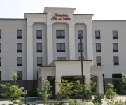
Hampton Inn - Suites Chesapeake-Square Mall
Hilton Garden Inn Chesapeake-Suffolk
Hilton Garden Inn Suffolk Riverfront
Candlewood Suites CHESAPEAKE/SUFFOLK
STUDIOS AND SUITES 4 LESS-CHESAPEAKE
MOTEL 6 CHESAPEAKE
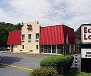
Econo Lodge Near Chesapeake Square
Sleep Inn & Suites Chesapeake - Portsmouth
Videos from this area
These are videos related to the place based on their proximity to this place.
SEAN G :: 2nd To None
I wrote this right after going to Warrior Leader Course (WLC) for the Army. Forgot all about it until it popped up on my itunes. Threw a video together so I ...
Chase Murray | Baseball Clearinghouse | High School | Mid Atlantic Pirates
Chase Murray | Baseball Clearinghouse | High School | Mid Atlantic Pirates http;//www.baseballclearinghouse.net Chase Murray 2017 2B/RHP Alliance Christian Academy, Portsmouth,VA Mid Atlantic...
Trey Posilero | Baseball Clearinghouse | High School | Mid Atlantic Pirates
Trey Posilero | Baseball Clearinghouse | High School | Mid Atlantic Pirates http;//www.baseballclearinghouse.net Trey Posilero 2016 SS/2B Princess Anne HS, Virginia Beach,VA Mid Atlantic Pirates-...
Regina Apartments for Rent Video - 4902 Queen Street
http://www.caprent.com/Properties/Regina/Southwood_Green.aspx for more information on these apartments for rent in Regina visit our web page Southwood Green Apartments 4902 Queen Street,...
Western Branch High School Bruin Sinfonia Orchestra Performing, Christmas Quatrain
Please Support the WBHS Orchestra through our Schwan's Fundraiser to help raise money to get to NY to perform at Carnegie Hall in the Spring of 2015. It's a once in a lifetime trip!! https://www....
Dylan Cyphert | Baseball Clearinghouse | Cranberry HS | Evoshield Canes
Dylan Cyphert | Baseball Clearinghouse | Cranberry HS | Evoshield Canes http;//www.baseballclearinghouse.net Dylan Cyphert 2015 LHP Cranberry HS HS, Oil City, PA June 2014 Chapel Hill, NC...
Landing Hampton Road Exec KPVG
Stop by KPVG on our return trip to Outer Bank, NC. Runway 4057' long 70' wide.
Ricky McCleod | Baseball Clearinghouse | High School | Mid Atlantic Pirates
Ricky McCleod | Baseball Clearinghouse | High School | Mid Atlantic Pirates http;//www.baseballclearinghouse.net Ricky McCleod 2015 LHP/OF Kings Fork HS, Suffolk,VA Mid Atlantic Pirates-...
Noah Gear | Baseball Clearinghouse | High School | Mid Atlantic Pirates
Noah Gear | Baseball Clearinghouse | High School | Mid Atlantic Pirates http;//www.baseballclearinghouse.net Noah Gear 2015 RHP/1B Phoebus HS, Hampton,VA Mid Atlantic Pirates- ...
Videos provided by Youtube are under the copyright of their owners.
Attractions and noteworthy things
Distances are based on the centre of the city/town and sightseeing location. This list contains brief abstracts about monuments, holiday activities, national parcs, museums, organisations and more from the area as well as interesting facts about the region itself. Where available, you'll find the corresponding homepage. Otherwise the related wikipedia article.
WTKR
WTKR is the CBS affiliate television station serving the Hampton Roads area of Virginia, officially known as the Norfolk-Portsmouth-Newport News DMA. The station is licensed to Norfolk and broadcasts on channel 40. Its transmitter is located in Suffolk, Virginia. Owned by Local TV, the station is sister to The CW affiliate WGNT.
WHRO-TV
WHRO-TV digital channel 15 is the Public Broadcasting Service (PBS) member Public television station for Hampton Roads, Virginia. The station is licensed to both Hampton and Norfolk with the studios at the Public Telecommunications Center for Hampton Roads next to the campus of Old Dominion University in Norfolk. Its transmitter is located in Suffolk, Virginia.
WTVZ-TV
WTVZ-TV is the MyNetworkTV affiliate serving the Norfolk-Portsmouth-Newport News, Virginia television market. The station broadcasts on channel 33 and owned by the Sinclair Broadcast Group. WTVZ's transmitter is located in Suffolk, Virginia. Syndicated programming on WTVZ-TV includes Seinfeld, The People's Court, Family Feud and The Big Bang Theory, among other shows.
WPXV-TV
WPXV-TV is the Ion Television owned and operated station for the Hampton Roads area, licensed to Norfolk, Virginia. The station is owned by ION Media Networks, and operates on UHF digital channel 46.
WTPC-TV
WTPC-TV is a religious television station in Virginia Beach, Virginia, broadcasting locally on channel 21 as a TBN owned-and-operated station.
Nansemond River High School
Nansemond River High School is a public secondary school in Suffolk, Virginia. It opened in September 1990 and originally consisted of students from three of the four former high schools of Suffolk, VA, John F. Kennedy High School, John Yeates High School, and Suffolk High School. Nansemond River opened its doors to approximately 1700 students. The student population swelled to nearly 2000 students in the year of 2003, and in 2004, a new high school, King's Fork, was formed.
WHRO-FM
WHRO-FM is a Public Radio formatted broadcast radio station licensed to Norfolk, Virginia, serving Hampton Roads. WHRO-FM is owned and operated by Hampton Roads Educational Telecommunictns Association, Inc.
WHRV
WHRV is a Public Radio formatted broadcast radio station licensed to Norfolk, Virginia, serving Hampton Roads. WHRV is owned and operated by Hampton Roads Educational Telecommunications Association, Inc. , which is operated by 18 public school systems in Eastern Virginia.


