Safety Score: 2,7 of 5.0 based on data from 9 authorites. Meaning we advice caution when travelling to United States.
Travel warnings are updated daily. Source: Travel Warning United States. Last Update: 2024-08-13 08:21:03
Explore Gloversville
Gloversville in City of Suffolk (Virginia) is located in United States about 143 mi (or 230 km) south of Washington DC, the country's capital.
Local time in Gloversville is now 10:27 AM (Saturday). The local timezone is named America / New York with an UTC offset of -4 hours. We know of 8 airports in the wider vicinity of Gloversville, of which 4 are larger airports. The closest airport in United States is Newport News Williamsburg International Airport in a distance of 19 mi (or 31 km), North. Besides the airports, there are other travel options available (check left side).
There is one Unesco world heritage site nearby. It's Monticello and the University of Virginia in Charlottesville in a distance of 96 mi (or 154 km), North-West. Also, if you like golfing, there are multiple options in driving distance. We found 7 points of interest in the vicinity of this place. If you need a place to sleep, we compiled a list of available hotels close to the map centre further down the page.
Depending on your travel schedule, you might want to pay a visit to some of the following locations: Suffolk, Isle of Wight, Newport News, Portsmouth and Hampton. To further explore this place, just scroll down and browse the available info.
Local weather forecast
Todays Local Weather Conditions & Forecast: 17°C / 62 °F
| Morning Temperature | 16°C / 61 °F |
| Evening Temperature | 15°C / 60 °F |
| Night Temperature | 14°C / 58 °F |
| Chance of rainfall | 0% |
| Air Humidity | 46% |
| Air Pressure | 1028 hPa |
| Wind Speed | Gentle Breeze with 9 km/h (5 mph) from South |
| Cloud Conditions | Overcast clouds, covering 100% of sky |
| General Conditions | Overcast clouds |
Saturday, 2nd of November 2024
17°C (62 °F)
14°C (57 °F)
Broken clouds, gentle breeze.
Sunday, 3rd of November 2024
18°C (64 °F)
16°C (62 °F)
Overcast clouds, gentle breeze.
Monday, 4th of November 2024
21°C (70 °F)
19°C (67 °F)
Scattered clouds, moderate breeze.
Hotels and Places to Stay
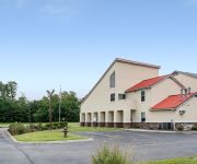
Econo Lodge Inn & Suites Carrollton Smithfield
Videos from this area
These are videos related to the place based on their proximity to this place.
Coastal RV Episode 2 - Reviews the Trailer-Aid
Do you dread the thought of having a flat RV trailer tire while on vacation? Check-out the Trailer-Aid and see how it could make changing a trailer tire easier, faster and much more convenient!
Coastal RV Episode 1 - Stabilizer Jacks
Fred, from Coastal RV, gives tips on how to properly use your RV stabilizer jacks.
Coastal RV Episode 3 - Checklist
Use the Coastal RV Checklist to make sure you remember to do those last minute tasks before pulling away from your campsite.
164 Lexington Square, Founders Pointe, Isle of Wight County, VA
Welcome to 164 Lexington Square, a unique luxury home located on a .74 acre privately wooded homesite in Founders Pointe, located in the Carrollton area of Isle of Wight County, near the historic...
ORLEANS HOMES in Hampton Roads, Virginia
Orleans Homebuilders is a Featured Builder in three East West Communities in the Hampton Roads area of Virginia- Founders Pointe, the Riverfront at Harbour View, and Graystone at Eagle Harbor....
Coastal Victorian Cottage Model- 87 Alexandria Way, Founders Pointe
Welcome to 87 Alexandria Way, Carrollton, VA, a new Coastal Cottage style home built by Sasser Construction. Currently listed for sale for $449900 with East West Realty in the Founders Pointe...
Videos provided by Youtube are under the copyright of their owners.
Attractions and noteworthy things
Distances are based on the centre of the city/town and sightseeing location. This list contains brief abstracts about monuments, holiday activities, national parcs, museums, organisations and more from the area as well as interesting facts about the region itself. Where available, you'll find the corresponding homepage. Otherwise the related wikipedia article.
Chuckatuck, Virginia
Chuckatuck is a neighborhood of the independent city of Suffolk, Virginia, United States. It is located at the junction of State Route 10/State Route 32 and State Route 125, just south of SR 10/32's crossing of Chuckatuck Creek. Its elevation is 36 feet above mean sea level. The neighborhood is relatively small and consists of such businesses as a garden store, general store, automobile repair shop, three churches, two gas stations, a restaurant, a hardware store, and others.
Kings Highway Bridge
Kings Highway Bridge was located on the Nansemond River in the independent city of Suffolk, Virginia, United States. Built in 1928, it carried traffic on the Kings Highway, also known as State Route 125, for over 75 years. The drawbridge was deemed unsafe and closed to traffic in March 2005 by the Virginia Department of Transportation (VDOT). In March 2007, VDOT announced that the bridge would be demolished and removed, and that the agency has no plans to replace it.


