Safety Score: 2,7 of 5.0 based on data from 9 authorites. Meaning we advice caution when travelling to United States.
Travel warnings are updated daily. Source: Travel Warning United States. Last Update: 2024-08-13 08:21:03
Discover West End
West End in City of Roanoke (Virginia) is a place in United States about 195 mi (or 314 km) south-west of Washington DC, the country's capital city.
Current time in West End is now 08:26 AM (Saturday). The local timezone is named America / New York with an UTC offset of -4 hours. We know of 11 airports near West End, of which 5 are larger airports. The closest airport in United States is Roanoke Regional Woodrum Field in a distance of 4 mi (or 6 km), North. Besides the airports, there are other travel options available (check left side).
Also, if you like playing golf, there are a few options in driving distance. We encountered 9 points of interest in the vicinity of this place. If you need a hotel, we compiled a list of available hotels close to the map centre further down the page.
While being here, you might want to pay a visit to some of the following locations: Roanoke, Salem, Fincastle, New Castle and Rocky Mount. To further explore this place, just scroll down and browse the available info.
Local weather forecast
Todays Local Weather Conditions & Forecast: 19°C / 66 °F
| Morning Temperature | 11°C / 51 °F |
| Evening Temperature | 14°C / 57 °F |
| Night Temperature | 11°C / 52 °F |
| Chance of rainfall | 0% |
| Air Humidity | 43% |
| Air Pressure | 1027 hPa |
| Wind Speed | Light breeze with 4 km/h (2 mph) from North-West |
| Cloud Conditions | Scattered clouds, covering 27% of sky |
| General Conditions | Scattered clouds |
Saturday, 2nd of November 2024
17°C (62 °F)
10°C (50 °F)
Scattered clouds, light breeze.
Sunday, 3rd of November 2024
18°C (65 °F)
12°C (53 °F)
Overcast clouds, light breeze.
Monday, 4th of November 2024
22°C (71 °F)
14°C (58 °F)
Scattered clouds, gentle breeze, broken clouds.
Hotels and Places to Stay
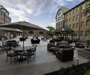
Sheraton Roanoke Hotel & Conference Center
Hotel Roanoke - Conference Center Curio Collection by Hilton
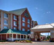
Country Inn and Suites by Radisson Fredericksburg
BEST WESTERN PLUS VALLEY VIEW
Howard Johnson Inn Roanoke Airport
Holiday Inn ROANOKE - VALLEY VIEW
Comfort Inn Airport
Courtyard Roanoke Airport
Residence Inn Roanoke Airport
Hyatt Place Roa Arpt Valley View Mall
Videos from this area
These are videos related to the place based on their proximity to this place.
ThyssenKrupp Hydraulic Elevator @ Campbell Parking Garage Roanoke VA
This is the nice elevator at the campbell garage, notice the messed up labeling of the buttons... Facebook: http://www.facebook.com/dieselducy Website: http://www.dieselducy.com Google+: http://www...
Roanoke City, Orange Avenue - House Fire - Onscene - 7/30/12
right at 14th Street, small laundry fire in the basement quickly extinguished by interior crews. Units operating onscene: Engines - 5, 2, and 3 ...
Roanoke City - Engine 1, Ladder 1, and Medic 1 Leaving Station 1
Roanoke Fire EMS - Station 1 units heading to the staging area for the Dickens of a Christmas Parade. 12-13-13.
The Journey of Israel (Part 23) - Daniel S. Brogan - Nepali Church of Roanoke
Daniel S. Brogan speaking at the Nepali Church of Roanoke at Calvary Baptist Church, 608 Campbell Ave SW, Roanoke, VA 24016.
The Journey of Israel (Part 25) - Daniel S. Brogan - Nepali Church of Roanoke
Daniel S. Brogan speaking at the Nepali Church of Roanoke at the Baptist Friendship House, 635 Elm Ave SW, Roanoke, VA 24016.
The Journey of Israel (Part 22) - Daniel S. Brogan - Nepali Church of Roanoke
Daniel S Brogan speaking on 13 Apr 2014 at the Nepali Church of Roanoke at Calvary Baptist Church, 608 Campbell Ave SW, Roanoke, VA 24016.
The Journey of Israel (Part 17) - Daniel S. Brogan - Nepali Church of Roanoke
Daniel Brogan speaking on 20 Oct 2013 at the Nepali Church of Roanoke located at Calvary Baptist Church 608 Campbell Ave SW, Roanoke, VA 24016.
Highland Park Roanoke City Public Art Project
This small garden in Highland Park is the site of the next Roanoke, VA Public Art Project. The art will be located in both the NE and SW corners of the garden area. To orient yourself, the...
The Journey of Israel (Part 12) - Daniel S. Brogan - Nepali Church of Roanoke
Daniel Brogan speaking on 30 Jun 2013 at the Nepali Church of Roanoke at Calvary Baptist Church 608 Campbell Ave SW, Roanoke, VA 24016.
Roanoke City Ladder 7 Responding
on Memorial Avenue during May 2010. Ladder 7 is a 2009 Pierce Velocity.
Videos provided by Youtube are under the copyright of their owners.
Attractions and noteworthy things
Distances are based on the centre of the city/town and sightseeing location. This list contains brief abstracts about monuments, holiday activities, national parcs, museums, organisations and more from the area as well as interesting facts about the region itself. Where available, you'll find the corresponding homepage. Otherwise the related wikipedia article.
WSNV
WSNV is a Light Adult Contemporary formatted broadcast radio station licensed to Salem, Virginia, serving Metro Roanoke. WSNV is owned and operated by Clear Channel Communications. WSNV broadcasts in an all-Christmas format from mid-November through Christmas Day.
WGMN
WGMN is a Sports Radio formatted broadcast radio station licensed to Roanoke, Virginia, serving the Metro Roanoke area. WGMN is owned and operated by 3 Daughters Media.
WSFF
WSFF and WSNZ are Adult Hits formatted broadcast radio stations. WSFF is licensed to Vinton, Virginia, serving Metro Roanoke. WSFF is owned and operated by Clear Channel Communications and WSNZ is licensed to Lynchburg, Virginia serving Metro Lynchburg. Both WSFF and WSNZ are owned and operated by Clear Channel Communications.
WRIS
WRIS is a Religious formatted broadcast radio station licensed to Roanoke, Virginia, serving Roanoke and Roanoke County, Virginia. WRIS is owned and operated by WRIS, LLC.
Evergreen Burial Park
Evergreen Burial Park is a cemetery located at 1307 Summit Avenue, SW in the Raleigh Court neighborhood of Roanoke, Virginia. The cemetery began in 1916 in what was then Roanoke County. The cemetery was designed by the Hare and Hare design firm of Kansas City, Missouri. There were nearly 25,000 burials in the 54-acre cemetery by late 2011. A walking tour is available highlighting some of the more interesting individuals and stories of the social history of Roanoke.
Memorial Bridge (Roanoke, Virginia)
The Memorial Bridge is a two-lane, 785 feet long bridge spanning the Roanoke River along U.S. Route 11 (Memorial Avenue) in Roanoke, Virginia. The bridge serves as a connection between the southwestern areas of the city (including the Grandin Village area) with central Roanoke. Built by contractor W.W. Boxley, the bridge consists of five 120 feet spans, with construction commencing in summer 1925. The bridge officially opened to traffic on May 6, 1926, at a final cost of $282,750.
Washington Park, Roanoke, Virginia
Washington Park is a Roanoke, Virginia neighborhood located in central Roanoke, that initially developed in the 1920s as an early Roanoke suburb. It borders the neighborhoods of Roundhill on the north and Williamson Road on the north and east, Gainsboro and Harrison on the south and Melrose-Rugby on the west. Its northern and eastern boundary is concurrent with Interstate 581 and its southern boundary is concurrent with U.S. Route 460 (Orange Avenue).
West End, Roanoke, Virginia
West End is a Roanoke, Virginia neighborhood located in central Roanoke south of the Norfolk Southern railyard. It borders the neighborhoods of Hurt Park and Mountain View on the west, Downtown on the east, Gilmer on the north across the Norfolk Southern railyard and Old Southwest on the south.


