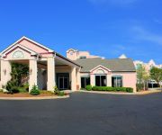
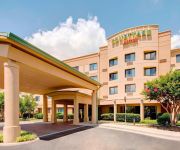
Safety Score: 2,7 of 5.0 based on data from 9 authorites. Meaning we advice caution when travelling to United States.
Travel warnings are updated daily. Source: Travel Warning United States. Last Update: 2024-08-13 08:21:03
Explore Fairhope
Fairhope in City of Roanoke (Virginia) is located in United States about 195 mi (or 313 km) south-west of Washington DC, the country's capital.
Local time in Fairhope is now 11:15 PM (Thursday). The local timezone is named America / New York with an UTC offset of -5 hours. We know of 11 airports in the wider vicinity of Fairhope, of which 5 are larger airports. The closest airport in United States is Roanoke Regional Woodrum Field in a distance of 2 mi (or 2 km), North-East. Besides the airports, there are other travel options available (check left side).
Also, if you like golfing, there are multiple options in driving distance. We found 7 points of interest in the vicinity of this place. If you need a place to sleep, we compiled a list of available hotels close to the map centre further down the page.
Depending on your travel schedule, you might want to pay a visit to some of the following locations: Roanoke, Salem, Fincastle, New Castle and Rocky Mount. To further explore this place, just scroll down and browse the available info.
Local weather forecast
Todays Local Weather Conditions & Forecast: 4°C / 40 °F
| Morning Temperature | -0°C / 31 °F |
| Evening Temperature | 4°C / 39 °F |
| Night Temperature | 6°C / 43 °F |
| Chance of rainfall | 0% |
| Air Humidity | 54% |
| Air Pressure | 1006 hPa |
| Wind Speed | Fresh Breeze with 13 km/h (8 mph) from East |
| Cloud Conditions | Broken clouds, covering 50% of sky |
| General Conditions | Scattered clouds |
Friday, 22nd of November 2024
8°C (46 °F)
4°C (39 °F)
Overcast clouds, moderate breeze.
Saturday, 23rd of November 2024
13°C (55 °F)
6°C (42 °F)
Overcast clouds, light breeze.
Sunday, 24th of November 2024
18°C (64 °F)
13°C (55 °F)
Broken clouds, light breeze.
Hotels and Places to Stay
Sheraton Roanoke Hotel & Conference Center
Residence Inn Roanoke Airport
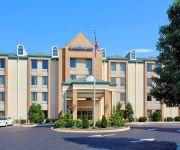
Comfort Inn Airport
Affordable Corporate Suites - Florist Road
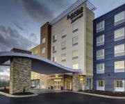
Fairfield Inn & Suites Roanoke Salem
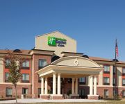
Holiday Inn Express & Suites SALEM
Home2 Suites by Hilton Roanoke
Hampton Inn and Suites Roanoke Airport VA
BEST WESTERN PLUS VALLEY VIEW
Courtyard Roanoke Airport
Videos from this area
These are videos related to the place based on their proximity to this place.
Roanoke City, Melrose - Hit and Run - MVC - Onscene - 6/18/12
At Melrose and Overbrook. Roanoke Fire EMS - Engine 13, Ladder 5, Medic 5, and Medic 4 Roanoke City Police.
Roanoke City Medic 4 Responding 3-25-12
Roanoke Fire EMS - Medic 4 responding with Engine 5 to a critical cardiac patient at the Country Club. Medic 4 is a Chevrolet/Wheeled Coach, and they are housed with Engine 4 on Peters Creek...
Airplane Takeoff: Roanoke Regional Airport flight 5605 at Sunrise
This is leaving the Roanoke Regional airport at a very beautiful time of the day. You can clearly see how Roanoke lies in a valley in this video. Facebook: http://www.facebook.com/dieselducy...
Roanoke Regional AIrport: Boarding Flight 5605 for elevatortimes
This is going from the ticket counter to the plane. Hanny wanted to see our airport. Facebook: http://www.facebook.com/dieselducy Website: http://www.dieselducy.com Google+: http://www.google.com/.
Westinghouse Hydraulic elevator @ Roanoke Regional Airport Roanoke VA
Westinghouse with RT fixtures. It was installed in 1989. I find it very interesting. Facebook: http://www.facebook.com/dieselducy Website: http://www.dieselducy.com Google+: http://www.google.com...
Comfort Inn in Roanoke, VA Hotel Coupons
http://freehotelcoupons.com/Roanoke/Comfort%20Inn/19229 Comfort Inn Airport 5070 Valley View Blvd, Roanoke, VA Comfort Inn hotel near the Roanoke Regional Airport Stay steps from the Valley...
Landing in Roanoke!
This is landing in Roanoke VA at the Roanoke Regional Airport Facebook: http://www.facebook.com/dieselducy Website: http://www.dieselducy.com Google+: http://www.google.com/+dieselducy Flickr:.
Hampton Inn & Suites Roanoke Airport, VA Hotel Coupon & Discount
Hampton Inn & Suites Roanoke Airport VA6271 http://freehotelcoupons.com/Roanoke/Hampton%20Inn%20&%20Suites,%20Roanoke%20Airport/61185 a welcoming hotel near Valley View Mall and ...
Sunset Flight from Roanoke
The sun slowly dips behind the horizon: as seen while in flight from Roanoke, VA to St. Pete/Clearwater, FL, on November 18, 2008. The flight is Allegiant Air, #884. The clip is preceded...
BEST WESTERN PLUS Inn at Valley View - Roanoke VA Hotel Coupon
http://freehotelcoupons.com/Roanoke/Best%20Western%20Plus/5177 BEST WESTERN PLUS Inn at Valley View The BEST WESTERN PLUS Inn at Valley View situated just off Central Virginia's ...
Videos provided by Youtube are under the copyright of their owners.
Attractions and noteworthy things
Distances are based on the centre of the city/town and sightseeing location. This list contains brief abstracts about monuments, holiday activities, national parcs, museums, organisations and more from the area as well as interesting facts about the region itself. Where available, you'll find the corresponding homepage. Otherwise the related wikipedia article.
Roanoke Regional Airport
Roanoke Regional Airport, also known as Woodrum Field, is a regional airport located three nautical miles northwest of the central business district of Roanoke, a city in Roanoke County, Virginia, United States. It is governed by the five-member Roanoke Regional Airport Commission that includes representatives from both the city and county of Roanoke. The airport has two runways and over 60 scheduled flights each day.
Northside High School (Roanoke, Virginia)
Northside High School is one of five high schools in Roanoke County, Virginia.
William Fleming High School
William Fleming High Schoolis an urban school, and one of the only two public high schools in the Roanoke City area school division, the other being the Patrick Henry High School. The edifice itself is located at 3649 Ferncliff Ave. Roanoke, Virginia 24017 and is positioned within the Miller/Arrowood neighborhood of the city.
WSNV
WSNV is a Light Adult Contemporary formatted broadcast radio station licensed to Salem, Virginia, serving Metro Roanoke. WSNV is owned and operated by Clear Channel Communications. WSNV broadcasts in an all-Christmas format from mid-November through Christmas Day.
WSFF
WSFF and WSNZ are Adult Hits formatted broadcast radio stations. WSFF is licensed to Vinton, Virginia, serving Metro Roanoke. WSFF is owned and operated by Clear Channel Communications and WSNZ is licensed to Lynchburg, Virginia serving Metro Lynchburg. Both WSFF and WSNZ are owned and operated by Clear Channel Communications.
Wilmont, Roanoke, Virginia
Wilmont is a Roanoke, Virginia neighborhood located in far western Roanoke. It borders the neighborhoods of South Washington Heights on the north, Cherry Hill on the south, Shenandoah West on the east and Ridgewood Park on the west.
Intervale, Virginia
Intervale is an unincorporated community in Alleghany County, Virginia, United States.
Westview Terrace, Roanoke, Virginia
Westview Terrace is a Roanoke, Virginia neighborhood located in northwest Roanoke. It borders the neighborhoods of Peachtree/Norwood on the west, Villa Heights and Washington Heights on the south and Miller Court/Arrowood on the north and east. The neighborhood is predominantly residential in character throughout its area with limited commercial development along its Virginia State Route 117 (Peters Creek Road) frontage.


