Safety Score: 2,7 of 5.0 based on data from 9 authorites. Meaning we advice caution when travelling to United States.
Travel warnings are updated daily. Source: Travel Warning United States. Last Update: 2024-08-13 08:21:03
Discover West Park Manor
The district West Park Manor of Portsmouth Heights in City of Portsmouth (Virginia) is a district in United States about 147 mi south of Washington DC, the country's capital city.
Looking for a place to stay? we compiled a list of available hotels close to the map centre further down the page.
When in this area, you might want to pay a visit to some of the following locations: Portsmouth, Norfolk, Chesapeake, Hampton and Suffolk. To further explore this place, just scroll down and browse the available info.
Local weather forecast
Todays Local Weather Conditions & Forecast: 10°C / 50 °F
| Morning Temperature | 9°C / 48 °F |
| Evening Temperature | 12°C / 54 °F |
| Night Temperature | 9°C / 48 °F |
| Chance of rainfall | 0% |
| Air Humidity | 58% |
| Air Pressure | 1010 hPa |
| Wind Speed | Fresh Breeze with 14 km/h (8 mph) from East |
| Cloud Conditions | Broken clouds, covering 79% of sky |
| General Conditions | Broken clouds |
Sunday, 24th of November 2024
13°C (55 °F)
10°C (50 °F)
Sky is clear, gentle breeze, clear sky.
Monday, 25th of November 2024
13°C (55 °F)
12°C (53 °F)
Few clouds, light breeze.
Tuesday, 26th of November 2024
17°C (62 °F)
11°C (52 °F)
Few clouds, moderate breeze.
Hotels and Places to Stay
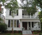
The Mermaids' Porch Bed and Breakfast
Hilton Garden Inn Chesapeake-Suffolk
TownePlace Suites Suffolk Chesapeake
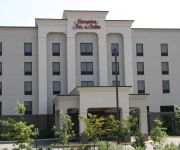
Hampton Inn - Suites Chesapeake-Square Mall
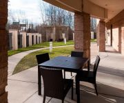
Courtyard Suffolk Chesapeake
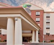
Holiday Inn Express & Suites CHESAPEAKE
Oakwood at Myrtles of OldeTwne
Fairfield Inn & Suites Chesapeake Suffolk
Extended Stay America Chesapeake Churchland Blvd
Candlewood Suites CHESAPEAKE/SUFFOLK
Videos from this area
These are videos related to the place based on their proximity to this place.
Ford Flex Vs. Honda Odyssey Vehicle Comparison | Portsmouth Ford | Cavalier Ford Chesapeake Square
Ford Flex Vs. Honda Odyssey Vehicle Comparison | Portsmouth Ford | Cavalier Ford Chesapeake Square | http://cavalierfordchesapeakesquare.com | CALL 888-853-3929 Chesapeake is proud to be ...
3805 Harding Dr Chesapeake VA
http://www.exite-listings.com/43576 This home is the definition of extravagance with countless luxuries throughout! Home is on a half acre with deep water...
2015 Ford Super Duty F-250 Virtual Test Drive | Portsmouth Ford | Cavalier Ford Chesapeake Square
2015 Ford Super Duty F-250 Virtual Test Drive | Portsmouth Ford | Cavalier Ford Chesapeake Square | http://cavalierfordchesapeakesquare.com | CALL 888-853-3929 Chesapeake is proud to be one...
2015 Ford Fusion Virtual Test Drive | Portsmouth Ford | Cavalier Ford Chesapeake Square
2015 Ford Fusion Virtual Test Drive | Portsmouth Ford | Cavalier Ford Chesapeake Square | http://cavalierfordchesapeakesquare.com | CALL 888-853-3929 Chesapeake is proud to be one of the ...
Portsmouth Boxing-TIGER Martial Arts Boxing, Jiu Jitsu, Kick Boxing and Karate
Get in the best shape of your life with Portsmouth Boxing at TIGER Martial Arts Boxing, MMA, Jiu Jitsu and Thai Boxing.
2015 Ford Transit Vehicle Review – Portsmouth Ford Dealer
2015 Ford Transit Vehicle Review – Portsmouth Ford Dealer | http://cavalierfordchesapeakesquare.com | CALL 888-853-3929 Chesapeake is proud to be one of the premier dealerships in the area....
City Park Portsmouth Flying #4 BEST VIDEO!
Attached a camcorder to my hobbyzone supercub LP and this is what I now have! I have a bunch of videos like this all over the place in my channel so check it out! Also Thank you for watching!
Used 2005 Chrysler Town Country Suffolk VA
We are proud to present this 2005 Chrysler Town and Country . Please visit our website at http://www.cavalierportsmouthford.com and if you have any questions...
2011 Chrysler Town Country Portsmouth VA
We are proud to present this 2011 Chrysler Town and Country . Please visit our website at http://www.cavalierportsmouthford.com and if you have any questions...
2007 Chrysler Town and Country Chesapeake VA 23321
We are proud to present this 2007 Chrysler Town and. Please visit our website at http://www.cavalierportsmouthford.com and if you have any questions you can ...
Videos provided by Youtube are under the copyright of their owners.
Attractions and noteworthy things
Distances are based on the centre of the city/town and sightseeing location. This list contains brief abstracts about monuments, holiday activities, national parcs, museums, organisations and more from the area as well as interesting facts about the region itself. Where available, you'll find the corresponding homepage. Otherwise the related wikipedia article.
Portsmouth, Virginia
Portsmouth is located in the Hampton Roads metropolitan area of the U.S. Commonwealth of Virginia. As of 2012, the city had a total population of 97,450. The Norfolk Naval Shipyard, often called the Norfolk Navy Yard, is a historic and active U.S. Navy facility that is actually located in Portsmouth rather than Norfolk; the name "Norfolk" was adopted to avoid confusion with Portsmouth, New Hampshire, where a naval shipyard already existed when the Virginia facility opened.
Lambert's Point
Lamberts Point is a point of land on the south shore of the Elizabeth River near the downtown area of the independent city of Norfolk in the South Hampton Roads region of eastern Virginia, United States. It includes a large coal exporting facility, a residential area, and a golf course.
Craney Island (Virginia)
Craney Island is a point of land in the independent city of Portsmouth in the South Hampton Roads region of eastern Virginia in the United States. The location, formerly in Norfolk County, is near the mouth of the Elizabeth River opposite Lambert's Point on Hampton Roads. It is managed by the U.S. Army Corps of Engineers.
Midtown Tunnel (Virginia)
The Midtown Tunnel crosses the main channel of the Elizabeth River in the South Hampton Roads area of Virginia where it is one of two tunnels that link the cities of Norfolk and Portsmouth. It carries U.S. Highway 58 and operates without tolls.
WVBW
WVBW is a classic hits formatted broadcast radio station licensed to Suffolk, Virginia, serving Hampton Roads. WVBW is owned and operated by Max Broadcast Group Holdings, LLC.
Hodges Ferry Bridge
Hodges Ferry Bridge carries State Route 337 across the western branch of the Elizabeth River in the independent city of Chesapeake in the South Hampton Roads region of southeastern Virginia. At the point it crosses the western branch, Route 337 is also named Portsmouth Boulevard.
Lambert's Point Deperming Station
Lambert's Point Deperming Station is a United States Navy deperming facility located in the Elizabeth River just off Lambert's Point, Norfolk, Virginia, United States. It was built in the mid-1940s and services the U.S. Atlantic Fleet. The station, which is administered by Naval Station Norfolk, consists of two parallel pile-supported piers, roughly 1140 ft. (345 m.
WUSH
WUSH is a Country formatted broadcast radio station licensed to Poquoson, Virginia, serving Hampton Roads. The station is owned and operated by Sinclair Telecable, Inc.
Belleville, Virginia
Belleville is an unincorporated community in the independent city of Suffolk, Virginia, United States. It is located at the junction of Interstate 664, U.S. Route 17, and State Route 164. {{#invoke:Coordinates|coord}}{{#coordinates:36.865|-76.436|region:US-VA|||||| |primary |name= }}
Lambert Point Light
The Lambert Point Light was a small screwpile lighthouse in Norfolk, Virginia; it was built in 1872. The lighthouse was meant to serve the increased shipping traffic on the Elizabeth River, and initially was designed with six piles. The plans were changed when five surplus piles were found; in the end the structure was square, and sat on these five piles. The building was painted brown, and showed a red light from a fifth-order Fresnel lens.
Western Branch High School
Western Branch High School is a suburban high school in Chesapeake, Virginia, USA. Established in 1968, it currently has the largest school population in Chesapeake with over 2200 students. The two feeder schools of WBHS are Joliff Middle School and Western Branch Middle School.
WNSB
WNSB is an Mainstream Urban formatted broadcast radio station licensed to Norfolk, Virginia, serving the Hampton Roads. WNSB is owned and operated by Norfolk State University Board of Visitors. The station is run primarily by students in the Mass Communications and Journalism Department.
I. C. Norcom High School
I.C. Norcom High School is a public high school located in Portsmouth, Virginia. It is administered by Portsmouth City Public Schools. The school colors are maroon and grey, and the nickname is the Greyhounds. The school was named after Israel Charles Norcom, its first supervising principal. I. C. Norcom High School is located at 1801 London Boulevard conveniently located between the revitalized downtown and the Midtown Tunnel. It was opened September, 1997 under the leadership of Mr.
Woodrow Wilson High School (Portsmouth, Virginia)
Woodrow Wilson High School is a public high school located in Portsmouth, Virginia. It is administered by Portsmouth City Public Schools. The school colors are royal blue, orange, and white, and the nickname is the Presidents.
Churchland High School
Churchland High School is a public high school located in Portsmouth, Virginia. It is administered by Portsmouth City Public Schools. The school colors are black, orange, and white. The school's mascot is a "Trucker". Churchland is designated as a magnet school for the Visual & Performing Arts, with subjects including dance, chorus, orchestra, band, drama, and the visual arts.
Club Lake Ahoy
Club Lake Ahoy was a water park situated within a man-made lake located in current day Chesapeake, Virginia. Many of the amusements contained in this park would by today's standards be considered dangerous. Huge metal towers with high dive platforms and Zip-cable rides over twenty feet high in the air dotted the lake. It has since been acquired by the City of Chesapeake and is under review for redevelopment as a City park.
WPMH
WPMH is a Christian Talk formatted broadcast radio station licensed to Portsmouth, Virginia, serving Hampton Roads. WPMH is owned by The Walt Disney Company, brokered to Christian broadcaster Chesapeake-Portsmouth Broadcasting Corporation.
WGPL
WGPL is an Urban Oldies formatted broadcast radio station licensed to Portsmouth, Virginia, serving Hampton Roads. WGPL is owned and operated by Christian Broadcasting of Norfolk.
WPCE
WPCE is a Black Gospel formatted broadcast radio station licensed to Portsmouth, Virginia, serving Hampton Roads. WPCE is owned and operated by Willis Broadcasting Corporation.
Bide-A-Wee Golf Course
Bide-A-Wee Golf Course is an 18-hole municipal public golf course founded by former PGA Champion Chandler Harper in 1956 located in and owned by the city of Portsmouth, Virginia.
Evergreen Memorial Park (Portsmouth, Virginia)
Evergreen Memorial Park is a cemetery in Portsmouth, Virginia.
Chesapeake Square Mall
Chesapeake Square is a 717,282 sq. ft. regional mall and was built in 1989 in Chesapeake, Virginia, in the Hampton Roads metropolitan area. The mall has approximately 100 stores, six anchors, several eateries at the mall's food court including Chick-Fil-A, Dairy Queen & Sbarro, and two restaurants: Piccadilly Cafeteria and Big Woody's. (both located at the mall's main entry) Chesapeake Square is 75% owned by Simon Property Group and has an 86.5% occupancy rate of its stores.
Western Branch Elizabeth River
The Western Branch Elizabeth River is a 7.0-mile-long tidal river located in the city of Portsmouth, Virginia, in the United States. It is a tributary of the Elizabeth River, part of the harbor of Hampton Roads in southeastern Virginia.
Greenbrier Mall
Greenbrier Mall is a nearly 900,000 sq. ft. regional mall in Chesapeake, Virginia, in the Hampton Roads metropolitan area. The mall has a hillside terrain, meaning entries exist on both upper and lower levels. It serves communities on the east coast in the states of Virginia and North Carolina.
Angelos Bible College
Angelos Bible College was an unaccredited Bible college in Portsmouth, Virginia. The college was founded by Calvary Evangelical Baptist Church and was a member of Association of Christian Schools International. Classes were held in the church's facilities. The college graduated its first class in 2001.


