Safety Score: 2,7 of 5.0 based on data from 9 authorites. Meaning we advice caution when travelling to United States.
Travel warnings are updated daily. Source: Travel Warning United States. Last Update: 2024-08-13 08:21:03
Delve into Pennsytown
Pennsytown in City of Norfolk (Virginia) is located in United States about 146 mi (or 235 km) south of Washington DC, the country's capital town.
Current time in Pennsytown is now 08:13 AM (Sunday). The local timezone is named America / New York with an UTC offset of -5 hours. We know of 8 airports close to Pennsytown, of which 4 are larger airports. The closest airport in United States is Norfolk International Airport in a distance of 2 mi (or 4 km), North-East. Besides the airports, there are other travel options available (check left side).
There is one Unesco world heritage site nearby. It's Monticello and the University of Virginia in Charlottesville in a distance of 106 mi (or 170 km), North-West. Also, if you like playing golf, there are some options within driving distance. We encountered 6 points of interest near this location. If you need a hotel, we compiled a list of available hotels close to the map centre further down the page.
While being here, you might want to pay a visit to some of the following locations: Norfolk, Chesapeake, Portsmouth, Hampton and Virginia Beach. To further explore this place, just scroll down and browse the available info.
Local weather forecast
Todays Local Weather Conditions & Forecast: 13°C / 55 °F
| Morning Temperature | 8°C / 46 °F |
| Evening Temperature | 14°C / 57 °F |
| Night Temperature | 11°C / 51 °F |
| Chance of rainfall | 0% |
| Air Humidity | 51% |
| Air Pressure | 1020 hPa |
| Wind Speed | Gentle Breeze with 9 km/h (5 mph) from East |
| Cloud Conditions | Clear sky, covering 6% of sky |
| General Conditions | Sky is clear |
Sunday, 24th of November 2024
15°C (60 °F)
14°C (57 °F)
Scattered clouds, gentle breeze.
Monday, 25th of November 2024
17°C (62 °F)
11°C (51 °F)
Light rain, moderate breeze, scattered clouds.
Tuesday, 26th of November 2024
9°C (49 °F)
8°C (46 °F)
Scattered clouds, gentle breeze.
Hotels and Places to Stay
DoubleTree by Hilton Hotel Norfolk Airport
MAGNUSON HOTEL VIRGINIA BEACH
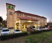
La Quinta Inn and Suites Norfolk Airport
BEST WESTERN CENTER INN
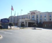
Hampton Inn - Suites Norfolk-Airport
Holiday Inn Express & Suites NORFOLK AIRPORT
Holiday Inn NORFOLK AIRPORT
Residence Inn Norfolk Airport
Quality Suites Lake Wright - Norfolk Airport
Savannah Suites Norfolk
Videos from this area
These are videos related to the place based on their proximity to this place.
1060 Norview Ave Norfolk VA
http://www.exite-listings.com/78325 Virtual Tour: http://www.exite-listings.com/etour.html/TOURID/78325 **Refer to listing website for current information. Video uploaded on Thu 30...
2005 Chrysler Town and Country Used Cars Norfolk VA
http://www.bellmotors.net This 2005 Chrysler Town and Country is available from Bell Motors. For details, call us at 757-858-0775.
City Manager’s Listening Tour - Day Two
To best shape the FY 2016 budget to the wants and needs of the community, Norfolk City Manager Marcus Jones reached out to residents on a two day “listening tour.” Residents grouped up...
2001 Suzuki Grand Vitara XL-7 Used Cars North Bergen NJ
http://www.allinonemotors.com This 2001 Suzuki Grand Vitara XL-7 is available from All In One Motors. For details, call us at 201-866-0577.
2009 Chrysler Town & Country Used Cars North Bergen NJ
http://www.allinonemotors.com This 2009 Chrysler Town & Country is available from All In One Motors. For details, call us at 201-866-0577.
2006 Chrysler Town & Country Used Cars North Bergen NJ
http://www.allinonemotors.com This 2006 Chrysler Town & Country is available from All In One Motors. For details, call us at 201-866-0577.
2006 Chrysler Town & Country Used Cars Norfolk VA
http://www.bellmotors.net This 2006 Chrysler Town & Country is available from Bell Motors. For details, call us at 757-858-0775.
Videos provided by Youtube are under the copyright of their owners.
Attractions and noteworthy things
Distances are based on the centre of the city/town and sightseeing location. This list contains brief abstracts about monuments, holiday activities, national parcs, museums, organisations and more from the area as well as interesting facts about the region itself. Where available, you'll find the corresponding homepage. Otherwise the related wikipedia article.
Elmhurst, Virginia
Elmhurst is a neighborhood in the independent city of Norfolk in the State of Virginia in the United States of America. It is located at latitude 36°53'3" North, longitude 76°13'50" West.
Met Park
Metropolitan Memorial Park aka Met Park was a baseball stadium in Norfolk, Virginia. Built in 1969, it was the home to the Norfolk Tides (known at that time as the Tidewater Tides) until the construction of Harbor Park was completed for the Tides to play the 1993 season there. Met Park sat 6,200, and was located near the end of the primary runway of the Norfolk International Airport.
JANAF Shopping Center
JANAF Shopping Center in Norfolk, Virginia was one of the first large shopping centers in the United States. The Hampton Roads area experienced tremendous growth during and after World War II. In the 1950s, a trend in retail was the shopping center, a group of stores along a common sidewalk adjacent to off-street parking, usually in a suburban location. It also had higher aspirations than most shopping centers; JANAF included a Norfolk Public Library branch and medical office building.
Norview High School
Norview High School is a public high school in central Norfolk, Virginia, Norview High School is one of the 5 local high schools that serve the city. It is home of the Dodson Scholars Program and the Leadership Center for Science and Engineering (or commonly referred to as LCSE).
Lake Taylor High School
Lake Taylor High School is a public high school located in Norfolk, Virginia and is the "Home of the Mighty Titans". It is administered by Norfolk City Public Schools. The school colors are blue,red and white and its mascot is the Titans. Lake Taylor High is also the home to a NJROTC program and is called The Academy of Leadership and Military Science.
Ballentine / Broad Creek (Tide station)
Ballentine / Broad Creek is a light rail station on the Tide Light Rail line in Norfolk, Virginia, U.S.A. , which opened in August 2011. Ballentine / Broad Creek is situated just west of Ballentine Boulevard. The station is adjacent to the east end of Norfolk State University and several residential neighborhoods.
Ingleside Road (Tide station)
Ingleside Road is a light rail station on the Tide Light Rail line in Norfolk, Virginia, U.S.A. , which opened in August 2011. Ingleside Road Station is situated along Ingleside Road. The station primarily serves residents of adjacent neighborhoods.
Lake Taylor Transitional Care Hospital
Lake Taylor Transitional Care Hospital (LTTCH) is a 296 bed, state-licensed, long-term acute care hospital and nursing facility located in Norfolk, Virginia. LTTCH is a not-for-profit organization governed by a Board of Commissioners appointed by the Norfolk City Council with an incorporation name of "Hospital Authority of Norfolk."


