Safety Score: 2,7 of 5.0 based on data from 9 authorites. Meaning we advice caution when travelling to United States.
Travel warnings are updated daily. Source: Travel Warning United States. Last Update: 2024-08-13 08:21:03
Discover Langley View
Langley View in City of Hampton (Virginia) is a city in United States about 131 mi (or 211 km) south of Washington DC, the country's capital city.
Local time in Langley View is now 11:39 AM (Friday). The local timezone is named America / New York with an UTC offset of -5 hours. We know of 8 airports in the vicinity of Langley View, of which 4 are larger airports. The closest airport in United States is Newport News Williamsburg International Airport in a distance of 10 mi (or 15 km), North-West. Besides the airports, there are other travel options available (check left side).
There is one Unesco world heritage site nearby. It's Monticello and the University of Virginia in Charlottesville in a distance of 92 mi (or 148 km), North-West. Also, if you like golfing, there are a few options in driving distance. We discovered 6 points of interest in the vicinity of this place. Looking for a place to stay? we compiled a list of available hotels close to the map centre further down the page.
When in this area, you might want to pay a visit to some of the following locations: Poquoson, Hampton, Newport News, Norfolk and Yorktown. To further explore this place, just scroll down and browse the available info.
Local weather forecast
Todays Local Weather Conditions & Forecast: 6°C / 42 °F
| Morning Temperature | 4°C / 39 °F |
| Evening Temperature | 9°C / 48 °F |
| Night Temperature | 9°C / 48 °F |
| Chance of rainfall | 0% |
| Air Humidity | 51% |
| Air Pressure | 1004 hPa |
| Wind Speed | Strong breeze with 21 km/h (13 mph) from East |
| Cloud Conditions | Clear sky, covering 7% of sky |
| General Conditions | Sky is clear |
Friday, 22nd of November 2024
11°C (51 °F)
10°C (50 °F)
Light rain, strong breeze, scattered clouds.
Saturday, 23rd of November 2024
12°C (54 °F)
12°C (53 °F)
Sky is clear, moderate breeze, clear sky.
Sunday, 24th of November 2024
12°C (53 °F)
13°C (56 °F)
Few clouds, gentle breeze.
Hotels and Places to Stay
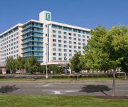
Embassy Suites by Hilton Hampton Hotel Convention Ctr - Spa
LA QUINTA INN NORFOLK HAMPTON NEWPORT N
Courtyard Hampton
SpringHill Suites Hampton
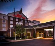
Hilton Garden Inn Hampton Coliseum Central
ExecuStay at Monticello Twn Ct
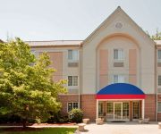
Candlewood Suites HAMPTON
VA Hampton Country Inn and Suites by Radisson
Holiday Inn Express HAMPTON - COLISEUM CENTRAL
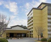
Quality Inn Near Hampton Coliseum
Videos from this area
These are videos related to the place based on their proximity to this place.
1987 Oshkosh Tilt-T Fire Truck on GovLiquidation.com
http://www.GovLiquidation.com - You're looking at a 1987 Oshkosh Tilt-T Fire Truck. It is available for bidding from December 24-27. This fire truck is located at Langley AFB, VA, and can be...
F-22 Raptor Demo and Heritage Flight 2007
Recorded at the Air Power Over Hampton Roads Air Show on Langley AFB 4-28-2007. Planes in the Heritage Flight are, F-86 Sabre, A-10 Thunderbolt 2, F-15 Eagle and F-22 Raptor.
Back River 18 Speckled Trout Catch and Release
Fishing a shallow grass flat surrounded by deep water.
Tests of Ground-Effect Machines Over Water
This 1959 film shows testing of the Ground-Effect Machine (GEM) both on a dry surface and water. This test was conducted at NASA Langley Research Center's Full Scale Tunnel. Testing for the...
Parawing capsule Truck Tows and Air Drop
Parawings were tested at NASA Langley Research Center's Full Scale Tunnel in the mid-1960s. This video shows actual parawing testing at an unknown location in the west. http://crgis.ndc.nasa.go...
Langley Honor Guard Retirement Ceremony
Will have to turn up the volume as high as you can to hear anything.
Air Power Over Hampton Roads 2009 - F-15C Eagle Demonstration - Friday Night
In this video is Nuke flying in front of the crowd on the Friday night show at Langley AFB. A lot of Afterburner is a good thing during the late afternoon! I missed the slow wing walk in the...
Willow Oaks Apartments For Rent - Hampton, VA
Hampton apartments - Willow Oaks apartments for rent in Hampton, VA. Get into the swing of things! Call 877.527.8497 or Visit ...
Videos provided by Youtube are under the copyright of their owners.
Attractions and noteworthy things
Distances are based on the centre of the city/town and sightseeing location. This list contains brief abstracts about monuments, holiday activities, national parcs, museums, organisations and more from the area as well as interesting facts about the region itself. Where available, you'll find the corresponding homepage. Otherwise the related wikipedia article.
Back River (Virginia)
The Back River is an estuarine inlet of the Chesapeake Bay between the independent cities of Hampton and Poquoson in the Hampton Roads area of southeastern Virginia. Formed by the confluence of the Northwest and Southwest Branches, and at just over two miles long, the Back River is a breeding ground for many of the Bay's prized sport fish and the well known blue crab.
Air Power Park
The Air Power Park is an outdoor, roadside museum in Hampton, Virginia which recognizes Hampton's role in America's early space exploration and aircraft testing. The outdoor park is open year-round, seven days a week from sunrise to sunset. Several vintage aircraft and experimental space launch vehicles from the 1950s and 1960s are displayed out of doors. The park is on a 15 acres plot and includes a children's playground.
Kecoughtan High School
Kecoughtan High School is a public high school located in Hampton, Virginia. The current grades offered are 9–12. Kecoughtan High School is one of four high schools located in the Hampton City Public School District. The other three are Phoebus High School, Bethel High School (Hampton, Virginia), and Hampton High School (Hampton, Virginia).
Phoebus High School
Phoebus High School is a public high school located in Hampton, Virginia. Named after the nearby neighborhood and former town of Phoebus, it is the newest of the four high schools in the city. Considered unique for the IDE Academy which includes Video Media Design, Engineering, and Video Game Programming. Originally designed as an "Open-Concept" school, permanent interior walls were minimized in favor of partitions that could be adjusted depending on building needs.
Fox Hill, Virginia
Fox Hill is an area within the eastern part of Hampton, Virginia. It is mostly a neighborhood community with a few small businesses scattered throughout. Fox Hill is bordered to the south by Phoebus, a neighborhood and former town that was incorporated within the city of Hampton; and Buckroe, a small waterfront community. Fox Hill Extends from Bloxom's Corner down Beach Road to Grandview Island and includes areas down Beach Road and borders Colonial Acres at Silver Isles Blvd.
WNIS
WNIS is a News/Talk/Sports formatted broadcast radio station licensed to Norfolk, Virginia, serving Hampton Roads. WNIS is owned and operated by Sinclair Telecable, Inc.
Langley Field
Langley Field is a United States military facility located adjacent to Hampton and Newport News, Virginia. It was one of thirty-two Air Service training camps established after the United States entry into World War I in April 1917. On 1 October 2010, Langley Field was joined with Fort Eustis to become Joint Base Langley–Eustis. The base was established in accordance with congressional legislation implementing the recommendations of the 2005 Base Realignment and Closure Commission.
Joint Base Langley–Eustis
Joint Base Langley–Eustis is a United States military facility located adjacent to Hampton and Newport News, Virginia. The base is an amalgamation of the United States Air Force's Langley Air Force Base and the United States Army's Fort Eustis which were merged on 1 October 2010. The base was established in accordance with congressional legislation implementing the recommendations of the 2005 Base Realignment and Closure Commission.


