Safety Score: 2,7 of 5.0 based on data from 9 authorites. Meaning we advice caution when travelling to United States.
Travel warnings are updated daily. Source: Travel Warning United States. Last Update: 2024-08-13 08:21:03
Delve into Gardners Mobile Home Park
Gardners Mobile Home Park in City of Hampton (Virginia) is a city located in United States about 131 mi (or 211 km) south of Washington DC, the country's capital town.
Current time in Gardners Mobile Home Park is now 06:31 AM (Friday). The local timezone is named America / New York with an UTC offset of -5 hours. We know of 8 airports closer to Gardners Mobile Home Park, of which 4 are larger airports. The closest airport in United States is Newport News Williamsburg International Airport in a distance of 7 mi (or 12 km), North-West. Besides the airports, there are other travel options available (check left side).
There is one Unesco world heritage site nearby. It's Monticello and the University of Virginia in Charlottesville in a distance of 90 mi (or 145 km), North-West. Also, if you like playing golf, there are some options within driving distance. We saw 6 points of interest near this location. In need of a room? We compiled a list of available hotels close to the map centre further down the page.
Since you are here already, you might want to pay a visit to some of the following locations: Hampton, Poquoson, Newport News, Yorktown and Norfolk. To further explore this place, just scroll down and browse the available info.
Local weather forecast
Todays Local Weather Conditions & Forecast: 6°C / 42 °F
| Morning Temperature | 5°C / 40 °F |
| Evening Temperature | 9°C / 48 °F |
| Night Temperature | 9°C / 48 °F |
| Chance of rainfall | 0% |
| Air Humidity | 50% |
| Air Pressure | 1003 hPa |
| Wind Speed | Strong breeze with 19 km/h (12 mph) from East |
| Cloud Conditions | Clear sky, covering 7% of sky |
| General Conditions | Sky is clear |
Friday, 22nd of November 2024
11°C (52 °F)
10°C (49 °F)
Light rain, strong breeze, clear sky.
Saturday, 23rd of November 2024
11°C (51 °F)
12°C (54 °F)
Sky is clear, moderate breeze, clear sky.
Sunday, 24th of November 2024
12°C (53 °F)
14°C (57 °F)
Sky is clear, gentle breeze, clear sky.
Hotels and Places to Stay
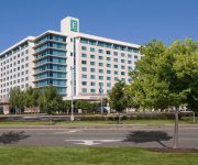
Embassy Suites by Hilton Hampton Hotel Convention Ctr - Spa
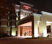
Hampton Inn Hampton-Newport News
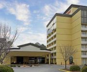
Quality Inn Near Hampton Coliseum
Crowne Plaza HAMPTON-MARINA
SpringHill Suites Hampton
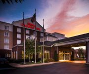
Hilton Garden Inn Hampton Coliseum Central
LA QUINTA INN NORFOLK HAMPTON NEWPORT N
Courtyard Hampton
BEST WESTERN HAMPTON COLISEUM
ExecuStay at Signature Place
Videos from this area
These are videos related to the place based on their proximity to this place.
Tidewater Parent attends Disney on Ice in Hampton, VA 2008
Tidewater Parent attends "Disney on Ice" at the Hampton Colliseum in Hampton, VA, Sep. 2008. www.tidewaterparent.com.
Spotlight: BMore's Finest 17U - DMVelite.com
A look at the BMore's FInest AAU 17U program at the Hoop Group Southern Jam Fest in Hampton, Va. Includes interviews with 2014 guard John Crosby, 2015 wing Will Robinson, 2014 guard Andre ...
NASA 990 Fire at March AFB
On July 17, 1985 the Convair NASA 990 suffered a blown tire during take-off at a speed of around 140 knots (Vr=154 kts). The runway 32 take-off was rejected immediately. The captain tried to...
PA-28 T-Tail Aircraft Flights 16, 17, 19
A continuation of the PA-28 T-Tail aircraft tests conducted as part of NASA Langley Research Center's stall/spin studies. Numerous flights on the NASA #519 aircraft. For more on the stall/spin...
LJ-1487 Flights 242 and 243
Stall/spin research flight LJ-1487, flight number 242 and 243 conducted 12 May 1986. Model research was conducted at NASA Langley Research Center's Spin Tunnel. Live flights were conducted...
Langley Flip
Me flipping at Langley Speedway on 10/14/07. I was driving the #23 in the Gold Plate Flathead division. The wreck was caused from the steering column breaking. This flip won the 2007 HRKC Best...
Demolition of the 16-Foot Transonic Tunnel
This is a series of pictures of the demolition of building 1146. In the late 1930s, the Special Committee on Future Research Facilities proposed the construction at Langley of a wind tunnel...
SMaKRacing 20 May 2007 Wreck
Racing at Langley Speedway in Virginia. I'm in the black #2 car. I get loose coming out of turn 4 and wind up wrecking me and another driver (#70). Action, Motor Sport, Sports Talk, Racing,...
Joe Brownlee Spins
This video is part of the stall/spin research conducted at NASA Langley Research Center in the 1970s. Cameras are in the cockpit with FAA flight test pilot, Joe Brownlee. The flight takes...
Videos provided by Youtube are under the copyright of their owners.
Attractions and noteworthy things
Distances are based on the centre of the city/town and sightseeing location. This list contains brief abstracts about monuments, holiday activities, national parcs, museums, organisations and more from the area as well as interesting facts about the region itself. Where available, you'll find the corresponding homepage. Otherwise the related wikipedia article.
Langley Research Center
Langley Research Center (LaRC) is the oldest of NASA's field centers, located in Hampton, Virginia, United States. It directly borders Poquoson, Virginia and Langley Air Force Base. LaRC focuses primarily on aeronautical research, though the Apollo lunar lander was flight-tested at the facility and a number of high-profile space missions have been planned and designed on-site.
Virginia Peninsula
The Virginia Peninsula is a peninsula in southeast Virginia, USA, bounded by the York River, James River, Hampton Roads and Chesapeake Bay. It is sometimes known as the "Southern Neck" to distinguish it from two other peninsulas to the north. Hampton Roads is the common name for the metropolitan area that surrounds the body of water of the same name.
Langley Speedway (Virginia)
For Langley Speedway, closed racetrack in British Columbia, Canada, see Langley Speedway (British Columbia). Langley Speedway 250pxLocation 3165 N. Armistead Ave. Hampton, Virginia 23666Capacity 6,000 est.
Peninsula Town Center
Peninsula Town Center is an open air mixed-use development located in the Coliseum Central Business improvement district of Hampton, Virginia in the Hampton Roads region. The Town Center is located on the site of the original Coliseum Mall, an enclosed facility constructed in 1973 by Mall Properties Inc. of New York, its only owner. At 991,000-square feet (876,000 retail, 115,000 office), Peninsula Town Center is the largest redevelopment project in Hampton's history.
Hampton Christian Schools
Hampton Christian Schools (HCS) is a Preschool-12 Christian school located in Hampton, Virginia, United States. The school consists of two campuses, including an elementary school campus and a high school campus.
Bridgeport Academy
Bridgeport Academy is an alternative school in Hampton, Virginia. Established in 2007, the school serves middle and high school students who have been suspended from regular Hampton City Public Schools.
Langley Field
Langley Field is a United States military facility located adjacent to Hampton and Newport News, Virginia. It was one of thirty-two Air Service training camps established after the United States entry into World War I in April 1917. On 1 October 2010, Langley Field was joined with Fort Eustis to become Joint Base Langley–Eustis. The base was established in accordance with congressional legislation implementing the recommendations of the 2005 Base Realignment and Closure Commission.
Joint Base Langley–Eustis
Joint Base Langley–Eustis is a United States military facility located adjacent to Hampton and Newport News, Virginia. The base is an amalgamation of the United States Air Force's Langley Air Force Base and the United States Army's Fort Eustis which were merged on 1 October 2010. The base was established in accordance with congressional legislation implementing the recommendations of the 2005 Base Realignment and Closure Commission.


