Safety Score: 2,7 of 5.0 based on data from 9 authorites. Meaning we advice caution when travelling to United States.
Travel warnings are updated daily. Source: Travel Warning United States. Last Update: 2024-08-13 08:21:03
Discover Afton Hills
The district Afton Hills of New Design in City of Danville (Virginia) is a district in United States about 202 mi south-west of Washington DC, the country's capital city.
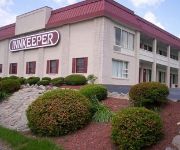
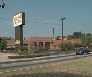
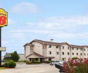
Looking for a place to stay? we compiled a list of available hotels close to the map centre further down the page.
When in this area, you might want to pay a visit to some of the following locations: Danville, Chatham, Yanceyville, Wentworth and Martinsville. To further explore this place, just scroll down and browse the available info.
Local weather forecast
Todays Local Weather Conditions & Forecast: 6°C / 43 °F
| Morning Temperature | -4°C / 25 °F |
| Evening Temperature | 4°C / 40 °F |
| Night Temperature | 4°C / 40 °F |
| Chance of rainfall | 0% |
| Air Humidity | 33% |
| Air Pressure | 1026 hPa |
| Wind Speed | Moderate breeze with 9 km/h (6 mph) from North-East |
| Cloud Conditions | Clear sky, covering 0% of sky |
| General Conditions | Sky is clear |
Thursday, 5th of December 2024
3°C (38 °F)
-4°C (24 °F)
Scattered clouds, moderate breeze.
Friday, 6th of December 2024
4°C (39 °F)
-3°C (27 °F)
Few clouds, gentle breeze.
Saturday, 7th of December 2024
6°C (42 °F)
1°C (34 °F)
Broken clouds, light breeze.
Hotels and Places to Stay
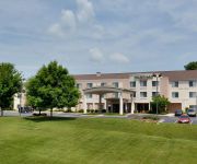
Courtyard Danville
Hampton Inn Danville
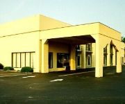
RED CARPET INN AND SUITES DANVILLE
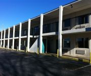
Budget Inn Danville
ASTORIA HOTEL DANVILLE NORTH
Holiday Inn Express DANVILLE
ASTORIA HOTEL DANVILLE WEST
Holiday Inn Express & Suites DANVILLE
Stratford Inn
SUPER 8 MOTEL - DANVILLE
Videos from this area
These are videos related to the place based on their proximity to this place.
Historic Tobacco Warehouse Lofts in Danville VA
Historic Tobacco Warehouse Lofts in Danville VA. These old warehouses are being converted to loft apartments and condos in Danville VA. This type of revitalization is very popular in VA. Prudentia...
Used Cars Danville VA - Buying Used Cars In Danville VA - Part 1
http://PiedmontAutoDirectory.com Largest Selection Of Used Vehicles From Auto Dealers All Across Central Virginia & North Carolina Used Cars Danville VA - Buying Used Cars In Danville VA...
Part 2: Lynchburg College vs Piedmont 2008 D3 South Region
Part 2 of 2. LC game one vs Piedmont College.
Ride-Along Danville Tank Crushing Cars!
The Extravaganza at the AAF Tank Museum in Danville, Virginia, April 25, 2009. Dana and James, members of the H*E*A*T R/C Tank Club, get to ride along in a M60A2 Patton tank as it crushes...
Danville Register & Bee/GoDanRiver.com Weekend Preview June 28, 2014
Denice Thibodeau previews her weekend story for the Danville Register & Bee and www.GoDanRiver.com.
Dan River. Union Street Bridge. Sunset Danville Va
This was taken from the Union Street Bridge at sunset in Danville Virginia.
Multi-Family House in City of Danville...
For more details click here: http://www.visualtour.com/showvt.asp?t=2618119 1422 N. Main Street Danville, VA 24540 $44900, 3 bed, 3.0 bath, 2596 SF, MLS# 123436 GREAT POTENTIAL! This home...
Mud Run Training
The Dirty Dan Dash is a crossover race with a combination of obstacles spread throughout the City of Danville as well as off road running and mud pits. For more information call Parks and Rec...
Videos provided by Youtube are under the copyright of their owners.
Attractions and noteworthy things
Distances are based on the centre of the city/town and sightseeing location. This list contains brief abstracts about monuments, holiday activities, national parcs, museums, organisations and more from the area as well as interesting facts about the region itself. Where available, you'll find the corresponding homepage. Otherwise the related wikipedia article.
Wreck of the Old 97
Old 97 was a Southern Railway train officially known as the Fast Mail. The train started its career on December, 1902, close to two years after Casey Jones's death. It ran from Washington DC to Atlanta, Georgia. On September 27, 1903 while en route from Monroe, Virginia, to Spencer, North Carolina, the train derailed at Stillhouse Trestle near Danville, Virginia.
American Legion Field (Danville)
American Legion Field is a stadium in Danville, Virginia. Located in this Southside Virginia city's Dan Daniel Memorial Park, just north of the Dan River, it is primarily used for baseball and is the home field of the Danville Braves minor league baseball team. It was built in 1993 and was named for American Legion Memorial Post 325, which serves the city's northern half. It holds 2,588 people, in a V-shaped configuration of several disconnected units running from the first to third base side.
Averett University
Averett University is a private not-for-profit college in Danville, Virginia, USA, in south-central Virginia near the North Carolina border. Founded in 1859 as a women's college, Averett became a 4-year, coeducational institution in 1969. In 2011 the university restored its Baptist affiliation, renewing a relationship that had existed from Averett's founding until 2005.
George Washington High School (Danville, Virginia)
George Washington High School is a secondary school of Danville, Virginia. It is a member of the AAA Western Valley District. The school has approximately 2,000 students and 200 staff. The school mascot has been the eagle since 1970/71 school year (previously being the cardinal), upon the school's integration.
Galileo Magnet High School
Galileo Magnet High School opened in September 2002 in Danville Public School's District. The school was originally funded by an 8 million dollar grant to the Danville Public School System. By working directly with organizations like NASA at Langley Research Center and Virginia Tech, Galileo offers a technology-based curriculum. Galileo offers three strands of study for students to choose from.
Danville Community College
Danville Community College (DCC) is one of the twenty-three two year colleges in the Virginia Community College System. It is located in Danville, Virginia. Unlike many of the other VCCS schools, it predates the formation of a statewide body for junior colleges. Its roots began in 1936 as Danville Textile School. In addition, a branch campus of Virginia Tech located in Danville was folded into the college in 1968.
Danville Regional Medical Center
Danville Regional Medical Center is a 250-bed hospital located in Danville, Virginia, USA. It was formerly known as The Memorial Hospital and changed its name in 1993, before being purchased by Lifepoint Hospitals in July 2005. The hospital is certified by the Joint Commission.
WBTM
WBTM is a Full service formatted broadcast radio station licensed to Danville, Virginia, serving Danville and Southern Pittsylvania County, Virginia. WBTM is owned and operated by Piedmont Broadcasting Corporation.
WDVA
WDVA is a Black Gospel formatted broadcast radio station licensed to Danville, Virginia. WDVA serves Danville and Chatham in Virginia and Eden and Yanceyville in North Carolina. WDVA is owned and operated by Mitchell Communications, Inc.
WWDN
WWDN is a classic hits broadcast radio station licensed to Danville, Virginia, serving Danville, Virginia and Yanceyville, North Carolina. WWDN is owned and operated by Lakes Media LLC.
Beaver Park, Virginia
Beaver Park is an unincorporated community located in Madison County, Virginia, United States.
Cougars Den
The Cougars Den is located in Danville, Virginia, and serves as the home stadium for the Averett University Cougars football, men's and women's soccer teams. The Den has a maximum seating capacity of 1,500.
WXRE-LP
This article is about the now silent WXRE-LP, but is left for archival reasons. WXRE-LPCity of license Danville, VirginiaBroadcast area South of Chatham, VirginiaFrequency 97.9 MHzFirst air date 2003Format DefunctPower 5 WattsHAAT 131.3 MetersClass L1Facility ID 126857Transmitter coordinates {{#invoke:Coordinates|coord}}{{#coordinates:36|43|34.0|N|79|24|34.0|W|type:landmark | |name= }}Owner International Religious Society, Inc.
Blairs, Virginia
Blairs is a census-designated place (CDP) in Pittsylvania County, Virginia, United States. The population as of the 2010 Census was 916.
Fairfield Park, Virginia
Fairfield Park is an unincorporated community in Pittsylvania County, in the U.S. state of Virginia.
Laniers Mill, Virginia
Laniers Mill is an unincorporated community in Pittsylvania County, in the U.S. state of Virginia.
Lumpkin Forest, Virginia
Lumpkin Forest is an unincorporated community in Pittsylvania County, in the U.S. state of Virginia.
Mount Hermon, Virginia
Mount Hermon is a census-designated place (CDP) in Pittsylvania County, Virginia, United States. The population as of the 2010 Census was 3,966.
Olde Hunting Hills, Virginia
Olde Hunting Hills is an unincorporated community in Pittsylvania County, in the U.S. state of Virginia.
Pleasant Gap, Virginia
Pleasant Gap is an unincorporated community in Pittsylvania County, in the U.S. state of Virginia.
Ridgecrest, Virginia
Ridgecrest is an unincorporated community in Pittsylvania County, in the U.S. state of Virginia.
Surry Hills, Virginia
Surry Hills is an unincorporated community in Pittsylvania County, in the U.S. state of Virginia.
Woodlake Park, Virginia
Woodlake Park is an unincorporated community in Pittsylvania County, in the U.S. state of Virginia.
Witt, Virginia
Witt is an unincorporated community in Pittsylvania County, in the U.S. state of Virginia.
Wyndover Woods, Virginia
Wyndover Woods is an unincorporated community in Pittsylvania County, in the U.S. state of Virginia.


