Safety Score: 2,7 of 5.0 based on data from 9 authorites. Meaning we advice caution when travelling to United States.
Travel warnings are updated daily. Source: Travel Warning United States. Last Update: 2024-08-13 08:21:03
Discover Broadmoor
Broadmoor in City of Chesapeake (Virginia) is a place in United States about 152 mi (or 244 km) south of Washington DC, the country's capital city.
Current time in Broadmoor is now 11:48 AM (Thursday). The local timezone is named America / New York with an UTC offset of -5 hours. We know of 8 airports near Broadmoor, of which 4 are larger airports. The closest airport in United States is Norfolk International Airport in a distance of 11 mi (or 17 km), North-East. Besides the airports, there are other travel options available (check left side).
There is one Unesco world heritage site nearby. It's Monticello and the University of Virginia in Charlottesville in a distance of 108 mi (or 174 km), North-West. Also, if you like playing golf, there are a few options in driving distance. We encountered 6 points of interest in the vicinity of this place. If you need a hotel, we compiled a list of available hotels close to the map centre further down the page.
While being here, you might want to pay a visit to some of the following locations: Chesapeake, Portsmouth, Norfolk, Hampton and Suffolk. To further explore this place, just scroll down and browse the available info.
Local weather forecast
Todays Local Weather Conditions & Forecast: 12°C / 53 °F
| Morning Temperature | 9°C / 48 °F |
| Evening Temperature | 12°C / 53 °F |
| Night Temperature | 8°C / 46 °F |
| Chance of rainfall | 0% |
| Air Humidity | 45% |
| Air Pressure | 1006 hPa |
| Wind Speed | Fresh Breeze with 17 km/h (10 mph) from South-East |
| Cloud Conditions | Clear sky, covering 0% of sky |
| General Conditions | Light rain |
Thursday, 21st of November 2024
6°C (43 °F)
8°C (46 °F)
Sky is clear, moderate breeze, clear sky.
Friday, 22nd of November 2024
12°C (53 °F)
9°C (48 °F)
Sky is clear, moderate breeze, clear sky.
Saturday, 23rd of November 2024
11°C (52 °F)
11°C (51 °F)
Sky is clear, gentle breeze, clear sky.
Hotels and Places to Stay
Aloft Chesapeake
Hilton Norfolk The Main
Norfolk Waterside Marriott
Sheraton Norfolk Waterside Hotel
Renaissance Portsmouth-Norfolk Waterfront Hotel
Courtyard Norfolk Downtown
Oakwood at Myrtles of OldeTwne
SpringHill Suites Chesapeake Greenbrier
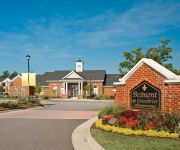
ExecuStay at Belmont Greenbrie
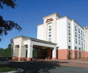
Hampton Inn - Suites Chesapeake-Battlefield Blvd
Videos from this area
These are videos related to the place based on their proximity to this place.
DIY Christmas Tree Wreath!
Make your own Christmas Wreathing using leftover tree trimmings! When you go to buy your Christmas tree, the tree cutters will usually "spruce up" your tree for you (shave down the bottom,...
Different uses for Weedbarrier!
Different uses for Weed Barrier! I enjoy, repurposing stuff. This stuff was a dollar from the Dollar Tree. I'm using it as a backdrop. Can you think of any other uses? NEW- Join the CheapGeek...
Havoc in the Heights II DVD RELEASE!
This is the professional scout version DVD for "Havoc in the Heights" 2, Civil War Games, 40 Men, 3 Rings, 1 Cage Took place on Saturday March 26th, 2011. Bell Time was 7:30 pm Colonial...
Murder in the City (Avett Brothers' cover) by Brian Bodnar
Me trying to play Avett Brothers' "Murder in the City"... while dehydrated and weak... just waiting to get a tooth pulled the next day...
2003 Chrysler Town & Country Used Cars Portsmouth VA
http://www.selectimportsva.com This 2003 Chrysler Town & Country is available from Select Imports of Portsmouth. For details, call us at 757-558-9800.
2006 Chrysler Town & Country Used Cars Portsmouth VA
http://www.selectimportsva.com This 2006 Chrysler Town & Country is available from Select Imports of Portsmouth. For details, call us at 757-558-9800.
2003 Chrysler Town and Country available from Select Imports
This 2003 Chrysler Town and Country is available from Select Imports of Portsmouth. For details, call us at 757-558-9800 or visit us at http://www.selectimpo...
2005 Chrysler Town & Country Used Cars Portsmouth VA
http://www.selectimportsva.com This 2005 Chrysler Town & Country is available from Select Imports of Portsmouth. For details, call us at 757-558-9800.
2006 Chrysler Town & Country Used Cars Portsmouth VA
http://www.selectimportsva.com This 2006 Chrysler Town & Country is available from Select Imports of Portsmouth. For details, call us at 757-558-9800.
Videos provided by Youtube are under the copyright of their owners.
Attractions and noteworthy things
Distances are based on the centre of the city/town and sightseeing location. This list contains brief abstracts about monuments, holiday activities, national parcs, museums, organisations and more from the area as well as interesting facts about the region itself. Where available, you'll find the corresponding homepage. Otherwise the related wikipedia article.
Chesapeake, Virginia
Chesapeake is an independent city located in the South Hampton Roads portion of the Hampton Roads metropolitan area of Virginia in the United States. One of the cities Hampton Roads, Chesapeake was formed in 1963 by a political consolidation of the city of South Norfolk with the former Norfolk County, which dated to 1691. Chesapeake is the second-largest city by land area in the Commonwealth of Virginia.
Jordan Bridge
Jordan Bridge was a tolled highway lift bridge which carried State Route 337 over the southern branch of the Elizabeth River from the City of Portsmouth into the City of Chesapeake in South Hampton Roads, Virginia. Opened in 1928, it was privately built by an organization led by South Norfolk businessmen Wallace and Carl Jordan. It was later renamed the Jordan Bridge, principally to honor long-standing manager Carl M. Jordan.
Gilmerton Bridge
Gilmerton Bridge was a Twin Bascule Drawbridge now a Vertical-lift bridge which spans the southern branch of the Elizabeth River in the City of Chesapeake in South Hampton Roads in southeastern Virginia. Completed in 1938, it carries U.S. Route 13 (US 13 and US 460 and is part of the Military Highway . The Gilmerton Bridge is operated by the City of Chesapeake.
High Rise Bridge
High Rise Bridge is a bascule drawbridge which carries a portion of the Hampton Roads Beltway designated as Interstate 64 across the Southern Branch of the Elizabeth River in Chesapeake, Virginia. The twin spans of concrete and steel were completed in 1972, and are owned by the Virginia Department of Transportation (VDOT). On Wednesday November 10, 2010 after the 2:30 opening the bridge was stuck in the up position causing widespread traffic delays.
Deep Creek High School
Deep Creek High School is a public secondary school in Chesapeake, Virginia. It is part of Chesapeake City Public Schools and is located on 2900 Margaret Booker Drive.
St. Julien's Creek Annex
St. Julien's Creek Annex (SJCA) is a U.S. naval support facility that provides administrative offices, light industrial shops, and storage facilities for tenant naval commands. Its primary mission is to provide a radar testing range (35 acres or 141,640 m) and various administrative and warehousing structures for the Norfolk Naval Station.
Bide-A-Wee Golf Course
Bide-A-Wee Golf Course is an 18-hole municipal public golf course founded by former PGA Champion Chandler Harper in 1956 located in and owned by the city of Portsmouth, Virginia.
Angelos Bible College
Angelos Bible College was an unaccredited Bible college in Portsmouth, Virginia. The college was founded by Calvary Evangelical Baptist Church and was a member of Association of Christian Schools International. Classes were held in the church's facilities. The college graduated its first class in 2001.


