Safety Score: 2,7 of 5.0 based on data from 9 authorites. Meaning we advice caution when travelling to United States.
Travel warnings are updated daily. Source: Travel Warning United States. Last Update: 2024-08-13 08:21:03
Delve into Sheddsville
Sheddsville in Windsor County (Vermont) is located in United States about 395 mi (or 636 km) north-east of Washington DC, the country's capital town.
Current time in Sheddsville is now 05:19 AM (Sunday). The local timezone is named America / New York with an UTC offset of -5 hours. We know of 12 airports close to Sheddsville, of which 5 are larger airports. The closest airport in United States is Lebanon Municipal Airport in a distance of 14 mi (or 22 km), North-East. Besides the airports, there are other travel options available (check left side).
Also, if you like playing golf, there are some options within driving distance. If you need a hotel, we compiled a list of available hotels close to the map centre further down the page.
While being here, you might want to pay a visit to some of the following locations: Woodstock, Newport, Lyme Town Offices, Rutland and Chelsea. To further explore this place, just scroll down and browse the available info.
Local weather forecast
Todays Local Weather Conditions & Forecast: 5°C / 41 °F
| Morning Temperature | 4°C / 39 °F |
| Evening Temperature | 2°C / 36 °F |
| Night Temperature | 0°C / 32 °F |
| Chance of rainfall | 0% |
| Air Humidity | 63% |
| Air Pressure | 1005 hPa |
| Wind Speed | Moderate breeze with 12 km/h (7 mph) from South-East |
| Cloud Conditions | Scattered clouds, covering 44% of sky |
| General Conditions | Scattered clouds |
Sunday, 24th of November 2024
5°C (42 °F)
2°C (36 °F)
Sky is clear, gentle breeze, few clouds.
Monday, 25th of November 2024
4°C (39 °F)
1°C (34 °F)
Moderate rain, moderate breeze, overcast clouds.
Tuesday, 26th of November 2024
4°C (39 °F)
1°C (34 °F)
Light snow, moderate breeze, overcast clouds.
Hotels and Places to Stay
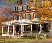
The Pond House Inn at Shattuck Hill Farm
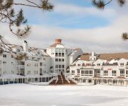
Holiday Inn Club Vacations AT ASCUTNEY MOUNTAIN RESORT
Kedron Valley Inn
KEDRON VALLEY INN
Videos from this area
These are videos related to the place based on their proximity to this place.
Third Generation Design Signs 101
Making signs is more than just cranking vinyl out of a computer. It's a learned art.
Mt. Ascutney Hillclimb 5-20-2012 Impreza 2.5RS
Terry Murphy driving his N/A 2001 Subaru Impreza 2.5RS to a 3rd place P2 finish in the May 2012 SCCNH Mt. Asutney Hillclimb Best run of 3:08.21 www.hillclimb.org.
30 Linden Road Hartland VT
http://myhzm.com/93706 A rare opportunity to buy into the Cobb Hill cohousing village community! This sunny 2100 square foot home offers 4 bedrooms and 15 baths, open floor plan, pine...
Bowers Covered Bridge Restoration 2012-Brownsville VT
Bowers Covered Bridge Restoration West Windsor VT March 19, 2012 Copyright ©2012 Nancy Nutile-McMenemy www.photosbynanci.com For The Vermont Standard: ...
1956 Rush Meadow Road West Windsor VT
http://myhzm.com/75063 Privately located geodesic dome country retreat set on 1374 acres near Route 44 Move in ready, this well kept, cozy home features include single level living with...
Lester Bradley Two Step, composed and performed by Adam Boyce
I wrote this tune several years ago for Lester Bradley, square dance caller, et al, of Thornton, New Hampshire, who recently passed away.
This rooster tried to rape this turkey hen
The tom turkey showed up to help, but she's got this. She's been chasing him around for almost thirty minutes since he tried. He'll be off to freezer camp with our next batch.
Mount Ascutney Winter Hike
What a beautiful day for a winter hike - just one day before rain moved in.
Videos provided by Youtube are under the copyright of their owners.
Attractions and noteworthy things
Distances are based on the centre of the city/town and sightseeing location. This list contains brief abstracts about monuments, holiday activities, national parcs, museums, organisations and more from the area as well as interesting facts about the region itself. Where available, you'll find the corresponding homepage. Otherwise the related wikipedia article.
Brownsville, Vermont
Brownsville is an unincorporated village in West Windsor, Vermont, United States. Located on State Route 44, the village houses a number of administrative offices for the town of West Windsor. The village derives its name from two settlers, John and Briant Brown. The West Windsor Historical Society is in Brownsville and has a wealth of information on the sheep farms and industries that sustained the early residents.
Ascutney Mountain Resort
Ascutney Mountain was a ski area located on the western side of Mount Ascutney in Brownsville, Vermont. It opened in the winter of 1946 under the ownership of Catharine Cushman. Most recently, it was owned from 1993 until summer 2010 by Steven and Susan Plausteiner.


