Safety Score: 2,7 of 5.0 based on data from 9 authorites. Meaning we advice caution when travelling to United States.
Travel warnings are updated daily. Source: Travel Warning United States. Last Update: 2024-08-13 08:21:03
Explore Clarendon
The district Clarendon of in Rutland County (Vermont) with it's 2,489 inhabitants Clarendon is located in United States about 383 mi north-east of Washington DC, the country's capital.
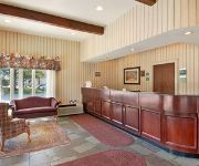
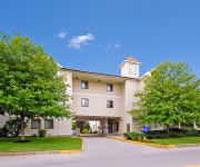
If you need a place to sleep, we compiled a list of available hotels close to the map centre further down the page.
Depending on your travel schedule, you might want to pay a visit to some of the following locations: Rutland, Woodstock, Middlebury (village), Newfane and Queensbury. To further explore this place, just scroll down and browse the available info.
Local weather forecast
Todays Local Weather Conditions & Forecast: 6°C / 43 °F
| Morning Temperature | 6°C / 43 °F |
| Evening Temperature | 4°C / 40 °F |
| Night Temperature | 4°C / 39 °F |
| Chance of rainfall | 17% |
| Air Humidity | 92% |
| Air Pressure | 1002 hPa |
| Wind Speed | Gentle Breeze with 7 km/h (4 mph) from West |
| Cloud Conditions | Overcast clouds, covering 100% of sky |
| General Conditions | Moderate rain |
Friday, 22nd of November 2024
4°C (40 °F)
2°C (36 °F)
Rain and snow, moderate breeze, overcast clouds.
Saturday, 23rd of November 2024
3°C (37 °F)
3°C (38 °F)
Rain and snow, gentle breeze, overcast clouds.
Sunday, 24th of November 2024
2°C (36 °F)
-1°C (31 °F)
Rain and snow, moderate breeze, overcast clouds.
Hotels and Places to Stay
Holiday Inn RUTLAND-KILLINGTON AREA
Hampton Inn Rutland
Quality Inn Rutland
Comfort Inn Trolley Square
Budget Host Killington Lodge
Videos from this area
These are videos related to the place based on their proximity to this place.
Wallingford, VT flood. Whitcombs pit (next to true temper)monday am.mp4
Came off creek road behind the old whitcombs pit to get to town.
BTSP - Responses From Real Students
Behind the Screen Project (BTSP) is a student-lead organization committed to raising awareness of cyber-bullying. BTSP was founded at Mill River Union High School in Clarendon, Vermont. ...
Vermont ScreenPrinting and Sign Shop
This was ShirtPrinting.com back in the COLD weather days. Still "slinging cotton" to this day!
NYU Medical Center Promotional Video
Produced for NYU Medical Center to promote the future opening of their downtown medical facility. The challenge to editing this promotional video was the fact that there was no footage to...
2009 Video: Thyssenkrupp Hydraulic Elevator At Hampton Inn, Rutland Vermont
Originally Uploaded: June 27, 2009 Originally Filmed: June 26, 2009 The ORIGINAL "Green Mountain" elevator video. This was also my first ThyssenKrupp Aurora. This Hampton Inn opened in...
Videos provided by Youtube are under the copyright of their owners.
Attractions and noteworthy things
Distances are based on the centre of the city/town and sightseeing location. This list contains brief abstracts about monuments, holiday activities, national parcs, museums, organisations and more from the area as well as interesting facts about the region itself. Where available, you'll find the corresponding homepage. Otherwise the related wikipedia article.
Rutland County, Vermont
Rutland County is a county located in the U.S. state of Vermont. As of 2010, the population was 61,642. Its shire town is Rutland. Rutland County is the second most-populous county in Vermont, although it is one of a few Vermont counties to have lost population between the censuses of 2000 and 2010.
Rutland (city), Vermont
Rutland is a city in and the shire town of Rutland County, Vermont, United States. As of the 2010 census, the city had a total population of 16,495. Rutland is located approximately 65 miles north of Massachusetts and 20 miles east of New York state. Rutland is the third largest city in Vermont. It is surrounded by the town of Rutland, which is a separate municipality. The downtown area of the city is listed as a historic district on the National Register of Historic Places.
West Rutland, Vermont
West Rutland is a town in Rutland County, Vermont, United States. The population was 2,326 at the 2010 census. The town center, located in the south central portion of the town and where about 87% of the population resides, is defined by the U.S. Census Bureau as a census-designated place (CDP). The town is part of the Rutland micropolitan NECTA.
College of St. Joseph
The College of St. Joseph is a private, residential, liberal arts Catholic college. Located on 117 wooded acres in Rutland, Vermont, it is located 15 minutes from the Killington Ski Resort and other outdoor recreational facilities and activities. The College's president is Frank G. Miglorie. The College of St.
Killington Peak
Killington Peak is the second highest summit in the Green Mountains and in the U.S. state of Vermont. It is located east of Rutland in south-central Vermont. A ski resort, Killington Ski Resort, nicknamed "the beast of the east, is located on the mountain. Killington is a stop on the Long Trail, which here shares its route with the Appalachian Trail. Traveling southbound on the Trail, it is the last 4,000 feet peak until Virginia.
St. Peter's Church and Mount St. Joseph Convent Complex
St. Peter's Church, in Rutland, Vermont, is a 19th century Roman Catholic parish church. Built largely through the efforts of Italian-American stoneworkers in the latter half of the 19th century, St. Peter's is one of three Roman Catholic parish churches in the city of Rutland. It is closely associated with the Mount St. Joseph Academy, as well as the nearby convent. It is within the Roman Catholic Diocese of Burlington.
Rutland Regional Medical Center
Founded in 1896, Rutland Regional Medical Center (RRMC) has grown from a 10-bed hospital with eight attending physicians into Vermont's second largest health care facility. RRMC has 188 licensed beds,and 120 physicians. RRMC is designated a Sole Community Provider by Medicare. RRMC has also been designated a Rural Referral Center by the Centers for Medicare and Medicaid Services.
WEXP (FM)
WEXP (101.5 FM, "The Fox") is a radio station licensed to Brandon, Vermont, that broadcasts a classic rock format with an effective radiated power of 350 watts with a directional antenna located atop "Grandpa's Knob" near Castleton, Vermont. WEXP's on air slogan is "Vermont's Best Rock". WEXP is currently owned by Gail and William Goddard's Electromagnetic Company, LLC. The station previously carried "Imus in the Morning" when it was syndicated by Westwood One.
WJEN
WJEN (105.3FM, "Cat Country") is a 1,250 watt country music station located in Rutland, Vermont. The transmitter is located on Pico Mountain in Killington, Vermont.
Vermont Marble Museum
The Vermont Marble Museum or Vermont Marble Exhibit is a museum commemorating the contributions of Vermont marble and the Vermont Marble Company, located in Proctor, Vermont, USA. The museum is located in a wing of one of the former Vermont Marble Company buildings.
Mill River Union High School
Mill River Union High School, commonly known as Mill River or MRU, is a public junior-senior high school in Clarendon, Vermont. and is part of the Rutland South Supervisory Union. RSSU includes the towns of Clarendon, Wallingford, Shrewsbury, Ira, Middletown Springs, Tinmouth, Danby and Mount Holly. The current principal is Andy Pomeroy and the middle school director is Katherine Fogg
WRVT
WRVT (88.7 FM) is a radio station licensed to Rutland, Vermont. The station is owned by Vermont Public Radio, and is an affiliate of their News and Information network. Main article: Vermont Public Radio
Mount Saint Joseph Academy (Rutland, Vermont)
Mount Saint Joseph Academy is a Roman Catholic college preparatory high school located in Rutland, Vermont. The school is under the jurisdiction of the Diocese of Burlington.
Rutland (Amtrak station)
Rutland is a train station in Rutland, Vermont served by Amtrak, the national railroad passenger system. It is served daily by Amtrak's Ethan Allen Express. Rutland Amtrak station was built in 1999 along a former Delaware and Hudson Railroad line, which served the Ethan Allen Express since 1996, and is not a reused D&H, or Rutland Railroad depot.
Wilson Castle
Wilson Castle is a nineteenth century estate located at Proctor in the U.S. state of Vermont. The house was built in 1867 in a mix of nineteenth century architectural styles including Dutch neo-renaissance, Scottish baronial, Queen Anne, and Romanesque Revival. It is now operated as a house museum and is open late May until late October for an admission fee.
WSYB
WSYB is a radio station in Rutland, Vermont.
WZRT
WZRT is a radio station broadcasting a contemporary hit radio format. Licensed to Rutland, Vermont, USA, the station serves the Lebanon-Rutland-White River Junction area. The station is currently owned by Pamal Broadcasting. Z97 assumed the WZRT call sign in 1989, prior to that the station had the call sign of WRUT. Z97 branded itself as "The Official Ski Station" and later on as "The Official Ski and Ride Station". Z97 broadcast live from many restaurants and nightclubs throughout Killington.
WJJR
WJJR is a radio station broadcasting an Adult Contemporary format. Licensed to Rutland, Vermont, USA, the station serves the Lebanon-Rutland-White River Junction area with "the best mix of music. " The station is currently owned by Pamal Broadcasting.
Pico Mountain
Pico Mountain Ski Area is a ski area located in Vermont, USA. Established in 1937, it was one of the first commercial ski resorts in the state. The base lodge is located on the northwest side of Pico Peak on U.S. Route 4 approximately 9 miles northeast of Rutland, Vermont.
Chaffee Art Center
The Chaffee Art Center for the Visual Arts is an art center located in Rutland, Vermont. The center's exhibit gallery usually displays artwork made by artists that reside in the Rutland County area.
Vermont State Fairgrounds
The Vermont State Fairgrounds are the official fairgrounds of Vermont, USA, and are located in Rutland, Vermont. The fairgrounds are best known for it being the location of the Vermont State Fair.
WMTZ-LP
WMTZ-LP (95.7 FM, "We're Marching To Zion") is a radio station broadcasting a Religious format. Licensed to Rutland, Vermont, USA, the station is currently owned by Green Mountain Adventist Media, Inc.
Rutland High School
Rutland High School is a senior high school located in Rutland (city), Vermont, and attended by students in grades 9-12. Originally located in the current Rutland Intermediate School building on Library Avenue, it has been located on Stratton Road since 1994. A part of the Rutland City Public School District, the superintendent is Mary Moran, and policy is determined by a school board of 12 commissioners.


