Safety Score: 2,7 of 5.0 based on data from 9 authorites. Meaning we advice caution when travelling to United States.
Travel warnings are updated daily. Source: Travel Warning United States. Last Update: 2024-08-13 08:21:03
Explore Marshall Heights
The district Marshall Heights of Layton in Davis County (Utah) is located in United States about 1,844 mi west of Washington DC, the country's capital.
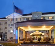
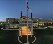
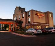
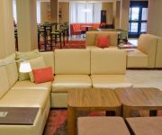
If you need a place to sleep, we compiled a list of available hotels close to the map centre further down the page.
Depending on your travel schedule, you might want to pay a visit to some of the following locations: Farmington, Ogden, Morgan, Salt Lake City and Brigham City. To further explore this place, just scroll down and browse the available info.
Local weather forecast
Todays Local Weather Conditions & Forecast: 7°C / 44 °F
| Morning Temperature | 3°C / 37 °F |
| Evening Temperature | 4°C / 40 °F |
| Night Temperature | 4°C / 39 °F |
| Chance of rainfall | 0% |
| Air Humidity | 55% |
| Air Pressure | 1027 hPa |
| Wind Speed | Calm with 2 km/h (1 mph) from West |
| Cloud Conditions | Clear sky, covering 2% of sky |
| General Conditions | Sky is clear |
Thursday, 5th of December 2024
7°C (44 °F)
4°C (38 °F)
Broken clouds, calm.
Friday, 6th of December 2024
6°C (42 °F)
3°C (38 °F)
Sky is clear, light breeze, clear sky.
Saturday, 7th of December 2024
6°C (42 °F)
6°C (42 °F)
Broken clouds, light breeze.
Hotels and Places to Stay
Holiday Inn Express LAYTON-I-15
Home2 Suites by Hilton Layton UT
Fairfield Inn Salt Lake City Layton
Hilton Garden Inn Salt Lake City-Layton
Hampton Inn Salt Lake City-Layton
TownePlace Suites Salt Lake City Layton
Courtyard Salt Lake City Layton
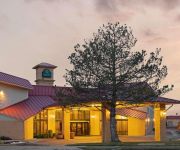
La Quinta Inn and Suites Salt Lake City - Layton
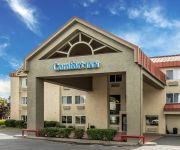
Comfort Inn Layton
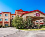
BW PLUS CANYON PINES
Videos from this area
These are videos related to the place based on their proximity to this place.
Plastic Surgeon Utah - Plastic Surgeon Salt Lake City - (801) 525-8727
Board certified facial plastic surgeon Utah http://www.drjohnbitner.com offers before and after rhinoplasty photos. Dr Bitner specializes in rhinoplasty, revision rhinoplasty and other facial...
Parkour and Freerunning East Layton Utah
Just doing some parkour and freerunning around the East Layton Elementary school playground. Hope you enjoy watching! Comment, Like, and Subscribe for more content!
Water Damage Layton UT 84041 801-407-9111 All Star Restoration
Visit: http://allstarwaterdamagelayton.com 801-407-9111 or 435-275-4224 Water Damage Layton UT 84041. All Star Restoration Water Extraction, Flood Damage, Certified Restoration Specialists,...
Splash Pad Layton Utah Opening Day
A couple features of the Splash Pad on Opening Day at Layton, Utah.
Fitness Workout in Park City Utah Http://Epix.Fitness workout Oct 30 2014
Park city utah HOME http://Epix.Fitness | http://www.FACEBOOK.com/epixfitness | http://www.TWITTER.com/epixfit PLEASE READ! Http://Epix.Fitness is our program for community outreach. We...
Layton Campus of Broadview University Tour
http://www.broadviewuniversity.edu This virtual tour of the Layton campus of Broadview University http://www.broadviewuniversity.edu shows you the PC computer labs, student computer stations,...
Riding canyons in Utah
Seth Slack, Alex Yee, Bobby Harris, Josh Leech, GV, and I take a little ride out to Park City from Hill AFB UT.
24K Gold Plating Solution - Pure Gold Plating a Quarter in Real-Time
99.9%+ Pure 24K Gold Plating Solution | Gold Solution Supplier | Gold Plating Services (801) 546-6200 info@goldplating.com || "24K Pure Gold Solution" || Gold Plating Services '24K Pure Gold...
Kevin wakes up to a car crash
Returning from a scout trip, Kevin falls asleep in the car and is abruptly awakened by the troop's prankish screams. The scouts begged me to post this.
Gold Plating Kit - Brush Plating (Complete Start-Up Kit & Gold Solution)
Brush Gold Plating & Fine Detail Pen Plating Kit | http://www.goldplating.com/goldsmith.htm 801-546-6200 info@goldplating.com Gold Plating Services releases our newest gold plating kit,...
Videos provided by Youtube are under the copyright of their owners.
Attractions and noteworthy things
Distances are based on the centre of the city/town and sightseeing location. This list contains brief abstracts about monuments, holiday activities, national parcs, museums, organisations and more from the area as well as interesting facts about the region itself. Where available, you'll find the corresponding homepage. Otherwise the related wikipedia article.
Hill Air Force Base
Hill Air Force Base is a major U.S. Air Force base located in northern Utah, just south of the city of Ogden, and near the towns of Clearfield, Riverdale, Roy, Sunset, and Layton. It is about 30 miles north of Salt Lake City. The base was named in honor of Major Ployer Peter Hill of the U.S. Army Air Corps, who died test-flying a prototype of the B-17 Flying Fortress bomber.
Utah Botanical Center
The Utah Botanical Center is a botanical garden located in Kaysville, Utah, and is a Utah State University (USU) distance education site. Originally located in Farmington, the garden moved to the current location in Kaysville in 1999. Through USU Extension, the center offers a Giving Garden, a 12,000 acre community farm. The farm is maintained by community members and all produce is donated to local food banks.
Christopher Layton
Christopher Layton (March 8, 1821 – August 7, 1898) was a Mormon colonizer and Patriarch who founded the cities of Kaysville, Utah, Layton, Utah, and Thatcher, Arizona. Layton, Utah is named after him. Layton was born at Thorncote Green, Northill, Bedfordshire, England. He joined The Church of Jesus Christ of Latter-day Saints in 1842 and a year later emigrated to the United States. In 1846, Layton joined the Mormon Battalion. In 1852, he moved to Kaysville, Utah Territory.
Webster University Utah
Webster University Utah is a branch of Webster University, an independent, accredited, non-profit, private university in St. Louis, Missouri. Its campus location is at Hill Air Force Base, comprising only one of Webster's many campuses around the world. Webster opened its first Utah campus at Hill Air Force Base in 2000, and currently offers master's degree programs. Webster is accredited by The Higher Learning Commission and is a member of the North Central Association.
Layton High School
Layton High School is a secondary school located in Layton, Utah USA. Part of the Davis School District, Layton High School educates students in grades 10 to 12. As of 2002, 1,805 students were enrolled and actively attending the school.
Northridge High School (Layton, Utah)
Northridge High School (NHS), is a high school which is located in Layton, Utah. It was opened in 1992 and is part of the Davis School District.
Northern Utah Academy for Math Engineering and Science
The Northern Utah Academy for Math Engineering and Science (NUAMES) is a grades ten through twelve public charter high school started in 2004 that specializes in preparing high school students for an early transition into a university baccalaureate program in fields related to math, engineering or science. The Principal is Alan Stokes, the Vice Principal is Dave Dau and Debbie Hefner is the director of business operations. The curriculum focuses on math, engineering, and science.
Davis High School (Kaysville, Utah)
Davis High School is a public school located in Kaysville, Utah, United States. It is operated by the Davis School District. The mascot of Davis High School is a Dart. The school was established in 1914 and underwent reconstruction during the 2003-2004 school year.
Hill Aerospace Museum
Hill Aerospace Museum, located near Ogden, Utah, is a U.S. Air Force museum that is part of the United States Air Force Heritage Program. The museum, founded in 1981 and moved to its current location in 1991, displays over 90 aircraft from around the world, in addition to a variety of munitions, equipment, auxiliary vehicles, and other items of historical interest. In 1996, the Museum became the home of the Utah Aviation Hall of Fame.
KLO (AM)
KLO is a news/talk radio station broadcasting out of Ogden, Utah to the Salt Lake City area. The station airs syndicated conservative talk shows, including Bill Bennett, Laura Ingraham, Michael Medved, and Dennis Miller. When startup 97.5 FM Talk changed its format in late 2006, KLO added Michael Savage and Bill O'Reilly, who had previously been a part of their lineup. KLO's skywave signal has been heard as far away as Casa Grande, Arizona at night.
Syracuse Junior High School
Syracuse Junior High School consists of grades 7–9. The school is located in Syracuse, Utah, in the Davis School District. The school has become very crowded due to the increase in the city of Syracuse's population, (But not anymore because the south side of Syracuse city now goes to Legacy Junior High in West Layton) which is currently estimated to be around 21,000 people. The school's official mascot is the "Seahawk".
North Layton Junior High School
North Layton Junior High School is a Secondary School in Layton, Utah serving communities of North Layton, Northwest Layton and Hill Air Force Base. It is a part of Davis School District.
Morrisite War
The Morrisite War was a skirmish between a Latter Day Saint sect known as the "Morrisites" and the Utah territorial government.
George D. Watt
George Darling Watt (May 12, 1812 – October 24, 1881) was the first convert to Mormonism baptized in the British Isles. As a member of The Church of Jesus Christ of Latter-day Saints (LDS Church), Watt was a secretary to Brigham Young, the primary editor of the Journal of Discourses and the primary inventor of the Deseret Alphabet. Watt was born in Manchester, England. While living in Preston as a young man, Watt was a member of the Reverend James Fielding's congregation.
KANN
KANN is a radio station broadcasting a Christian contemporary format. Licensed to Roy, Utah, USA, the station serves the Salt Lake City area. The station is currently owned by Faith Communications Corporation. KANN signed on in December, 1961 on 1250 kHz. In 1967 it moved to 1090 kHz then moved to 1120 kHz in 1989. KANN's skywave signal has been reported in Flagstaff, Arizona. \t\t \t\t\tKANNtowers. jpg \t\t\t The radio towers for KANN 1120, outside of Syracuse, Utah.
Ogden–Clearfield metropolitan area
The Ogden-Clearfield, UT Metropolitan Statistical Area, as defined by the United States Office of Management and Budget, is an area consisting of four counties in north central Utah, anchored by the cities of Ogden and Clearfield. As of the 2010 census, the MSA had a population of 547,184.
Lifetime Products
Lifetime Products Inc. is the world's leading manufacturer of blow-molded polyethylene folding chairs and tables, picnic tables, and home basketball equipment. They also manufacture other consumer products, including sheds, trailers, kayaks and paddleboards, and lawn and garden items, along with OEM steel and plastic items for other companies.
Clearfield (UTA station)
Clearfield is a commuter rail station in Clearfield, Utah, United States served by FrontRunner, Utah Transit Authority's (UTA) commuter rail that operates along the Wasatch Front from Pleasant View in northern Weber County through Ogden, Davis County, Salt Lake City, and Salt Lake County to Provo in central Utah County.
Layton (UTA station)
Layton is a commuter rail station in Layton, Utah, United States served by FrontRunner, Utah Transit Authority's (UTA) commuter rail that operates along the Wasatch Front from Pleasant View in northern Weber County through Ogden, Davis County, Salt Lake City, and Salt Lake County to Provo in central Utah County.
Weber Canyon
Weber Canyon is a canyon in the Wasatch Range near Ogden, Utah, through which the Weber River flows west toward the Great Salt Lake. It is fed by 13 tributary creeks and is 40 miles long.
East Layton, Utah
East Layton is a former city in Davis County, Utah, United States. Adjacent to Layton, it was incorporated in 1936 in order to secure funding for a community water system. East Layton remained a small, steadily growing residential town for decades, becoming a city in 1972. Rapid expansion during the 1970s led to a merger in 1981 with Layton, now Davis County's most populous city and one of the largest in Utah.
Freeport Center
The Freeport Center is a manufacturing, warehousing, and distribution center located in Clearfield, Utah, United States. It was originally built in 1942 as the Clearfield Naval Supply Depot, which was decommissioned in 1962. The 680-acre Freeport Center consists of 78 buildings, totaling more than 7,000,000 square feet . Buildings range in size from 4,000 square feet to 400,000 square feet . Most buildings have a railroad loading dock on one side, and a truck loading dock on the other.
Cherry Hill (amusement park)
Cherry Hill is a small campground/amusement park in Kaysville, Utah. The park opened for business on June 4, 1967 originally as just a campground. It later, based upon the popularity of it as a campsite, created some water attractions for its campers to enjoy in the summer season. It is mainly popular during the summer because of its main focus of water rides.
Davis Applied Technology College
Davis Applied Technology College (DATC) is a public technical training institution located in Kaysville, Utah. It provides competency-based education in an open-entry, open-exit environment which prepares over 7,400 high school and adult students with career and technical skills. Students may start or end at any time during the year and progress at a rate suited to individual learning style.
Layton Hills Mall
Layton Hills Mall is an enclosed shopping mall in Layton, Utah. Opened in 1980, the mall features Dick's Sporting Goods, J.C. Penney and Macy's as its anchor stores. The mall is owned by CBL & Associates Properties.


