Safety Score: 2,7 of 5.0 based on data from 9 authorites. Meaning we advice caution when travelling to United States.
Travel warnings are updated daily. Source: Travel Warning United States. Last Update: 2024-08-13 08:21:03
Delve into Edgefield
The district Edgefield of Forest Hills in Sullivan County (Tennessee) is a district located in United States about 321 mi south-west of Washington DC, the country's capital town.
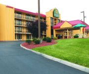
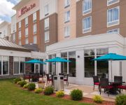
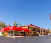
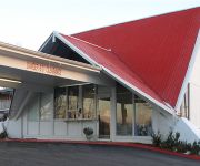
In need of a room? We compiled a list of available hotels close to the map centre further down the page.
Since you are here already, you might want to pay a visit to some of the following locations: Bristol, Blountville, Abingdon, Elizabethton and Lebanon. To further explore this place, just scroll down and browse the available info.
Local weather forecast
Todays Local Weather Conditions & Forecast: 2°C / 35 °F
| Morning Temperature | -10°C / 14 °F |
| Evening Temperature | -1°C / 30 °F |
| Night Temperature | 5°C / 40 °F |
| Chance of rainfall | 0% |
| Air Humidity | 48% |
| Air Pressure | 1027 hPa |
| Wind Speed | Moderate breeze with 12 km/h (7 mph) from North-East |
| Cloud Conditions | Scattered clouds, covering 46% of sky |
| General Conditions | Scattered clouds |
Thursday, 5th of December 2024
-0°C (31 °F)
-8°C (18 °F)
Light rain, moderate breeze, scattered clouds.
Friday, 6th of December 2024
2°C (35 °F)
-6°C (22 °F)
Few clouds, light breeze.
Saturday, 7th of December 2024
6°C (43 °F)
-1°C (31 °F)
Broken clouds, light breeze.
Hotels and Places to Stay
Holiday Inn BRISTOL CONFERENCE CTR
BAYMONT INN & SUITES BRISTOL
Courtyard Bristol
Hilton Garden Inn Bristol
Skyland Inn
Econo Lodge Near Motor Speedway
RVABR - RED CARPET INN BRISTOL
Super 8 Bristol
Comfort Inn Bristol
DAYS INN BRISTOL PARKWAY
Videos from this area
These are videos related to the place based on their proximity to this place.
1040 Sam Bush Band Jammin @ Bristol Rhythm and Roots 2012
Sam Bush Band Jammin @ Bristol Rhythm and Roots If you like this go to http://www.sambush.com http://sugarhillrecords.com/
Westbrook Self Leveling Traction elevator @ Grand Antiques Bristol VA for thelilrubix1
This elevator is very nice, there is 2 on the bank however car A is being used as a closet. Facebook: http://www.facebook.com/dieselducy Website: http://www.dieselducy.com Google+: http://www.googl.
Gentleman of the Road Stopover - Bristol TN/VA 2012 - Mumford and Sons
Gentleman of the Road Stopover - Bristol TN/VA 2012 - Mumford and Sons.
Bristol Motor Speedway-21Aug2010.avi
BobbyP swoops Bristol Motor Speedway on 21 Aug 2010 for the NASCAR Race bringing in the USAF Flag and the USN Flag. What a great time!
Southern 2-8-0 #630 steams across southern Virginia
One of Norfolk Southern's steam excursions in 2014, this was a round trip from Bristol, TN, to Radford VA and back.
King College Tornado Dance Team 2012
King College Tornado Dance Team November 14 2012 Make sure to change quality to 720p.
NS 22A 1/11/11
NS 22A departs snowy Bristol, VA with a friendly crew on board. This was the first 22A to run with a DPU on the rear. NS 22A (1/11/11) NS 7599 (ES40DC) NS 9705 (C40-9W) NS 7711 (ES40DC)...
1128 Mountain Vista Dr, Bristol, TN 37620
http://applesold.com/341745 5 Bedrooms, 6 Full Bath, 2 Half Bath -- 4 Story Custom Chateau in Exclusive Gated Community.Admire top tier granite counter tops throughout house. Access elevator...
Bad Driver on Old Airport Rd in Bristol VA 2014 04 24
From my dashboard camera: After this, the driver gets caught by the next two red lights and construction. Endangering lives for no reason.
Videos provided by Youtube are under the copyright of their owners.
Attractions and noteworthy things
Distances are based on the centre of the city/town and sightseeing location. This list contains brief abstracts about monuments, holiday activities, national parcs, museums, organisations and more from the area as well as interesting facts about the region itself. Where available, you'll find the corresponding homepage. Otherwise the related wikipedia article.
Bristol, Virginia
Bristol is an independent city in Virginia, United States, bounded by Washington County, Virginia; Bristol, Tennessee; and Sullivan County, Tennessee. The 2010 U.S. Census enumerated a population of 17,835. It is the twin city of Bristol, Tennessee, just across the state line, which runs down the middle of its main street, State Street. The Bureau of Economic Analysis combines the city of Bristol, Virginia with Washington County for statistical purposes.
Walnut Hill, Tennessee
Walnut Hill is a census-designated place (CDP) in Sullivan County, Tennessee, United States. The population was 2,394 at the 2010 census. It is part of the Kingsport–Bristol (TN)–Bristol (VA) Metropolitan Statistical Area, which is a component of the Johnson City–Kingsport–Bristol, TN-VA Combined Statistical Area – commonly known as the "Tri-Cities" region.
Bristol, Tennessee
Bristol is a city in Sullivan County, Tennessee, United States. The population was 26,702 at the 2010 census. It is the twin city of Bristol, Virginia, which lies directly across the state line between Tennessee and Virginia. The boundary between the two cities is that of the States, which runs along State Street in their common downtown district.
Virginia Intermont College
Virginia Intermont College is a private, four-year liberal arts college in Bristol, Virginia. Founded in 1884 to create additional education opportunities for women, the College has been coeducational since 1972. The name "Intermont" is a reference to the College's mountain setting. The Holston Range, which merges into the Blue Ridge Mountains, can be seen from campus.
Bristol Motor Speedway
Bristol Motor Speedway, formerly known as Bristol International Raceway and Bristol Raceway is a NASCAR short track venue located in Bristol, Tennessee. Constructed in 1960, it held its first NASCAR race on July 30, 1961. Despite its short length, Bristol is among the most popular tracks on the NASCAR schedule because of its distinct features, that include extraordinarily steep banking, an all concrete surface, two pit roads and stadium-like seating.
John S. Battle High School
John S. Battle High School is a high school located in the Southwest portion of Virginia in Washington County. The school was named after the Governor John S. Battle. It was built in 1959. There have been many additions. The Mason building is in the Northwest quadrant of the school. In the 1970s, it was added to accommodate more than 1000 students. For the 2006-2007 academic school year, the school accommodates over 650 students.
Devault Memorial Stadium
Devault Memorial Stadium is a stadium in Bristol, Virginia. It is primarily used for baseball, and is the home field of the Bristol White Sox minor league baseball team. Also, home to the Virginia High School baseball team. Virginia High won the 1993 and 1996 Virginia state baseball championships at this location. It was built in 1969. It holds 2,000 people. The stadium is named for Charlton Ross ("Chauncey") DeVault, Sr. (1910 – 1980), of Bristol, TN. Mr.
WCYB-TV
WCYB-TV is the NBC-affiliated television station serving the Tri-Cities area of Northeastern Tennessee and Southwestern Virginia. It broadcasts a high definition digital signal on VHF channel 5 from a transmitter on Rye Patch Knob of Holston Mountain in the Cherokee National Forest. Owned by the Bonten Media Group, the station operates Fox affiliate WEMT (owned by Esteem Broadcasting, LLC) through a local marketing agreement (LMA), whose transmitter is co-located with WCYB.
WZAP
WZAP is a Religious and Southern Gospel formatted broadcast radio station licensed to Bristol, Virginia. The station serves the Tri-Cities area with an AM signal at 690 kilohertz. WZAP is owned and operated by RAM Communications, Inc.
WEMT
For the acronym of WEMT see Wilderness emergency medical technician. WEMT 200px125pxGreeneville/Kingsport/Johnson City/Bristol, Tennessee-Bristol, VirginiaCity of license Greeneville, TennesseeBranding Fox Tri-Cities Fox Tri-Cities NewsSlogan Earning Your TrustChannels Digital: 38Virtual: 39Subchannels 39.1 Fox39.2 This TVTranslators Owner Esteem Broadcasting, LLC(Esteem License Holdings, Inc.
Viking Hall (Bristol)
The Viking Hall is a 6,100-seat multi-purpose arena in Bristol, Tennessee, USA. It hosts locals sporting events and concerts. The arena is the home stadium for Bristol Tennessee High School. It was opened in 1981. Also the major site of controversy when White Zombie came to perform in the early 90's and local churches came to protest Rob Zombie's purported "connection to Satan"
South Holston Lake
South Holston Lake is located near the cities of Abingdon, Virginia and Bristol, Virginia / Bristol, Tennessee, and is a 7,580-acre impoundment operated by the Tennessee Valley Authority (TVA). Much of the reservoir is in Tennessee, but the Virginia portion of the reservoir offers anglers more than 1,600 acres of water. At this time there is a South Holston Reservoir Fishing License that will allow anglers from the two states to fish the entire lake with the purchase of this license.
WETS-FM
WETS-FM is the National Public Radio member station for the Tri-Cities region of northeast Tennessee and southwest Virginia. The station is operated by East Tennessee State University as a partnership between ETSU and the station’s listeners. WETS receives a little over half of its funding from listener contributions. It also receives public funding from federal and government-funded university sources. Its studios are located on the ETSU campus in Johnson City, Tennessee.
Bristol Mall
Bristol Mall is the only regional shopping mall serving Bristol, Virginia. The mall was built in the early to mid-1970s. The mall is notable to the area because it was at one time the largest enclosed indoor mall in the Upper East Tennessee/Southwest Virginia area. Anchor stores of the mall comprise two Belk stores, as well as JCPenney and Sears. One of the Belk stores was previously Parks-Belk, while the other, which opened as Miller's Department Store, later became Hess's and then Proffitt's.
WIGN
WIGN is a radio station broadcasting a Gospel Music format. Licensed to Bristol, Tennessee, USA, it serves the Tri-Cities Tennessee and Virginia area. The station is currently owned by Sunshine Broadcasters, Inc..
WOPI (AM)
WOPI is a broadcast radio station licensed to serve Bristol, Virginia, USA. The station is owned and operated by Holston Valley Broadcasting Corporation. WOPI broadcasts a classic country and bluegrass music format serving Bristol, Virginia and Bristol, Tennessee.
WFHG (AM)
WFHG is a Sports formatted broadcast radio station affiliated with Fox Sports Radio. WFHG is licensed to Bristol, Virginia, serving the Tri-Cities of Tennessee and Virginia. WFHG is owned and operated by Bristol Broadcasting Company, Inc.
Virginia High School (Virginia)
Virginia High School is a high school located in Bristol, Virginia. In 1999, Virginia High started offering the Tri-Cities area's first International Baccalaureate Diploma Programme. Classes from the Advanced Placement program are also offered to help students who are headed to college. A vocational wing was added to the main school building to help students who wish to go into a trade straight from high school.
Sullins College
Sullins College was founded about 1868 and named for David Sullins, a Methodist minister. It was both a high school for girls and later also a junior college, operated by the Methodist Church. Its first location was in downtown Bristol, Virginia, United States. The entire building burned during Christmas vacation in late December 1915, and the Methodist Church decided not to rebuild. Some of the citizens of Bristol prevailed upon William E.
WCYB-DT2
WCYB-DT2 is the CW-affiliated television station for the Tri-Cities area of Northeastern Tennessee and Southwestern Virginia. The station is part of The CW Plus. WCYB-DT2 is a second digital subchannel of the area's NBC affiliate WCYB-TV which is owned by the Bonten Media Group. Over-the-air, the station broadcasts a digital signal on VHF channel 5.2 from a transmitter on Rye Patch Knob of Holston Mountain in the Cherokee National Forest.
Bristol Tennessee High School
Bristol Tennessee High School (more commonly called Tennessee High) is a public high school located in Bristol, Tennessee, operated as part of the Bristol City School System.
WKJV-LP
WKJV-LP is a Southern Gospel/Religious formatted broadcast radio station licensed to Bristol, Virginia, serving Bristol, Virginia and Bristol, Tennessee. WKJV-LP is owned and operated by Belle Meadows Baptist Church.
South Holston Dam
South Holston Dam is a hydroelectric and flood control dam on the South Fork Holston River in Sullivan County, in the U.S. state of Tennessee. It is the uppermost of three dams on the South Fork Holston owned and operated by the Tennessee Valley Authority, which built the dam in the 1940s as part of efforts to control flooding in the Tennessee River watershed. The dam impounds the South Holston Lake of 7,550 acres, which extends northeastward across the Tennessee-Virginia state line.
Virginia Highlands Airport
Virginia Highlands Airport is a public-use airport located in Abingdon, Virginia. The airport has a single asphalt runway designated 6/24. It measures 4,471 feet in length with a width of 75 feet. It is owned by the Virginia Highlands Airport Authority. The manager is Mickey Hines.
Mountain Empire Baptist School
Mountain Empire Baptist School was a private Baptist K-12 grade school, and was a ministry of Belle Meadows Baptist Church. Started in 2001, was member of the Tennessee Association of Christian Schools. With old fashioned style worship and preaching from the King James Bible (1611), it was a Baptist school without apologizing for doctrine, heritage, nor for zeal. Their goal was to not take the place of the Christian home, but seek to complement it. The curriculum used for all grades was A Beka.


