Safety Score: 2,7 of 5.0 based on data from 9 authorites. Meaning we advice caution when travelling to United States.
Travel warnings are updated daily. Source: Travel Warning United States. Last Update: 2024-08-13 08:21:03
Delve into Ponderosa Estates
The district Ponderosa Estates of Mount Carmel in Hawkins County (Tennessee) is a subburb in United States about 347 mi south-west of Washington DC, the country's capital town.
If you need a hotel, we compiled a list of available hotels close to the map centre further down the page.
While being here, you might want to pay a visit to some of the following locations: Gate City, Jonesborough, Blountville, Norton and Rogersville. To further explore this place, just scroll down and browse the available info.
Local weather forecast
Todays Local Weather Conditions & Forecast: 12°C / 53 °F
| Morning Temperature | 3°C / 38 °F |
| Evening Temperature | 10°C / 49 °F |
| Night Temperature | 10°C / 50 °F |
| Chance of rainfall | 0% |
| Air Humidity | 50% |
| Air Pressure | 1015 hPa |
| Wind Speed | Light breeze with 3 km/h (2 mph) from South-West |
| Cloud Conditions | Overcast clouds, covering 100% of sky |
| General Conditions | Overcast clouds |
Thursday, 28th of November 2024
10°C (50 °F)
6°C (42 °F)
Moderate rain, moderate breeze, overcast clouds.
Friday, 29th of November 2024
7°C (45 °F)
-1°C (31 °F)
Broken clouds, gentle breeze.
Saturday, 30th of November 2024
6°C (42 °F)
-1°C (30 °F)
Sky is clear, light breeze, clear sky.
Hotels and Places to Stay
MeadowView Conference Resort & Convention Center
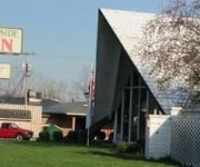
Westside Inn
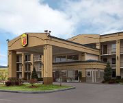
SUPER 8 KINGSPORT
Videos from this area
These are videos related to the place based on their proximity to this place.
112 Unaka Ave, Mount Carmel, TN 37645
112 Unaka Ave Mount Carmel, TN Lynn Byrd Remax Results http://www.realestatebook.com/homes/listing/101-3002416644/refer=FP42A THIS NEWLY REMODELED RANCH HOME...
330 Hemlock St, Mount Carmel, TN 37645
330 Hemlock St Mount Carmel, TN Lynn Byrd Remax Results http://www.realestatebook.com/homes/listing/101-3002126917/refer=FP42A MOVE RIGHT IN TODAY! This love...
2012-07-04Fireworks in Kingsport TN. as seen from Mt.Carmel TN.
Fireworks in Kingsport TN, as seen from Mt.Carmel TN. videoed from a cell phone.
Sprayingtheworld heavy today over Mount CarmelTN.
Sprayingtheworld heavy today over Mount Carmel TN.
402 Creekside Drive
For more details click here: http://www.visualtour.com/showvt.asp?t=2637817 402 Creekside Drive Mount Carmel, TN 37645 $99000, 3 bed, 2.0 bath, 1721 SF, ML...
Thunderstorm 7-1-12
Thunderstorm in my area with huge chunks of hail. Hail was the size of your hand in some parts. This was recorded in the Mount Carmel, Tn. area.
NOT A DRIVE BY! A MUST SEE!!
For more details click here: http://www.visualtour.com/showvt.asp?t=2506198 116 ASPEN COURT MT. CARMEL, TN 37645 $127000, 3 bed, 2.5 bath, 1800 SF, MLS# 30...
Videos provided by Youtube are under the copyright of their owners.
Attractions and noteworthy things
Distances are based on the centre of the city/town and sightseeing location. This list contains brief abstracts about monuments, holiday activities, national parcs, museums, organisations and more from the area as well as interesting facts about the region itself. Where available, you'll find the corresponding homepage. Otherwise the related wikipedia article.
Scott County, Virginia
Scott County is a county located in the U.S. state of Virginia. Scott County was formed by an act of the General Assembly on November 24, 1814 from parts of Washington, Lee, and Russell Counties and was named for Virginia born General Winfield Scott. As of 2010, the population was 23,177. Its county seat is Gate City.
Mount Carmel, Tennessee
Mount Carmel is a town located in Hawkins County, Tennessee. As of the 2005 estimate, the town had a total population of 5500. It is part of the Kingsport–Bristol (TN)–Bristol (VA) Metropolitan Statistical Area, which is a component of the Johnson City–Kingsport–Bristol, TN-VA Combined Statistical Area – commonly known as the "Tri-Cities" region. The population of Mount Carmel, Church Hill and surrounding area is well over 30,000 and is the fastest growing area in upper East Tennessee.
Church Hill, Tennessee
Church Hill is a city in Hawkins County, Tennessee, United States. The population was 5,916 at the 2000 census. It is part of the Kingsport–Bristol (TN)–Bristol (VA) Metropolitan Statistical Area, which is a component of the Johnson City–Kingsport–Bristol, TN-VA Combined Statistical Area – commonly known as the "Tri-Cities" region.
Bloomingdale, Tennessee
Bloomingdale is a census-designated place (CDP) in Sullivan County, Tennessee, United States. The population was 10,888 at the 2010 census. It is part of the Kingsport–Bristol (TN)–Bristol (VA) Metropolitan Statistical Area, which is a component of the Johnson City–Kingsport–Bristol, TN-VA Combined Statistical Area – commonly known as the "Tri-Cities" region.
Colonial Heights, Tennessee
Colonial Heights is a census-designated place (CDP) in Sullivan County, Tennessee, United States. The population was 6,934 at the 2010 census. It is part of the Kingsport–Bristol (TN)–Bristol (VA) Metropolitan Statistical Area, which is a component of the Johnson City–Kingsport–Bristol, TN-VA Combined Statistical Area – commonly known as the "Tri-Cities" region.
Clinchport, Virginia
Clinchport is a town in Scott County, Virginia, United States. The population was 70 at the 2010 census. It is part of the Kingsport–Bristol (TN)–Bristol (VA) Metropolitan Statistical Area, which is a component of the Johnson City–Kingsport–Bristol, TN-VA Combined Statistical Area – commonly known as the "Tri-Cities" region.
Gate City, Virginia
Gate City is a town in Scott County, Virginia, United States. The population was 2,034 at the 2010 census. It is the county seat of Scott County. Gate City is part of the Kingsport–Bristol (TN)–Bristol (VA) Metropolitan Statistical Area, which is a component of the Johnson City–Kingsport–Bristol, TN-VA Combined Statistical Area – commonly known as the "Tri-Cities" region. Some scenes from The River were shot here.
Weber City, Virginia
Weber City is an incorporated town in Scott County, Virginia, United States. The population was 1,327 at the 2010 census. It is part of the Kingsport–Bristol (TN)–Bristol (VA) Metropolitan Statistical Area, which is a component of the Johnson City–Kingsport–Bristol, TN-VA Combined Statistical Area – commonly known as the "Tri-Cities" region.
Fall Branch, Tennessee
Fall Branch is a census-designated place (CDP) in Washington and Greene counties in the U.S. state of Tennessee. The population was 1,291 at the 2010 census. Fall Branch is part of the Johnson City Metropolitan Statistical Area, which is a component of the Johnson City–Kingsport–Bristol, TN-VA Combined Statistical Area – commonly known as the "Tri-Cities" region.
Kingsport, Tennessee
Kingsport is a city in Sullivan and Hawkins counties in the U.S. state of Tennessee. The population according to the 2010 census is 48,205. Kingsport is the largest city in the Kingsport–Bristol–Bristol, TN-VA Metropolitan Statistical Area (MSA), which had a population of 309,544 as of 2010. The Metropolitan Statistical Area is a component of the Johnson City–Kingsport–Bristol, TN-VA Combined Statistical Area – commonly known as the "Tri-Cities" region.
Hunter Wright Stadium
Hunter Wright Stadium is a minor league baseball facility in Kingsport, Tennessee, named for the popular muli-term former mayor. Built in 1995, it seats 2,500. Hunter Wright is the home field of the Kingsport Mets, an affiliate of the New York Mets, in the Appalachian League.
Dobyns Bennett High School
Dobyns-Bennett High School is a high school in Kingsport, Tennessee. It is estimated to have around 1,800 some students. As a part of Kingsport City Schools, students must be city residents paying city taxes to attend. Students that are not residents of the city may pay a tuition fee to attend. This tuition is considered to be a good value as Dobyns-Bennett features a variety of programs for students of all academic levels.
WKPT (AM)
WKPT is a North American radio station, located in Kingsport, Tennessee. It operates with a daytime/nighttime power of 1,000 watts. WKPT is one of the oldest radio stations in East Tennessee, first taking the airwaves in 1940.
Sullivan South High School (Tennessee)
Sullivan South High School (commonly known as SSHS or Sullivan South) is a public high school located in Kingsport, Tennessee in Sullivan County. The school has a student body of approximately 1,000 students. The principal is Greg Harvey. The school had a 79% graduation rate in 2004, well short of the state goal of 90%. http://www. k-12. state. tn. us/rptcrd04/school1. asp. The average ACT scores of students is a 21.6.
Gate City High School
Gate City High School is a public high school in Gate City, Virginia. The school was built in 1956. The school employs 185 teachers and the student to teacher ratio is 21:1. The school recently received attention when David Taylor, a local resident, contacted the Virginia ACLU about a prayer that was broadcast over the PA system at a football game against Sullivan South High School. The ACLU stated that if this was to happen again a lawsuit would be filed.
WCSK
WCSK (90.3 FM) is a non-commercial, educational FM radio station in Kingsport, Tennessee licensed by the Federal Communications Commission to the Kingsport Board of Education. The radio studio is located at Dobyns-Bennett High School. The WCSK radio transmitter is mounted on a tower atop Bays Mountain in Kingsport. It broadcasts at an effective radiated power of 195 watts.
WGAT
WGAT is a Southern Gospel formatted broadcast radio station licensed to Gate City, Virginia, serving Gate City and Scott County, Virginia, also Kingsport, Tennessee. WGAT is owned and operated by Tri-Cities Broadcasting Corp.
WMCH
WMCH is a radio station broadcasting a religious radio format. Licensed to Church Hill, Tennessee, USA, it serves the Tri-Cities Tennessee and Virginia area. The station is currently owned by Tri-City Radio, LLC.
Holston Army Ammunition Plant
The mission of Holston Army Ammunition Plant (HSAAP) is to manufacture Research Department Explosive and High Melting Explosive for ammunition production and development. Research and development plays a vital role in the production of new and better explosives and products. It is government-owned and contractor-operated (GOCO).
WEYE
WEYE (104.3 FM, "Eagle 104.3") is a radio station licensed to serve Surgoinsville, Tennessee, USA. The station is owned by Positive Alternative Radio, Inc. It broadcasts a classic country format. The station was assigned the WEYE call letters by the Federal Communications Commission on July 16, 1990.
Natural Tunnel State Park
Natural Tunnel State Park is a Virginia state park, centered around the Natural Tunnel, a massive naturally formed cave that is so large it is used as a railroad tunnel. It is located in the Appalachian Mountains near Duffield in Scott County, Virginia. The Natural tunnel, which is up to 200 feet wide and 80 feet high, began to form more than a million years ago when groundwater bearing carbonic acid percolated through crevices and slowly dissolved limestone and dolomite bedrock.
Fort Patrick Henry Dam
Fort Patrick Henry Dam is a hydroelectric dam on the South Fork Holston River within the city of Kingsport, in Sullivan County in the U.S. state of Tennessee.
Moccasin Gap
Moccasin Gap, also known as Big Moccasin Gap, is a gap in Clinch Mountain near Gate City, Virginia, United States, the county seat of Scott County. The gap was on the route of an Indian trail through the mountains. In 1775, Daniel Boone built the Indian path into a road, part of the Wilderness Road between the Great Valley of Virginia and the Alleghenies.
WRZK
WRZK (95.9 FM, "95.9 The Hog") is a radio station broadcasting an active rock format. Licensed to Colonial Heights, Tennessee, USA, it serves the Tri-Cities TN / VA area. The station is currently owned by Holston Valley Broadcasting Corporation. The station was assigned the WRZK call letters by the Federal Communications Commission on March 21, 1997.
Morrison City, Tennessee
Morrison City is an unincorporated community in Sullivan County, Tennessee, United States. Named for pioneer settler Peter Morison, Morrison City developed with the industrial growth of nearby Kingsport, Tennessee in the 1930s. Peter Morison, his wife Mary Kirkpatrick Morison, and other relatives, are buried in the Morrison Chapel Cemetery, in the heart of the community.


