Safety Score: 2,7 of 5.0 based on data from 9 authorites. Meaning we advice caution when travelling to United States.
Travel warnings are updated daily. Source: Travel Warning United States. Last Update: 2024-08-13 08:21:03
Discover Kingston Springs
Kingston Springs in Cheatham County (Tennessee) with it's 2,770 citizens is a town in United States about 585 mi (or 941 km) west of Washington DC, the country's capital city.
Current time in Kingston Springs is now 01:04 PM (Thursday). The local timezone is named America / Chicago with an UTC offset of -6 hours. We know of 10 airports near Kingston Springs, of which 5 are larger airports. The closest airport in United States is Nashville International Airport in a distance of 24 mi (or 39 km), East. Besides the airports, there are other travel options available (check left side).
There is one Unesco world heritage site nearby. It's Mammoth Cave National Park in a distance of 101 mi (or 162 km), North-East. Also, if you like playing golf, there are a few options in driving distance. We discovered 1 points of interest in the vicinity of this place. Looking for a place to stay? we compiled a list of available hotels close to the map centre further down the page.
When in this area, you might want to pay a visit to some of the following locations: Ashland City, Charlotte, Franklin, Nashville and Springfield. To further explore this place, just scroll down and browse the available info.
Local weather forecast
Todays Local Weather Conditions & Forecast: 8°C / 46 °F
| Morning Temperature | 5°C / 40 °F |
| Evening Temperature | 4°C / 39 °F |
| Night Temperature | 3°C / 38 °F |
| Chance of rainfall | 0% |
| Air Humidity | 46% |
| Air Pressure | 1015 hPa |
| Wind Speed | Moderate breeze with 12 km/h (8 mph) from South-East |
| Cloud Conditions | Clear sky, covering 9% of sky |
| General Conditions | Sky is clear |
Thursday, 21st of November 2024
8°C (46 °F)
4°C (39 °F)
Broken clouds, moderate breeze.
Friday, 22nd of November 2024
10°C (51 °F)
5°C (41 °F)
Few clouds, light breeze.
Saturday, 23rd of November 2024
16°C (60 °F)
10°C (51 °F)
Broken clouds, gentle breeze.
Hotels and Places to Stay
Quality Inn Kingston Springs
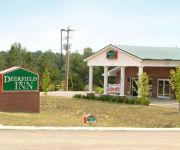
DEERFIELD INN AND S
FAIRVIEW INN AND SU
Videos from this area
These are videos related to the place based on their proximity to this place.
Zipping Tennessee at Adventureworks, Kingston Springs
Adventureworks introduces the mid-state's first canopy zip tour, an nine-station steel-cable zip line adventure through their beautiful old-growth forest, located adjacent to Harpeth River State Park.
KS_Elementary_1
Recorded on May 3, 2010 using a Flip Video camcorder. Kingston Springs Elementary on E. Kingston Springs Rd. is 4 ft. under water in the front. Soon after this video was shot, transformers...
.ara.: Waiting - LIVE at The Fillin' Station
ara. performs "Waiting" from her debut EP "Waiting" at Performing Writer March 11, 2015 at The Fillin' Station in Kingston Springs, TN. Buy .ara.'s EP "Waiting" on iTunes: https://itunes.apple.co...
ADVENTUREWORKS ZIPLINE
Adventureworks ZipLine adventures is located in Kingston Springs, TN in the Harpeth River Valley and offer zipline tours in groups of 10-12 that are great fun for all requardless of age. Meet...
Harpeth River: After the Floods May 31, 2010
http://www.southcheatham.com The small video camera could not capture the debris and devastation along the banks of the Harpeth in Pegram and Kingston Springs. Massive trees are downed,...
Burns Park
Recorded on May 3, 2010 using a Flip Video camcorder. Burns Park in Kingston Springs. Harpeth River flooded about 20 ft higher than usual level.
HarpethRiverFlood_1
Recorded on May 3, 2010 using a Flip Video camcorder. Park Rd/Pinnacle Hill Rd. Bridge over (under) Harpeth River. River typically runs 20 feet below this bridge. The water level rose a few...
HarpethRiverFlood_2
Recorded on May 3, 2010 using a Flip Video camcorder. Park Rd/Pinnacle Hill Rd. Bridge over (under) Harpeth River. River typically runs 20 feet below this bridge. The water level rose a few...
Videos provided by Youtube are under the copyright of their owners.
Attractions and noteworthy things
Distances are based on the centre of the city/town and sightseeing location. This list contains brief abstracts about monuments, holiday activities, national parcs, museums, organisations and more from the area as well as interesting facts about the region itself. Where available, you'll find the corresponding homepage. Otherwise the related wikipedia article.
Kingston Springs, Tennessee
Kingston Springs is a town in Cheatham County, Tennessee, United States. The population was 2,773 at the 2000 census.
National Register of Historic Places listings in Tennessee
This is a list of properties and historic districts in Tennessee that are listed on the National Register of Historic Places. There are over 2,000 in total. Of these, 29 are National Historic Landmarks. Each of Tennessee's 95 counties has at least one listing. The locations of National Register properties and districts (at least for all showing latitude and longitude coordinates below), may be seen in a Google map by clicking on "Map of all coordinates".
Craggie Hope, Tennessee
Craggie Hope, Tennessee is an unincorporated small rural community located on the CSX Transportation railroad line from Nashville to Memphis in southern Cheatham County, Tennessee. Its location is approximately {{#invoke:Coordinates|coord}}{{#coordinates:36|05|40|N|87|08|50|W| | |name= }}.
Bell Town, Tennessee
Bell Town, Tennessee (also known as Belltown) is an unincorporated rural community located in southern Cheatham County along U.S. Highway 70. Its location is {{#invoke:Coordinates|coord}}{{#coordinates:36|06|46|N|87|09|29|W| |primary |name= }}. Bell Town has traditionally been an African American community.


