Safety Score: 2,7 of 5.0 based on data from 9 authorites. Meaning we advice caution when travelling to United States.
Travel warnings are updated daily. Source: Travel Warning United States. Last Update: 2024-08-13 08:21:03
Discover South Rolling Hills
The district South Rolling Hills of Laurel Springs in Bradley County (Tennessee) is a district in United States about 503 mi south-west of Washington DC, the country's capital city.
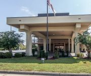
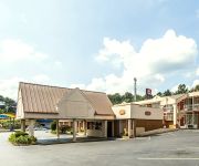
Looking for a place to stay? we compiled a list of available hotels close to the map centre further down the page.
When in this area, you might want to pay a visit to some of the following locations: Cleveland, Benton, Dayton, Decatur and Ringgold. To further explore this place, just scroll down and browse the available info.
Local weather forecast
Todays Local Weather Conditions & Forecast: 14°C / 57 °F
| Morning Temperature | 4°C / 39 °F |
| Evening Temperature | 12°C / 54 °F |
| Night Temperature | 16°C / 60 °F |
| Chance of rainfall | 0% |
| Air Humidity | 51% |
| Air Pressure | 1015 hPa |
| Wind Speed | Moderate breeze with 9 km/h (6 mph) from North |
| Cloud Conditions | Overcast clouds, covering 100% of sky |
| General Conditions | Overcast clouds |
Thursday, 28th of November 2024
14°C (57 °F)
7°C (44 °F)
Light rain, moderate breeze, overcast clouds.
Friday, 29th of November 2024
9°C (49 °F)
1°C (33 °F)
Few clouds, gentle breeze.
Saturday, 30th of November 2024
7°C (45 °F)
1°C (33 °F)
Sky is clear, light breeze, clear sky.
Hotels and Places to Stay
Fairfield Inn & Suites Cleveland
Clarion Inn Cleveland
La Quinta Inn and Suites Cleveland
Hampton Inn Cleveland TN
Quality Inn Cleveland
TownePlace Suites Cleveland
RAMADA LIMITED CLEVELAND
Comfort Inn & Suites Cleveland
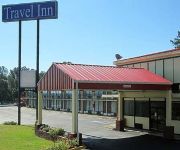
TRAVEL INN CLEVELAND
Econo Lodge Cleveland
Videos from this area
These are videos related to the place based on their proximity to this place.
Payday Loans Cleveland TN 37311 | (423) 479-2000
http://local.checkintocash.com/tn/cleveland.html - Get Cash Fast! Come into our Check Into Cash Cleveland store, where we've helped local customers with short-term financial needs since 2002....
Fletcher Park, Cleveland, TN - CX-20 test
This video was recorded at 1080p by a Mobius camera on a clone brushless gimbal mounted under a Cheerson CX-20 with a 5.8Ghz video downlink. The whole rig is together. Now I need to get some.
Bike Ride on the Cleveland TN / Bradley County Greenway 08-14-2013 part 1
Me riding my 1961 Western Flyer bicycle on the Cleveland TN / Bradley County Greenway 08-14-2013 part 1.
CX-20 drone - aerial view around Cleveland TN
I have the flight controller ceiling set to the FAA max of 400ft. I encountered more wind above the trees. The autopilot was constantly correcting position. It is especially noticeable when...
Toyota of Cleveland Hybrid Sales Event - Cleveland, TN - 2009 Toyota Camry Hybrid
http://toyotaofcleveland.com or 423-339-1138. Take advantage of our Hybrid Sales Event. Toyota of Cleveland in Cleveland, TN has an overstocked inventory of New Toyota Camry Hybrids, Toyota...
www.clevelandtravelinn.com (Travel Inn Slide Show)
We are located just minutes from Chattanooga; the Travel Inn of Cleveland, TN is close to golfing, shopping, museums, and just a short drive to Red Clay Stat...
Cleveland High School Homecoming 2008
Cleveland High School Homecoming in Cleveland Tennessee Sept 5, 2008.
Minor Flooding in Cleveland, TN
This was the scene outside after a severe thunderstorm (including a tornado warning and possible wall cloud) passed through the area, dumping hail and lots of rain in a short period.
Cleveland TN rap battle turns into fist fight
Tension rises as two gang leaders battle it out once and for all to determine who's the bigger "bitch nigga." Will "TRU CRU" stand their ground or will the "Play Ground Bandits" take all the glory?
Videos provided by Youtube are under the copyright of their owners.
Attractions and noteworthy things
Distances are based on the centre of the city/town and sightseeing location. This list contains brief abstracts about monuments, holiday activities, national parcs, museums, organisations and more from the area as well as interesting facts about the region itself. Where available, you'll find the corresponding homepage. Otherwise the related wikipedia article.
Bradley County, Tennessee
Bradley County is a county located in the U.S. state of Tennessee. As of the 2010 census, the population was 98,963. Its county seat is Cleveland. It is included in the Cleveland, Tennessee, Metropolitan Statistical Area. Red Clay State Park, the site of the last Cherokee council before The Trail of Tears began, is located in Bradley County.
East Cleveland, Tennessee
East Cleveland is a census-designated place (CDP) in Bradley County, Tennessee, United States. The population was 1,608 at the 2010 census. It is included in the Cleveland, Tennessee Metropolitan Statistical Area.
Hopewell, Bradley County, Tennessee
Hopewell is a census-designated place (CDP) in Bradley County, Tennessee, United States. The population was 1,874 at the 2010 census. It is included in the Cleveland, Tennessee Metropolitan Statistical Area.
Cleveland, Tennessee
Cleveland is a city in Bradley County, Tennessee, United States. The population was 41,285 at the 2010 census. It is the county seat of Bradley County. It is the principal city of and is included in the Cleveland, Tennessee Metropolitan Statistical Area, which is included in the Chattanooga, Tennessee-Cleveland, Tennessee Combined Statistical Area.
South Cleveland, Tennessee
South Cleveland is a census-designated place (CDP) in Bradley County, Tennessee, United States. The population was 6,912 at the 2010 census. It is included in the Cleveland, Tennessee Metropolitan Statistical Area.
Wildwood Lake, Tennessee
Wildwood Lake is a census-designated place (CDP) in Bradley County, Tennessee, United States. The population was 3,124 at the 2010 census. It is included in the Cleveland, Tennessee Metropolitan Statistical Area.
The Church of God for All Nations
The Church of God for All Nations is a theocratic Pentecostal holiness body of Christians. Samuel Doffee, born February 2, 1931 and died April 23, 2010, formed The Church of God for All Nations in 1981. Doffee had been previously associated with the Church of God of Prophecy and The Church of God (Jerusalem Acres), and served in various ministerial capacaties in the latter body. Bishop Grady R. Kent founded The Church of God of All Nations (now "Jerusalem Acres") in 1957.
Lee University
Lee University is a private, faith-based liberal arts college in Cleveland, Tennessee, United States. Historically, the school was affiliated with the Church of God, a Christian denomination. Lee was the denomination's Bible Training School from 1918 until 1947, when the name was changed to Lee College. Lee became a university in 1997.
Chatata
Chatata is the original Cherokee Indian name of a populated area located in Bradley County, Tennessee. This area is close to an idyllic natural spring known as "Blue Hole Spring", which was considered sacred to the Cherokee located at Red Clay State Historical Park. Now a state park, Red Clay was the final Council Grounds in the east for the Cherokee Nation before the forced removal of the Cherokees along the Trail of Tears.
Georgetown, Tennessee
Georgetown is an unincorporated community at the junction of Bradley, Hamilton, and Meigs counties, Tennessee. The community is located along State Route 60. The Bradley County portion of Georgetown is part of the Cleveland, TN Metropolitan Statistical Area, while the Hamilton County portion is part of the Chattanooga, TN–GA Metropolitan Statistical Area. Georgetown is the place name associated with U.S. Postal Service zip code 37336.
Hardwick Field
Hardwick Field, also known as Cleveland Municipal Airport, is a public airport located four miles (6 km) northeast of the central business district of Cleveland, in Bradley County, Tennessee, United States. It is owned by the City of Cleveland. Although most U.S. airports use the same three-letter location identifier for the FAA and IATA, Hardwick Field is assigned HDI by the FAA but has no designation from the IATA.
Fort Cass
Fort Cass, established in 1835, was an important site during the Cherokee removal known as the Trail of Tears. Located on the Hiwassee River in present-day Charleston, Tennessee, it housed a garrison of United States troops and watched over the largest concentration of internment camps where Cherokee were kept during the summer of 1838 before starting the main trek west to Indian Territory.
Ocoee Middle School
Ocoee Middle School (OMS) is a middle school located at northern edge of downtown Cleveland, Tennessee. As of 2007, it is the 17th largest middle school in Tennessee, and the largest in the county. Its current principal is Ron Spangler. Its name is reminiscent of the nearby Ocoee River.
Bachman Academy
Bachman Academy is a 6th-12th, co-ed boarding and day school in Bradley County, Tennessee. It serves to provide a non-traditional educational environment for students with learning difficulties, such as ADHD, Dyslexia, and NLD, but who have average to above average intelligence.
WSAA
For the radio station in St. Petersburg, Florida that previously used these calls, see WSUN (defunct).
WPLZ
WPLZ is a country music formatted radio station licensed to Ooltewah, Tennessee, USA, and serves the Chattanooga area. The station is currently owned by J. L. Brewer Broadcasting of Cleveland, LLC. WPLZ has their home studio at the Chattanooga offices of Brewer Broadcasting at 1305 Carter Street, along with sister stations Power 94, Groove 93 and ESPN 105.1.
Hopewell Estates, Tennessee
Hopewell Estates is an unincorporated community in Bradley County, Tennessee, United States. It lies at an elevation of 751 feet (229 m).
National Register of Historic Places listings in Bradley County, Tennessee
This is a list of the National Register of Historic Places listings in Bradley County, Tennessee. This is intended to be a complete list of the properties and districts on the National Register of Historic Places in Bradley County, Tennessee, United States. Latitude and longitude coordinates are provided for many National Register properties and districts; these locations may be seen together in a Google map. There are 20 properties and districts listed on the National Register in the county.
WBAC
WBAC is a radio station licensed to Cleveland, Tennessee, USA. The station is currently owned by East Tennessee Radio Group Iii, .
WCLE (AM)
WCLE is a radio station broadcasting a News Talk Information format. Licensed to Cleveland, Tennessee, USA, the station is currently owned by Hartline, LLC and features programing from CNN Radio, Motor Racing Network, and Premiere Radio Networks.
WCLE-FM
WCLE-FM (104.1 FM, "Mix 104.1") is a radio station broadcasting an adult contemporary music format. Licensed to Calhoun, Tennessee, USA, the station is currently owned by Hartline, LLC and features programing from Fox News Radio and Motor Racing Network.
WYMA-LP
WYMA-LP is a radio station broadcasting a Christian music format. Licensed to Calhoun, Tennessee, USA, the station is currently owned by Advent Home Youth Services, Inc.
WMYU-LP
WMYU-LP (99.7 FM, "My 100") is a radio station broadcasting a Contemporary Inspirational music format. Licensed to Ooltewah, Tennessee, USA, the station is currently owned by The Freedom Fund and features programing from USA Radio Network.
WOOP-LP
WOOP-LP (99.9 FM, "America's Original Music") is a radio station broadcasting a country music format. Licensed to Cleveland, Tennessee, USA, the station is currently owned by Traditional Music Resource Center, Inc. WOOP is the most technically advanced 100 watt station in USA.
Tennessee Christian Preparatory School
Tennessee Christian Preparatory School (TCPS) is a private Christian college preparatory school located in Cleveland, Tennessee. In addition to being the only state-accredited private college preparatory school in the immediate area, TCPS is also the largest private school in the area.


