Safety Score: 2,7 of 5.0 based on data from 9 authorites. Meaning we advice caution when travelling to United States.
Travel warnings are updated daily. Source: Travel Warning United States. Last Update: 2024-08-13 08:21:03
Delve into Terraville
Terraville in Lawrence County (South Dakota) is a city located in United States about 1,424 mi (or 2,292 km) west of Washington DC, the country's capital town.
Current time in Terraville is now 02:16 PM (Thursday). The local timezone is named America / Denver with an UTC offset of -7 hours. We know of 4 airports closer to Terraville. The closest airport in United States is Rapid City Regional Airport in a distance of 41 mi (or 67 km), South-East. Besides the airports, there are other travel options available (check left side).
Also, if you like playing golf, there are some options within driving distance. In need of a room? We compiled a list of available hotels close to the map centre further down the page.
Since you are here already, you might want to pay a visit to some of the following locations: Deadwood, Sturgis, Belle Fourche, Rapid City and Sundance. To further explore this place, just scroll down and browse the available info.
Local weather forecast
Todays Local Weather Conditions & Forecast: 7°C / 45 °F
| Morning Temperature | -4°C / 25 °F |
| Evening Temperature | 2°C / 35 °F |
| Night Temperature | 1°C / 34 °F |
| Chance of rainfall | 0% |
| Air Humidity | 26% |
| Air Pressure | 1021 hPa |
| Wind Speed | Gentle Breeze with 6 km/h (4 mph) from North-West |
| Cloud Conditions | Scattered clouds, covering 44% of sky |
| General Conditions | Scattered clouds |
Thursday, 21st of November 2024
8°C (46 °F)
-2°C (29 °F)
Overcast clouds, gentle breeze.
Friday, 22nd of November 2024
-0°C (31 °F)
1°C (34 °F)
Overcast clouds, moderate breeze.
Saturday, 23rd of November 2024
2°C (36 °F)
-6°C (22 °F)
Scattered clouds, moderate breeze.
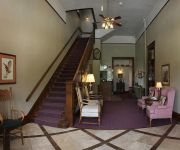
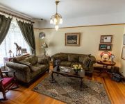
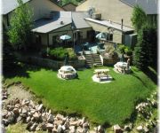
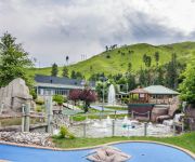
Hotels and Places to Stay
Town Hall Inn
1899 Inn
Mineral Palace Hotel & Casino
DEADWOOD GULCH RESORT
Martin & Mason Hotel
Holiday Inn Express & Suites DEADWOOD-GOLD DUST CASINO
Whistler Gulch Campground
Comfort Inn & Suites
Stampmill Suites
Iron Horse Inn
Videos from this area
These are videos related to the place based on their proximity to this place.
Blizzard Shuts Down Deadwood, Black Hills in South Dakota
This video from a driveway in the historic gold rush town of Deadwood shows several feet of snow on the ground and more continuing to fall, with a car almost completely buried in a large drift....
CampgroundViews.com - Mystic Hills Hideaway Deadwood South Dakota SD
http://www.CampgroundViews.com takes user submitted videos combined with professional editing to provide tent and RV campers with a first person view of a campground or RV park. Mystic Hills...
CampgroundViews.com - Whistlers Gulch RV Park Deadwood South Dakota SD
http://www.CampgroundViews.com takes user submitted videos combined with professional editing to provide tent and RV campers with a first person view of a campground or RV park. Whistlers Gulch.
CampgroundViews.com - Roubaix Lake Campground Deadwood and Lead South Dakota SD Forest Service
http://www.CampgroundViews.com takes user submitted videos combined with professional editing to provide tent and RV campers with a first person view of a campground or RV park. Roubaix Lake...
2014 DEADWEIRD in DEADWOOD (near Rapid City, SD)
This video is about 2014 DEADWEIRD in DEADWOOD (near Rapid City, SD)
Fighting a Three-Foot Snowdrift with Snowblower in Deadwood
Deadwood resident Tom Griffith fights a three-foot high snowdrift in his driveway with a snowblower during a blizzard in the Black Hills of South Dakota.
Days of '76 rodeo in Deadwood South Dakota(1)
The Days of '76 Rodeo in Deadwood, South Dakota is one of the best in the country.
Deadwood, South Dakota and Spearfish Highway
Deadwood during the day during the "Kool Deadwood Nights" festival, August 25, 2007.
Videos provided by Youtube are under the copyright of their owners.
Attractions and noteworthy things
Distances are based on the centre of the city/town and sightseeing location. This list contains brief abstracts about monuments, holiday activities, national parcs, museums, organisations and more from the area as well as interesting facts about the region itself. Where available, you'll find the corresponding homepage. Otherwise the related wikipedia article.
Lawrence County, South Dakota
Lawrence County is a county located in the U.S. state of South Dakota. As of the 2010 census, the population was 24,097. Its county seat is Deadwood. Lawrence County is coextensive with the Spearfish, South Dakota, Micropolitan Statistical Area.
Central City, South Dakota
Central City is a city in Lawrence County, South Dakota, United States. The population was 134 at the 2010 census.
Lead, South Dakota
Lead (pronounced "leed") is a city in Lawrence County, South Dakota, United States. The population was 3,124 at the 2010 census. Lead is located in western South Dakota, in the Black Hills near the Wyoming state line.
Homestake Mine (South Dakota)
The Homestake Mine was a deep underground gold mine located in Lead, South Dakota. Until it closed in 2002 it was the largest and deepest gold mine in North America, producing more than 40 million ounces (approximately 1.25 million kilograms) of gold. The Homestake Mine is famous in scientific circles for being the site at which the solar neutrino problem was first discovered. This became known as the Homestake Experiment. The deep underground laboratory was set up by Raymond Davis Jr.
Homestake experiment
The Homestake experiment (sometimes referred to as the Davis experiment) was an experiment headed by astrophysicists Raymond Davis, Jr. and John N. Bahcall in the late 1960s. Its purpose was to collect and count neutrinos emitted by nuclear fusion taking place in the Sun. Bahcall did the theoretical calculations and Davis designed the experiment. After Bahcall calculated the rate at which the detector should capture neutrinos, Davis's experiment turned up only one third of this figure.
Black Hills Gold Rush
The Black Hills Gold Rush took place in Dakota Territory in the United States. It began in 1874 following the Custer Expedition and reached a peak in 1876-77. Rumors and poorly documented reports of gold in the Black Hills go back to the early 19th century. In the 1860s, Roman Catholic missionary Father De Smet is reported to have seen Sioux Indians carrying gold which they told him came from the Black Hills.
Adams Museum & House
Adams Museum & House, was built in Deadwood, South Dakota, United States, in 1930 by Deadwood businessman and former mayor W.E. Adams as a tribute to the Black Hills pioneers and in remembrance of his deceased first wife and two daughters. The museum was a gift to the city of Deadwood and it remains city property to this day. It is located at 54 Sherman Street. Deadwood's Adams Museum is considered the Black Hills' oldest history museum.
Blacktail, South Dakota
Blacktail (also known as Black Tail) is a populated place in Lawrence County, South Dakota, United States. The name was collected by the United States Geological Survey between 1976 and 1980, and entered into the Geographic Names Information System on February 13, 1980.


