Safety Score: 2,7 of 5.0 based on data from 9 authorites. Meaning we advice caution when travelling to United States.
Travel warnings are updated daily. Source: Travel Warning United States. Last Update: 2024-08-13 08:21:03
Discover General Sumter Estates
General Sumter Estates in Sumter County (South Carolina) is a place in United States about 391 mi (or 629 km) south-west of Washington DC, the country's capital city.
Current time in General Sumter Estates is now 11:05 PM (Thursday). The local timezone is named America / New York with an UTC offset of -5 hours. We know of 9 airports near General Sumter Estates, of which 5 are larger airports. The closest airport in United States is Columbia Metropolitan Airport in a distance of 36 mi (or 58 km), West. Besides the airports, there are other travel options available (check left side).
Also, if you like playing golf, there are a few options in driving distance. If you need a hotel, we compiled a list of available hotels close to the map centre further down the page.
While being here, you might want to pay a visit to some of the following locations: Sumter, Camden, Bishopville, Manning and Saint Matthews. To further explore this place, just scroll down and browse the available info.
Local weather forecast
Todays Local Weather Conditions & Forecast: 10°C / 51 °F
| Morning Temperature | 4°C / 39 °F |
| Evening Temperature | 8°C / 46 °F |
| Night Temperature | 5°C / 42 °F |
| Chance of rainfall | 0% |
| Air Humidity | 40% |
| Air Pressure | 1010 hPa |
| Wind Speed | Moderate breeze with 12 km/h (7 mph) from South-East |
| Cloud Conditions | Clear sky, covering 7% of sky |
| General Conditions | Sky is clear |
Friday, 22nd of November 2024
14°C (56 °F)
8°C (47 °F)
Sky is clear, gentle breeze, clear sky.
Saturday, 23rd of November 2024
17°C (63 °F)
11°C (51 °F)
Sky is clear, gentle breeze, clear sky.
Sunday, 24th of November 2024
20°C (67 °F)
14°C (56 °F)
Sky is clear, gentle breeze, clear sky.
Hotels and Places to Stay
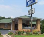
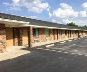
EAGLE INN SUMTER
MOTEL 6 SUMTER SC
Videos from this area
These are videos related to the place based on their proximity to this place.
Linwood Plantation Subdivision, Dalzell, SC Phase II
Created on January 16, 2010 using FlipShare. Linwood Plantation Subdivision, Dalzell, SC. Phase II. Located near the back gate of Shaw Air Force Base.
P3D - Lockheed SR-71 Blackbird - Shaw Air Force Base - By JMCV 2013
See Also; http://jmcv.fr * Prepar3D (P3D) is a simulation platform developed by Lockheed Martin. * The Lockheed SR-71 "Blackbird" was an advanced, long-range, Mach 3+ strategic reconnaissance...
General Sumter Estates subdivision Dalzell, SC
Created on January 9, 2010 using FlipShare. General Sumter Estates subdivision, Dalzell, SC.
Snow in Sumter, SC Feb 12, 2010
Created on February 12, 2010 using FlipShare. Those of you living in more northern climes will judge this to be insignificant, as snowfall goes. But -- it's not finished, it's just started,...
Get gouged less clip, My gun hates CCI
Raw clip #4 from my upcoming video on an economic irony YOU can EXPLOIT in the price of plinking ammo. Filmed on my neighbor Don's porch. If you don't know who HE is, check out ...
Mayfield Subdivision in Sumter, SC
This is a special request from a viewer of my website at www.sumtersubdivisions.com This person wanted more info about this neighborhood. The video is rather poor and has no audio.
AWCC - Modeling The Way - Toughen Up 8-25-13
Sermon from Autumn Woods Christian Church located at 2490 Sargent Rd Dalzell, SC 29040.
USAF Honor Guard
United States Air Force Honor Guard decided to visit Shaw AFB on a recruiting tour. They're currently looking for NCO's and SrAs that have been through ALS!
2010 Shaw AFB Airshow Thunderbirds HD 2 0f 4
http://SecretsofSocialMarketing.com Here is the second video of four of the 2010 Shaw AFB Airshow with the Thunderbirds. It was a great show and the video turned out great and super high quality...
Videos provided by Youtube are under the copyright of their owners.
Attractions and noteworthy things
Distances are based on the centre of the city/town and sightseeing location. This list contains brief abstracts about monuments, holiday activities, national parcs, museums, organisations and more from the area as well as interesting facts about the region itself. Where available, you'll find the corresponding homepage. Otherwise the related wikipedia article.
Cherryvale, South Carolina
Cherryvale is a census-designated place (CDP) in Sumter County, South Carolina, United States. The population was 2,461 at the 2000 census. It is included in the Sumter, South Carolina Metropolitan Statistical Area.
Oakland, South Carolina
Oakland is a census-designated place (CDP) in Sumter County, South Carolina, United States. The population was 1,272 at the 2000 census. It is included in the Sumter, South Carolina Metropolitan Statistical Area. Part of the area of the census-designated place is located within the Stateburg Historic District
Stateburg, South Carolina
Stateburg is a census-designated place (CDP) in the High Hills of Santee in Sumter County, South Carolina, United States. The population was 1,380 at the 2010 census. It is included in the Sumter, South Carolina Metropolitan Statistical Area. Stateburg is located within the larger Stateburg Historic District.
Shaw Air Force Base
Shaw Air Force Base (Shaw AFB) is a United States Military facility located approximately 8.4 miles west-northwest of Sumter, South Carolina. It is under the jurisdiction of the United States Air Force Air Combat Command (ACC). The United States Air Force 20th Fighter Wing (20 FW) is the host unit. It is one of the largest military bases operated by the United States.
Church of the Holy Cross (Stateburg, South Carolina)
Church of the Holy Cross U.S. National Register of Historic Places U.S. National Historic Landmark 250px Historic Church of the Holy Cross, High Hills of the Santee, Stateburg, built of rammed earthLocation: SC 261, 335 N. Kings Hwy.


