Safety Score: 2,7 of 5.0 based on data from 9 authorites. Meaning we advice caution when travelling to United States.
Travel warnings are updated daily. Source: Travel Warning United States. Last Update: 2024-08-13 08:21:03
Delve into East Sunway Knolls
The district East Sunway Knolls of Dinkins in Sumter County (South Carolina) is a district located in United States about 389 mi south-west of Washington DC, the country's capital town.
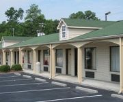
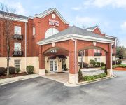
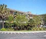
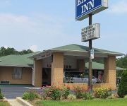
In need of a room? We compiled a list of available hotels close to the map centre further down the page.
Since you are here already, you might want to pay a visit to some of the following locations: Sumter, Bishopville, Manning, Camden and Saint Matthews. To further explore this place, just scroll down and browse the available info.
Local weather forecast
Todays Local Weather Conditions & Forecast: 11°C / 51 °F
| Morning Temperature | 4°C / 40 °F |
| Evening Temperature | 8°C / 47 °F |
| Night Temperature | 6°C / 42 °F |
| Chance of rainfall | 0% |
| Air Humidity | 39% |
| Air Pressure | 1010 hPa |
| Wind Speed | Moderate breeze with 12 km/h (7 mph) from South-East |
| Cloud Conditions | Clear sky, covering 5% of sky |
| General Conditions | Sky is clear |
Saturday, 23rd of November 2024
14°C (57 °F)
9°C (48 °F)
Sky is clear, gentle breeze, clear sky.
Sunday, 24th of November 2024
17°C (63 °F)
11°C (52 °F)
Sky is clear, gentle breeze, clear sky.
Monday, 25th of November 2024
20°C (68 °F)
14°C (57 °F)
Sky is clear, gentle breeze, clear sky.
Hotels and Places to Stay
Hampton Inn Sumter
SUPER 8 SUMTER
Holiday Inn Express & Suites SUMTER
SC Sumter Country Inn and Suites by Radisson
Comfort Suites Sumter
SpringHill Suites Sumter
Econo Lodge Sumter
Candlewood Suites SUMTER
MOUNT VERNON INN
EAGLE INN SUMTER
Videos from this area
These are videos related to the place based on their proximity to this place.
Sumter 3D Industrial Video
This 3D animation illustrates how products that are created in Sumter, South Carolina are used all across the globe. Ideally situated between the Atlantic Ocean and Blue Ridge Mountains, Sumter...
Swan Lake Iris Gardens in Sumter, SC
The Swan Lake Iris Gardens is in the heart of Sumter, SC. The home of the Iris Festival, Swan Lake Iris Gardens is a favorite place for Sumter locals and visitors. The only public park that...
Minato@ADDL2013 (Doubles Compulsory+Speed Final)
Team Name: Minato Club Name: Jump Mon Star Grade: 4th Country: JAPAN Date and Time: 15 Jun 2013 15:18 Class: Doubles Compulsory+Speed Final Event: American Double Dutch League 2013, ...
Episode 5.5: Battle for Cloud City
Featuring the styling of Jean Marie Brailsford and Wren Stogner Bunch.
AID@ADDL2013 (Doubles FreeStyle Final)
Team Name: AID Club Name: s'il vous plait(Doshisha University) + DUTCHER'S616(Otemon Gakuin University) Grade: Open Division Country: JAPAN Date and Time: 15 Jun 2013 14:45 Class: ...
KUKAI@ADDL2013 (Singles FreeStyle Elimination)
Team Name: KUKAI Club Name: RAN-NAWA (Nippon Sport Science University) Grade: Open Division Country: JAPAN Date and Time: 14 Jun 2013 14:16 Class: Singles FreeStyle Elimination Event: ...
Minato@ADDL2013(Singles FreeStyle Final)
Team Name: Minato Club Name: Jump Mon Star Grade:4th Country: JAPAN Date and Time: 15 Jun 2013 12:16 Class: Singles FreeStyle Final Event: American Double Dutch League 2013, 40th ...
KUKAI@ADDL2013 (Doubles FreeStyle Elimination)
Team Name: KUKAI Club Name: RAN-NAWA (Nippon Sport Science University) Grade: Open Division Country: JAPAN Date and Time: 14 Jun 2013 15:18 Class: Doubles FreeStyle Elimination Event: ...
Videos provided by Youtube are under the copyright of their owners.
Attractions and noteworthy things
Distances are based on the centre of the city/town and sightseeing location. This list contains brief abstracts about monuments, holiday activities, national parcs, museums, organisations and more from the area as well as interesting facts about the region itself. Where available, you'll find the corresponding homepage. Otherwise the related wikipedia article.
Sumter County, South Carolina
Sumter County is a county located in the U.S. state of South Carolina. Its county seat is Sumter. The 2000 census recorded its population to be 104,646. In 2005, the U.S. Census Bureau estimated that its population had reached 105,517. It is included in the Sumter Metropolitan Statistical Area. It is the home of Shaw AFB. Shaw is home to the 9th USAF HQ and the largest F-16 base in the USAF.
Cane Savannah, South Carolina
Cane Savannah is a census-designated place (CDP) in Sumter County, South Carolina, United States. The population was 1,452 at the 2000 census. It is included in the Sumter, South Carolina Metropolitan Statistical Area.
East Sumter, South Carolina
East Sumter is a census-designated place (CDP) in Sumter County, South Carolina, United States. The population was 1,220 at the 2000 census. It is included in the Sumter, South Carolina Metropolitan Statistical Area.
Cherryvale, South Carolina
Cherryvale is a census-designated place (CDP) in Sumter County, South Carolina, United States. The population was 2,461 at the 2000 census. It is included in the Sumter, South Carolina Metropolitan Statistical Area.
Dalzell, South Carolina
Dalzell is a census-designated place (CDP) in Sumter County, South Carolina, United States. The population was 2,260 at the 2000 census. It is included in the Sumter, South Carolina Metropolitan Statistical Area.
Lakewood, South Carolina
Lakewood is a census-designated place (CDP) in Sumter County, South Carolina, United States. The population was 2,603 at the 2000 census. It is included in the Sumter, South Carolina Metropolitan Statistical Area.
Millwood, South Carolina
Millwood is a census-designated place (CDP) in Sumter County, South Carolina, United States. The population was 885 at the 2000 census. It is included in the Sumter, South Carolina Metropolitan Statistical Area.
Mulberry, South Carolina
Mulberry is a census-designated place (CDP) in Sumter County, South Carolina, in the United States. The population was 841 at the 2000 census. It is included in the Sumter, South Carolina Metropolitan Statistical Area.
South Sumter, South Carolina
South Sumter is a census-designated place (CDP) in Sumter County, South Carolina, United States. The population was 3,365 at the 2000 census. It is included in the Sumter, South Carolina Metropolitan Statistical Area.
Sumter, South Carolina
Sumter is the county seat of Sumter County, South Carolina, United States. Known as the Sumter Metropolitan Statistical Area, the namesake county adjoins Clarendon and Lee to form the core of Sumter-Lee-Clarendon tri-county area of South Carolina, an area that includes the three counties in east central South Carolina. The U.S. Census Bureau estimated the city's population was 39,643 at the 2000 census. The 2010 census puts the city at 40,524.
Shaw Air Force Base
Shaw Air Force Base (Shaw AFB) is a United States Military facility located approximately 8.4 miles west-northwest of Sumter, South Carolina. It is under the jurisdiction of the United States Air Force Air Combat Command (ACC). The United States Air Force 20th Fighter Wing (20 FW) is the host unit. It is one of the largest military bases operated by the United States.
Morris College
Morris College (MC), located in Sumter, South Carolina, is a four-year, coeducational, liberal arts, private, historically black college founded and operated by the Baptist Educational and Missionary Convention of South Carolina.
Swan Lake/Iris Gardens
Located in Sumter, South Carolina, Swan Lake-Iris Gardens began in 1927 as a private fishing lake for wealthy businessman Hamilton Carr Bland, who also began landscaping his garden with Japanese Iris flowers. It is currently the only public park in the United States to have all eight species of swans—including Royal White Mutes, Black Necks, Coscorobas, Whoopers, Black Australians, Whistlers, Bewicks, and Trumpeters.
University of South Carolina Sumter
The University of South Carolina Sumter is a public university located in Sumter, South Carolina. One of the 7 regional USC campuses and is currently an accredited two-year school in the University of South Carolina System, it is home to approximately 1,500 students. It is fully accredited by the Commission on Colleges of the Southern Association of Colleges and Schools.
Riley Park (Sumter)
Riley Park is a stadium in Sumter, South Carolina. It is primarily used for baseball and was the home of Sumter Braves. Today the stadium is mostly used for American Legion Baseball in the summer. It is also home to the USC Sumter Fire Ants of the NJCAA and the Morris College Hornets of the NAIA. The ballpark has a capacity of 2,000 people.
Sumter Airport
Sumter Airport is a public use airport located four nautical miles (7 km) north of the central business district of Sumter, a city in Sumter County, South Carolina, United States. It is owned by the city and county of Sumter. Although most U.S. airports use the same three-letter location identifier for the FAA and IATA, this airport is assigned SMS by the FAA and SUM by the IATA.
Ebenezer Middle School
Ebenezer Middle School is one of four public middle schools located in Sumter, South Carolina. The school was created in 1980's and serves approximately 450 students in the Sumter Metropolitan Area.
St. Francis Xavier High School (Sumter, South Carolina)
St. Francis Xavier High School is a private, Roman Catholic high school in Sumter, South Carolina. It is run independent of the Roman Catholic Diocese of Charleston.
Palmetto Tennis Center
Palmetto Tennis Center is a National Tennis Court in Palmetto Park in Sumter, South Carolina. It is the largest tennis center in the state. They have 18 lit hard courts as well as 6 Deco-Turf courts. They host several tournaments every year both junior and adult. PTC is also the host of the Palmetto Pro Open a women's 10K event on the USTA Pro Circuit.
WDXY
WDXY is a radio station broadcasting a News Talk Information format. Licensed to Sumter, South Carolina, USA. The station is currently owned by Miller Communications, Inc. and features programing from ABC Radio .
WWHM
WWHM is a radio station licensed to serve Sumter, South Carolina. The station is owned by Miller Communications, Inc. It airs a Urban Oldies format. The station was assigned the WWHM call letters by the Federal Communications Commission on November 21, 2007.
Claremont County, South Carolina
Claremont County was a former county in east central South Carolina. Its county seat was Stateburg. It lasted from its creation from 1785, when it was created from the Camden District, until it was absorbed into the newly created Sumter District in 1800.
WSSC (AM)
WSSC is a radio station broadcasting a Christian radio format. WSSC is licensed to serve the community of Sumter, South Carolina, USA. The station is currently owned by Sumter Baptist Temple, Inc. and features programming from Westwood One.
Battle of Dingle's Mill
The Battle of Dingle's Mill was an American Civil War battle that took place near Sumterville, Sumter County, South Carolina.
Sumter High School
Sumter High School is a co-educational four-year public high school serving grades 9 through 12 in Sumter School District located in the south side of Sumter, South Carolina, United States. With a current enrollment of 2,931 Sumter High is the largest school in the Midlands of South Carolina. In 2004 Sumter High School was designated The Model School for SC and one of thirty model schools nationwide by a national organization funded by the Bill and Melinda Gates Foundation.


