Safety Score: 2,7 of 5.0 based on data from 9 authorites. Meaning we advice caution when travelling to United States.
Travel warnings are updated daily. Source: Travel Warning United States. Last Update: 2024-08-13 08:21:03
Discover Eastmont
The district Eastmont of Mill Creek Estates in Richland County (South Carolina) is a subburb in United States about 403 mi south-west of Washington DC, the country's capital city.
If you need a hotel, we compiled a list of available hotels close to the map centre further down the page.
While being here, you might want to pay a visit to some of the following locations: Columbia, Lexington, Saint Matthews, Camden and Winnsboro. To further explore this place, just scroll down and browse the available info.
Local weather forecast
Todays Local Weather Conditions & Forecast: 9°C / 48 °F
| Morning Temperature | 0°C / 32 °F |
| Evening Temperature | 7°C / 44 °F |
| Night Temperature | 7°C / 45 °F |
| Chance of rainfall | 0% |
| Air Humidity | 34% |
| Air Pressure | 1029 hPa |
| Wind Speed | Moderate breeze with 9 km/h (6 mph) from North-East |
| Cloud Conditions | Clear sky, covering 2% of sky |
| General Conditions | Sky is clear |
Thursday, 5th of December 2024
13°C (56 °F)
4°C (39 °F)
Scattered clouds, moderate breeze.
Friday, 6th of December 2024
8°C (46 °F)
4°C (38 °F)
Broken clouds, gentle breeze.
Saturday, 7th of December 2024
10°C (50 °F)
8°C (47 °F)
Broken clouds, light breeze.
Hotels and Places to Stay
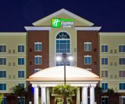
Holiday Inn Express & Suites COLUMBIA-FORT JACKSON
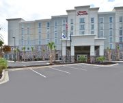
Hampton Inn - Suites Columbia-Southeast Ft Jackson SC
La Quinta Inn Columbia SE / Fort Jackson
TownePlace Suites Columbia Southeast/Fort Jackson
SC Columbia Country Inn and Suites by Radisson
Baymont Inn & Suites Columbia Fort Jackson
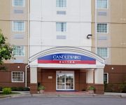
Candlewood Suites COLUMBIA-FT. JACKSON
Extended Stay America Columbia Ft Jackson
Rodeway Inn & Suites Fort Jackson
Econo Lodge Fort Jackson
Videos from this area
These are videos related to the place based on their proximity to this place.
Bishop Joe Jackson, Sr.- The Core Church
Order # 171 March 29, 2015 Bishop Joe Jackson, Sr. "Hosanna In The Highest" Palm Sunday Service 12noon 1520 Lower Richland Blvd., Hopkins, SC Bishop Joe Jackson, Sr.- Pastor If you would like.
2014 Gastonia Eagles Girls 10yrs 4x100m Relay Team
Battle of the Borders AAU Track & Field Meet - 05-17-14 Lower Richland High School Hopkins SC Relay Team: McKynzie Mauney, Breyana Jackson, Lauren Tolbert & Kaylyn Brown.
Columbia SC Furnished Apartments at Deer Meadow by Select Corporate Housing
Select Corporate Housing offers fully-furnished apartments at Deer Meadow Village in Columbia SC. Our all-inclusive furnished apartments in Columbia for temporary housing offer a more affordable...
Fort Jackson Family Day 2/60th Entrance, Aug 1, 2012
Soldiers running out into formation. 2nd Battalion, 60th Infantry Regiment.
Home Improvement Contractor in Columbia SC - Home Addition Remodel Renovation
http://hazelwoodconstsc.com Hazelwood Construction Company your Home Improvement Contractor in Columbia South Carolina call (803) 695-9896 for free quote. Ho...
Homes For Rent Columbia SC | (803) 394-5144
http://www.scbrs.com - SCBRS, LLC - A Property Management Co. (803) 394-5144 SCBRS, LLC is a professional property management firm that specializes in helping renters to find the ideal home...
8364 GARNERS FERRY ROAD, Hopkins, SC 29061
8364 GARNERS FERRY ROAD Hopkins, SC Southern Visions Realty, Inc. http://www.realestatebook.com/homes/listing/101-3001469692/refer=FP42A 16.26 Acres with 467...
7511 Fairmont Road, Columbia, SC 29209
http://100financing.epropertysites.com?rs=youtube Large lot, fenced backyard, hardwoods under carpet. Beautiful knotty pine walls, separate laundry room, ext...
Videos provided by Youtube are under the copyright of their owners.
Attractions and noteworthy things
Distances are based on the centre of the city/town and sightseeing location. This list contains brief abstracts about monuments, holiday activities, national parcs, museums, organisations and more from the area as well as interesting facts about the region itself. Where available, you'll find the corresponding homepage. Otherwise the related wikipedia article.
Richland County, South Carolina
Richland County is a county located in the U.S. state of South Carolina. As of the 2010 census recorded that its population had reached 384,504. It is the second most populous county in South Carolina, behind only Greenville County. The county seat is Columbia, the state capital. It is also the center of population of South Carolina. Richland County is part of the Columbia, South Carolina, Metropolitan Statistical Area.
Arcadia Lakes, South Carolina
Arcadia Lakes is a small town in Richland County, South Carolina, United States. The population was 861 at the 2010 census. It is part of the Columbia, South Carolina, Metropolitan Statistical Area. Arcadia Lakes shares a ZIP code with part of northeastern Columbia, and all locations in the town have Columbia mailing addresses.
Forest Acres, South Carolina
Forest Acres is a city in Richland County, South Carolina, United States. The population was 10,361 at the 2010 census. It is part of the Columbia, South Carolina, Metropolitan Statistical Area.
Woodfield, South Carolina
Woodfield is a census-designated place (CDP) in Richland County, South Carolina, United States. The population was 9,303 at the 2010 census. It is part of the Columbia, South Carolina Metropolitan Statistical Area.
Five Points (Columbia, South Carolina)
Five Points in Columbia, South Carolina is a shopping, restaurant, and nightlife area that attracts customers from the nearby University of South Carolina and throughout the Columbia metropolitan area. It is the center for the city's annual St. Patrick’s Day Festival. It was Columbia's first neighborhood shopping district, named for the intersection of Harden Street, Devine Street and Santee Avenue.
Moore School of Business
The Darla Moore School of Business is the business school of University of South Carolina in Columbia, South Carolina, United States. Founded in 1919, the Moore School has a special focus on international business. It currently enrolls over 4,800 students in degree-seeking programs. These programs include bachelor, masters and doctorate degrees.
Williams-Brice Stadium
Williams-Brice Stadium is the home football stadium for the South Carolina Gamecocks, the college football team representing the University of South Carolina in Columbia, South Carolina. It is currently the 20th largest college football stadium in the NCAA and is located on the corner of George Rogers Boulevard and Bluff Road adjacent to the South Carolina State Fairgrounds. Carolina football teams consistently attract standing-room-only crowds to Williams-Brice Stadium.
University of South Carolina
The University of South Carolina (also referred to as USC, SC, South Carolina, or simply Carolina) is a public, co-educational research university located in Columbia, South Carolina, United States, with 7 surrounding satellite campuses. Its historic campus covers over 359 acres in downtown Columbia not far from the South Carolina State House. The University has been recognized by the Carnegie Foundation for its research and engagement, has received a Top-10 ranking from U.S.
WUSC-FM
WUSC-FM is a student-run College radio station operating at the University of South Carolina in Columbia, South Carolina, United States.
Capital City Stadium
Capital City Stadium is a stadium in Columbia, South Carolina, United States. Originally built in 1927, it is primarily used for baseball and was the home for more than 20 years of the Capital City Bombers. It is situated in the Olympia section, near the old Olympia mills. While playing at "The Cap" the Bombers' enjoyed a rich history of success with numerous South Atlantic League Championships, including the memorable years of 1986, 1991 and 1998.
Melton Memorial Observatory
Melton Memorial Observatory is an astronomical observatory owned and operated by University of South Carolina. It is named after Dr. William Davis Melton and built in 1928. It is located in Columbia, South Carolina (USA).
Sarge Frye Field
Sarge Frye Field was a baseball stadium in Columbia, South Carolina and served as home field of the University of South Carolina Gamecock baseball team until the 2008 season. The stadium held 6,000 people and was named after a longtime grounds keeper of the school's athletic fields. On February 21, 2009, USC began playing at the new Carolina Stadium. The last game at Sarge Frye was played on May 17, 2008.
Eugene E. Stone III Stadium (Columbia, South Carolina)
Eugene E. Stone III Stadium is a soccer stadium located in Columbia, South Carolina on the campus of the University of South Carolina. The 5,700 seat ground is home to the USC Gamecocks soccer teams since 1981, when the Gamecocks started the men's program in 1978. The current grandstand was built in 1996 thanks to a USD 1m grant from Eugene E. Stone III, a Carolina graduate. The nickname "the Graveyard" comes from the stadium's proximity to House of Peace cemetery.
Heathwood Hall Episcopal School
Heathwood Hall Episcopal School, Heathwood Hall, or simply Heathwood is an independent coeducational college preparatory school in Columbia, South Carolina. Founded in 1951, Heathwood offers classes for students in pre-kindergarten/nursery school through grade 12, and is the only independent school in the state with three National Blue Ribbon School awards from the US Department of Education.
Charlie W. Johnson Stadium
Charlie W. Johnson Stadium is a stadium in Columbia, South Carolina. It is primarily used for American football, and is the home field of the Benedict College. The stadium holds 11,000 people and opened in 2006.
Dreher High School
Dreher High School is a co-educational four-year public high school in Richland County School District One located in Columbia, South Carolina, USA. Dreher, established in 1938, is one of the oldest public high schools in the state. In 2009, Dreher was listed as the 702nd best school in the country by Newsweek in their annual best-high school rankings.
Mays Arena
Mays Arena is a 3,500-seat multi-purpose arena in Columbia, South Carolina. It is the home of the Columbia Rottweilers of the American Basketball Association and Benedict College Tigers basketball teams. The arena is a namesake of De. Benjamin E. Mays.
Hand Middle School
Hand Middle School is a middle school in Columbia, South Carolina, USA that educates around 950 students in grades 6-8. A Blue Ribbon school, it feeds into Dreher High School and it is one of Richland County School District One's oldest schools. Marisa Vickers is the Principal. The mascot is the Hornet and the school colors are Blue and Gold.
Richland Northeast High School
Richland Northeast High School is a public high school in Columbia, South Carolina. Richland Northeast, often abbreviated as RNE, RNH, or RNHS, was founded in 1978 to handle the excessive population of students at Spring Valley High School. Spring Valley is now Richland Northeast's largest rival in sporting events. Richland Northeast is one of five high schools in Richland County School District 2 (RSD2).
WCOS (AM)
WCOS is a inspiration Gospel radio station licensed to Columbia, South Carolina and serves the Columbia market. The Clear Channel Communications outlet is licensed by the Federal Communications Commission (FCC) to broadcast at 1400 kHz with an ERP of 1 kW. The station goes by the name Hallelujah 1400.
Midlands Technical College
Midlands Technical College, is a comprehensive, multi-campus, public, two-year college serving the primary region of Richland, Lexington and Fairfield counties of South Carolina. One of South Carolina’s largest two-year colleges, Midlands Technical College enrolls approximately 16,000 students seeking to develop career-skills or transfer to a four-year institution.
Cardinal Newman High School (Forest Acres, South Carolina)
Cardinal Newman High School is a diocesean, Roman Catholic high school in Forest Acres, South Carolina. It is located in the Roman Catholic Diocese of Charleston.
A.C. Flora High School
A.C. Flora High School is a high school in Forest Acres, South Carolina, USA. It is part of Richland County School District One. The school has won many athletic state championships and numerous academic awards. A.C. Flora is considered one of the top high schools in the state. Its enrollment as of 2011 is 1350 students.
Hammond School (South Carolina)
Hammond School Location Columbia, South Carolina Coordinates coord}}{{#coordinates:33.963704|-80.96617|type:edu_region:US-SC primary name= }} Information Type Private, Day School Established 1966 Headmaster Chris Angel Grades Pre-K through grade 12 Enrollment 980 Campus Non-Residential Mascot SkyHawks Website http://www. hammondschool. org/ Hammond School is a preK through 12 college preparatory day school in Columbia, South Carolina. It was founded in 1966 as a segregation academy.
Jim Hamilton – L.B. Owens Airport
Jim Hamilton – L.B. Owens Airport is a county-owned public-use airport located two nautical miles (3.7 km) south of the central business district of Columbia, in Richland County, South Carolina, United States. In 2008, the airport was renamed in honor of former airport manager Jim Hamilton. It was formerly known as Columbia Owens Downtown Airport.


