Safety Score: 2,7 of 5.0 based on data from 9 authorites. Meaning we advice caution when travelling to United States.
Travel warnings are updated daily. Source: Travel Warning United States. Last Update: 2024-08-13 08:21:03
Discover Allen Benedict Court
The district Allen Benedict Court of Columbia in Richland County (South Carolina) is a district in United States about 403 mi south-west of Washington DC, the country's capital city.
Looking for a place to stay? we compiled a list of available hotels close to the map centre further down the page.
When in this area, you might want to pay a visit to some of the following locations: Lexington, Winnsboro, Saint Matthews, Camden and Orangeburg. To further explore this place, just scroll down and browse the available info.
Local weather forecast
Todays Local Weather Conditions & Forecast: 6°C / 42 °F
| Morning Temperature | 1°C / 33 °F |
| Evening Temperature | 4°C / 39 °F |
| Night Temperature | 2°C / 35 °F |
| Chance of rainfall | 0% |
| Air Humidity | 35% |
| Air Pressure | 1032 hPa |
| Wind Speed | Gentle Breeze with 7 km/h (5 mph) from South |
| Cloud Conditions | Scattered clouds, covering 30% of sky |
| General Conditions | Scattered clouds |
Wednesday, 4th of December 2024
9°C (47 °F)
7°C (45 °F)
Sky is clear, moderate breeze, clear sky.
Thursday, 5th of December 2024
14°C (57 °F)
3°C (37 °F)
Scattered clouds, moderate breeze.
Friday, 6th of December 2024
8°C (46 °F)
4°C (39 °F)
Broken clouds, gentle breeze.
Hotels and Places to Stay
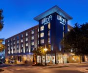
Aloft Columbia Downtown
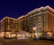
Hilton Columbia Center
Columbia Marriott
Sheraton Columbia Downtown Hotel
Staybridge Suites COLUMBIA
SpringHill Suites Columbia Downtown/The Vista
Holiday Inn Express & Suites COLUMBIA - DOWNTOWN
Courtyard Columbia Downtown at USC
Hampton Inn Columbia Downtown Historic District
Hilton Garden Inn Columbia Downtown
Videos from this area
These are videos related to the place based on their proximity to this place.
Pet Therapy at Providence Hospitals, Columbia S.C.
Filmed and edited by Jeff Bopp In addition to the quality care of our physicians, nurses and health care professionals at Providence Hospital, a Labradoodle named Annie promotes the healing...
ROAD TRIP TO FLORIDA! (LIFE IN FLORIDA)
http://www.jonesfamilytravels.com Today we headed home from Columbia, SC to sunny Florida! We had a leisure breakfast at Cracker Barrel and then hit the road for our 4 1/2 hour road trip....
WE BUY HOUSES IN SC | COLUMBIA | CHARLESTON | GREENVILLE | SOUTH CAROLINA
WE BUY HOUSES IN SC - Columbia, Charleston, Greenville http://masonbuyshouses.com Find Out How We Can Pay You CASH For Your House Save You From Paying Thousands in Realtor ...
***** PALMETTO CLASSIC SUMMERFEST ***** (watch in high quality)
SUNDAY, SEPTEMBER 6TH, 2009 IS THE DATE SET FOR THE MOST HIGHLY ANTICIPATED EVENT VENUED @ THE BENEDICT COLLEGE STADIUM IN COLUMBIA, SC! TO PERFORM: YUNG LA, ...
City Council Work Session 3/10/2015
City Council Work Session 3/10/2015 - Water & Sewer Work Session.
City Art Wedding Reception in Columbia, SC
http://www.ColumbiaWeddingPhotos.com Wedding Photos by Columbia, SC, wedding photographer Jeff Blake. A wedding reception at City Art in Columbia, SC, by Jeff Blake of www.
Our Story Matters: Sarah Mae Flemming
On June 28, Columbia SC 63 unveiled a street sign at the corner of Main and Washington to honor one of South Carolina's greatest civil rights heros; Sarah Mae Flemming. This video is the press...
Todd Habberkorn calls Vic.
So I was at banzai.. And Tod called Vic.. He was STANDING NEXT TO BILL NYE THE SCIENCE GUY XD lol my three favourite people in the universe all connected at one point in time and I was to ...
Spruce Creek Rainsaver
Our Spruce Creek Rainsaver fills up with 54 gallons of water from a recent thunderstorm. The overflow is carried down a rocky streambed to a ephemeral pond. For the next week or so, we'll...
Videos provided by Youtube are under the copyright of their owners.
Attractions and noteworthy things
Distances are based on the centre of the city/town and sightseeing location. This list contains brief abstracts about monuments, holiday activities, national parcs, museums, organisations and more from the area as well as interesting facts about the region itself. Where available, you'll find the corresponding homepage. Otherwise the related wikipedia article.
Five Points (Columbia, South Carolina)
Five Points in Columbia, South Carolina is a shopping, restaurant, and nightlife area that attracts customers from the nearby University of South Carolina and throughout the Columbia metropolitan area. It is the center for the city's annual St. Patrick’s Day Festival. It was Columbia's first neighborhood shopping district, named for the intersection of Harden Street, Devine Street and Santee Avenue.
Congaree Vista
Congaree Vista is a cosmopolitan section of Columbia, South Carolina, near the banks of the Congaree River, which was revitalized during the late 1990s and early 2000s. The section includes many small, upscale shops and restaurants, often in renovated warehouse buildings. "The Vista," as it is known by locals, is centered on one of the city's old train stations along Gervais Street.
Moore School of Business
The Darla Moore School of Business is the business school of University of South Carolina in Columbia, South Carolina, United States. Founded in 1919, the Moore School has a special focus on international business. It currently enrolls over 4,800 students in degree-seeking programs. These programs include bachelor, masters and doctorate degrees.
University of South Carolina
The University of South Carolina (also referred to as USC, SC, South Carolina, or simply Carolina) is a public, co-educational research university located in Columbia, South Carolina, United States, with 7 surrounding satellite campuses. Its historic campus covers over 359 acres in downtown Columbia not far from the South Carolina State House. The University has been recognized by the Carnegie Foundation for its research and engagement, has received a Top-10 ranking from U.S.
WUSC-FM
WUSC-FM is a student-run College radio station operating at the University of South Carolina in Columbia, South Carolina, United States.
Columbia Film Society
The Columbia Film Society is a nonprofit organization founded in January 1979 in Columbia, South Carolina. It is a community arts organization whose aim is to stimulate discussion and enhance appreciation of media arts in the community by presenting a wide variety of alternative films and sponsoring media arts events and educational programs. The Society is mostly known for operating the Nickelodeon Theatre, a 77 seat storefront venue located in the shadow of the state capitol building.
Benedict College
Benedict College is a historically black, liberal arts college located in Columbia, South Carolina. Founded in 1870 by northern Baptists, it was originally a teachers' college. It has since expanded into a four-year college.
Melton Memorial Observatory
Melton Memorial Observatory is an astronomical observatory owned and operated by University of South Carolina. It is named after Dr. William Davis Melton and built in 1928. It is located in Columbia, South Carolina (USA).
Jefferson Square
For the historic park in Omaha, Nebraska see Jefferson Square (Omaha). Jefferson Square, an office complex in downtown Columbia, South Carolina, is the headquarters of the state's Department of Health and Human Services, which oversees the Medicaid program for South Carolinians. Located at 1801 Main St. in the city's historic Arsenal Hill neighborhood, the complex includes a 12-story, 150,000 sq ft . office tower, a two-story courtyard plaza and The Lunch Box, a popular deli.
Finlay Park
Finlay Park, at 14 acres, is the largest and most visited park in downtown Columbia, South Carolina. The park opened in 1991. Initially named Sidney Park, it was renamed after a former Columbia mayor Kirkman Finlay. In the park there is a scenic waterfall along with cascading mountain type stream falling to the park lake. There are picnic tables, two playground areas and a cafe. The park is a favorite for families. Outdoor movies are played on Friday nights during the summer months.
Columbia Museum of Art
The following history of the Columbia Museum of Art is based upon information contained in Charles R. Mack,European Art in the Columbia Museum of Art. Volume I: The Thirtenth Through the Sixteenth Century, Columbia: Univ. of South Carolina Press, 2009, pp.12-14 and Robert Ochs, The Columbia Art Association, 1915-1975.
Blue Sky (artist)
Blue Sky is the legal name (formerly Warren Edward Johnson) of an American painter and sculptor best known for his mural, Tunnelvision.
Charlie W. Johnson Stadium
Charlie W. Johnson Stadium is a stadium in Columbia, South Carolina. It is primarily used for American football, and is the home field of the Benedict College. The stadium holds 11,000 people and opened in 2006.
Mays Arena
Mays Arena is a 3,500-seat multi-purpose arena in Columbia, South Carolina. It is the home of the Columbia Rottweilers of the American Basketball Association and Benedict College Tigers basketball teams. The arena is a namesake of De. Benjamin E. Mays.
South Carolina Institute of Archaeology and Anthropology
The South Carolina Institute of Archaeology and Anthropology, or SCIAA, was founded in 1963 as a research institute at University of South Carolina and as a State cultural resource management agency.
WARQ
WARQ is a Modern Rock radio station licensed to Columbia, South Carolina and serves the Columbia market. The YMF Media outlet is licensed by the Federal Communications Commission (FCC) to broadcast at 93.5 MHz with an effective radiated power (ERP) of 2.8 kW. The station goes by the name Rock 93.5 and its current slogan is "New Rock Now."
WCOS (AM)
WCOS is a inspiration Gospel radio station licensed to Columbia, South Carolina and serves the Columbia market. The Clear Channel Communications outlet is licensed by the Federal Communications Commission (FCC) to broadcast at 1400 kHz with an ERP of 1 kW. The station goes by the name Hallelujah 1400.
WXRY-LP
WXRY-LP is a LPFM radio station, broadcasting at 99.3 FM. The station is owned by Gamecock Alumni Broadcasters, a nonprofit organization. The format is officially Adult Album Alternative, although it leans more toward Alternative rock.
WWNQ
WWNQ is a country music radio station licensed to Forest Acres, South Carolina and serves the Columbia, South Carolina market. The Hometown Columbia outlet is licensed by the Federal Communications Commission (FCC) to broadcast at 94.3 MHz with an effective radiated power (ERP) of 2,550 watts. The station goes by the name Carolina Country on-air.
St. Peter's Roman Catholic Church (Columbia, South Carolina)
St. Peter's Roman Catholic Church is located at 1529 Assembly St. in Columbia, South Carolina. This is the second building of the oldest Catholic parish in Columbia and the Midlands of South Carolina. The St. Peter's Church was listed the National Register of Historic Places in 1989. The first resident Catholic priest came to Columbia in 1820. St. Peter's first church, designed by the South Carolina architect Robert Mills, was completed in 1824.
Old Campus District, University of South Carolina
The Old Campus District, University of South Carolina, is an historic district centered around The Horseshoe on the main campus of the University of South Carolina in Columbia, South Carolina. On June 5, 1970, it was listed in the National Register of Historic Places.
Trinity Episcopal Cathedral (Columbia, South Carolina)
Trinity Episcopal Church, now known as Trinity Episcopal Cathedral, is the first Episcopal and the oldest surviving sanctuary in Columbia, South Carolina. It is a Gothic Revival church that is modeled after York Minster in York, England. It was named to the National Register of Historic Places on February 24, 1971. Trinity Church is on east side of Sumter Street between Gervais and Senate Streets. It is directly east of the South Carolina State House.
Richland County Public Library
Richland County Public Library is the public library system of Richland County, South Carolina. It has 11 branches including its 242,000 sq ft Main Library. In 2001, it was named the National Library of the Year by the Library Journal and the Gale Group.
Capture of Columbia
The capture of Columbia occurred February 17–18, 1865, during the Carolinas Campaign of the American Civil War. The state capital of Columbia, South Carolina, was captured by Union forces under Maj. Gen. William T. Sherman and much of the city was burned.
Anna Hyatt Huntington/Works of Anne Hyatt Huntington
Return to Anna Hyatt Huntington


