Safety Score: 2,7 of 5.0 based on data from 9 authorites. Meaning we advice caution when travelling to United States.
Travel warnings are updated daily. Source: Travel Warning United States. Last Update: 2024-08-13 08:21:03
Discover Monaco Estates
The district Monaco Estates of Mountaindale in Pickens County (South Carolina) is a subburb in United States about 431 mi south-west of Washington DC, the country's capital city.
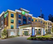
If you need a hotel, we compiled a list of available hotels close to the map centre further down the page.
While being here, you might want to pay a visit to some of the following locations: Pickens, Anderson, Walhalla, Hartwell and Greenville. To further explore this place, just scroll down and browse the available info.
Local weather forecast
Todays Local Weather Conditions & Forecast: 11°C / 51 °F
| Morning Temperature | 1°C / 35 °F |
| Evening Temperature | 7°C / 44 °F |
| Night Temperature | 4°C / 39 °F |
| Chance of rainfall | 0% |
| Air Humidity | 31% |
| Air Pressure | 1010 hPa |
| Wind Speed | Moderate breeze with 11 km/h (7 mph) from South-East |
| Cloud Conditions | Few clouds, covering 18% of sky |
| General Conditions | Few clouds |
Saturday, 23rd of November 2024
14°C (56 °F)
7°C (44 °F)
Scattered clouds, gentle breeze.
Sunday, 24th of November 2024
17°C (63 °F)
8°C (47 °F)
Few clouds, light breeze.
Monday, 25th of November 2024
20°C (68 °F)
14°C (57 °F)
Scattered clouds, gentle breeze.
Hotels and Places to Stay
Courtyard Clemson
Holiday Inn Express & Suites CLEMSON - UNIV AREA
The Abernathy of Clemson
Hampton Inn Clemson-University Area SC
Comfort Inn Clemson - University Area
Americas Best Inn Clemson
DAYS INN CLEMSON
BEST WESTERN PLUS UNIV INN
HOTEL TILLMAN
Videos from this area
These are videos related to the place based on their proximity to this place.
Clemson vs Citadel 2013
Clemson military appreciation day versus the Citadel on November 23, 2013. This game was also the last home game of the 2013 season and Senior Day for the football players. The video was...
Visit Clemson: In Season, Every Season
An 8-minute promotional video highlighting the many attractions and activities in the Clemson, South Carolina area.
Clemson's Network Operations Center Tour
Clemson's NOC utilizes cutting edge technology, equipment, and monitoring tools to proactively monitor the network infrastructure and critical computing systems and services provided by CCIT...
Clemson University ECE 496 Senior Design Project
This video summarizes our Clemson ECE 496 senior design project. We were challenged to build an automatous robot that could play air hockey. The design shown utilizes two motors, one for...
Clemson's Kappa Alpha Psi Probate w/ dancing
Clemson's Kappa Alpha Psi Spring 2008 Probate. Please yall, be nice with your comments or just dont post anything at all.
Single Family, Log Home - Clemson, SC
For more details click here: http://www.visualtour.com/showvt.asp?t=3271113 210 Payne Lane Clemson, SC 29631 $344900, 4 bed, 3.0 bath, SF, MLS# 20150989 Unique and pristine custom home ...
Clemson University Math Club: Elena Dimitrova on Cellular Automata, Part 1 of 2
Pattern formation in living organisms seems so mysterious and complicated that it has been suggested that it is not worth even trying to understand and explain. Or is it? In the early 1950s,...
GRAND CENTRAL STATION WALKTHRU -- front 9
GRAND CENTRAL STATION WALKTHRU -- front 9 ** AVAILABLE IN FULL HD 1080!!! ** Not all shots shown, just a simple walkthrough to show the course and the navigation. Designed to whet your ...
Disc Golf - Grand Central Station
Some footage of myself (Daniel Ahl), and Ryan Wettlin playing a round of discgolf at Grand Central Station in Central, SC.
University Village Apartments - Central Apartments For Rent
Central Apartments - University Village Apartments For Rent | 128 University Village Dr. Central, SC 29630 | For more info visit http://www.apartmenthomeliving.com/apartment-finder/University-Vill...
Videos provided by Youtube are under the copyright of their owners.
Attractions and noteworthy things
Distances are based on the centre of the city/town and sightseeing location. This list contains brief abstracts about monuments, holiday activities, national parcs, museums, organisations and more from the area as well as interesting facts about the region itself. Where available, you'll find the corresponding homepage. Otherwise the related wikipedia article.
Pendleton, South Carolina
Pendleton is a town in Anderson County, South Carolina, United States. The population was 2,964 at the 2010 census. It is a sister city of Stornoway in the Outer Hebrides of Scotland. The Pendleton Historic District, consisting of the town and its immediate surroundings, was added to the National Register of Historical Places in 1970 as District No. 70000560. Particularly notable historic buildings on the Pendleton town square include Farmer's Hall and Hunter's Store.
Central, South Carolina
Central is a town in Pickens County, South Carolina, United States, along SC Highway 93. Contrary to its name, it is not near the central area of South Carolina. It received its name from its geographic location, being the halfway or central point between Atlanta and Charlotte along the former Atlanta and Richmond Air-Line Railway line. Central's population was 3,522 at the 2000 census. The town is part of the Greenville–Mauldin–Easley metropolitan area.
Norris, South Carolina
Norris is a town in Pickens County, South Carolina, United States. The population was 847 at the 2000 census. It is part of the Greenville–Mauldin–Easley Metropolitan Statistical Area.
Six Mile, South Carolina
Six Mile is a town in Pickens County, South Carolina, United States. The population was 553 at the 2000 census. It is part of the Greenville–Mauldin–Easley Metropolitan Statistical Area. Six Mile was named "Six Mile" because it was located six miles from Fort Prince George. Many other landmarks in this area were named by their distance from Fort Prince George such as 12 Mile River and 18 Mile Creek.
Clemson University
Clemson University /ˈklɛmsən/ is an American public, coeducational, land-grant and sea-grant research university located in Clemson, South Carolina, United States. Founded in 1889, Clemson University consists of five colleges: Agriculture, Forestry and Life Sciences; Architecture, Arts and Humanities; Business and Behavioral Sciences; Engineering and Science; and Health, Education and Human Development.
Clemson, South Carolina
Clemson is a college town located in Pickens and Anderson counties in the U.S. state of South Carolina. The city is best known as the home to the Clemson University campus. The population was 13,905 at the 2010 census and center of an urban cluster with a total population of 42,199. Clemson is part of the Greenville-Spartanburg-Anderson, South Carolina Combined Statistical Area. Most of the city is in Pickens County, which is part of the Greenville-Mauldin-Easley Metropolitan Statistical Area.
Memorial Stadium, Clemson
Frank Howard Field at Memorial Stadium, popularly known as Death Valley, is home to the Clemson Tigers, an NCAA Division I FBS football team, located in Clemson, South Carolina. Built in 1941-1942, the stadium has seen expansions throughout the years, with the most recent being the WestZone, which began in 2004 and was completed in 2006. Prior to the completion of Bank of America Stadium, in Charlotte, it was used by the Carolina Panthers NFL team, in its inaugural 1995 season.
Doug Kingsmore Stadium
Doug Kingsmore Stadium (known prior to 2003 officially as Beautiful Tiger Field) is a stadium in Clemson, South Carolina. It is primarily used for NCAA college baseball and is the home field of the Clemson Tigers of the Division I Atlantic Coast Conference. It opened in 1970 and has a record single-game attendance of 6,480 (set on March 7, 2004, against South Carolina). Doug Kingsmore has ranked in the top 20 in attendance for 15 consecutive seasons.
Littlejohn Coliseum
J.C. Littlejohn Coliseum, usually known as Littlejohn Coliseum, is a 10,325-seat multi-purpose arena in Clemson, South Carolina, United States. It is home to the Clemson University Tigers men's and women's basketball teams. It is also the site of Clemson graduations and the Clemson Career Fair. It is owned and operated by Clemson University and hosts more than 150 events per year including concerts, trade shows, galas, and sporting events.
ESSO Club
The Esso Club is a sports bar in Clemson, South Carolina, that evolved from a 1920s gas station and grocery on Old Greenville Highway, which was at the time the main highway between Atlanta, Georgia and Greenville, South Carolina. As local historians note, the corporate trademark change to Exxon went unnoticed by local patrons and the original Esso oval sign is still displayed out front.
Southern Wesleyan University
Southern Wesleyan University is a four-year and graduate Christian college, with its main campus in the town of Central, South Carolina. The university was founded in 1906 by what is now the Wesleyan Church. The school prepares students for leadership and graduate study in such fields as business, education, religion, music, medicine, law and a variety of civic and social service professions.
South Carolina Botanical Garden
The South Carolina Botanical Garden (295 acres) is located in Clemson, South Carolina on the campus of Clemson University. This garden has nature trails, pathways, ponds, streams, woodlands, trial gardens, the Bob Campbell Geology Museum, and the Fran Hanson Discovery Center, which has exhibits by local artists. It is open to the public every day of the week.
Fike Recreation Center
Fike Recreation Center, originally known as Clemson Field House, is an on-campus recreation facility at Clemson University in Clemson, South Carolina. It houses several gymnasiums, a pool, a fitness atrium, racquetball courts, an indoor walk/jog/run track, and a climbing wall. The basketball team played there from 1930 to 1968, when Littlejohn Coliseum opened. The building originally opened in 1930 as the Clemson Field House, and was the indoor home to Clemson athletics.
Isunigu
Isunigu (also called Seneca, Esseneca, and Sinica) was a Cherokee town on the Keowee River, near present-day Clemson, South Carolina and Seneca, South Carolina. It was on the west side of the Keowee River, near the mouth of Coneross Creek, in today's Oconee County, South Carolina. Nearby, on the east side of the Keowee River, was the "Hopewell" plantation of General Pickens, where the 1785 Treaty of Hopewell was signed.
Riggs Field
Riggs Field is a 6,500-capacity soccer-specific stadium located in Clemson, South Carolina. The stadium is home to the Clemson Tigers men's and women's soccer teams. It has also hosted the NCAA Men's Soccer Championship in 1987. The stadium opened for soccer in 1980, and was renovated in 1987. Previous to this, it hosted a variety of the school's athletic teams, including the football team from 1915 until 1941 and the baseball team from 1916 until 1969.
Clemson (Amtrak station)
The Clemson Amtrak Station, located in Clemson, South Carolina, is served by the Crescent passenger train. The station sits on the corner of Calhoun Memorial Highway and College Avenue, in the heart of downtown Clemson. The station was originally erected by the Southern Railway in 1916. In the early 1960s, R.C. Edwards, then Clemson University president, convinced D.W. Brosnan, president of the Southern at the time, to prefer Clemson over Seneca as the main station for the area.
WCCP-FM
WCCP-FM is a Sports Talk radio station operating out of Clemson, South Carolina, under the name "The Drive 104.9". The station is licensed by the FCC to broadcast at 104.9 FM with an ERP of 4600 Watts. In addition, WCCP-FM operates broadcast translator W289AV licensed to Fountain Inn, South Carolina. WCCP-FM is an affiliate of the Atlanta Braves radio network, the largest radio affiliate network in Major League Baseball.
WSBF-FM
WSBF-FM is a college radio station licensed to Clemson, South Carolina. The station is owned by the Clemson University Board of Trustees and serves the Clemson University community. It is entirely student-managed and features an alternative music radio format.
WAHT
WAHT is an Oldies formatted radio station that serves Clemson, South Carolina, USA. WAHT offers an all-Oldies format with a lot of Carolina Beach Music. The station is owned by Golden Corners Broadcasting, Inc. and it features programming from ABC Radio's True Oldies Channel.
Issaqueena Bombing Range
The Issaqueena Bombing Range was a World War II target range used for training flight crews from Greenville Army Air Base, later renamed Donaldson Air Force Base. The Army Air Field was established in 1942 for the preparation of aircrew using North American B-25 Mitchell twin-engine bombers, and a suitable target area was established using Lake Issaqueena, northwest of Calhoun, South Carolina and Clemson College, completely within the Clemson Experimental Forest.
Oconee County Regional Airport
Oconee County Regional Airport is a county-owned municipal airport in Oconee County, South Carolina, 3 miles west of Clemson. Clemson University's Flying Club and the Flying Tigers Skydiving Club are based at the airport. During football season, the airport sees a spike in activity, due to its proximity to the University and Memorial Stadium.
Jervey Athletic Center
The Jervey Athletic Center is a building in Clemson, South Carolina, on the campus of Clemson University. It contains the gymnasium for the women's volleyball team and offices and training facilities for all of Clemson's athletic teams. The facility was built in 1973 and renovated in 1995.
Tri-County Technical College
Tri-County Technical College is a 2-year, community college located in Pendleton, South Carolina. It is part of the South Carolina Technical College System. Established in 1962, Tri-County Tech has four campuses in Pendleton, Anderson, Easley, and Seneca, serving the Anderson, Oconee, and Pickens counties. The college has a partnership with nearby Clemson University to allow students who narrowly miss acceptance to Clemson to enroll at Tri-County and transfer to Clemson after two years.
D. W. Daniel High School
D. W. Daniel High School (or Daniel High School) is a comprehensive public high school serving students in grades nine through twelve in the town of Central, South Carolina, United States. It is in Pickens County and is the one of four high schools administered by the School District of Pickens County (SDPC) (or Pickens 01).
Walker Golf Course
The John E. Walker Sr. Golf Course (often referred to as the Walker Course) is an 18-hole golf course on the campus of Clemson University in South Carolina. The course is the home of the Clemson Tigers men's and women's golf teams. Its signature 17th green and bunkers echo the university's tiger paw logo. In 2012, the Professional Golfers' Association of America ranked the Walker Course as the 9th best university golf course in the United States.


