Safety Score: 2,7 of 5.0 based on data from 9 authorites. Meaning we advice caution when travelling to United States.
Travel warnings are updated daily. Source: Travel Warning United States. Last Update: 2024-08-13 08:21:03
Delve into Woodland Trailer Park
The district Woodland Trailer Park of Walhalla in Oconee County (South Carolina) is a district located in United States about 439 mi south-west of Washington DC, the country's capital town.
In need of a room? We compiled a list of available hotels close to the map centre further down the page.
Since you are here already, you might want to pay a visit to some of the following locations: Toccoa, Clayton, Pickens, Carnesville and Hartwell. To further explore this place, just scroll down and browse the available info.
Local weather forecast
Todays Local Weather Conditions & Forecast: 13°C / 56 °F
| Morning Temperature | 2°C / 36 °F |
| Evening Temperature | 9°C / 48 °F |
| Night Temperature | 6°C / 43 °F |
| Chance of rainfall | 0% |
| Air Humidity | 44% |
| Air Pressure | 1017 hPa |
| Wind Speed | Gentle Breeze with 6 km/h (4 mph) from East |
| Cloud Conditions | Clear sky, covering 5% of sky |
| General Conditions | Sky is clear |
Sunday, 24th of November 2024
15°C (60 °F)
8°C (47 °F)
Sky is clear, light breeze, clear sky.
Monday, 25th of November 2024
19°C (66 °F)
12°C (53 °F)
Broken clouds, gentle breeze.
Tuesday, 26th of November 2024
22°C (71 °F)
10°C (49 °F)
Broken clouds, gentle breeze.
Hotels and Places to Stay
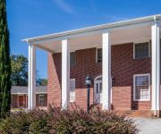
Walhalla Motel
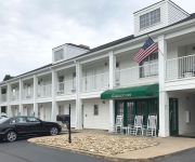
Quality Inn Seneca
Videos from this area
These are videos related to the place based on their proximity to this place.
519 Acres Subdivided Into 5 Tracts, Oconee County, S.C.
Beautiful wooded property with a mix of merchantable pine timber and hardwood forests divided into 5 separate tracts. Coneross Creek makes up part of property boundary and intersects a portion...
Upstate Lady Eagles vs Walhalla - Dec. 28, 2009
December 28, 2009 27 Upstate Lady Eagles 54 Walhalla.
3 - Walhalla / Punk & Athena
We hang out with our friends jessi & her boyfran whilst he helps us out with a tune up before we reeeally hit the road like it stole something from us.
SOLD! $100,000 West Union SC Ranch 3 Bed 2 Bath Across from Walhalla Elementary
Ranch very nicely kept. This home is perfect for 1st home buyers or retirees. Home is very energy efficient. Located at the end of the street and backing up to woods makes it feel very secluded....
Kudzu baskets
Not letting the Kudzu infestation get to her like everyone else, Nancy decided to weave baskets and make paper from invasive plant kudzu in Walhalla, South Carolina.
Jackson Dies Last We're Gonna Kick Your Ass Preview
This is a preview of Jackson Dies Last We're Gonna Kick Your Ass! January 12, 2013 8:00pm at The Outside Inn Tavern and Grille 108 South Cathrine St. Walhalla SC 29691. Brought to you by Station.
Ms Busy B's (864) 784-2539
Ms. Busy B's Walhalla, SC, 29672 (864) 784-2539 "Making Everyday Life Easier For You" Does All The Dirt and Dust have you down don't frown call Ms. Busy B's now! We can handle the mess if...
Rotary Oktoberfest 5K 10 16 10
5K Road Race in Walhalla, SC October 16, 2010. This event supports the Rotary Foundations drive to eradicate Polio worldwide.
165 Beaver Lake Drive, West Union, SC 29696
165 Beaver Lake Drive West Union, SC Lorraine Harding Real Estate http://www.realestatebook.com/homes/listing/101-3002043508/refer=FP42A PRICED TO SELL!! The spacious log cabin sits on ...
The Vintage Market 3.MOV
This is Video # 3 of The Vingtage Market in West Union, SC. Look for us online at www.thevintagemarketonline.com and become a fan of The Vintage Market on facebook. This store is an example...
Videos provided by Youtube are under the copyright of their owners.
Attractions and noteworthy things
Distances are based on the centre of the city/town and sightseeing location. This list contains brief abstracts about monuments, holiday activities, national parcs, museums, organisations and more from the area as well as interesting facts about the region itself. Where available, you'll find the corresponding homepage. Otherwise the related wikipedia article.
Oconee County, South Carolina
Oconee County is the westernmost county of South Carolina. The 2010 census recorded its population to be 74,273. Its county seat is Walhalla. Other cities in the county include Seneca and Westminster. Towns include Salem and West Union. The county is included in the Seneca Micropolitan Statistical Area. South Carolina Highway 11, the Cherokee Foothills National Scenic Highway, begins in Southern Oconee County at Interstate Highway 85 at the Georgia state line.
Salem, South Carolina
Salem is a town in Oconee County, South Carolina, United States. The population was 135 at the 2010 United States Census.
Utica, South Carolina
Utica is a census-designated place (CDP) in Oconee County, South Carolina, United States. The population was 1,322 at the 2000 census.
Walhalla, South Carolina
Walhalla is a mountain city in Oconee County, South Carolina, United States. It is located 16 miles from Clemson University in Clemson, South Carolina and is also located in the Appalachian Mountains of South Carolina. The population was 3,801 at the 2000 census. It is the county seat of Oconee County. The current mayor of Walhalla is Danny Edwards.
Seneca, South Carolina
Seneca is a city in Oconee County, South Carolina, United States. The population was 8,102 at the 2010 census. It is the principal city of the Seneca Micropolitan Statistical Area (population 74,273 according to the year 2010 census), an (MSA) which includes all of Oconee County and which is further included in the greater Greenville-Spartanburg-Anderson, South Carolina Combined Statistical Area (population 1,266,995 according to the year 2010 census).
West Union, South Carolina
West Union is a town in Oconee County, South Carolina, United States, Even though its name suggests that it is near Union, they are about four counties apart. The population was 297 at the 2000 census.
Westminster, South Carolina
Westminster is a city in Oconee County, South Carolina, United States. The population was 2,743 at the 2000 census.
WHZT
WHZT is an urban-leaning Rhythmic Contemporary Hit Radio station licensed to Williamston, South Carolina and serves the Upstate South Carolina region. The Cox Radio outlet is licensed by the Federal Communications Commission (FCC) to broadcast at 98.1 MHz with an effective radiated power (ERP) of 100,000 watts. The station goes by the name Hot 98.1 and its current slogan is "Carolina's #1 Hit Music Station."
Pine Mountain, Rabun County, Georgia
This article refers to the community in Rabun County, Georgia. For the town in Harris County, see Pine Mountain, Harris County, Georgia. Pine Mountain is an unincorporated community located in eastern Rabun County, Georgia, United States, at an elevation of 1661 feet. It is the birthplace of Ranger "Nick" Nicholson, an important figure in the early development of the Chattahoochee National Forest and Rabun County.
Tugaloo
Tugaloo was a Cherokee town on the Tugaloo River, at the mouth of Toccoa Creek, near present-day Toccoa, Georgia and very near the historic tavern called Travelers Rest. The town's proper name, in Cherokee, was Dugiluyi, abbreviated to Dugilu. In English it was spelled variously as Tugaloo, Toogelah, Toogoola, etc. Its meaning in Cherokee is uncertain, but "seems to refer to a place at the forks of a stream" (Mooney, 1900).
Dick's Creek Falls
Dick's Creek Falls is a waterfall that features a 60 ft drop of Dicks Creek into the Chattooga River. Located in the Chattahoochee National Forest, it is reached by using the Dick's Creek Trail, which is short trail (about 1.4 miles in and out) that connects to the Bartram Trail in eastern Rabun County, Georgia. To reach the falls, take Warwoman Road from Clayton, Georgia east. Turn right on Sandy Ford Rd. Sandy Ford Rd. will make a left turn over a bridge and turn into a dirt road.
WGOG
WGOG is a commercial American radio station licensed by the Federal Communications Commission (FCC) to serve the community of Walhalla, South Carolina, owned by Appalachian Broadcasting Co. , Inc. WGOG broadcasts a Country music format and carries syndicated programing from Dial Global Radio Network and NBC News Radio / United Stations Radio Network, and broadcasts local sports talk programming and news.
WSNW
WSNW is a radio station broadcasting a Talk radio/oldies format. Licensed to Seneca, South Carolina, USA. The station is currently owned by Tugart Properties, LLC and features programing from CBS Radio.
Isaqueena Falls
Isaqueena Falls, located near Walhalla, South Carolina, is a waterfall in the Oconee District of the Sumter National Forest. The falls are named after a Cherokee girl who allegedly leaped from the top of the falls with her lover, an Oconee brave, in an attempt to hide him from the rest of her tribe, which was at war with the Oconee. Isaqueena allegedly then hid him in the recessed area just below the top of the falls. It is very close to Stumphouse Tunnel, another notable local landmark.
Mountain Rest, South Carolina
Mountain Rest is an unincorporated community near the Chattooga River in Northwestern Oconee County, South Carolina.
West-Oak High School
West-Oak High School was created by the consolidation of Oakway and Westminster High Schools. The school serves students from approximately one-half of the land area in Oconee County, South Carolina. Both Oakway and Westminster schools had been previously consolidated in the 1960s with Fair Play, Long Creek and Cleveland community schools. Construction for the new building began in 1982, students entered in the fall of 1983, and the first class graduated in the spring of 1984.
Tamassee, South Carolina
Tamassee is an unincorporated community located in northwestern Oconee County, South Carolina, United States.


